Radstadt Tauern
| Radstadt Tauern | ||
|---|---|---|
|
View from the Dachstein to the Radstädter Tauern, in the background the Hohe Tauern |
||
| Highest peak | Weißck ( 2711 m above sea level ) | |
| location | Salzburg , Austria | |
| part of | Lower Tauern | |
| Classification according to | AVE 45a | |
|
|
||
| Coordinates | 47 ° 9 ' N , 13 ° 23' E | |
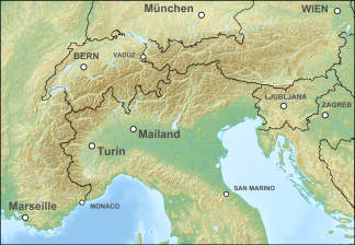
The Radstädter Tauern are a mountain group of the central Eastern Alps in Austria . Together with the Schladminger Tauern , the Rottenmanner and Wölzer Tauern and the Seckauer Tauern , the Radstädter Tauern form the large group of the Lower Tauern . The mountains are located in the east of the Austrian state of Salzburg between the upper reaches of the Enns and Mur rivers .
geography
location
The Radstädter Tauern form the westernmost part of the Niedere Tauern. They border the Hohe Tauern in the southwest , the Pongau in the northwest and the Schladminger Tauern in the east. It is named after the town of Radstadt im Ennstal .
Neighboring mountain groups
The Radstädter Tauern border on the following mountain groups in the Alps:
- Schladminger Tauern (in the east)
- Nockberge (in the southeast)
- Ankogel Group and Hafner Group (in the west)
- Salzburg Slate Alps (in the north)
Boundary
According to the Alpine Club division of the Eastern Alps , the group is delimited by the following line clockwise: Wagrainer Bach from the confluence with the Salzach - Wagrainer Höhe - Litzlingbach to the confluence with the Enns - Enns to Radstadt - northern Taurachtal - Obertauern - southern Taurachtal - Mauterndorf - Neuseß - Mur - Murtörl - Kreealpenbach - Grossarlbach to the confluence with the Salzach - Salzach to the confluence with Wagrainer Bach.
traffic
The Radstädter Tauern is crossed on its eastern edge by the Radstädter Tauern Pass ( 1738 m above sea level ) and has been underpassed by the tunnel of the Tauern Autobahn (A10) since around 1970 . The railways and federal highways of the uppermost Ennstal and Mur valley run in the north and south of the mountains .
summit
- Weißck ( 2711 m above sea level )
- Hochfeind ( 2687 m above sea level )
- Mosermandl ( 2680 m above sea level )
- Faulkogel ( 2654 m above sea level )
Lakes
tourism
Refuges
- DAV House Obertauern , 1735 m
- Draugsteinhütte , 1714 m
- Franz Fischer Hut , 2001 m
- Kleinarler Hut , 1754 m
- Speiereck hut , 2074 m
- Sticklerhütte , 1752 m
- Südwiener Hütte , 1802 m
- Tappenkarseehütte , 1820 m
Ski areas
The use of the Radstädter Tauern for skiing is concentrated around the town of Obertauern and the ski areas in the north and north-west, such as Altenmarkt-Zauchensee or Flachau . The Radstädter Tauern are also known as ski touring areas , with many also using the Gnadenalm as a starting point.
literature
- Alexander Tollmann : Semmering and Radstädter Tauern. A comparison in shift sequence and construction. In: Mitteilungen der Geologische Gesellschaft in Wien 50 (1957), pp. 325–354 ( article pdf , uibk.ac.at).


