
Tristkopf (Kitzbühel Alps)
| Dreary | ||
|---|---|---|
.jpg) Tristkopf from the north |
||
| height | 2361 m above sea level A. | |
| location | Salzburg and Tyrol , Austria | |
| Mountains | Kitzbühel Alps | |
| Dominance | 1.1 km → Baumgartgeier | |
| Notch height | 101 m ↓ wide notch | |
| Coordinates | 47 ° 17 '20 " N , 12 ° 8' 38" E | |
|
||
| Normal way | from the Nadernachjoch | |

The Tristkopf (also Dristkopf ) is 2361 m above sea level. A. high mountain in the western Kitzbühel Alps on the border of Tyrol in the north and the Salzburg region in the south. The mountain is part of the touring area of the Neue Bamberger Hütte to the north and can be reached in 2 hours on the marked path over the Nadernachjoch ( 2100 m ) in the northeast of the Tristkopf. The mountain can be climbed from the Hotel Ronach on Alte Gerlosstraße through the Nadernachtal valley from the south . Either you walk through the whole valley to Nadernachjoch and then follow the path that comes from the Neue Bamberger Hütte, or you climb from the Putzalm on the marked path over the Ronachgeier ( 2236 m ) to the Baumgartgeier ( 2392 m ). From there the route is no longer marked and leads over the Breite Scharte ( 2260 m ) north to the Tristkopf. Both variants are popular as a round tour. If you are fit, you can also climb the Kröndlhorn ( 2444 m ) to the northeast, together with the Tristkopf , to which a marked trail also leads from the Nadernachjoch.
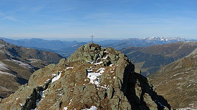
Summit of the Tristkopf

360-degree panorama from the summit of the Tristkopf
.jpg)
.jpg)