Outside
| Outside | ||
| Data | ||
| location | Italy , Austria , Slovenia , Croatia , Hungary | |
| River system | Danube | |
| Drain over | Danube → Black Sea | |
| source | From several sources around Innichen , South Tyrol ( Italy ) 46 ° 43 ′ 9 ″ N , 12 ° 15 ′ 16 ″ E |
|
| Source height | 1450 m slm | |
| muzzle | near Osijek ( Croatia ) in the Danube Coordinates: 45 ° 32 '38 " N , 18 ° 55' 36" E 45 ° 32 '38 " N , 18 ° 55' 36" E |
|
| Mouth height | 90 m. i. J. | |
| Height difference | 1360 m | |
| Bottom slope | 1.8 ‰ | |
| length | 749 km | |
| Catchment area | 40,120.4 km² | |
| Drain |
MQ |
670 m³ / s |
| Left tributaries | Isel , Möll , Lieser , Gurk , Lavant , Mur | |
| Right tributaries | Gail , Vellach , Mieß , Drann , Bednja | |
| Big cities | Maribor , Osijek | |
| Medium-sized cities | Lienz , Spittal , Villach , Völkermarkt , Ptuj , Varaždin | |
| Ports | Osijek | |
| Navigable | Osijek to Čađavica , according to other sources to Barcs , earlier to Marburg | |
|
Drava springs at Toblacher Feld |
||

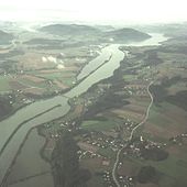
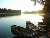
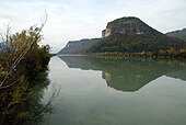
The Drava (rare Drave ; Italian , Slovenian and Croatian : Drava , Hungarian : Dráva ) is a tributary of the Danube , which in the Italian South Tyrol rises, then through East Tyrol and Carinthia ( Austria ) as well as by the Lower Styria ( Slovenia ), Croatia and Hungary flows .
With a length of 749 km and an average discharge of 670 m³ / s it is the fourth longest tributary of the Danube after Theiss , Pruth and Save .
etymology
The name is traced back to the Pannonian ( lat. Dravus ); see. old indian dravati for walking . The name can already be found in ancient literature with Pliny (Draus) , Sextus Rufus (Dravus) and Strabo (Drabos) . The Dravit , the Ambidravi and numerous place and field names are named after the Drava .
River course
South and East Tyrol
The Drau rises on the northern slope of the Neunerkofel (Haunold group) above the Toblacher Feld in the Puster Valley in South Tyrol ( Italy ) in the municipality of Toblach ( Italian Dobbiaco). The water from its five main springs flows a few hundred meters over steep meadows and forest floors to the bottom of the valley, where a real stream bed is only formed. In the first ten kilometers, the Drau overcomes 430 meters in altitude. The Toblacher Sattel forms an important watershed (main watershed), because the springs on the western slope of the Neunerkofel flow into the Rienza and thus further into the Adriatic . However, the Drau flows to the east and thus towards the Black Sea . It is one of the few rivers in Italy that does not drain into the Mediterranean. After a few kilometers, past San Candido , it crosses the border with East Tyrol , where it is dammed for the first time at Strassen .
In Lienz it takes up the Isel , which almost quadruples its size. The Isel is particularly dominant in early summer when the snowmelts in the Venediger Group . That is why the Drau above the mouth of the Isel is sometimes referred to as the Kleine Drau ; not to be confused with the Kleine Drau in the Rosental.
Carinthia


Just west of Oberdrauburg , the Drau reaches Carinthia . Between the Kreuzeck group in the north and the Gailtal Alps in the south, it winds through the upper Drautal , which it leaves again after a narrow valley between Sachsenburg and Möllbrücke . There she takes the Möll on which the glacier water of Pasterze leads and whitewater athletes and rafting tour is very popular. After a few kilometers over the Lurnfeld , past the Teurnia excavations , you reach the lower Drautal near Spittal . Reinforced by the water of the Lieser , it flows to the Drau town of Villach . From Paternion , the Drava is almost continuously contained in reservoirs as far as Croatia. In Villach, it can be viewed for the first time from a ship of the line. After the river bed has been lowered, the foothills of the Rosegger reservoir are used for tourism by the excursion boat Landskron .
East of Villach the Gail flows into the Drau, and this leaves the Villach Basin to enter the Rosental . Between the Sattnitz in the north and the Karawanken in the south and more reservoir than river, it reaches Völkermarkt . Before that, she picks up the gherkin and the vellach .
At Völkermarkt, the Drau is dammed up by the Drau power plant Edling to form the second largest body of water in Carinthia after the Wörthersee . An excursion boat, the MS Magdalena , has been operating on this “Völkermarkter Stausee” since 2005 . After the Edling barrage, the Drau flows through the Jaunfeld in an approximately 100 m deep gorge . This incision in the gravel cone of the terminal moraine of the Drau glacier has long been an almost insurmountable geographical obstacle for the residents on both sides of the Drava. It was only largely overcome with the construction of two large bridges, the approximately 100 m high Jauntal Bridge for the railroad in 1964 and the new Lippitzbach Bridge (96 m high) for national road traffic in 2006. The oldest large Drau power plant, the Schwabegg power plant, is also located in this incision . This was built in the time of the Third Reich and was one of the most important cornerstones of Austria's power supply, especially in the years immediately after the war and until the first large Danube power plants were built. “When the Schwabegg power plant failed, the lights went out in Vienna,” said contemporary witnesses.
At Lavamünd , the last Carinthian river flows into the Drau, the Lavant , before it leaves Austria before Dravograd (Unterdrauburg) and flows to Slovenia . With 11,828 km² the Drau has the third largest catchment area in Austria after the Danube and the Inn .
Slovenia
In Slovenia it takes up the Mieß (Slovenian: Meža) just after Dravograd and flows through a rather sparsely populated area and several reservoirs to the first large city. Maribor (Marburg) with around 120,000 inhabitants is the largest city on the Drava and the most important economic center in northeastern Slovenia. After Ptuj (Pettau) , the Drava is again transformed into a reservoir by a power station.
Croatia

Even shortly after the border with Croatia, which it passes near Ormož , it is dammed several times to generate electricity. The city of Varaždin is circumnavigated to the north before the Drava at Legrad absorbs the Mur and then forms the border with Hungary . The Drava flows into the Danube below the city of Osijek (approx. 110,000 inhabitants) at Dravski Kut (Draueck) in Croatia .
ecology
The Drau drains East Tyrol and almost all of Carinthia. For these two regions, it represents the most important lifeline, which has a decisive influence on their ecology. The upper reaches of the Drau and the streams flowing towards it are natural over long stretches. But already in San Candido she is forced into a narrow walled bed to protect against flooding. Outside the villages, it is bordered by narrow floodplains and stands out as a dark green band from the light green of the surrounding meadows and pastures. Since there are no polluting industrial operations on its upper reaches, it has water quality class 1 throughout - and a correspondingly rich fauna and flora. In order to protect meadows, fields and localities from the often unpredictable power of the Drava and to gain arable land, it was more and more deprived of its floodplains in the second half of the 19th century, so that it is now only in the Upper Drautal over long stretches is lined by narrow strips of shore, often kept away from meadows and fields by dams. In order to restore ecological diversity, various projects for the renaturation of the river landscape have been launched in recent years . They are intended to create a diverse habitat for such rare species as the jackdaw crab , which in Austria only occurs in Carinthia. Flood protection and nature protection are by no means mutually exclusive, because the targeted return of former floodplains gives the river space and thus prevents the rapid uncontrolled runoff of large bodies of water. These measures should enable species as diverse as the huchen , common sandpiper and little ringed plover , but also rare plants such as the German tamarisk to survive.
Further downstream, the Drau is used intensively for energy purposes. Here the formerly wild river has become a chain of reservoirs that are connected by relatively short stretches of flow. Restoration measures are only possible to a very limited extent in this area. In spite of this, measures have been taken in some places to enable biodiversity in line with the quieter habitus of the river. The Wernberger Drauschleife below Villach was redesigned into an artificial oxbow lake, which now serves as a breeding and hunting ground for a wide variety of water birds. Artificial peninsulas, islands, bays and ponds have been created within the protective dams on many stretches of the banks to provide spawning grounds and nurseries for the fish and amphibians native to this area. In order to maintain the water quality, all central settlement areas in Carinthia have been gradually connected to the sewer system and thus to fully biological sewage treatment plants since the beginning of the 1970s .
In its lower reaches on the border between Hungary and Croatia, the Drava is particularly interesting for nature lovers because it is almost untouched; their floodplains show a great diversity of species. However, the river sections in the section between the Croatian-Hungarian border and Osijek in the 1991/92 front area and were fortified accordingly. In the river basin and its banks, mines can still be expected today.
Fish stocks
The high water quality of the Drava is also reflected in its species-rich fish population. In its upper course with its relatively high flow speed, high oxygen content and low nutrient content, rainbow trout and brown trout , but also noses , barbel , aitel , grayling and huchen can be found. In the calmer and somewhat warmer waters of the reservoirs in the lower Drautal, but especially in the Rosental, there are other species such as pikeperch , pike , bream , rudd , roach , carp , eel rods , brook char and tench . Rarely do fishermen catch a catfish . Towards the Slovenian border, there are also lesser-known species such as female nerfling , nerdy and bitterling .
Signal crabs can also be found in the reservoir of the Annabrücke power plant .
Economy and Transport
navigability
The Drava is navigable from the Croatian Čađavica downwards, according to other sources from Barcs . Earlier sources that refer to a lower level of development of hydropower use indicate Maribor . In addition, there are regular services with excursion boats at Villach and Völkermarkt and in the Upper Drautal and from Lavamünd rafting services for tourist purposes. There is also a river boat and rafting service for tourists in Maribor.
The less regulated section from Lienz to Paternion is popular for paddle boats .
According to the standards of 1860, the Drau was navigable from Villach. The Faal power station was built between 1913 and 1918 with a raft lock .
Drau cycle path
The Drau cycle path stretches almost from the source over 510 km from Toblach to Varaždin. An extension to the point where it flows into the Danube is planned.
Drau power plants
Austria
The topmost Drau power plant is the Strassen-Amlach power plant in Tyrol. In Tassenbach is a Drava and Gailbach fed reservoir from which the water through a pressure tunnel to 370 m deeper power plant in Amlach is passed.
Between 1939 and 1943 the first power plant was built in Schwabegg on the Drau in Carinthia. Today there are ten power plants from Paternion to the Slovenian border, almost all of which dam the Drava. In all cases, the operator is VERBUND Hydro Power AG as the successor to ÖDK . With their maximum output of around 600 MW and an annual energy production of around 2600 gigawatt hours, they contribute around three percent to covering Austria's electricity needs.
Slovenia
In Slovenia there are power plants near Dravograd (Unterdrauburg) , Vuzenica (Saldenhofen) , Vuhred (Wuchern) , Ožbalt (St. Oswald an der Drau) , Fala (Faal) , Mariborski otok (Marburg Drau Island) , Melje, Zlatoličje (Golldorf) and Formin. The installed capacity is given as 577 MW, the electricity generated in Slovenian Drau power plants covers around 25% of the country's needs.
Croatia
There are three Drau power plants in Croatia with an installed capacity of 168 MW.
Others
Already in the early Middle Ages, in the year 811, the Drava - in this context called "Drauus fluvius" in Latin - was determined by Charlemagne as the border between the dioceses of Salzburg and Aquileia in the Eastern Alps.
The Drau is featured in the Carinthian Heimatlied ([…] where the river Drau's gorgeous green is swiftly flowing through the Matten […]) , in the Lijepa naša ([…] Teci Savo, Dravo teci, […]) and in the Styrian national anthem “ Dachsteinlied “ ([...] all the way to the vineyards in the Drav valley [...]) .
In addition, the Croatian (later Viennese) poet Ilka Maria Ungar (1879–1911) dedicated a few poems to her homeland in rhyming “Drava idylls” in her poem cycle Feierabend (Lexikus Verlag 2011).
From 1868 to 1929 a German-language newspaper with the title Die Drau was published in Osijek (Croatia) .
The Carinthian and Klagenfurt Drava Verlag , an important institution of the Carinthian Slovenes with a regional and intercultural focus, is named after the river.
In Vienna, Draugasse has been named after the river since 1996 (previously Draustraße since 1953 ).
literature
- Anton Kreuzer: The Drau - The river and its neighbors. Kreuzer Verlag, Klagenfurt 2011.
Web links
- Drau on the website of the South Tyrolean Environment Agency
- Power plants on the Drau ( Memento from December 27, 2004 in the Internet Archive )
- Drau Cycle Path - 366 km through Italy, Austria and Slovenia
- Drau / Drava - Old River and New Sounds - a musical network project
- Hydrographic service in Carinthia - online measurement data
Individual evidence
- ↑ Federal Ministry of Agriculture, Forestry, Environment and Water Management (Ed.): Area directory of the Austrian river basins: Draugebiet. Contributions to the hydrography of Austria, issue No. 59, Vienna 2011, p. 58 ( PDF; 3.7 MB )
- ↑ Austria Forum - Drau. aeiou , accessed April 6, 2013 .
- ↑ Reke follow. Statistični urad Republike Slovenije , accessed on June 14, 2012 .
- ↑ a b c Brockhaus Encyclopedia, 21st edition , Volume 11, December 2005; ISBN 3-7653-4142-8 .
- ↑ a b c Brockhaus Encyclopedia in Twenty Volumes Volume 25, 1966
- ^ Egon Kühebacher : The place names of South Tyrol and their history . 2: The historically grown names of the valleys, rivers, streams and lakes. Publishing house Athesia, Bozen 1995, ISBN 88-7014-827-0 , p. 51 .
- ↑ At the confluence point, the mean water flow of the Isel is 39.0 m³ / s ( Lienz gauge , 1 km above the mouth) and that of the Drau is 13.5 m³ / s ( Lienz-Falkensteinsteg gauge , 2 km above the mouth)
- ↑ Little Dr Sillian. Retrieved April 29, 2014 .
- ↑ The decline of a river. Retrieved April 29, 2014 .
- ↑ The Little Drava. (No longer available online.) Archived from the original on April 29, 2014 ; Retrieved April 29, 2014 . Info: The archive link was inserted automatically and has not yet been checked. Please check the original and archive link according to the instructions and then remove this notice.
- ↑ Mine warning along the border between Croatia and Serbia. Retrieved July 4, 2016 .
- ↑ Max Biffart: Germany. Nitzschke, 1860, p. 48. Restricted preview in the Google book search
- ↑ 100 YEARS OF THE FALA HYDRO POWER PLANT - HSE - Holding slovenske elektrarne. In: hse.si. Retrieved September 27, 2018 .
- ↑ TIWAG: Amlach power plant ( Memento of the original from February 27, 2016 in the Internet Archive ) Info: The archive link was inserted automatically and has not yet been checked. Please check the original and archive link according to the instructions and then remove this notice.
- ↑ Use of energy in Austria. In: Umweltbundesamt.at. Accessed December 31, 2014 .
- ↑ a b Dravske elektrarne Maribor (September 29, 2008, English)
- ↑ Google Maps: Location coordinates for KW Varaždin , accessed July 9, 2012
- ↑ Google Maps: Location coordinates KW Čakovec , accessed July 9, 2012
- ↑ Google Maps: Location coordinates KW Dubrava , accessed July 9, 2012
- ↑ Martin Bitschnau , Hannes Obermair : Tiroler Urkundenbuch , II. Department: The documents on the history of the Inn, Eisack and Pustertal valleys. Vol. 1: Up to the year 1140 . Universitätsverlag Wagner, Innsbruck 2009, ISBN 978-3-7030-0469-8 , p. 55-56 No. 79 .
- ↑ Vlado Obad (Ed.): Regional press Austria-Hungary and the urban culture. Vienna 2007, p. 120ff.
- ↑ Drava Publishing House. In: drava.at. December 19, 2014, accessed December 31, 2014 .


