
Oberdrauburg
|
market community Oberdrauburg
|
||
|---|---|---|
| coat of arms | Austria map | |
 |
|
|
| Basic data | ||
| Country: | Austria | |
| State : | Carinthia | |
| Political District : | Spittal an der Drau | |
| License plate : | SP | |
| Surface: | 69.92 km² | |
| Coordinates : | 46 ° 45 ′ N , 12 ° 58 ′ E | |
| Height : | 632 m above sea level A. | |
| Residents : | 1,188 (January 1, 2020) | |
| Population density : | 17 inhabitants per km² | |
| Postal code : | 9781 | |
| Area code : | 0 47 10 | |
| Community code : | 2 06 25 | |
| NUTS region | AT212 | |
| Address of the municipal administration: |
Marktplatz 1 9781 Oberdrauburg |
|
| Website: | ||
| politics | ||
| Mayor : | Stefan Brandstätter ( ÖVP ) | |
|
Municipal Council : ( 2015 ) (15 members) |
||
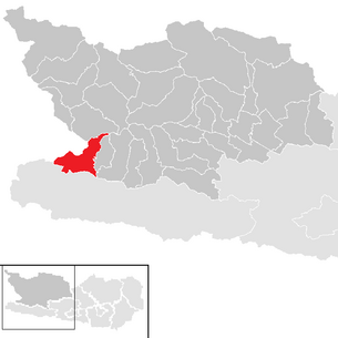
| Location of Oberdrauburg in the Spittal an der Drau district | ||
  |
||
| Source: Municipal data from Statistics Austria | ||


Oberdrauburg is a market town with 1188 inhabitants (as of January 1, 2020) in the Spittal an der Drau district in Carinthia .
geography
Geographical location
The center of the municipality is to the left of the Drau in the far west of Carinthia on the border with East Tyrol , about 20 km east of Lienz . In Oberdrauburg the road branches off to the Gailbergsattel in the Gailtal . The place is a good starting point for excursions to the Lienz Dolomites and the Kreuzeck group .
The place is below the Kärntner Tor at the point where the Drau enters Carinthia. Carinthia in the borders before the First World War left the Drau near Unterdrauburg .
Community structure


Oberdrauburg is divided into the cadastral municipalities of Flaschberg, Oberdrauburg and Zwickenberg, the municipal area comprises the following ten localities (population in brackets as of January 1, 2020):
- Flaschberg (40)
- Gailberg (0)
- Oberdrauburg (354)
- Oberpirkach (14)
- Otting (207)
- Rosenberg (7)
- Schrottenberg (11)
- Unterpirkach (55)
- Waidach (271)
- Zwickenberg (229)
history
Settlement of the municipality can already be proven from the time of the Celts and Romans . In 1240 the Oberdrauburg Castle was first mentioned in writing as Traburch castrum ; it belonged to the Carinthian Duke Bernhard von Spanheim . Also mentioned is a Zwicko from Oberdrauburg, from which the name Zwickenberg should come.
In the course of the 13th century, a street settlement was built to protect the castle at the junction to the road over the Gailberg. In 1292 Oberdrauburg came under the rule of Gorizia and in 1308 the place was run as a Salzburg fiefdom; probably the castle was originally owned by the Salzburg archbishops. In 1325 Oberdrauburg was granted market rights with toll rights. Oberdrauburg benefited from its convenient location and was able to generate high toll revenues.
In 1364 the Counts Meinhard VI. and Meinhard VII. von Görz mentioned as owners, in 1385 Oberdrauburg came into the possession of the Counts of Ortenburg and in 1418 to the Count Hermann von Cilli , then in 1456 to the Habsburgs , which triggered an inheritance war with the rule of Gorizia. After the death of the last count of Gorizia, Oberdrauburg and the entire county of Gorizia fell to the Habsburgs in 1500. From 1524 to 1639 Oberdrauburg was run as a fiefdom of the Counts Salamanca-Ortenburg . In 1640 a stately hospital was built. The Widmann family from Villach acquired the Oberdrauburg landscape with the title of Count "von Ortenburg". In 1643 the new owners also acquired the "Flaschberg" estate and in 1655 the criminal jurisdiction was granted.
In 1662 Prince Johann Porcia bought the County of Ortenburg from Count Widmann. In 1664 the pastor of Irschen released the church of St. Oswald von Oberdrauburg from his care. St. Oswald was first mentioned in a document in 1513.
Between 1721 and 1733, a neighborhood aid was set up in the event of damage from fires, Drau and torrent floods, which is still known today as the “neighborhood”. In 1747 Oberdrauburg was ravaged by a devastating fire. As a result, the pilgrimage vow to Maria Luggau was pronounced.
During the French Wars of 1797–1814, Oberdrauburg appeared several times occupied by Napoleon and had to pay heavy tribute. In 1809 Upper Carinthia became part of the Kingdom of Illyria through the Treaty of Schönbrunn , which was reunited with Austria in 1813. In 1835, Oberdrauburg received the French requisition money back, which remained as share capital for the market municipality.
In 1851 Oberdrauburg submitted an application to the imperial court office for state aid to regulate the Drau and torrent for Upper Carinthia, which was largely granted. In 1884 a state law was passed, according to which the state has to pay 9/15, the state 4/15 and the neighboring municipality 2/15.
The Marburg - Franzensfeste railway line ( Austrian Southern Railway ) was built from 1863 to 1871 . On 24./25. In September 1870 a major fire destroyed most of the market.
During the First World War , Oberdrauburg became a stage stop for the Italian front in 1915.
In 1923 the market municipality in Simmerlach built an electricity plant.
In 1930 Robert Baron Klinger von Klingerstorff acquired the rule, but could not hold it. The landscaped property was divided up and sold individually.
The property of the market commune was transferred to the community in 1938 for the time of Nazi rule.
At the end of the Second World War, Oberdrauburg suffered a lot from air raids. The last attack on April 24, 1945, where the castle and many houses in the lower part of the market were destroyed, caused severe damage.
In 1946 the market commune was reintroduced as a “ neighborhood ”.
In 1964 the market community experienced area growth through the affiliation of the former local community Flaschberg and in 1973 through the union with Zwickenberg.
In 1965 and 1966 there were three flood disasters within 14 months (September 1965, August 1966 and November 1966), which caused severe damage. In 1967 the relocation of the river bed began.
The bypass came about in 1978 and 1979.
population
According to the 2001 census, Oberdrauburg has 1,334 inhabitants, 98.1% of whom are Austrian citizens. 94.8% of the population profess to the Roman Catholic and 2.3% to the Protestant Church, 1.6% are without religious belief. The population speaks Trabrigerisch , an Upper Carinthian dialect with strong East Tyrolean influences.
After a peak in the population in 1971 with 1,440 inhabitants, the number of inhabitants is falling due to a negative migration balance . While this was mitigated from 1981 to 2001 by a positive birth balance, the birth balance from 2001 to 2011 is also negative.
Culture and sights
Buildings
- Hohenburg castle ruins, the symbol of the community
- Flaschberg castle ruins
- Gut Schröttelhof
Natural monuments and experiences
- Trögerwandhöhlen
- Silver case
- Hochstadel - the eastern summit of the Lienz Dolomites
- Lisgen - wetland in the east of the municipality
- Via ferrata Pirknerklamm
- Zwickenberg waterfall
politics
Municipal council
The municipal council of Oberdrauburg has 15 members and has been composed as follows since the municipal council election in 2015 :
The directly elected mayor is Stefan Brandstätter (ÖVP).
coat of arms
The coat of arms shows the Drau and Draubrücke bridges with gate towers, behind and next to them town houses with shingle roofs. In the upper half of the shield, the two late medieval towers are depicted, which stand above the market church and the castle.
The original coat of arms award certificate was issued to the market on June 2, 1625 by Georg Graf von Ortenburg in Spittal. The description of the coat of arms read:
- “[...] A shield, wrapped in two thails, the upper thail yellow, in which a green mountain, on it two identical brown white pasty thorns with sloping roofs, both placed against each other, the underthail red, inside also in the middle a such white pasty thorn like in the upper Thail, with two large haylofts built on them and in the middle of the Thurn a gate, from which the streets go over Thraaprucken [...] "
This representation was precisely implemented in the seals of the 17th and 18th centuries. Later images changed the proportions or introduced new elements such as B. Trees a. On the occasion of the certification of the coat of arms and the award of the flag on May 22, 1973, the original representation was returned. The blazon valid from there on is:
- “Split shield; Above, in gold, across the entire width of the dividing line, a green three-mountain, occupied by two half-facing tinned silver bastion towers, below, in red, a tinned silver bastion tower with a gate that opens to the brown Drau bridge and the naturally reproduced river, a large one added to the right and left silver house with a naturally colored tiled roof. "
The flag is yellow-red with an incorporated coat of arms.
Personalities
Honorary citizen
- Friedrich Marx (1830–1905), kk colonel and local poet
- Josef Pirker, Honorary Mayor
- Franz Jochum (* 1944), market historian, Vice Mayor
Sons and daughters of the church
- Josef Ferdinand Fromiller (1693–1760), painter
- Hannes Jochum (* 1977), soccer player
- Hellmuth Marx (1915–2002), sculptor
- Roland Schwarzl (* 1980), athlete
Partner communities
In the 1990s, Oberdrauburg concluded partnership agreements with the following three municipalities under the then mayor Josef Pirker:
- Paluzza , Italy
- Signa , Italy, since 1996
- Türkenfeld , Germany, since 1990
Web links
- Market town of Oberdrauburg
- 20625 - Oberdrauburg. Community data, Statistics Austria .
- Info Oberdrauburg
- Historical postcards from Oberdrauburg
- Archive recordings from and about Oberdrauburg in the online archive of the Austrian Media Library (folklore films, interview)
Individual evidence
- ↑ Statistics Austria: Population on January 1st, 2020 by locality (area status on January 1st, 2020) , ( CSV )
- ↑ List of the Carinthian agricultural communities List of Austrian agricultural communities # Carinthia
- ^ Statistics Austria, population census, demographic data. May 15, 2001, accessed March 3, 2019 .
- ^ Statistics Austria, A look at the community of Oberdrauburg, population development. Retrieved March 3, 2019 .
- ↑ a b quoted from Wilhelm Deuer: The Carinthian municipal coat of arms . Verlag des Kärntner Landesarchiv, Klagenfurt 2006, ISBN 3-900531-64-1 , p. 208
- ↑ Partner communities ( Memento of the original from September 24, 2015 in the Internet Archive ) Info: The archive link was inserted automatically and has not yet been checked. Please check the original and archive link according to the instructions and then remove this notice. (oberdrauburg.at)
Bad Kleinkirchheim | Baldramsdorf | Berg im Drautal | Dellach im Drautal | Flattach | Gmünd in Carinthia | Greifenburg | Großkirchheim | Heiligenblut am Großglockner | Irschen | Kleblach-Lind | Krems in Carinthia | Lendorf | Lurnfeld | Mallnitz | Malta | Millstatt am See | Mörtschach | Mühldorf | Oberdrauburg | Obervellach | Radenthein | Rangersdorf | Reisseck | Rennweg am Katschberg | Sachsenburg | Seeboden am Millstätter See | Spittal an der Drau | Stall | Steinfeld | Trebesing | Weissensee | Winklern