Dellach in the Drautal
|
Dellach in the Drautal
|
||
|---|---|---|
| coat of arms | Austria map | |
|
|
||
| Basic data | ||
| Country: | Austria | |
| State : | Carinthia | |
| Political District : | Spittal an der Drau | |
| License plate : | SP | |
| Surface: | 76.09 km² | |
| Coordinates : | 46 ° 44 ' N , 13 ° 5' E | |
| Height : | 614 m above sea level A. | |
| Residents : | 1,590 (January 1, 2020) | |
| Population density : | 21 inhabitants per km² | |
| Postal code : | 9772 | |
| Area code : | 0 47 14 | |
| Community code : | 2 06 04 | |
| NUTS region | AT212 | |
| UN / LOCODE | AT DDT | |
| Address of the municipal administration: |
No. 18 9772 Dellach im Drautal |
|
| Website: | ||
| politics | ||
| Mayor : | Johannes Pirker ( ÖVP ) | |
|
Municipal Council : ( 2015 ) (15 members) |
||
| Location of Dellach im Drautal in the Spittal an der Drau district | ||
| Source: Municipal data from Statistics Austria | ||
Dellach im Drautal is a municipality with 1590 inhabitants (as of January 1, 2020) in the Spittal an der Drau district in Carinthia ( Austria ).
geography
Dellach im Drautal is located in the Drautal about halfway between Lienz and Spittal , nestled between the Gailtal Alps in the south and the Kreuzeck group of the Hohe Tauern in the north.
Community structure
The municipality is divided into the five cadastral communities Dellach im Drautal, Drassnitz, Drassnitzdorf, Nörenach and Stein and includes the following 12 localities (population in brackets as of January 1, 2020):
- Dellach (669)
- Draßnitz (35)
- Draßnitzdorf (100)
- Glatschach (104)
- Grientschnig (50)
- Nörenach (132)
- Racy (38)
- Rietschach (59)
- Enamel (248)
- Stone (55)
- Suppersberg (75)
- Vineyard (25)
climate
On July 27, 1983, Dellach recorded 39.7 ° C, the highest temperature in Austria since records began. A new nationwide temperature extreme was reached, again in Dellach, on August 3, 2013 with 39.9 ° C, but exceeded a few days later, on August 8, in Bad Deutsch-Altenburg with 40.5 ° C.
|
Average monthly temperatures and precipitation for Dellach
|
|||||||||||||||||||||||||||||||||||||||||||||||||||||||||||||||||||||||||||||||||||||||||||||||||||||||||||||||||||||||||||||||||||||||||||||||||||||||||||||||||||||||||
history
Dellach im Drautal was first mentioned in 1267 as "Doellach". Also at the time Dellach was first mentioned, the place names Grientschnig (Gorintschih), Draßnitzdorf (Draesentzach), Unterdraßnitz (Tressorezach), Oberdraßnitz (Draesniz), Suppersberg (Supansperge), Nörenach (Norinach) and a short time later Rietschach (Glzezerietsach) and Glenschach) already proven. The local community was constituted in 1850, and in 1923 the village of Pflügl (previously part of KG Stein) was ceded from the original community area to the neighboring community of Irschen.
Although these names have all Slavic roots, it is considered certain that the localities in question do not represent real Slovenian settlements, but only old, previously found field names were adopted by the later settlers. For a long time, mining was of great importance for the entire Drau valley and especially for Dellach. There were once four mines in the municipality, namely Jauken, Draßnitztal, Kolm and Glatschach. During the heyday, up to 2000 quintals of zinc went down on rafts every year. In 1703 a post line through Carinthia, Drava and Pustertal was established on the orders of Emperor Josef I. The transport on the Drava went back. From the centuries-old ore blessing, dilapidated tunnels, place names such as Schmelz and old house names remain as silent witnesses of the past.
In 1787 the elementary school was founded. The school had to change classrooms several times. The first lesson was held in the Messnerkeusche. When this was too small, the former Gasthaus Pacher was purchased and converted and served as a schoolhouse until 1957. Today it houses the municipal office. From 1810 to 1813 Upper Carinthia was administered by France. The construction of the southern runway through the Drautal began in 1869. In 1871 the first train ran to Franzensfeste. The end of the float comes to an end. After the Dellacher Draubrücke was torn away during a flood in 1882, the Drau river was regulated and the Draßnitzbach was built. On May 8, 1945 Dellach was occupied by British troops. On February 6, 1961, the Carinthian state government granted the municipality of Dellach the right to use a municipal coat of arms, the symbolism of which is intended to recall the mining tradition and the use of water power in the village. On May 27, 1966, the municipality of Dellach was awarded the title climatic health resort by decision of the Carinthian state government .
population
A census in 1900 counted 1150 inhabitants in the municipality. At the time of the 2001 census, Dellach im Drautal had 1,769 inhabitants, 98.7% of whom were Austrian citizens. 94.8% of the population confessed to the Roman Catholic and 2.9% to the Protestant Church, 2.0% of the population was without religious belief.
From 1869 to 1971 the population of Dellach almost doubled to 1,924. Since then, the population has been falling due to strong emigration. This can not be offset by a positive birth balance either.
Culture and sights
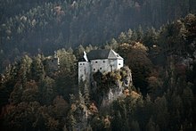
- The Stein Castle is a well-preserved medieval rock castle on a steep cliff about 200 meters above the valley floor. Erected in the late 12th century, it was owned by an Ortenburg ministerial in 1190 . It was first mentioned in a document in 1440 as a property of the Counts of Cilli and then in 1456 with Emperor Friedrich III. as the owner. In 1500 it came into the possession of the Graben zum Stein , in which it remained until 1668. The castle complex is currently owned by the Orsini-Rosenberg family and is not open to the public.
- The parish church of St. Margaretha in Dellach is a medium-sized late Baroque building from the late 18th century. Parts of the chancel, the tower and a late Gothic mural on the northern choir wall come from an old, earlier chapel. The wall and ceiling paintings designed by Christoph Brandstätter depict scenes from the life of St. Margaretha and the finding of the cross and apparition of the cross from Emperor Constantine.
- Mater dolorosa chapel in Glatschach
- Chapel of Mary Seven Sorrows in Drassnitzdorf, built around 1800
- The Tonele shaft furnace in the Draßnitztal valley, where silver and copper were mined from 1524 to 1789, and the manor house, a former trade center at a smelter, are reminiscent of the mining operations in Dellach.
- Draßnitztal shaft furnace : At an altitude of almost 1,600 m you come across the remains of an old shaft furnace from the 16th century, which have been listed and restored by the Carinthian mountain rescue service. Until the 19th century, the shaft furnace was used for the raw smelting of roasted copper ores that were mined in the Draßnitz valley.
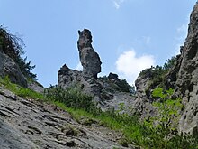
- The Geißlochklamm is a gorge cut deep into the limestone cliffs of the Jaukenstock on the municipal boundary between Berg and Dellach. The gorge was made accessible by footbridges and can be easily reached from the Berg-Dellach bike and hiking trail. At the entrance there is an old renovated lime kiln with a display board, which until a few decades ago was used for lime extraction in rural areas. The sometimes very steep side walls of the gorge offer bizarre rock formations and some climbing routes.
- At the Weittalwasserfall natural monument, the waters of the Weittalwasserfall tumble down to the valley at an altitude of around 1500 m . The natural spectacle was placed under protection as a natural monument around 20 years ago.
- Natural monuments Wacholderhain and Tuffbachl : A group of tree-shaped junipers on the slope below Schloss Stein represents a very rare vegetation variant that is actually not found in this form in our latitudes and has therefore been placed under protection. At the Lappenbach, known as Tuffbachl, above the homestead vlg. Schuster in the village of Stein, the spring water, which is rich in minerals, in combination with certain lichens and mosses that occur there, constantly creates new tuff limestone. Source corridors and streams are given a special appearance and are constantly changing.
- Barbarastollen, a healing gallery in the Holztratten district.
- Drau oasis near Raßnig. As part of the integration of the Upper Drau into the Upper Drau European Protected Area ( Natura 2000 ), the approximately 7-meter-high DrAUENland viewing platform was built on the southern bank of the Drau in 2007 , built around a tree and offering a good view of the Drau.
Economy and Infrastructure
Dellach was an important economic community in the upper Drautal at the beginning of the 20th century: In addition to traditional agriculture and the location on the transit route through the Drautal, mining was carried out in Glatschach (mercury), Jauken (gold), Kolm (nickel, calamine ). In addition, there was a state zinc smelter from the 18th and 19th centuries , which was later converted into an iron hammer mill. In its place, Johann Taurer built the first wood pulp and cardboard factory in Carinthia in 1872, which was followed by others in 1897 and 1908. Dellach im Drautal is located on Drautal Straße (B 100).
The economy of Dellach im Drautal is characterized by summer tourism and forestry and wood processing. A larger production facility of the Europlast company is based in Dellach, it manufactures plastic containers and large plastic boxes.
politics
Municipal council
The Dellach municipal council has 15 members and has been composed as follows since the 2015 municipal council election :
After mayor Walter Egger (SPÖ), who was elected in March 2009, did not take office for health reasons, it became necessary to elect another mayor, which Johannes Pirker (ÖVP) won.
coat of arms
The motifs of the Dellacher coat of arms, which was awarded to the municipality on February 6, 1961, allude with the five mining symbols on the diverse mining past in the municipality, and the lower blue half of the shield with wave division on the importance of the Drava for the municipality.
Sons and daughters of the church
- Hermann Lackner (1899–1984), politician of the SPÖ , member of the Styrian state parliament 1945–1949, member of the National Council 1949–1962
Web links
- Dellach im Drautal community
- 20604 - Dellach im Drautal. Community data, Statistics Austria .
Individual evidence
- ↑ Statistics Austria: Population on January 1st, 2020 by locality (area status on January 1st, 2020) , ( CSV )
- ↑ The standard : Austria-wide heat record: 39.9 degrees in the Carinthian Dellach , August 3, 2013
- ↑ The standard : 40.5 degrees in Bad Deutsch Altenburg new official record , August 8, 2013
- ↑ In Spiegel der Zeiten on the Hotel Glocknerhof page, accessed on February 19, 2014
- ^ Statistics Austria, population census, demographic data. May 15, 2001, accessed March 3, 2019 .
- ^ Statistics Austria, A look at the community Dellach im Drautal, population development. Retrieved March 3, 2019 .
- ↑ Upper Drava. Federal Ministry of Sustainability and Tourism
- ↑ Kleine Zeitung online , accessed on March 24, 2009.
- ↑ Kleine Zeitung online , accessed on June 29, 2009.


