
Großkirchheim
|
Großkirchheim
|
||
|---|---|---|
| coat of arms | Austria map | |
 |
|
|
| Basic data | ||
| Country: | Austria | |
| State : | Carinthia | |
| Political District : | Spittal an der Drau | |
| License plate : | SP | |
| Main town : | Dollach | |
| Surface: | 109.51 km² | |
| Coordinates : | 46 ° 59 ' N , 12 ° 54' E | |
| Height : | 1024 m above sea level A. | |
| Residents : | 1.310 (January 1, 2020) | |
| Population density : | 12 inhabitants per km² | |
| Postal code : | 9843 | |
| Area code : | 0 48 25 | |
| Community code : | 2 06 05 | |
| NUTS region | AT212 | |
| Address of the municipal administration: |
Döllach 47 9843 Großkirchheim |
|
| Website: | ||
| politics | ||
| Mayor : | Peter Suntinger (independent) | |
|
Municipal Council : ( 2015 ) (15 members) |
||
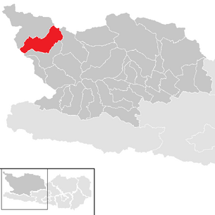
| Location of Großkirchheim in the Spittal an der Drau district | ||
  |
||
| Source: Municipal data from Statistics Austria | ||


Großkirchheim is a municipality with 1,310 inhabitants (as of January 1, 2020) in the Spittal an der Drau district in Carinthia .
geography
Geographical location
Großkirchheim is an average of 1024 meters above sea level in the Großglockner region of the Hohe Tauern , in the east it is bounded by the Sonnblick group and in the west by the Schober group. About 40% of the municipality is in the Hohe Tauern National Park .
Neighboring municipalities are Heiligenblut , Flattach and Mörtschach , in the north the municipality borders on the state of Salzburg , in the west on East Tyrol .
Community structure
Großkirchheim is divided into the five cadastral communities Döllach, Mitten, Putschall, Sagritz and Winkel Sagritz, the community area includes the following 14 localities (population in brackets as of January 1, 2020):
- Allas (39)
- At the Putzenhof (18)
- Dollach (436)
- Egg (7)
- Goritz (32)
- Crazy (61)
- Mitteldorf (115)
- Middle (140)
- Putschall (59)
- Ranach (30)
- Sagritz (187)
- Subsagritz (99)
- Winklsagritz (48)
- Zirknitz (39)
climate
|
Average monthly temperatures and precipitation for Döllach
|
|||||||||||||||||||||||||||||||||||||||||||||||||||||||||||||||||||||||||||||||||||||||||||||||||||||||||||||||||||||||||||||||||||||||||||||||||||||||||||||||||||||||||
history
Großkirchheim Castle was first mentioned in a document around 1140/50 at "locus Chyrichaim" (Kirchheim).
Gold was mined in the Hohe Tauern as early as the time of the Celts and Romans in Carinthia . The mining of precious metals experienced its heyday here in the Middle Ages and from the end of the 15th century. A document written in 1338 granted the mining rights for the "goldärtzt in the Kirchhaimer court and the one in the Tauern bey dem industrious" . Up until the 17th century, gold was mined in what is today the municipality, only after more and more pits were frozen by the advancement of the Pasterze , mining had to be abandoned.
In the 17th and 18th centuries, several people and families from Sagritz and Großkirchheim emigrated to the Bavarian Alpine foothills.
In 1850 the independent local parishes of Döllach, Sagritz and Mitten were first established in what is now the municipality, with the latter two merging as early as 1856. From 1939 Döllach and Sagritz had a joint mayor's office, in 1956 they merged to form the municipality of Döllach-Sagritz, which was finally renamed Großkirchheim in 1983, following the historical importance of the castle and regional court.
In the course of the 20th century, Großkirchheim developed into a two-season tourist destination (approx. 45,000 overnight stays) and the headquarters of the Hohe Tauern National Park office .
 |
 |
Großglockner Straße (B 107) leads through the municipality .
population
According to the 2001 census, Großkirchheim has 1,606 inhabitants, 96.6% of whom are Austrian and 2.6% German citizens. 95.8% of the population profess to the Roman Catholic and 2.1% to the Protestant Church, 1.5% are without religious belief.
Culture and sights
- Großkirchheim Palace in Döllach
- Parish Church of St. Georgen in Sagritz
- Filial church St. Andreas in Döllach
- Pilgrimage church Maria Dornach in Mitteldorf
- Gartl waterfall
- Tauern gold exhibition in the Putzenhof
politics
Municipal council
The municipal council of Großkirchheim has 15 members and has been composed as follows since the municipal council election in 2015 :
The directly elected mayor is Peter Suntinger (independent).
coat of arms
The central motif of the municipality's coat of arms is the Großkirchheim Castle, which was built by Melchior Putz von Kirchheimegg († 1583). This led in his coat of arms both three golden roses in the red shield head, as well as three wild rose fruits ("cleaning") as "talking" part; both were included in the municipal coat of arms. In the lower part of the coat of arms, the golden Zweiberg with the valley cut on the one hand (like the mining symbol) alludes to gold mining and on the other hand to the place name Döllach (from Slov. Doljah , for the valley inhabitants).
The blazon of the coat of arms, which was given to the municipality on September 5, 1978, reads:
- "Under a red shield head in green, covered with three golden roses, a golden, black open lock with a hipped roof over a golden two mountain, which is covered on the right with three red, green wild rose fruits, on the left with a black mine symbol."
The flag is green-red with an incorporated coat of arms.
Economy and Infrastructure
The community is accessed through the Großglockner Straße . In the Zirknitz Valley , which leads east into the Goldberg Group, there are plants from the Fragant power plant group . The Gradental , which leads west into the Schobergruppe , is accessible to tourists through the Adolf-Noßberger-Hütte .
Personalities
- Anton Granig (1901–1945), priest and resistance fighter
- Josef Kahn (1839–1915), Bishop of Gurk
- Hubert Sauper (* 1966), film director
Web links
- Großkirchheim community
- 20605 - Großkirchheim. Community data, Statistics Austria .
Individual evidence
- ↑ Statistics Austria: Population on January 1st, 2020 by locality (area status on January 1st, 2020) , ( CSV )
- ↑ Peter Tremmel: The Granegger. Series: Immigrants to the Aichacher Land during and after the Thirty Years War. http://www.genealogie-kiening.de/granegger.htm
- ^ Statistics Austria, A look at the community of Großkirchheim, overnight stays. Retrieved March 2, 2019 .
- ^ Statistics Austria, population census, demographic data. May 15, 2001, accessed March 2, 2019 .
- ^ Province of Carinthia, municipal council election . March 1, 2015, accessed March 4, 2019 .
- ^ Province of Carinthia, mayoral election. 2015, accessed March 4, 2019 .
- ^ Quoted from Wilhelm Deuer: The Carinthian municipal coat of arms . Verlag des Kärntner Landesarchiv, Klagenfurt 2006, ISBN 3-900531-64-1 , p. 128
Bad Kleinkirchheim | Baldramsdorf | Berg im Drautal | Dellach im Drautal | Flattach | Gmünd in Carinthia | Greifenburg | Großkirchheim | Heiligenblut am Großglockner | Irschen | Kleblach-Lind | Krems in Carinthia | Lendorf | Lurnfeld | Mallnitz | Malta | Millstatt am See | Mörtschach | Mühldorf | Oberdrauburg | Obervellach | Radenthein | Rangersdorf | Reisseck | Rennweg am Katschberg | Sachsenburg | Seeboden am Millstätter See | Spittal an der Drau | Stall | Steinfeld | Trebesing | Weissensee | Winklern
Salzburg:
Krimml |
Wald im Pinzgau |
Neukirchen am Großvenediger |
Bramberg am Wildkogel |
Hollersbach im Pinzgau |
Mittersill |
Uttendorf |
Kaprun |
Fusch an der Großglocknerstrasse |
Rauris |
Bad Gastein |
Hüttschlag |
Muhr |
Carinthia:
Malta |
Mallnitz |
Obervellach |
Heiligenblut am Großglockner |
Großkirchheim |
Mörtschach |
Winklern |
Tyrol:
Iselsberg-Stronach |
Dölsach |
Nussdorf-Debant |
Kals am Großglockner |
Matrei in East Tyrol |
Virgen |
Prägraten am Großvenediger |
Hopfgarten in Defereggen |
St. Veit in Defereggen |
St. Jakob in Defereggen
(clockwise)