
Mallnitz
|
Mallnitz
|
||
|---|---|---|
| coat of arms | Austria map | |
 |
|
|
| Basic data | ||
| Country: | Austria | |
| State : | Carinthia | |
| Political District : | Spittal an der Drau | |
| License plate : | SP | |
| Surface: | 111.73 km² | |
| Coordinates : | 46 ° 59 ' N , 13 ° 10' E | |
| Height : | 1191 m above sea level A. | |
| Residents : | 762 (January 1, 2020) | |
| Postal code : | 9822 | |
| Area code : | 04784 | |
| Community code : | 2 06 18 | |
| NUTS region | AT212 | |
| Address of the municipal administration: |
Mallnitz 11 9822 Mallnitz |
|
| Website: | ||
| politics | ||
| Mayor : | Günther Novak ( SPÖ ) | |
|
Municipal Council : ( 2015 ) (11 members) |
||
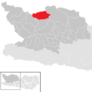
| Location of Mallnitz in the Spittal an der Drau district | ||
  |
||
| Source: Municipal data from Statistics Austria | ||


Mallnitz is a municipality with 762 inhabitants (as of January 1, 2020) in the Spittal an der Drau district in Carinthia in Austria .
Mallnitz is a climatic health resort .
geography
Geographical location
The municipality is located in a side valley to the left of the Möll and is traversed by the Mallnitzbach and the Seebach . It is embedded in the mountain range of the Goldberg and Ankogel groups , which belong to the Hohe Tauern National Park . The municipality borders the state of Salzburg in the north ; the southern portal of the Tauern tunnel of the Tauern railway is located near Mallnitz .
The communities of Flattach in the west, Malta in the east and Obervellach in the south border Mallnitz . However, there is only a direct connection via Mallnitzer Strasse B 105 to Obervellach.
Community structure
The municipality is divided into the cadastral communities Mallnitz and Dösen, to which the following four localities belong (number of inhabitants in brackets as of January 1, 2020):
- Doze (22)
- Mallnitz (438)
- Rabish (35)
- Stappitz (267)
climate
|
Average monthly temperatures and precipitation for Mallnitz
|
|||||||||||||||||||||||||||||||||||||||||||||||||||||||||||||||||||||||||||||||||||||||||||||||||||||||||||||||||||||||||||||||||||||||||||||||||||||||||||||||||||||||||
history
Due to its location in a high side valley in the Central Alps, the region around today's Mallnitz was probably first settled in the Bronze Age at the earliest , when a metal trade developed from the Salzburg area over the Tauern crossings to the south. One of the trade routes probably also led over crossings on Mallnitz soil, as the discovery of a bronze sword fragment in Obervellach suggests. The discovery of a Celtic silver coin on the Mallnitzer Tauern proves the presence of Celts who began to emerge from the 3rd century BC. BC settled in the region. The river name Möll (from molina , mountain stream) also comes from Celtic times . A permanent settlement is not yet detectable , even for the time of the Romans , who built important drivable roads over the Korntauern and Mallnitzer Tauern, and the remains of which can still be clearly seen in the area.
Around 600, Slavs coming from the south-east immigrated to the Carinthian area along the old Roman roads and settled there. The current place name Mallnitz is derived from the early Slavic Malinica ( to be interpreted as "little Möll" ). Even in the early Middle Ages, the entire Mölltal still had a few smaller localities, but from the 10th century onwards, clearing also began to make higher mountain regions arable. In the Mölltal as well as in the Mallnitztal, Schwaigen were created for cattle breeding, so that from this time on one can speak of a continuous settlement. Mallnitz was first mentioned in a document in 1299 in the land register of the front county of Görz ; At this point in time, today's municipal area belonged to the Falkenstein district court, which should not change until the local church was formed.
In the 12th and 13th centuries, trade in seams across the Tauern skyrocketed, from which the population also benefited. The transport of salt, later of the so-called catfish pig and the gold extracted in the Tauern, played a major role.
In August 1825, the Viennese alpinist and court chamber official Josef Kyselak (1798–1831) also visited Mallnitz on his Austria hike. He was amazed that people live permanently at this altitude: clover hung in a dry place on harps, rye and wheat were still immature in the field at the end of August! Corn formed little ridges on these; but I hadn't noticed anything of heather, beans or potatoes. How many fates did man have to experience, how many tries, until necessity forced him to move from laughing corridors into the vast corners of the Alps and to build seeds, only indigenous to Asia, for his livelihood in Siberia's climate! It's seven months of winter here, and the other five are divided into thaw and stifling heat. I was shown a line three fathoms high on the church tower, the snow was so high a few years ago; the whole village then necessarily had to be invisible, and the residents had to be close to suffocating, freezing or starving.
When the local congregations were formed in 1850, Mallnitz was initially part of the large community of Obervellach , which, however, was to be reduced in size by the state law of June 5, 1895. So the three new local communities Penk , Flattach and Mallnitz became independent . On March 30, 1896, the first municipal council elections were held, a date that can be considered the actual birth of the independent municipality of Mallnitz.
With the construction of the Tauern tunnel of the Tauern Railway (1901–1907) the community experienced a great boom. The commissioning can also be seen as the initial spark for the upturn in tourism in the Mallnitz Valley.
In the last days of the Second World War , the “ Führerzug ”, Adolf Hitler's special train, was parked at Mallnitz station (today Mallnitz-Obervellach ) . The Wehrmacht blew up and burned the 10206 saloon car here on May 7, 1945 so that it could not be used as a booty for a trophy.
population

According to the 2001 census, Mallnitz had 1,027 inhabitants, of which 88.7% were Austrian and 7.2% German citizens. 76.9% of the population professed the Roman Catholic and 11.5% the Evangelical Church, 1.6% Islam . 6.7% of the population were without religious beliefs.

With the construction of the Tauernbahn and the train station in Mallnitz, many new jobs were created and tourism was promoted. As a result, the population increased from 461 in 1900 to 1126 in 1951, but has since declined slightly again, on December 31, 2005, it was 951, and on January 1, 2018, it was only 786.
nature

The three local mountains of Mallnitz are
- the Auernig ( 2130 m above sea level ), east of Mallnitz,
- the Lonzaköpfl ( 2317 m above sea level ), southwest of Mallnitz and
- the Hindenburghöhe ( 2315 m above sea level ), north of Mallnitz.
All three mountains can be climbed in day hikes from Mallnitz.
The three-thousand-meter peaks frequently climbed from Mallnitz are the Ankogel ( 3252 m above sea level ) and the Säuleck ( 3086 m above sea level ). While the Ankogel is usually climbed in one day with the help of the Ankogelbahn , the ascent of the Säuleck can also be done in two days with an overnight stay in the Arthur-von-Schmid-Haus .
In the Seebachtal , bearded vultures have been successfully reintroduced into the wild several times over the past few years as part of a reintroduction program , most recently two young birds in June 2018.
Culture and sights

- Ensamble of five post mills from 1822 and a water wheel mill on Mallnitzbach.
- Shoemaker chaste; one of the oldest houses in Mallnitz. Einhof built entirely of wood , which has existed since at least 1743.
- Crowned south portal of the Tauern tunnel from 1909.
- Villa Mojsisovics, later Villa Libermann; built around 1900 as a stately summer residence for Edmund Mojsisovics von Mojsvár , with a view of his favorite mountain , the Ankogel . In a room in the National Park Center (see below) there is a small exhibition on Mojsisovics and the villa.
- National Park Center BIOS: Visitor information point for the Hohe Tauern National Park , permanent exhibition “What is life?” And changing special exhibitions (2015 for example “Up close and personal. Animals and plants in the Hohe Tauern National Park”).
tourism
Mallnitz allowed the (in Austria) certified predicate climatic health Höhenluftkurort lead. This makes it one of the few places in Austria. The stimulating alpine climate helps with many respiratory diseases. There are marked hiking trails for almost 25 kilometers, from flat valley trails to mountain routes around the three-thousand-meter peaks. In addition, Mallnitz entitled since 2008 mountaineering village of PES .
Mallnitz is a member of the Alpine Pearls , which advocate environmentally friendly mobility in the Alpine region.
traffic

Mallnitz is the highest station on the Tauern line . All InterCity trains (IC) stop here. Mallnitz is also the loading station for the ÖBB car lock through the 8.37 km long Tauern tunnel . It has been possible to load cars between Böckstein in the Gastein Valley and Mallnitz in the Mallnitz Valley for over 90 years .
Mallnitzer Straße B 105 leads through the Mallnitztal to Obervellach . A hiking and ski bus as well as a bus line to Obervellach are offered around Mallnitz, the Herbert Peitler Verkehrsbetriebe run the operation .
politics
City council and mayor
The municipal council of Mallnitz was reduced from 15 to 11 members in the 2015 municipal council election and is composed as follows: 6 together for Mallnitz, 5 SPÖ .
The directly elected mayor has been Günther Novak (SPÖ) since 2009 .
Town twinning
- Witten ( North Rhine-Westphalia , Germany ), since 1979
coat of arms
In Mallnitz's coat of arms, which was awarded to the municipality on January 26, 1981, the stepped rock symbolizes the main ridge of the Hohe Tauern with the Ankogel , in which the Tauern tunnel is indicated below. The earlier gold mining in the Tauern is indicated by the tinging , the rock crystal alludes to its rich local occurrence.
The coat of arms has the following blazon :
- "In blue, a gold, two-tiered rock, pierced in the base of the shield by a walled tunnel mouth opened in black and blue, top right with a silver triple rock crystal."
The flag is blue and yellow with an incorporated coat of arms.
literature
- Erich Glantschnig: Mallnitz (series alpine history in a nutshell ). Oesterreichischer Alpenverein, Innsbruck 2011 ( online ).
- Regina Stampfl, Roland Kals, Peter Haßlacher: Mallnitz. Pearl in the Hohe Tauern National Park. 4th edition, Austrian Alpine Association, Innsbruck 2016 ( online )
Web links
- Official website
- Mallnitz mountaineering village
- 20618 - Mallnitz. Community data, Statistics Austria .
Individual evidence
- ↑ Legally recognized climatic health resorts in Austria ( Memento of the original from May 23, 2015 in the Internet Archive ) Info: The archive link has been inserted automatically and has not yet been checked. Please check the original and archive link according to the instructions and then remove this notice. , at www.oehkv.at, accessed on June 7, 2015
- ↑ Statistics Austria: Population on January 1st, 2020 by locality (area status on January 1st, 2020) , ( CSV )
- ↑ "village Malnitz" in: Joseph Kyselak: sketches of a journey on foot through Austria, Styria, Carinthia, Berchtesgaden, Tyrol and Bavaria to Vienna Vienna 1829, p 102nd
- ↑ Statistical information based on municipal data , as of 2001 census from Statistics Austria
- ^ Statistics Austria, A look at the community of Mallnitz, population development. Retrieved March 2, 2019 .
- ↑ Bearded vultures released in the Hohe Tauern National Park
- ↑ Ideas - Deeds - Facts, No. 1: Start conference mountaineering villages in the mountaineering village of Ginzling, from 10-11. July 2008 , Austrian Alpine Association as part of the project “Specific Alpine Convention: Via Alpina and Mountaineering Villages”, Spatial Planning-Nature Conservation Department, Innsbruck 2008, p. 4. PDF download ( Memento of the original from November 8, 2018 in the Internet Archive ) Info: Der Archive link was inserted automatically and has not yet been checked. Please check the original and archive link according to the instructions and then remove this notice. , accessed November 7, 2018.
- ↑ https://www.alpine-pearls.com/die-urlaubsorte/ort/oesterreich/mallnitz/
- ^ Quoted from Wilhelm Deuer: The Carinthian municipal coat of arms . Verlag des Kärntner Landesarchiv, Klagenfurt 2006, ISBN 3-900531-64-1 , p. 180
Bad Kleinkirchheim | Baldramsdorf | Berg im Drautal | Dellach im Drautal | Flattach | Gmünd in Carinthia | Greifenburg | Großkirchheim | Heiligenblut am Großglockner | Irschen | Kleblach-Lind | Krems in Carinthia | Lendorf | Lurnfeld | Mallnitz | Malta | Millstatt am See | Mörtschach | Mühldorf | Oberdrauburg | Obervellach | Radenthein | Rangersdorf | Reisseck | Rennweg am Katschberg | Sachsenburg | Seeboden am Millstätter See | Spittal an der Drau | Stall | Steinfeld | Trebesing | Weissensee | Winklern
Salzburg:
Krimml |
Wald im Pinzgau |
Neukirchen am Großvenediger |
Bramberg am Wildkogel |
Hollersbach im Pinzgau |
Mittersill |
Uttendorf |
Kaprun |
Fusch an der Großglocknerstrasse |
Rauris |
Bad Gastein |
Hüttschlag |
Muhr |
Carinthia:
Malta |
Mallnitz |
Obervellach |
Heiligenblut am Großglockner |
Großkirchheim |
Mörtschach |
Winklern |
Tyrol:
Iselsberg-Stronach |
Dölsach |
Nussdorf-Debant |
Kals am Großglockner |
Matrei in East Tyrol |
Virgen |
Prägraten am Großvenediger |
Hopfgarten in Defereggen |
St. Veit in Defereggen |
St. Jakob in Defereggen
(clockwise)