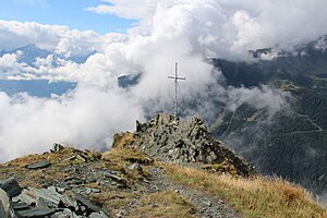
Auernig
| Auernig | ||
|---|---|---|
|
Auernig summit cross |
||
| height | 2130 m above sea level A. | |
| location | Carinthia , Austria | |
| Mountains | Ankogel Group , Hohe Tauern | |
| Coordinates | 46 ° 59 '30 " N , 13 ° 11' 19" E | |
|
|
||
| rock | Diabase , green slate | |
The Auernig ( 2130 m above sea level. A. ) is the mountain of Mallnitz in Carinthia . It is located in the Ankogel group east of Mallnitz. The Törlkopf behind it, which is much higher, is completely covered by it.
Routes
- Mallnitz - Auernig (900 meters in altitude, 3 hours). Shortest but very steep ascent through the forest, marked path. However, the path is sometimes not clearly visible.
- Mallnitz - Dösental - Wolligerhütte - Auernig (900 meters in altitude). Further route, but not so steep. Marked way. The National Park hiking bus also runs to the Wolligerhütte
- Auernig - Törlkopf ( 2446 m , around 300 meters in altitude)
Web links
Commons : Auernig - collection of images, videos and audio files


