
Rennweg on Katschberg
|
market community Rennweg on Katschberg
|
||
|---|---|---|
| coat of arms | Austria map | |
 |
|
|
| Basic data | ||
| Country: | Austria | |
| State : | Carinthia | |
| Political District : | Spittal an der Drau | |
| License plate : | SP | |
| Surface: | 120.48 km² | |
| Coordinates : | 47 ° 1 ' N , 13 ° 37' E | |
| Height : | 1143 m above sea level A. | |
| Residents : | 1,740 (January 1, 2020) | |
| Postcodes : | 9863 (9862 for part of Pleschberg) |
|
| Area code : | 04734 | |
| Community code : | 2 06 32 | |
| NUTS region | AT212 | |
| Address of the municipal administration: |
Rennweg 51 9863 Rennweg |
|
| Website: | ||
| politics | ||
| Mayor : | Franz Eder ( SPÖ ) | |
|
Municipal Council : ( 2015 ) (15 members) |
||
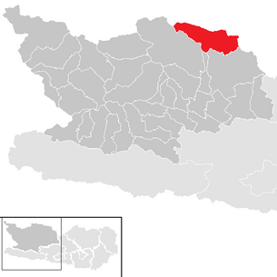
| Location of Rennweg am Katschberg in the Spittal an der Drau district | ||
  |
||
| Source: Municipal data from Statistics Austria | ||


Rennweg am Katschberg is a market town with 1740 inhabitants (as of January 1, 2020) in the north of Carinthia in Austria .
geography
The market town is located in the upper part of the Liesertal at the south portal of the Katschberg tunnel and extends from the valley floor to the Hafnereck on the main ridge of the Hohe Tauern . Katschtal is common as the landscape designation for the entire municipality .
Community structure
The market community is divided into the three cadastral communities Rennweg, St. Peter and Oberdorf. The inhabitants of the municipality are distributed over the following 25 localities (population in brackets as of January 1, 2020):
- Abwerg (28)
- Adenberg (16)
- Angern (10)
- Aschbach (60)
- Atzensberg (60)
- Brugg (40)
- Frankenberg (88)
- Semolina (171)
- Katschberghöhe (29)
- Krangl (160)
- Laußnitz (13)
- Muhlbach (45)
- Oberdorf (129)
- Pleschberg (22)
- Pölla (1)
- Pron (36)
- Rennweg (337)
- Reed (15)
- St. Georgen (101)
- St. Peter (239)
- Saraberg (30)
- Sleeping (44)
- Stone wall (4)
- Wirnsberg (40)
- Zanaischg (22)
Neighboring communities
Rennweg borders four Salzburg municipalities in the north and east and three Carinthian municipalities in the south:
| Muhr | St. Michael im Lungau | St. Margarethen in Lungau |
.svg)
|
Thomatal | |
| Malta | Gmünd in Carinthia | Krems in Carinthia |
history
From the 12th century (first mentioned in a document in 1197), Rauchenkatsch Castle, ancestral seat of the Lords of Katsch , was located on the southern edge of today's municipality, between the villages of Ried and St. Nikolai . From the late Middle Ages the church of St. Peter was their burial place. Today's municipal area was owned by Salzburg for a long time; some of the Lords of Katsch are also attested as Salzburg judges and keepers of Rauchenkatsch.
On May 4, 1201 a strong earthquake shook the Liesertal. According to the latest findings, the epicenter is located between St. Peter, Rennweg and Gmünd. The destruction of the archbishopric of Salzburg's Katsch Castle has been handed down. Damage has been handed down to the Drau valley. Weissenstein Castle was also destroyed in this quake .
When the local community was formed in 1850, the community area was larger than it is today, because as early as 1868 the cadastral communities of Reitern and St. Nikolai, which originally belonged to the community of Rennweg, were separated and connected to the city of Gmünd . Since then, the size of the community has not changed.
In 1995 the Inner Pöllatal was declared a Natura 2000 protected area by the state of Carinthia .
On July 1, 2007, according to the resolution of the Carinthian Parliament of May 10, 2007, the survey of the market community took place.
population
At the time of the 2001 census, Rennweg had 2,025 inhabitants, 98.3% of whom were Austrian citizens . 95.7% of the population confessed to the Roman Catholic and 2.4% to the Protestant Church, 1.2% were without religious belief.
Culture and sights
- The parish church of St. Peter in Katschtal in the village of St. Peter was first mentioned between 1184 and 1197. After a fire in 1642, most of the current building was erected; parts of a previous building were found in the southern part of the nave. The altar is one of the richest and most magnificent baroque altars in Carinthia.
- The church of St. Georgen in the village of St. Georgen was first mentioned as a subsidiary church of St. Peter in 1351. In 1778 the church was demolished and rebuilt because it was about to collapse and badly scrambled . The tower was destroyed in a major fire in the village in 1861 and rebuilt in 1892. The altarpiece shows St. Georg as a dragon slayer and was created by the Katschtal artist Josef Meßner .
- Pocher house in Oberdorf
Site design
In 2011, Rennweg was named the “Most Beautiful Flower Village in Europe” by the Entente Florale Europe .
Economy and Infrastructure
The localities of the municipality were and are strongly characterized by agriculture. In the last few decades tourism has also played an increasingly important role, both in summer and in winter.
The A 10 Tauern motorway runs through the municipality and connects the federal states of Carinthia and Salzburg through the Katschberg tunnel , the south portal of which is in the municipality . Over the Katschberg , the Katschberg Straße B 99 leads north over the Lungau in the direction of Bischofshofen , in the south it runs via Gmünd to Spittal an der Drau largely parallel to the Tauern motorway.
politics
City council and mayor
The Rennweg municipal council has 15 members and has been composed as follows since the 2015 municipal council election :
Franz Eder (SPÖ) has been the mayor of the community since 2000.
coat of arms
The motif of the Rennweger coat of arms has its origin in the seal of the Lords of Katsch and symbolizes a loyalty bond in the form of a handshake. The oldest surviving, albeit damaged, evidence of this seal can be found on the deed of foundation for the Marien Altar in the Church of Malta , which Albrecht von Katsch issued on February 1, 1349.
On September 30, 1960, the municipality received the right to carry a coat of arms and a flag with the following description:
- “As a coat of arms: Silver triangular shield with two angled, green clad arms that shake hands. As a flag, the colors green and white with an incorporated coat of arms. "
Web links
- Market town of Rennweg am Katschberg
- 20632 - Rennweg am Katschberg. Community data, Statistics Austria .
Individual evidence
- ↑ Statistics Austria: Population on January 1st, 2020 by locality (area status on January 1st, 2020) , ( CSV )
- ↑ Cf. Axel Huber : Earthquake damage to the Millstätter Stiftskirche - Conclusions for its building history. In: History Association for Carinthia: Carinthia I. Journal for historical regional studies of Carinthia. Volume 192/2002, pp. 343-361.
- ^ ZAMG Rauchenkatsch Castle
- ↑ natura2000.eea.europa.eu
- ^ Chronicle of the market town
- ^ Statistics Austria, population census, demographic data. May 15, 2001, accessed March 3, 2019 .
- ↑ Diocesan Archives Diocese Gurk
- ↑ DEHIO Carinthia . Vienna 2001, p. 812f.
- ↑ Prof. FG Ahn, Carinthia vol. 83; P. 192
- ↑ Wilhelm Deuer: The Carinthian municipal coat of arms , Klagenfurt 2006, p. 232
Bad Kleinkirchheim | Baldramsdorf | Berg im Drautal | Dellach im Drautal | Flattach | Gmünd in Carinthia | Greifenburg | Großkirchheim | Heiligenblut am Großglockner | Irschen | Kleblach-Lind | Krems in Carinthia | Lendorf | Lurnfeld | Mallnitz | Malta | Millstatt am See | Mörtschach | Mühldorf | Oberdrauburg | Obervellach | Radenthein | Rangersdorf | Reisseck | Rennweg am Katschberg | Sachsenburg | Seeboden am Millstätter See | Spittal an der Drau | Stall | Steinfeld | Trebesing | Weissensee | Winklern