Sattnitz
| Sattnitz | |
|---|---|
| Highest peak | Dance floor ( 929 m above sea level ) |
| location | Carinthia , Austria |
| part of | Gurktal Alps |
| Coordinates | 46 ° 33 ' N , 14 ° 8' E |
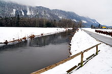
The Sattnitz ( Slovenian Sotnica or Gure ) is an 800 to 900 m above sea level. A. high mountain range in Carinthia between Keutschacher Seentalung, the Glanfurt, Glan and the lower Gurk in the north and the Drau in the south in the districts of Villach-Land and Klagenfurt-Land . Colloquially, the Glanfurt , the only outflow from the Wörthersee, is also known as Sattnitz .
Surname
The name Sattnitz for the low mountain range along the Drava was borrowed from its Slovene name (Sotnica) and should have been Germanized relatively late (not before the 13th century). The meaning of Sotnica can be roughly described as the area around the mountain road . Linguists associate this mountain path with the old path from St. Ruprecht near Klagenfurt via Maria Rain to Kirschentheuer . The Slovenian name Gure, which is more common today, comes from the dialect word "gora" (mountain, forest).
Geology and hydrology
From a geological point of view, the Sattnitz is characterized by tertiary conglomerates and coal-bearing fine-grain deposits . The mountains are formed from the so-called Sattnitz conglomerate, a rock from the Neogene (Young Tertiary). The Sattnitz conglomerate results in dry locations, the precipitation seeps away, so that the domestic water supply of the farms was always difficult. Sometimes karst phenomena such as swallow holes ( ponors ) occur. The seeping water occurs at the base, where water-retaining clays occur, in numerous, often very productive springs. They are widely used for water supply . An important source is the Eternal Rain near Maria Rain , which has been declared a natural monument .
expansion
The plateau is bounded in all directions by steep walls, some of which fall vertically. The Sattnitz has many steep faces on its northern and southern slopes. The Sattnitz extends from Rosegg or Velden am Wörther See in the west to the Annabrücke over the Drau and Grafenstein in the east. The shape of the conglomerate table is rectangular. The west-east extension is 34 km, the Nür-South extension 5 km, the area 170 km². The straight line delimitation of the plateau is tectonically caused by fractures and faults. They also divide the conglomerate table in a north-south direction into several sub-blocks, the intermediate pieces of which have sunk and appear as depressions.
The most important from a transport point of view is the Maria Rain valley . The most important traffic connection from Klagenfurt to the Rosental and the Loiblpass runs through it . The highest peak is the Tanzboden ( 929 m ) in the western part north of Ludmannsdorf .
To the east, the Stemeritsch depression connects with the villages of Stemeritsch, Strantschitschach, Saberda and Göltschach at around 650–700 m above sea level. The extensive plateau of Radsberg with the main towns of Radsberg , Tutzach and Schwarz joins them .
The Kossiach floe lies around 150 m lower in the south . The domed plateau, formed by the mighty lateral moraines of the Drau and Wörthersee glaciers, is 750–800 m. With partly vertical walls it breaks off in the east to the Mieger depression . Only in Ober- and Unterkreuth did post-glacial landslides make the demolition flatter.
The villages of Ober- and Untermieger, Hinterberg, Haber and Obitschach are located in the Mieger Senke . The Mieger Senke is around 550 m above sea level. In the east it rises to the plateau of Berg , the domed relief of which is between 600 and 700 m. In turn, it breaks off steeply to the Sabuatach depression at around 600 m above sea level. To the east, the Skarbin plateau closes off the Sattnitz with the village of the same name at around 710 m above sea level. It breaks off steeply to the Drava. The rock-forming Sattnitz conglomerate continues east of the Drau in the Rückersdorfer hill country around the Klopeiner See , but here no longer achieves the mighty cohesion as in the Sattnitz.
Use and settlements
The eastern part is less populated and just as intensely forested. On its southern slopes you will find orchid-rich beech forests and in places mixed deciduous forests . For a long time, smallholder farms were managed with a low degree of mechanization. Forestry played a major role in this.
The largest localities in the Sattnitz area are Ludmannsdorf and Köttmannsdorf in the western part and Maria Rain and Radsberg and Mieger in the eastern part.
literature
- Bettina Golob and Helmut Zwander: The Sattnitz. Conglomerate of nature in the south of Carinthia. A nature guide. Natural Science Association for Carinthia , Klagenfurt 2006, ISBN 3-85328-041-2 .
- Klaus Arnold: The eastern Sattnitz. The problem of a stagnating agricultural area in the outskirts of Klagenfurt . Diss. From the University of Vienna, 2 vol., Vol. 131/1 and 2, Association of Austrian Scientific Societies, Vienna 1976
- Klaus Arnold: The eastern Sattnitz - mountain farming area at the gates of Klagenfurt. Amaliendorf 2012. CD and online access. Arnold-Research.eu


