
Grafenstein (Carinthia)
|
market community Grafenstein
|
||
|---|---|---|
| coat of arms | Austria map | |
 |
|
|
| Basic data | ||
| Country: | Austria | |
| State : | Carinthia | |
| Political District : | Klagenfurt-Land | |
| License plate : | KL | |
| Surface: | 50.19 km² | |
| Coordinates : | 46 ° 37 ' N , 14 ° 28' E | |
| Height : | 418 m above sea level A. | |
| Residents : | 2,969 (January 1, 2020) | |
| Population density : | 59 inhabitants per km² | |
| Postal code : | 9131 | |
| Area code : | 04225 | |
| Community code : | 2 04 09 | |
| NUTS region | AT211 | |
| Address of the municipal administration: |
Hauptstrasse 49 9131 Grafenstein |
|
| Website: | ||
| politics | ||
| Mayor : | Stefan Deutschmann (List Deutschmann) | |
|
Municipal Council : ( 2015 ) (19 members) |
||
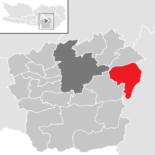
| Location of Grafenstein in the Klagenfurt-Land district | ||
  |
||
| Source: Municipal data from Statistics Austria | ||


Grafenstein ( Slovenian Grabštanj ) is a market town with 2969 inhabitants (as of January 1, 2020) in the Klagenfurt-Land district in Carinthia .
geography
Grafenstein is located in the Klagenfurt Basin , about 12 km east of the state capital Klagenfurt am Wörthersee .
Community structure
The community is divided into eight cadastral communities : Berg, Grafenstein ( Grabštanj ), Pakein ( Pokinj ), Replach ( Replje ), Saager ( Zagorje ), Thon ( Jadovce ), Truttendorf ( Sepec ), Wölfnitz ( Valovca )
The municipality includes the following 31 localities (population as of January 1, 2020):
- Aich (Dobje) (24)
- Althofen (Stari Dvor) (116)
- Dolina (Dolina) (128)
- Frog Village (Žvabiče) (121)
- Grafenstein (Grabštanj) (1027)
- Gumisch (Humelše) (57)
- Haidach (Vresje) (83)
- Hum (29)
- Little Venice (Ječmen) (66)
- Lind (Lipje) (51)
- Münzendorf (Incmanja vas) (29)
- Top fishermen (Zgornje Ribiče) (15)
- Oberwuchel (Zgornja Buhlja) (12)
- Pakein (Pokinj) (3)
- Pirk (Draža vas) (290)
- Replach (Replje) (74)
- Saager (Zagorje) (57) including Haslach
- Sabuatach (Zablate) (16)
- Sand (Prod) (18)
- St. Peter (Šentpeter) (71)
- Rain Castle (Krištofov Grad) (60)
- Shoulder village (Starče) (190)
- Skarbin (Škrbinja) (25)
- Tainacherfeld (Tinjsko Polje) (75)
- Thon (Jadovce) (34)
- Truttendorf (Sepec) (99)
- Underfishing (Spodnje Ribiče) (20)
- Undergrowth (Spodnja Buhlja) (47)
- Werda (Brdo) (9)
- Wölfnitz (Valovca) (99)
- Zapfendorf (Malčape) (24)
Another location is the Rotte Haslach .
Neighboring communities
| Poggersdorf | Völkermarkt | |
| Klagenfurt |
.svg)
|
Saint Kanzian |
| Ebenthal | Gallicia |
history
Grafenstein was first mentioned in a document in 890: Arnulf of Carinthia confirmed the possession of "Grauindorf" to Archbishop Friedrich von Salzburg . The parish church, built in Romanesque style, was consecrated in 1116. Grafenstein Castle was first mentioned in 1158 on the occasion of the enfeoffment of the property and the “Gravindorf” farm . The noble family of Grafensteiners named themselves after this castle, whose seal served as a template for today's municipal coat of arms, but which died out again in the 14th century. Afterwards, the castle and the manor often changed hands. The castle was badly damaged in the Dobratsch landslide in 1348 and gradually fell into disrepair. When Johann Andreas von Rosenberg acquired Grafenstein in 1629, he did not have the castle, which had already fallen into ruins, restored, but instead had a new castle built west of the village.
The local community Grafenstein was formed in 1850 and was expanded during the local structural reform in 1973 to include parts of the area of the dissolved local community Mieger. In 1990 Grafenstein was given the right to use the designation " Marktgemeinde ".
population
According to the 2001 census, the municipality of Grafenstein has 2,602 inhabitants, 97.1% of whom are Austrian citizens. 90.1% of the community population profess to the Roman Catholic Church , 2.8% to the Protestant Church , 5.5% are without religious beliefs.
The Slovenian dialect
The municipality of Grafenstein is historically part of the Slovene dialect area (dialect) of the Klagenfurt field ( poljanski govor oz. Poljanščina Celovškega Polja ), which is a transitional dialect between the Slovene dialects of the Jaun Valley ( podjunščina ) and the Rosental ( rožanščina ). Johann Scheinigg identified it as a special variant of the Slovenian Rosental dialect as early as 1882, which was confirmed in the dialectological study by Dr. Katja Sturm-Schnabl could be confirmed based on field research. In his work “The Assimilation…” Scheinigg divides the Slovenian Rosental dialect into three geographical areas: The Lower Rosental, the Upper Rosental and the Klagenfurt Plain. Regarding the latter area, he says: “... The third sub-dialect prevails in the plain around Klagenfurt (kl.), It has the pronunciation of the e and o in common with the first, but differs from the two previous ones in the frequent withdrawal of the accent where those have it on the final syllables; this is especially true of the neuter of nouns and adjectives, e.g. B. [...] " .
Culture and sights
Sacred building
- Parish church Grafenstein : The previous building of today's parish church was consecrated in 1116 and was a private church of the noble von Lungau . It was rebuilt because of dilapidation and in 1158 went to the Gurk Cathedral Chapter. The church is a single-nave, Romanesque building with a choir tower, polygonal choir and baroque chapel extensions on the north and south sides. The tower has ogival sound windows and an onion helmet
- Parish Church of St. Peter in Sankt Peter
- Filial church St. Oswald in Thon
- Filial church of St. Anna in Saager

- Filial church St. Maria im Walde in Dolina (motorway church) was once a popular and important Slovene pilgrimage church, today it is bilingual
Profane building
- Altgrafenstein Castle
- Grafenstein Castle
- Pakein Castle
- Riedenegg Castle in Lind
- Saager Castle
- Truttendorf Castle
Defender wayside shrines
- Lerchbaumerkreuz near Lind
- Pinter Cross near Thon
- Student cross near Little Venice
- Memorial plaque on the Korpitsch farm building near Schulterndorf
- War memorial on the church square in Grafenstein
Works of art
- Fountain with the sculpture "Jacob wrestles with the angel" by the sculptor Jan Milan Krkoška on the church square in Grafenstein
- "The Bull" by Prof. Wu Shaoxiang in Pakein (on the initiative of the art patron Gfrerer of the Pakein Castle)
- "Four Pictures of Life" (1993/94) by Ernst Gradischnig in Pakein (on the initiative of the art sponsor Gfrerer of Schloss Pakein)
- "The good guard" by Karl Brandstätter in the roundabout in front of the market town hall
Handicrafts
- Austria's last hand-held brickworks , in which floor tiles - the Grafensteiner slab - are manually "cut", is in operation in Grafenstein . Alois Falkinger took over the old brick factory from the Orsini-Rosenberg family in the 1990s and thus saved an old craft. Listed buildings in the Alps such as the Heihsgut were traditionally equipped with this special floor.
Economy and Infrastructure
traffic
The Grafensteiner Landesstraße (L107) branches off the B 70 (connection Klagenfurt to Völkermarkt ) east of the Gurkerbrücke near Rain Castle from Packerstraße and leads directly to Grafenstein. At the roundabout in front of the market town hall, the route continues south to the Annabrücke , Gallizien and Eisenkappel . From ÖR-Valentin-Deutschmann-Platz the L116 leads east to Tainach and Sankt Kanzian am Klopeinersee . In addition, the L102 leads from the market town hall in a westerly direction and connects the village of Truttendorf with the L100, Miegerer Straße in Ebenthal in Carinthia .
The construction of the Koralm Railway , which will connect the provincial capitals of Klagenfurt and Graz in the future, required drastic measures : the lowering of the route required the removal of industrial buildings; the old railway barrier system was replaced by an overpass.
Medical supplies
The market town Grafstein has a pharmacy, two Kassenärzte general practitioner and a dentist. In 2019, construction will begin on the Grafenstein health center with doctor's offices, café and public pharmacy, which is operated by the Kornblumen pharmacy.
Local supply
The place has a warehouse, a Spar market, a Billa market, as well as a baker and a butcher.
Industry
The Annabrücke power plant , a run-of- river power plant on the Drau, is located in Grafenstein .
politics
Municipal council
The municipal council of Grafenstein has 19 members and has been composed as follows since the municipal council election in 2015 :
The directly elected mayor is Stefan Deutschmann (List Deutschmann).
coat of arms
The seal of Heinrich von Grafenstein, which is preserved in documents from the years 1239 and 1240, served as a template for the municipality's coat of arms. It was awarded to the community on September 1, 1954 and has the following blazon : "A red shield in which a silver, gold-tongued wolf grows out of a golden crown decorated with five visible pearl prongs." The flag is red and yellow with an incorporated coat of arms.
Personalities

- Oswald Gutsmann / Ožbalt Gutsman (1727–1790), Slovenian lexicographer and linguist , author of important works.
- Franz Xaver Luschin (1781–1854), Prince-Bishop of Trento from 1824 to 1834 and Prince-Archbishop of Gorizia from 1835 to 1854 , was born at the Sonnenhof vulgo Luschin in Hum 18.
- Michael Nagele (1884–1969), social democratic politician
- Valentin Deutschmann (1928–2010) was Mayor of Grafenstein from 1958 to 2008.
- The sculptor and painter Giselbert Hoke has created a domicile and studio in Saager Castle.
literature
- Peter Orasch: market town of Grafenstein . Festschrift for the market survey. Klagenfurt 1990.
Web links
- Market town of Grafenstein
- 20409 - Grafenstein (Carinthia). Community data, Statistics Austria .
Individual evidence
- ↑ Statistics Austria: Population on January 1st, 2020 by locality (area status on January 1st, 2020) , ( CSV )
- ↑ The area of today's small Venice was a bog until after 1914. The name is probably an ironic reference to the pools and paints that existed at the time. ( Kleine Zeitung from Aug. 14, 2013)
- ^ Johann Scheinigg, The Assimilation in the Rosenthaler Dialekt, A contribution to Carinthian-Slovenian dialect research. Published in XXXII program of the kk Staatsgymn zu Klagenfurt 1882. Quoted from: Katja Sturm-Schnabl, The Slovenian dialects and dialect remains in the Klagenfurt Basin , phil. Diss., Vienna 1973, 287 pp. (Quote on page 33).
- ^ Dehio-Handbuch Kärnten , Vienna 2001, p. 236
- ^ Stefan Singer: Culture and Church History of the Dean's Office Tainach. Klagenfurt / Celovec [ea] 1995.
- ↑ Odilo Hajnsek: Marijine Božje poti. v Celovcu 1971
- ↑ Falkinger brickworks in Real Carinthia ( Memento of the original from February 9, 2010 in the Internet Archive ) Info: The archive link was inserted automatically and has not yet been checked. Please check the original and archive link according to the instructions and then remove this notice.
- ↑ Extension: Why this pharmacy is moving to a container . In: www.kleinezeitung.at . ( kleinezeitung.at [accessed on November 23, 2018]).
- ↑ Pharmacist wants to expand supply in the "East" . In: mein district.at . ( mein district.at [accessed on November 23, 2018]).
- ↑ 600 signatures: Medic fights for medicine cabinet . In: www.kleinezeitung.at . ( kleinezeitung.at [accessed on November 23, 2018]).
- ^ Quoted from Wilhelm Deuer: The Carinthian municipal coat of arms . Verlag des Kärntner Landesarchiv, Klagenfurt 2006, ISBN 3-900531-64-1 , p. 122
- ↑ Marija Mitrović: History of Slovenian Literature, From the Beginnings to the Present , translated from Serbo-Croatian and supplemented by Katja Sturm-Schnabl , Hermagoras, Klagenfurt / Celovec 2001, p. 89 f.
Ebenthal | Feistritz im Rosental | Ferlach | Grafenstein | Keutschach am See | Köttmannsdorf | Krumpendorf | Ludmannsdorf | Magdalensberg | Maria Rain | Maria Hall | Maria Wörth | Moosburg | Poggersdorf | Pörtschach am Wörther See | Sankt Margareten im Rosental | Schiefling am Wörthersee | Techelsberg | Cell