
Loiblpass road
| State road B91 in Austria | |||||||||||||||||||||||||||||||||||||||||||

|
|||||||||||||||||||||||||||||||||||||||||||
| |
|||||||||||||||||||||||||||||||||||||||||||
| Basic data | |||||||||||||||||||||||||||||||||||||||||||
| Start of the street: | Klagenfurt | ||||||||||||||||||||||||||||||||||||||||||
| End of street: | Loibl tunnel | ||||||||||||||||||||||||||||||||||||||||||
| Overall length: | 24.5 km | ||||||||||||||||||||||||||||||||||||||||||
|
State : |
|||||||||||||||||||||||||||||||||||||||||||
|
Course of the road
|
|||||||||||||||||||||||||||||||||||||||||||
The Loiblpass-Straße (B 91 / E 652 ) is a state road / European road in Austria . It runs over a length of 24.5 km from the Carinthian capital Klagenfurt first into the Rosental and then to the Loibl Tunnel on the state border with Slovenia . The road crosses the Ferlacher reservoir in the course of the Drau by means of the Hollenburg bridge .
The designation B 91 stems from its earlier status as a federal road, which has been transferred to the state authority as a state road since 2002. The abbreviation in L 91 has not been changed - as in most of Austria.
The Loiblpass-Landesstraße is named after the Loiblpass , which is located above the tunnel on the state border and which can no longer be used after the tunnel was opened in 1964.
history
The mule track, which was used until the Middle Ages , was expanded by the estates from 1560 onwards. Previously received from the city of Klagenfurt , they were now looking for a convenient connection to the port of Trieste . The construction cost 20,000 guilders and took 20 years due to the difficult conditions. For this purpose, the road could now be used with six-horse cars. From 1573 the road on the Carinthian side was completed. Two toll booths were set up - in Unterloibl and on the Kleiner Loibl - as well as the Devil's Bridge, which greatly shortened the route. During this time, the first short tunnel was built at the top of the pass, which, however, had to be removed because of the risk of collapse when Emperor Karl VI. wanted to cross the Loiblpass. Emperor Karl encouraged the further expansion of Loiblstrasse to become a paved art route, as he too wanted to use it as the main connecting route from Vienna to Trieste.
The Loibler road belongs to the former imperial roads that were taken in 1921 as federal highways. Until 1938 Loibler Strasse was designated as B 34, after the connection of Austria , Loibler Strasse was part of Reichsstrasse 333 until 1945 .
From 1966 onwards, the increase in tourism, and later also the homecoming of guest workers from Germany, caused traffic jams on the Loiblpass federal road. On busy days, these reached back to the Hollenburg near Maria Rain . With the collapse of Yugoslavia, tourist traffic to Dalmatia subsided and from 1991 the Karawanken tunnel became the most important traffic route to the south.
On October 11, 2008, the Carinthian Governor Jörg Haider was killed at 1:15 a.m. in a traffic accident in the village of Lambichl (Lage) south of the provincial capital Klagenfurt on the federal road.
On August 15, 2016 (Assumption of Mary), the pass road was moored in a storm, making it impassable in places.
photos
Rose Valley

Branch to Hollenburg with a view of the western Rosental and the Karawanken

Bridge over the Ferlach reservoir of the Drau


Sapotnica (Little Loibl)

Autumn beech forest above the Tscheppaschlucht

Gendarmerie barracks

Sapotnica

Branch into the Bodental
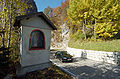
Wayside shrine


Loibltal and "German Peter"

Filial church of Saint Magdalena

Gasthof "Deutscher Peter"

Tunnel south of the "Deutscher Peter" inn

Old and new bridge over the Loiblbach

Old road bridge over the Loiblbach

South of the Leonhardi Chapel


swell
- ^ Federal law of July 8, 1921, regarding federal highways. Federal Law Gazette No. 387/1921.
- ^ Rainer Adamik: Ferlacher Chronik. A historical overview of the events in the municipality. Ferlach, 2009, self-published, p. 72.
- ↑ Severe damage caused by storms orf.at August 15, 2016, accessed August 16, 2016.
Web links
| B91 | Like the other former federal highways, Loiblpass Straße was part of the federal administration. Since April 1, 2002, it has been under state administration and continues to have the B in the number, but not the name Bundesstraße. |