Ormož
|
Ormož Friedau |
|||
|
|||
| Basic data | |||
|---|---|---|---|
| Country |
|
||
| Historic region | Lower Styria / Štajerska | ||
| Statistical region | Podravska (Drau region) | ||
| Coordinates | 46 ° 25 ′ N , 16 ° 9 ′ E | ||
| height | 218 m. i. J. | ||
| surface | 141.6 km² | ||
| Residents | 12,213 (January 1, 2017) | ||
| Population density | 86 inhabitants per km² | ||
| Telephone code | (+386) 2 | ||
| Post Code | 2270 | ||
| License Plate | MB | ||
| Structure and administration (status: 2018-2022) | |||
| Mayor : | Danijel Vrbnjak | ||
| Mailing address | Ptujska cesta 6 2270 Ormož |
||
| Website | |||
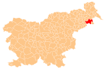
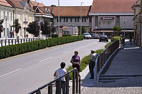
Ormož ( German : Friedau ) is a small town and municipality in northeastern Slovenia . It is located in the historical Spodnja Štajerska region ( Lower Styria ) and in the statistical region Podravska .
geography
location
The small town of Ormož is located in northeastern Slovenia on the left bank of the Drava , which forms the southern municipal border and thus also the border with Croatia . The central and northern part of the municipality, which is relatively large for the region, lies in the Slovenske gorice ( Windische Bühel ). Several small streams run there from north to south and then flow into the Drava. The only larger river next to the Drau is the Pesnica ( Pößnitz ), which flows into it shortly before the city. Shortly afterwards it is dammed up to the Ormoško jezero reservoir.
The next larger cities are Maribor in the north-west (about 42 km as the crow flies), Ptuj in the west (22 km) and Varaždin in south-east Croatia (18 km).
Community structure
The municipality comprises 61 localities. The German exonyms in brackets date from the middle of the 19th century and are no longer used today. (Population figures as of January 1, 2017):
- Bresnica ( Wresnitzen ), 249
- Cerovec Stanka Vraza ( Zerovetz ), 130
- Cvetkovci ( Zwetkofzen ), 448
- Dobrava ( Dobrova ), 133
- Dobrovščak ( Dobrovcak ), 11
- Drakšl ( Draxl ), 107
- Frankovci ( Frankofzen ), 167
- Gomila pri Kogu, ( Gomillenberg ) 147
- Hajndl ( Haindl ), 119
- Hardek ( Hardegg ), 256
- Hermanci ( Hermanetz ), 122
- Hujbar ( Huberberg ), 40
- Hum pri Ormožu ( Kulmberg ), 292
- Ivanjkovci ( Ivankofzen ), 244
- Jastrebci ( Jastrovetz ), 153
- Kajžar ( Kaisersberg ), 144
- Kog ( Kaag ), 236
- Krčevina ( Kerchovina ), 47
- Lačaves ( Latschendorf ), 139
- Lahonci ( Lacho Net ), 331
- Lešnica ( Löschnitz ), 187
- Lešniški Vrh ( Löschnitzberg ), 37
- Libanja ( Libonja ), 83
- Litmerk ( Littenberg ), 165
- Loperšice ( Loperschitz ), 184
- Lunovec ( Lunaberg ), 26
- Mali Brebrovnik ( Wrebrovnik ), 150
- Mihalovci ( Mihalotzen ), 151
- Mihovci pri Veliki Nedelji ( Mihovetz ), 522
- Miklavž pri Ormožu ( Saint Nikolai ), 262
- Ormož ( Friedau ), 2.031
- Osluševci ( Osluschofzen ), 204
- Pavlovci ( Paulofzen ), 209
- Pavlovski Vrh ( Paulusberg ), 148
- Podgorci ( Podgorzen ), 509
- Preclava ( Prezlava ), 44
- Pušenci ( Puschendorf ), 234
- Ritmerk ( Rittenberg ), 45
- Runeč ( Runtschen ), 172
- Senešci ( Seneschitz ), 227
- Sodinci ( Sodi Net ), 279
- Spodnji Ključarovci ( Klutscharovetz ), 117
- Stanovno ( Steinluger ), 114
- Strezetina ( Stresetin ), 72
- Strjanci ( Steriances ), 94
- Strmec pri Ormožu ( Stermetz ), 71
- Svetinje ( All Saints' Day ), 55
- Šardinje ( Scharding ), 139
- Trgovišče ( Altenmarkt ), 208
- Trstenik ( Oberröhr ) 37
- Veličane ( Wellitschan ), 119
- Velika Nedelja ( Big Sunday ), 281
- Veliki Brebrovnik ( Wrebrovnik ), 205
- Vičanci ( Vitschanetz ), 266
- Vinski Vrh ( Vineyard ), 263
- Vitan ( Vittan ), 92
- Vodranci, ( Adrianzen ) 139
- Vuzmetinci ( Wiesmannsdorf ), 133
- Zasavci ( small vineyard near Friedau ) 54
- Žerovinci ( Grünauberg ), 281
- Žvab ( Swabia ), 89
Neighboring communities
| Sveti Tomaž | Ljutomer | Štrigova ( HR ) |
| Dornava |

|
Središče ob Dravi |
| Gorišnica | Cestica ( HR ) | Petrijanec ( HR ) |
history
In ancient times the city was called Curta . It is mentioned in the Itinerarium Antonini and Ptolemy .
In the High Middle Ages, the city was known in the Holy Roman Empire under the name Holermuos , from which the current name Ormož developed. The city received market rights in 1293 and town rights in 1331 and was then called Friedau in German for a long time . With the establishment of the SHS state after the First World War , the city finally got its current name.
Separated from the city by a wall is Ormož Castle , built by Friedrich von Pettau as a fortified castle on the border to the then Kingdom of Hungary , which was first mentioned in 1278. In 1487 the city had to assert itself against an invasion by Hungary, in 1532 the advancing Ottomans left behind destruction, furthermore rebellious Hungarian farmers, the Heiducken (1605) and the Kuruzen (1704).
Until the 20th century Friedau was a predominantly German-speaking city with a Slovenian region. In the 1900 census, 593 of the 892 inhabitants gave German and 227 Slovene as the colloquial language.
traffic
National road 2 runs through the city from west to east, which leads to Ptuj , among other places . This is where the “Draženci” junction on the A4 is the closest connection to the national road network.
The Ormož crossing station is located on the one hand on the railway line from Pragersko to Središče , on the other hand it is the starting point of the railway line to Murska Sobota and Hodoš . In addition to the train station, there are a total of five other train stops in the municipality.
Web links
- Map of the Ormož municipality
- Ormož on 24cities.eu, Competence Center Steirisches Thermenland -Oststeiermark
Individual evidence
- ^ General state law and government gazette for the Crown Land of Styria. 1850 (supplement Marburg district)
- ↑ Statistical Office of the Republic of Slovenia ( English )
- ↑ J. Sasel: Rimske ceste v Sloveniji / Roman roads in Slovenia. In: Arheološka najdišča Slovenije. Ljubljana, 1975, p. 91
- ↑ KK Central Statistical Commission: Community encyclopedia of the kingdoms and countries represented in the Imperial Council. Volume IV Styria. Vienna 1904, p. 210.


