Benedict (Slovenia)
|
Benedikt St. Benedikt in the Windischen Büheln |
|||
|
|||
| Basic data | |||
|---|---|---|---|
| Country |
|
||
| Historic region | Lower Styria / Štajerska | ||
| Statistical region | Podravska (Drau region) | ||
| Coordinates | 46 ° 37 ' N , 15 ° 53' E | ||
| height | 247 m. i. J. | ||
| surface | 24.1 km² | ||
| Residents | 2,577 (January 1, 2019) | ||
| Population density | 107 inhabitants per km² | ||
| Post Code | 2234 | ||
| License Plate | MB | ||
| Structure and administration | |||
| Mayor : | Milan Repič | ||
| Mailing address | Čolnikov trg 5 2234 Benedict |
||
| Website | |||
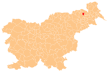
Benedikt ( German : Sankt Benedikt in den Windischen Büheln ) is a town and municipality in northeastern Slovenia . It is located in the historical Spodnja Štajerska ( Lower Styria ) region and in the statistical region of Podravska .
geography
location
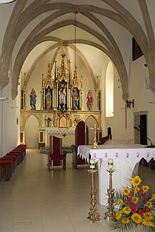
Benedict is located in the Slovenske gorice ( Windische Buehel ) in the valley of Drvanja ( Trie leg Bach ) to about 240 m. ü. A. National road 3 runs through the main town, which leads from Lenart to Gornja Radgona . The Church of the Three Kings in Sveti Trije Kralji on a ridge just southeast of Benedict is worth seeing.
The next larger towns are the small town of Lenart about 6 km southwest and the city of Maribor about 20 km west.
Community structure
The municipality comprises 13 localities. The German exonyms in brackets date from the middle of the 19th century and are no longer used today. (Population figures as of January 1, 2019):
|
|
Neighboring communities
| Sveta Ana | Gornja Radgona | |
| Lenart |

|
|
| Sveta Trojica |
Negau helmet
In Ženjak, a location between Benedikt and Obrat, a depot with Iron Age helmet shapes was discovered in 1811 ( Negau helmet ).
Web links
Individual evidence
- ^ General state law and government gazette for the Crown Land of Styria. 1850 (supplement Marburg district)
- ↑ Population tables of the Statistical Office of the Republic of Slovenia ( Slovene )
- ↑ Geopedia.si: Ženjak, Obrat and Negova / Negau


