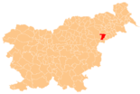
Majšperk
|
Majšperk Monsberg |
|||
|
|||
| Basic data | |||
|---|---|---|---|
| Country |
|
||
| Historic region | Lower Styria / Štajerska | ||
| Statistical region | Podravska (Drau region) | ||
| Coordinates | 46 ° 21 ' N , 15 ° 44' E | ||
| surface | 72.8 km² | ||
| Residents | 4,016 (January 1, 2017) | ||
| Population density | 55 inhabitants per km² | ||
| Post Code | 2322 | ||
| License Plate | MB | ||
| Structure and administration | |||
| Mayor : | Darinka Fakin | ||
| Mailing address | Majšperk 39 2322 Majšperk |
||
| Website | |||
Majšperk ( German : Monsberg ) is a town and municipality in Slovenia . It is located in the historical Spodnja Štajerska ( Lower Styria ) region and in the statistical region of Podravska .
The famous pilgrimage site Ptujska Gora is located in the municipality .
geography
location
The municipality of Majšperk is located in the hilly Haloze ( Kollos ), the main town in the Dravinja ( Drann ) valley at about 255 m. ü. A. The next larger towns are Ptuj in the northeast and Slovenska Bistrica in the west , both about 13.5 km away.
Community structure
The municipality comprises 26 localities. The German exonyms in brackets were mainly used by the German-speaking population until the area was ceded to the Kingdom of Serbs, Croats and Slovenes in 1918 and are largely uncommon today. (Population figures as of January 1, 2017):
|
|
|
Neighboring communities
| Slovenska Bistrica | Kidričevo | Videm |
| Macole |

|
Žetale |
| Rogaška Slatina | Rogatec | Žetale |
history
In 1168 the place was first mentioned as Monsberg . The name came from the mighty castle, which burned down in 1695. It was rebuilt, but fell into ruin after 1850. The municipality was originally part of the Ptuj Municipality until it became independent in 1994.


