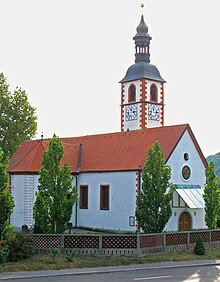
Videm
|
Videm Sankt Veit |
|||
|
|||
| Basic data | |||
|---|---|---|---|
| Country |
|
||
| Historic region | Lower Styria / Štajerska | ||
| Statistical region | Podravska (Drau region) | ||
| Coordinates | 46 ° 22 ' N , 15 ° 54' E | ||
| surface | 80.2 km² | ||
| Residents | 5,523 (January 1, 2017) | ||
| Population density | 69 inhabitants per km² | ||
| Post Code | 2284 | ||
| License Plate | MB | ||
| Structure and administration | |||
| Mayor : | Friderik Bračič | ||
| Mailing address | Videm pri Ptuju 54 2284 Videm pri Ptuju |
||
| Website | |||
Videm ( German Sankt Veit ) is a village and municipality in Slovenia . It is located in the historical Spodnja Štajerska ( Lower Styria ) region and in the statistical region of Podravska .
geography
location
The municipality extends over an area of 80.2 km². The municipality is located south of the Drava ( Drava ) and has been with the north of the drann ( Dravinja ) situated villages share in the flat and extensive Drava and Ptuj field ( Drava-Ptuj plain ). The southern and eastern municipal area, with the widely scattered settlements, takes up a considerable part of the hilly and vinous Haloze ( Kollos ). In the west, the municipality touches the "Waldhaloze" and foothills of the Dravinjske gorice ( hill country on the Drann ).
The highest point in the municipality at 503 meters above sea level. is located in the settlement area of Velika Varnica, near the secluded pilgrimage church Sveti Avguštin ( Sankt Augustin ), in the border area with Croatia, the deepest point, at 209 m above sea level. A., is located at the mouth of the Drann into the Drava in the village of Dravci.
Community structure
The municipality comprises 30 localities. The German exonyms that were valid until 1918 are listed in brackets behind the current place names . (Population figures as of January 1, 2017):
|
|
Neighboring communities
| Kidričevo | Hajdina , Ptuj | Markovci |
| Majšperk |

|
Circulans |
| Žetale | Podlehnik |
Bednja ( HR ), Lepoglava ( HR ) |
Personalities
The surgeon Fritz Hartmann (1900–1946) was born in Loibenberg .
Web links
- Geopedia.si, map: Videm municipality
- Geopedia.si, map: Place Videm pri Ptuju
- Website of the municipality in Slovenian
- Tourist site in English
Individual evidence
- ↑ special- local repertory of Styria. (Specialni krajevni repertorij za Štajersko) Vienna / Dunaj, 1918
- ↑ Population tables of the Statistical Office of the Republic of Slovenia ( Slovene )


