Podlehnik
|
Podlehnik Lichtenegg |
|||
|
|||
| Basic data | |||
|---|---|---|---|
| Country |
|
||
| Historic region | Lower Styria / Štajerska | ||
| Statistical region | Podravska (Drau region) | ||
| Coordinates | 46 ° 20 ′ N , 15 ° 52 ′ E | ||
| height | 240 m. i. J. | ||
| surface | 46 km² | ||
| Residents | 1,880 (January 1, 2017) | ||
| Population density | 41 inhabitants per km² | ||
| Telephone code | (+386) 02 | ||
| Post Code | 2286 | ||
| License Plate | MB | ||
| Structure and administration | |||
| Mayor : | Sebastian Toplak | ||
| Mailing address | Podlehnik 9 2286 Podlehnik |
||
| Website | |||
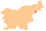
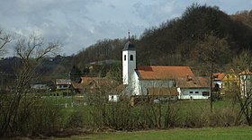
Podlehnik ( German : Lichtenegg ) is a town and municipality in Slovenia . It is located in the historical Spodnja Štajerska ( Lower Styria ) region and in the statistical region of Podravska .
geography
location
The municipality of Podlehnik is located in the Haloze ( Kollos ) wine-growing region at 229 m. ü. A. on the border with Croatia . The area is largely oriented towards the lower reaches of the Rogatnica ( Rogatnitza ) brook , which flows into the Dravinja ( Drann ) river on the northern municipal boundary . National road 9, which connects the cities of Ptuj and Zagreb via the Gruškovje-Macelj border crossing and which regularly congests, especially in the summer months, runs through the municipality. Parallel to this, the A4 motorway is currently (2017) under construction.
Community structure
The municipality comprises 13 localities. The German exonyms in brackets were mainly used by the German-speaking population until the area was ceded to the Kingdom of Serbs, Croats and Slovenes in 1918 and are largely uncommon today. (Population figures as of January 1, 2017):
|
|
Neighboring communities
| Videm | Videm | Videm |
| Videm |

|
Videm |
| Žetale | Đurmanec ( HR ) | Bednja ( HR ) |
history
The oldest finds come from the Bronze Age. Polished stones were found in the Podlehnik area as an ax and hammer.
In the Middle Ages the area was an important trade route from the Drava Plain to Croatia. The place was first mentioned in 1248.


