Cerkvenjak
|
Cerkvenjak Kirchberg in the Windischen Büheln |
|||
|
|||
| Basic data | |||
|---|---|---|---|
| Country |
|
||
| Historic region | Lower Styria , | ||
| Statistical region | Podravska (Drau region) | ||
| Coordinates | 46 ° 34 ' N , 15 ° 57' E | ||
| height | 339.8 m. i. J. | ||
| surface | 23 km² | ||
| Residents | 2,058 (January 1, 2019) | ||
| Population density | 89 inhabitants per km² | ||
| Post Code | 2236 | ||
| License Plate | MB | ||
| Structure and administration | |||
| Mayor : | Marjan Žmavc | ||
| Mailing address | Cerkvenjak 25 2236 Cerkvenjak |
||
| Website | |||
Cerkvenjak ( German : Kirchberg in den Windischen Büheln ) is a place and a municipality in the Slovenian region of Lower Styria (Štajerska).
geography
location
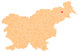
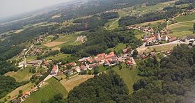
Cerkvenjak is located in north-eastern Slovenia in the Slovenske gorice ( Windische Bühel ) about 22 km east of the city of Maribor and about 9 km east of the small town of Lenart . The entire municipality is characterized by the gentle hill country, in a south-easterly direction it goes over into the valley of the Pesnica ( Pößnitz ).
The A5 motorway runs through the municipality and there is a direct connection to the "Cerkvenjak" junction.
Community structure
The municipality comprises 15 localities. The German exonyms in brackets date from the middle of the 19th century and are no longer used today. (Population figures as of January 1, 2019):
|
|
1 Ivanjski Vrh only partially belongs to the municipality of Cerkvenjak, the municipality of Gornja Radgona comprises another part.
Neighboring communities
| Gornja Radgona | ||
| Sveta Trojica v Slovenskih goricah |

|
Sveti Jurij ob Ščavnici |
| Sveti Andraž v Slovenskih goricah |
history
Until 1952, the parish was called Sveti Anton v Slovenskih goricah , named after the church in Cerkvenjak, which is dedicated to St. Anthony .
Personalities
- Rajmund Čuček (1849–1921), professor
- Franc Horvat (1870–1944), painter
Web links
Individual evidence
- ^ General state law and government gazette for the Crown Land of Styria. 1850 (supplement Marburg district)
- ↑ Population tables of the Statistical Office of the Republic of Slovenia ( Slovene )


