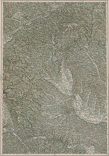
Windische Bühel
| Windische Bühel / Slovenske Gorice | ||
|---|---|---|
|
Kreuzberg from the southeast |
||
| Highest peak | Kreuzberg ( 633 m above sea level ) | |
| location | Styria , Slovenia | |
| part of | Lavanttal Alps (according to AVE ) or Alpine foothills in the east and south-east | |
| Classification according to | LdSt. V.3, Reg.Sl. 4.4. | |
|
|
||
| Coordinates | 46 ° 40 ′ N , 15 ° 35 ′ E | |
| surface | 1,500 km² | |
The Windischen Bühel , Slovenske Gorice in Slovene , are a hilly country in the border area of Slovenia and Styria and traditionally a mixed-language area, hence the name after the inhabitants and the language ( Windisch , Bühel / Bichl means ' hill ').
Location and landscape
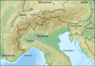
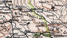
The Windischen Bühel run northwest-southeast between the area of Leutschach in the west and Ljutomer (Luttenberg) in the east. Its area of about 20 × 65 km lies between the rivers Mur and Drava . Like the Mur and Drava, the smaller bodies of water mostly flow in a south-easterly direction, but in the north-west they flow north to west. The Bühel curve along the Possruck north and east and form the continuation of the Koralpe . In terms of their appearance (morphologically) they correspond more to the east Styrian hill country than a transition to a low mountain range . The Windischen Bühel have heights of 200 to 400 m in the Slovenian part and a good 600 m summit surface in the Austrian part, the highest peak is the Kreuzberg at 633 m above sea level. A. north of Leutschach. The Slovenian part covers 1000 km², the Austrian 500 km².
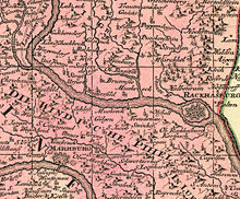
The Bühel extend to the northern city limits of Maribor (Marburg an der Drau) and lie south of the Mur near the Austrian Bad Radkersburg . The Spielfeld (between Maribor and Graz ) is the most important border crossing between Slovenia and Austria. The main towns in the Slovenian part are Jarenina (Jahring) and Lenart (St. Leonhard). Ormož (Friedau) and Ljutomer are located in the southwest on the edge of the Bühel. The hill country bordering west of Spielfeld extends in southwest Styria to the west of Leibnitz and St. Johann im Saggautal , the main town is Leutschach.
According to the Alpine Association of the Eastern Alps (AVE), the hill country is included in the Lavanttal Alps . The landscape structure of Styria already counts the area as sub-region 5 to the foreland (region V), the Slovenian natural geographic regional structure as mesoregion 4 to the subpanonska Slovenija (sub-Pannonian Slovenia, macroregion 4), so both already to the alpine foreland in the east and southeast.
Boundary and structure
To the northeast, the hill country is bounded by the Mur plain (Pomurska ravan). This includes the Leibnitzer Feld , the Untere Murtal, the Apaško polje (Abstaller Feld), Radensko Polje (Radeiner Feld) and the Mursko polje (Murfeld) near Murska Sobota (together the Mur plain ), behind which are the Styrian volcanic land in Eastern Styria and the Goričko in the Prekmurje region (Slovenian Übermurgebiet), in the east the Croatian Medžimurje adjoin . The easternmost hills of the Windische Bühel are called Prlekija, they stretch to the Središko polje (Polstrauer field) on the Drava. In the south lies the historical southern Styria with Ptujsko polje (Pettauerfeld) and Dravsko polje (Draufeld, together Dravsko-Ptujsko polje) and behind it the hill country of the Halože (Kollos). The south-western border is formed by the Pößnitz (Pesnica) - Pößnitzbach to the Possruck (Kozjak) valley . To the west lies beyond the Saggautals the Weststeirische Riedelland, northwest side of the lower Sulmtals of Sausal .
Except for the naming of the Prlekija hills, the area is only slightly divided, the most striking demarcation is the Sulm-Pesnica catchment area, which roughly forms the state border. Otherwise the hill country has great independence in terms of culture and natural landscape due to its local structure.
On the Hungarian side, there is the corresponding word Vendvidéki-dombság ('Vendian hills'), but this also includes the Goričko des Prekmurje, which extend to the Hungarian border.
geology
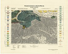
The area belongs to the Styrian Tertiary Basin , in which the Graz Bay (Styrian Basin) formed a marginal sea of the Paratethys . In it, the Windischen Bühel belonged to the eastern part of the Central Styrian Sill, which isolated part of this basin like a lagoon . The area is mainly made up of deposits of the Ottnangian , Carpathian and Badenian (turn of the lower Burdigalium to the Langhian of the Miocene , approx. 18-13 million years ago), a time in which the Paratethys advanced, but the Styrian folding phase of the formation of the Alps began Uplifts in the west.
In the 19th century it was assumed that the area was at least partially glaciated in the high phases of the Ice Ages , as evidenced by erratic boulders from the Koralpen Glacier on Ottenberg , Eckberg , Steinbach , near Sörnau , Kranach , on Fahrenbach , Kreuzberg or near Gündorf .
Climate and nature
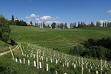
The region is characterized by a mild, fertile climate ( Illyrian climate ) and has viticulture .
The entire Austrian part belongs to the South Styrian Wine Country Nature Park ( Southwest Styrian Wine Country Protected Landscape Area ), while the Krajinski park Jeruzalemsko-ormoške gorice is located in Slovenia .
History and culture
All in all, according to new research, the Windischen Bühel are very productive archaeologically. They represent an important pass landscape between Mur and Drava, which has been inhabited since prehistory. The main road ran across the Platsch / Plački vrh , a little west of today's line via Spielfeld / Šentilj , from Roman times.
The area belonged to the Duchy of Styria ( Lower Styria ) until 1918 . The division goes back to the Treaty of St. Germain .
The most important tourism infrastructure in the Austrian part is the South Styrian Wine Road , the Grenzland Wine Road (L613) was fully opened to traffic again in 2007.
Web links
- Entry on Windische Bühel in the Austria Forum (in the AEIOU Austria Lexicon )
- Windische Bühel (Vorland) , in Umweltinformation Steiermark | Nature and landscape | Landscape structure .
Individual evidence
- ↑ This alpine division for mountaineering purposes does not define any external borders and is unspecific with regard to the edge alpine areas. In general, the area up to the Spielfeld – Marburg line is viewed according to this classification, i.e. mainly the Austrian part of the Windischen Bühel.
- ↑ Vendvidék corresponds to Prekmurje and Rábavidék (' Raab -Land'), the latter corresponds to the Slovenian Porabje : the Slovenian-Hungarian border forms the watershed Mur-Raab, the names, which tend to refer to the other side, reflect the historical mixed settlement; the neighboring landscape of Hungary is called Őrség in Hungarian .
- ↑ Josef Hafellner: A contribution to the lichen flora for the natural areas of West Styrian hill country, Sausal and Windische Bühel (Styria). In: Fritschiana 43, Karl-Franzens-Universität Graz (2003), 1. Introduction p. 47 ff - with an overview of the natural space ( full article p. 47–63 , pdf, uni-graz.at).
- ^ Fritz Ebener, Reinhard F. Sachsenhofer : The history of the development of the Styrian tertiary basin. = Mitt. Dept. Geol. And Paleont. Landesmuseum Joanneum , Heft 49, Graz 1991 ( pdf ( memento of the original from July 26, 2016 in the Internet Archive ) Info: The archive link has been inserted automatically and has not yet been checked. Please check the original and archive link according to the instructions and then remove this note. , museum-joanneum.at).
- ↑ a b cf. Geological information on Florian layers. In Karl Philipp: Fossils and Minerals from Styria , fossilien.heimat.eu (accessed July 21, 2016).
- ↑ Vincenz Hilber : The hiking blocks of the old Koralpen glacier on the Styrian side. I. The blocks on the west wing of the windy Büheln. In: Yearbook dkk gool. Reichsanstalt. 1879. Volume 29. 1st issue, pp. 351–379 ( article pdf , geologie.ac.at).
-
↑ Matija Črešnar, Marko Mele, Karl Peitler, Manca Vinazza (ed.): Archaeological Biography of a landscape on the Styrian-Slovenian border. Results of the cross-border project BorderArch-Steiermark / Arheološka biografija krajine ob meji med avstrijsko Štajersko in Slovenijo. Rezultati čezmejnega projekta BorderArch-Steiermark (= Universalmuseum Joanneum, Archeology & Münzkabinett: Schild von Steier , supplement 6/2015), Graz / Ljubljana 2015, ISBN 978-3-902095-69-5 .
Compare Hidden treasures on the border. Weir systems, settlements, tumuli, and pungen - an EU project examined the many archaeological treasures in the Styrian-Slovenian border area. Walter Schmidbauer in Kleine Zeitung online, April 22, 2015. - ↑ The Grenzland Wine Road is passable. In: Der Standard online, August 28, 2007.

