Miklavž na Dravskem Polju
|
Miklavž na Dravskem Polju St. Nikolai |
|||
|
|||
| Basic data | |||
|---|---|---|---|
| Country |
|
||
| Historic region | Lower Styria / Štajerska | ||
| Statistical region | Podravska (Drau region) | ||
| Coordinates | 46 ° 30 ' N , 15 ° 42' E | ||
| surface | 12.5 km² | ||
| Residents | 6,744 (January 1, 2019) | ||
| Population density | 540 inhabitants per km² | ||
| Post Code | 2204 | ||
| License Plate | MB | ||
| Structure and administration | |||
| Mayor : | Egon Repnik | ||
| Mailing address | Nad izviri 6 2204 Miklavž n. Dra. pole. |
||
| Website | |||
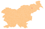
Miklavž na Dravskem Polju ( German : Sankt Nikolai ) is a village and municipality in Slovenia . It is located in the historical Spodnja Štajerska ( Lower Styria ) region and in the statistical region of Podravska .
geography
location
Miklavž na Dravskem polju is one of the smaller municipalities in Slovenia in terms of area. It is located about 7 km southeast of Maribor (as the crow flies) on the road to Ptuj at 259 m. ü. A. and are located in the northern corner of Dravsko polje ( Draufeld ). The municipality is a popular residential community due to its proximity to Maribor.
The Drava flows north-east past the place, but the canal of the Zlatoličje hydroelectric power station runs through the village ( Slovak : Prekop HE Zlatoličje ).
Community structure
The German exonyms in brackets were mainly used by the German-speaking population until the area was ceded to the Kingdom of Serbs, Croats and Slovenes in 1918 and are largely uncommon today. (Population figures as of January 1, 2019):
- Dobrovce ( Dobrofzen ), 814
- Dravski Dvor ( Drauhof ), 666
- Miklavž na Dravskem polju ( Saint Nikolai ), 4.192
- Skoke ( Skoggen ), 1072
Neighboring communities
| Maribor | ||
| Hoče-Slivnica |

|
|
| Starše |
traffic
National road 9, which connects Maribor with Ptuj , runs through Miklavž . The A1 and A4 motorways surround the community to the west like a bypass, resulting in numerous connection options. From north to south these would be the junction "Maribor-center" and "Rogoza" on the A1, as well as "Marjeta na Dravskem polju" on the A4.
The Zidani Most-Šentilj railway line runs west of the village. The nearest local train station is "Hoče", 3.5 km away, the next intercity train station is in "Maribor", 9 km away.
Even the Maribor airport is located in the immediate vicinity.


