Schärding district
| location | |
|---|---|
| Basic data | |
| state | Upper Austria |
| NUTS III region | AT-311 |
| Administrative headquarters | Schärding |
| surface | 618 km² |
| Residents | 57,391 (January 1, 2020) |
| Population density | 93 inhabitants / km² |
| License Plate | SD |
| District Commission | |
| District Captain | Rudolf Greiner |
| website | www.bh-schaerding.gv.at |
| map | |
The district of Schärding is a political district of the state of Upper Austria .
It borders in the south on the district of Ried im Innkreis , in the east on the districts of Grieskirchen and Rohrbach , in the north and west on the Free State of Bavaria . It corresponds to the Lower Innviertel region .
history
The district was established in 1868. In the course of the creation of the Grieskirchen district, the Peuerbach district court district had to be given up in 1906.
After the connection of Austria to the German Reich on March 13, 1938, "was out of the political district Schärding district Schärding". After 1945 the political district of Schärding was restored.
Until the end of 2003, there were three court districts in the district with the court districts Engelhartszell , Raab and Schärding . Engelhartszell and Raab were, however, dissolved on January 1, 2003 and the associated communities were subordinated to the Schärding judicial district.
Administrative division
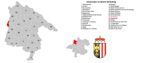
The district of Schärding is divided into 30 communities , including Schärding, a town and 9 market communities. Esternberg is the largest municipality in the district in terms of area. The population is from January 1st, 2020.
|
| local community | location | Ew | km² | Ew / km² | Judicial district | region | Type
|
photo | Metadata |
|---|---|---|---|---|---|---|---|---|---|
Altschwendt
|

|
702 | 12.74 | 55 | Schärding | local community
|
According to code: 41401 |
||
Andorf
|
|
5,211 | 37.67 | 138 | Schärding | market community
|
|
According to code: 41402 |
|
Brunnenthal
|

|
2,098 | 14.82 | 142 | Schärding | local community
|

|
Acc. To code: 41403 |
|
Diersbach
|
|
1,563 | 28.08 | 56 | Schärding | local community
|
According to code: 41404 |
||
Village on the Pram
|

|
1,047 | 12.67 | 83 | Schärding | local community
|
According to code: 41405 |
||
Eggerding
|

|
1,337 | 22.31 | 60 | Schärding | local community
|

|
Acc. To code: 41406 |
|
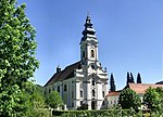
Engelhartszell
|

|
922 | 18.89 | 49 | Schärding | market community
|
|
According to code: 41407 |
|
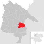
Enzenkirchen
|
|
1,778 | 23.29 | 76 | Schärding | local community
|
According to code: 41408 |
||
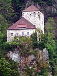
Esternberg
|

|
2,866 | 40.27 | 71 | Schärding | local community
|
|
Acc. To code: 41409 |
|
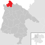
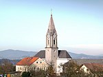
Freinberg
|
|
1,433 | 20.31 | 71 | Schärding | local community
|
|
According to code: 41410 |
|
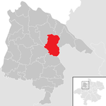
Kopfing in the Innkreis
|
|
1,985 | 33.3 | 60 | Schärding | market community
|

|
According to code: 41411 |
|
Mayrhof
|

|
324 | 5.33 | 61 | Schärding | local community
|
According to code: 41412 |
||
Münzkirchen
|

|
2,532 | 21.07 | 120 | Schärding | market community
|

|
Acc. To code: 41413 |
|
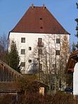
Raab
|

|
2,268 | 22.48 | 101 | Schärding | market community
|
|
According to code: 41414 |
|
Rainbach im Innkreis
|

|
1,490 | 24.41 | 61 | Schärding | local community
|
According to code: 41415 |
||
Riedau
|

|
2,072 | 7.63 | 272 | Schärding | market community
|

|
According to code: 41416 |
|
Saint Aegidi
|

|
1,551 | 28.64 | 54 | Schärding | local community
|
According to code: 41417 |
||
St. Florian am Inn
|

|
3.138 | 24.16 | 130 | Schärding | market community
|

|
According to code: 41418 |
|
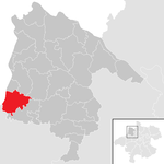
St. Marienkirchen near Schärding
|
|
1,897 | 24.91 | 76 | Schärding | local community
|

|
According to code: 41419 |
|
Power on
|

|
1,728 | 31.77 | 54 | Schärding | local community
|
According to code: 41420 |
||
St. Willibald
|

|
1.103 | 14.51 | 76 | Schärding | local community
|
Acc. To code: 41421 |
||
Schardenberg
|

|
2,440 | 31.59 | 77 | Schärding | market community
|

|
According to code: 41423 |
|
Schärding
|

|
5,269 | 3.96 | 1331 | Schärding | urban community
|

|
Acc. To code: 41422 |
|
Sigharting
|

|
824 | 5.67 | 145 | Schärding | local community
|

|
Acc. To code: 41424 |
|
Suben
|

|
1,552 | 6.41 | 242 | Schärding | local community
|
Acc. To code: 41425 |
||
Taufkirchen an der Pram
|

|
2,915 | 29.15 | 100 | Schärding | market community
|

|
Acc. To code: 41426 |
|
Vichtenstein
|
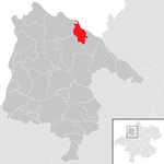
|
609 | 10.77 | 57 | Schärding | local community
|

|
According to code: 41427 |
|
Waldkirchen am Wesen
|
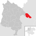
|
1,185 | 21.43 | 55 | Schärding | local community
|

|
Acc. To code: 41428 |
|
Wernstein am Inn
|

|
1,540 | 16.53 | 93 | Schärding | local community
|

|
According to code: 41429 |
|
Zell an der Pram
|

|
2.012 | 23.37 | 86 | Schärding | local community
|
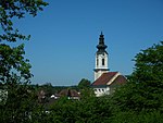
|
According to code: 41430 |
Focus
The geographical center of the district lies in the cadastral community Großwaging , community Diersbach ( ⊙ ).
Population development

economy
There are around 2,450 businesses in the district, 1,112 of which are in trade, 999 in trade, 203 in tourism, 203 in transport and 52 in industry. Small businesses make up a large proportion. The peripheral location far from the Upper Austrian central area complicates the conditions on the labor market. Some of the employees commute to Bavaria ( Euregio cooperation Inn-Salzach).
Personalities
Web links
Individual evidence
- ↑ Statistics Austria - Population at the beginning of 2002–2020 by municipalities (area status 01/01/2020)
- ↑ The center of the Schärding district. (PDF) Office of Upper Austria. State government, accessed on May 18, 2020 .
- ↑ Rudolf Lehr: State Chronicle of Upper Austria. Vienna 2008, p. 18 f.
Coordinates: 48 ° 27 ' N , 13 ° 26' E


