
Mayrhof
|
Mayrhof
|
||
|---|---|---|
| coat of arms | Austria map | |
 |
|
|
| Basic data | ||
| Country: | Austria | |
| State : | Upper Austria | |
| Political District : | Schärding | |
| License plate : | SD | |
| Surface: | 5.33 km² | |
| Coordinates : | 48 ° 21 ' N , 13 ° 30' E | |
| Height : | 430 m above sea level A. | |
| Residents : | 324 (January 1, 2020) | |
| Population density : | 61 inhabitants per km² | |
| Postal code : | 4777 | |
| Area code : | 07767 | |
| Community code : | 4 14 12 | |
| NUTS region | AT311 | |
| Address of the municipal administration: |
Mayrhof 14 4777 Mayrhof |
|
| Website: | ||
| politics | ||
| Mayor : | Johann Blümlinger ( ÖVP ) | |
|
Municipal Council : (2015) (9 members) |
||
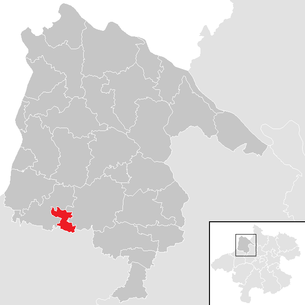
| Location of Mayrhof in the Schärding district | ||
  |
||
| Source: Municipal data from Statistics Austria | ||

Mayrhof is a municipality in Upper Austria in the district of Schärding in the Innviertel with 324 inhabitants (as of January 1, 2020). The community is located in the judicial district of Schärding .
geography
Mayrhof is located at an altitude of 430 m in the Innviertel. The extension is 3.3 km from north to south and 3.4 km from west to east. The total area is 5.4 km². 9.3% of the area is forested, 81.5% of the area is used for agriculture.
Community structure
The municipality includes the following three localities (population in brackets as of January 1, 2020):
- Heiligenbaum (32)
- Mayrhof (211) including Braunsberg and Mayrhof-scattered houses
- Oberndorf (81) including Sallaberg
The community consists of the cadastral community Mayrhof.
coat of arms
Blazon : In green, a red, two-winged, closed courtyard gate with a silver archway. The community colors are red-white-green
history
The area has been Bavarian since the founding of the Duchy of Bavaria. The place name Mayrhof appears for the first time in the 14th century. Mayrhof came to Austria after the Treaty of Teschen in 1779 with the Innviertel (then 'Innbaiern'). In 1785 Mayrhof came to the Eggerding parish as part of the Josephine reforms .
Briefly Bavarian again during the Napoleonic Wars , since 1814 it has finally belonged to Upper Austria.
After the annexation of Austria to the German Reich on March 13, 1938, the place belonged to the Gau Oberdonau . After 1945 the restoration of Upper Austria took place.
politics
Mayor is Johann Blümlinger from the ÖVP.
Population development
In 1991 the community had 238 inhabitants according to the census, then 257 in 2001. Since both the birth balance and the migration balance remained positive, the population rose to 297 in 2011 and finally to 322 in 2018.
Culture and sights
Regular events
Innviertel Midsummer Night's Dream, classical open air concert on the village square
Web links
- Further information about the municipality of Mayrhof can be found on the geo-information system of the federal state of Upper Austria .
Individual evidence
- ↑ Statistics Austria: Population on January 1st, 2020 by locality (area status on January 1st, 2020) , ( CSV )
- ^ State of Upper Austria, history and geography, coat of arms. Retrieved April 15, 2019 .
- ^ Province of Upper Austria, results of the 2015 elections. Retrieved on April 15, 2019 .
- ↑ Statistics Austria, A look at the community Mayrhof, population development. Retrieved April 15, 2019 .

Altschwendt | Andorf | Brunnenthal | Diersbach | Village on the Pram | Eggerding | Engelhartszell | Enzenkirchen | Esternberg | Freinberg | Kopfing im Innkreis | Mayrhof | Münzkirchen | Raab | Rainbach im Innkreis | Riedau | Saint Aegidi | St. Florian am Inn | St. Marienkirchen near Schärding | St. Roman | St. Willibald | Schardenberg | Schärding | Sigharting | Suben | Taufkirchen an der Pram | Vichtenstein | Waldkirchen am Wesen | Wernstein am Inn | Zell an der Pram