
Brunnenthal (Upper Austria)
|
Brunnenthal
|
||
|---|---|---|
| coat of arms | Austria map | |
 |
|
|
| Basic data | ||
| Country: | Austria | |
| State : | Upper Austria | |
| Political District : | Schärding | |
| License plate : | SD | |
| Surface: | 14.82 km² | |
| Coordinates : | 48 ° 28 ′ N , 13 ° 28 ′ E | |
| Height : | 383 m above sea level A. | |
| Residents : | 2,098 (January 1, 2020) | |
| Population density : | 142 inhabitants per km² | |
| Postal code : | 4786 | |
| Area code : | 07712 | |
| Community code : | 4 14 03 | |
| NUTS region | AT311 | |
| Address of the municipal administration: |
Dorfplatz 3 4786 Brunnenthal |
|
| Website: | ||
| politics | ||
| Mayor : | Roland Wohlmuth ( ÖVP ) | |
|
Municipal Council : (2015) (25 members) |
||
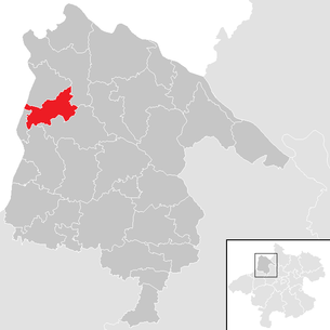
| Location of Brunnenthal in the Schärding district | ||
  |
||
 The parish and pilgrimage church of Brunnenthal |
||
| Source: Municipal data from Statistics Austria | ||

Brunnenthal is a municipality in the district of Schärding in the Innviertel in Upper Austria with 2098 inhabitants (as of January 1, 2020). The community is located in the judicial district of Schärding .
geography
Brunnenthal is located at an altitude of 383 m in the Innviertel. The extension is 6.6 km from north to south and 5.3 km from west to east. The total area is 15 km². 21.3% of the area is forested, 67.3% of the area is used for agriculture.
Community structure
The municipality includes the following 12 localities (population in brackets as of January 1, 2020):
- Atzmanning (63) including Atzmanning-Scattered Houses, Penning and Piret
- Brunnenthal (452)
- Brunnwies (177)
- Dobl (71)
- Eggersham (99)
- Haraberg (27)
- Hueb (432) including Huebsiedlung, Laina and pasture
- Kapfham (9)
- Korneredt (45)
- Kreuzberg (487) including Bräusiedlung
- Reikersberg (63) including Hizingergut
- Wallensham (173) and Wallensham-Scattered Houses
The parish consists of the cadastral parishes Brunnenthal and Eggersham.
history
The originally sparsely populated area has been Bavarian since the founding of the Duchy of Bavaria . At the time of the early church organization in the Middle Ages, the area around Brunnenthal belonged to the original parish of St. Weihflorian . Like the Münzkirchen parish , this consisted of areas that had originally belonged to the St. Severin parish in Passau's Innstadt . St. Weihflorian was first designated as an independent parish in 1182 when it was incorporated into the Passau “Innbruckamt”, which was subordinate to the St. Aegidien Hospital in the city center. The parish of St. Weihflorian was very extensive: It lay between the area of activity of the original parish of St. Severin and that of the original parish of Münsteuer and included the area of today's parishes of Brunnenthal, Schärding , St. Florian am Inn , Suben , St. Marienkirchen and Eggerding , plus shares in today's parishes of Taufkirchen , Lambrechte and Rainbach . When the parish of St. Weihflorian moved to Schärding in 1380 , Brunnenthal became a branch of Schärding.
Georg Auer, a farmer in Haraberg, had a brick-built "Creutz or torture pillars" built after his recovery, which he attributed to the healing power of the water from his well. The flow of pilgrims quickly increased as a result of this event. In 1668 a pilgrimage church was completed . Brunnenthal came to Austria after the Treaty of Teschen in 1779 with the Innviertel (then 'Innbaiern'). The local church suffered a huge loss of assets because Bavaria no longer gave its capital. In 1785 Emperor Josef II raised it to the status of an independent parish . During the Napoleonic Wars briefly Bavarian again, the place finally belonged to Upper Austria since 1814.
After the annexation of Austria to the German Reich on March 13, 1938, the place belonged to the Gau Oberdonau . After 1945 the restoration of Upper Austria took place.
Population development
In 1991 the municipality had 1,680 inhabitants according to the census. As both the birth balance and the migration balance were positive, the population increased to 1,923 in 2011 and further to 1,975 in 2011, peaking at 2,032 in 2018.
Culture and sights

- Parish and pilgrimage church : Baroque building from 1667/68, ground-in room vaulted with cross barrels by the architect Christoph Zuccalli (from the famous Graubünden family of architects)
- Chapel of Grace: consecrated in 1731
- Well chapel: between the Gnadenkapelle and Badhaus lies the actual center of the old Brunnenthal pilgrimage, the well chapel, "das Bründl", with a statue of Maria lactans as a fountain figure
- Stone carvers chapel: an interesting building from the second half of the 17th century
- The bath house: In 1679/81 the increasing stream of pilgrims led to the construction of the bath house
- Cross column: Georg Auer wayside shrine built in 1646
- Chapel in Eggersham: built in 1998 in Eggersham near Brunnenthal
- Chapel in Wallensham
Regular events
- Brunnenthal Concert Summer: offers original baroque sounds; Every year from May to August there are seven concerts
Economy and Infrastructure
In the village of Brunnwies, the Kapsreiter Group from Schärding operated a large construction depot ; today there is an industrial park owned by Haas Holding GmbH based in Brunnenthal .
Social facilities
- Building yard
- Volunteer firefighter
- Nursery with 2 groups
- Kindergarten with 4 groups
education
The first general public school was housed in a rear room in the former bathhouse in 1764 . It was not until 1850 that the school became two-tier. In 1920 compulsory schooling was introduced for 7 years in the village. In 1976 the construction of a new elementary school began and on October 23, 1977 the new school building with gym was inaugurated.
politics
The municipal council has a total of 25 members. With the municipal council and mayoral elections in Upper Austria in 2015 , the municipal council has the following distribution: 15 ÖVP, 7 FPÖ and 3 SPÖ.
mayor
- Since 2002 Roland Wohlmuth (ÖVP), Deputy Mayor is Ing.Friedrich Wadler (ÖVP)
coat of arms
Blazon : humiliated divided by silver and blue with Jochschnitt; Above is a red, heraldic rose with a golden clasp and golden sepals, surrounded by a golden ring. The community colors are blue-yellow-blue.
Personalities
- Norbert Zeilberger (1969–2012), organist. Harpsichordist, pianist; born here.
- Annerose Riedl (* 1949), sculptor; has lived here since 1973.
Web links
- Side of the community
- Brunnenthal on land-oberoesterreich.gv.at
- Map in the Digital Upper Austrian Room Information System ( DORIS )
- Further information about the municipality of Brunnenthal (Upper Austria) can be found on the geographic information system of the state of Upper Austria .
Individual evidence
- ↑ Statistics Austria: Population on January 1st, 2020 by locality (area status on January 1st, 2020) , ( CSV )
- ↑ a b Johann Ev. Lamprecht : Description of the kk landesfürstl. Gränzstadt Schärding am Inn and its surroundings. Wels 1860 ( online ), p. 276.
- ↑ Johann Ev. Lamprecht : Description of the kk landesfürstl. Gränzstadt Schärding am Inn and its surroundings. Wels 1860 ( online ), p. 275.
- ^ Hugo Lerch: The dispute between the Passau canon and Innbruckmaster Johann von Malenthein with the Passau cathedral chapter 1544–1549. In: Ostbairische Grenzmarken 6 (1962/1963), pp. 249–261, here pp. 250–251.
- ↑ Theodor Ebner: The anti-giant estuary. In: Yearbook of the Upper Austrian Museum Association. Year 148, Linz 2003, pp. 257–284 ( PDF (2.2 MB) on ZOBODAT ), here p. 279.
- ^ Statistics Austria, A look at the community of Brunnenthal, population development. Retrieved April 16, 2019 .
- ↑ In 1832 the pastor reported that in the dry season, crystal clear water gushes out of Mary's chest, but in the rainy season it was almost pearl-colored, with which the pilgrims wash their eyes . The water pipe was laid later, since then the water has been flowing from a pipe below the Mother of God with the baby Jesus into the fountain basin. In: Franz Schobesberger, Günter Pichler: Parish and pilgrimage church of the Visitation of the Virgin Mary and the old pilgrimage district of Brunnenthal . Passau 2008, ISBN 978-3-89643-697-9 , p. 22.
- ^ Province of Upper Austria, results of the 2015 elections. Retrieved on April 16, 2019 .
- ^ Brunnenthal community, politics, community council. Retrieved April 16, 2019 .
- ^ State of Upper Austria, history and geography, coat of arms. Retrieved April 16, 2019 .

Altschwendt | Andorf | Brunnenthal | Diersbach | Village on the Pram | Eggerding | Engelhartszell | Enzenkirchen | Esternberg | Freinberg | Kopfing im Innkreis | Mayrhof | Münzkirchen | Raab | Rainbach im Innkreis | Riedau | Saint Aegidi | St. Florian am Inn | St. Marienkirchen near Schärding | St. Roman | St. Willibald | Schardenberg | Schärding | Sigharting | Suben | Taufkirchen an der Pram | Vichtenstein | Waldkirchen am Wesen | Wernstein am Inn | Zell an der Pram