
Taufkirchen an der Pram
|
market community Taufkirchen an der Pram
|
||
|---|---|---|
| coat of arms | Austria map | |
 |
|
|
| Basic data | ||
| Country: | Austria | |
| State : | Upper Austria | |
| Political District : | Schärding | |
| License plate : | SD | |
| Surface: | 29.15 km² | |
| Coordinates : | 48 ° 25 ' N , 13 ° 32' E | |
| Height : | 338 m above sea level A. | |
| Residents : | 2,915 (January 1, 2020) | |
| Postal code : | 4775 | |
| Area code : | 07719 | |
| Community code : | 4 14 26 | |
| NUTS region | AT311 | |
| UN / LOCODE | AT TKP | |
| Address of the municipal administration: |
Schärdinger Strasse 1 4775 Taufkirchen an der Pram |
|
| Website: | ||
| politics | ||
| Mayor : | Paul Freund ( ÖVP ) | |
|
Municipal Council : (2015) (25 members) |
||
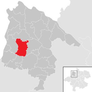
| Location of Taufkirchen an der Pram in the Schärding district | ||
  |
||
 Taufkirchen with the Pram in the foreground and the parish church in the background |
||
| Source: Municipal data from Statistics Austria | ||

Taufkirchen an der Pram is a market town in Upper Austria in the Schärding district in the Innviertel with 2915 inhabitants (as of January 1, 2020). The community is located in the judicial district of Schärding .
geography
Taufkirchen an der Pram is 338 m above sea level in the Innviertel. The extension is 7.9 km from north to south and 6 km from west to east. The total area is 29.2 km², 11.6% of the area is forested, 78.8% of the area is used for agriculture.
Community structure
The municipal area comprises the following 38 localities (population in brackets as of January 1, 2020):
- Aichberg (17)
- Aichedt (29)
- Bachschwölln (205) including Gmeinau
- Baumgarten (6)
- Mountain (6)
- Berndobl (31)
- Custom Village (45)
- Brunedt (10)
- Eggenberg (23)
- Feicht (8)
- Furth (61)
- Furth-Pfaffing (4)
- Gadern (171)
- Gmeinau (85)
- Haberedt (49)
- Höbmannsbach (71)
- Höbmannsdorf (21)
- Holzing (99)
- Iggling (32)
- Jechtenham (94) including Oberjechtenham and Unterjechtenham
- Kalchgrub (0)
- Chapels (87)
- Small waging (9)
- Laufenbach (191) including Gmeinau
- Leoprechting (165)
- Maad (53)
- Oberpramau (26)
- Pfaffingdorf (10)
- Pram (26)
- Schratzberg (20)
- Schwendt (125)
- Sonndorf (3)
- Taufkirchen an der Pram (767)
- Unterpramau (21)
- Wagholming (24)
- Wimm (129)
- Windten (59)
- Wolfsedt (133) including travel
The community consists of the cadastral communities Brauchsdorf, Höbmannsbach, Igling, Laufenbach, Schwendt and Taufkirchen an der Pram.
Neighboring communities
| Rainbach | ||
| St. Florian |
.svg)
|
Diersbach |
| St. Marienkirchen | Eggerding | Andorf |
Community partnerships
- Spitz on the Danube, Lower Austria
Population development
In 1991 the community had 2,957 inhabitants according to the census, in 2001 it had 2,938 inhabitants. The decline occurred despite a positive birth balance , as emigration was greater. The migration balance was also negative in the next decade , so that the population fell to 2,926 in 2011.
coat of arms
Blazon : "Between blue, wavy flanks in silver, a red baptismal font with a red, keel-arched lid, topped with a gold knob and cross."
The municipality colors are blue-white-red.
The municipal coat of arms awarded by the Upper Austrian provincial government in 1970 symbolizes the place name with the baptismal font as a talking coat of arms . The waves represent the location of the place on the Pram .
history
The place, first mentioned in 1160, was Bavarian until 1779 and came to Austria after the Treaty of Teschen with the Innviertel (then Innbaiern ). During the Napoleonic Wars briefly royal Bavarian again , since 1814 it has finally belonged to Austria ob der Enns .
After the annexation of Austria to the German Reich on March 13, 1938, the place belonged to the Gau Oberdonau . In 1945 Upper Austria was restored.
Taufkirchen was raised to the market on February 1, 2010. On May 23, 2010, the town's 850th anniversary was celebrated in a festival with a procession and a festival service at Taufkirchner Gemeindeplatz. This celebration was also a market survey celebration.
politics
The municipal council has a total of 25 members. With the municipal council and mayoral elections in Upper Austria in 2015 , the municipal council has the following distribution: 13 ÖVP, 8 FPÖ and 4 SPÖ.
- mayor
- until 2015 Josef Gruber (ÖVP)
- since 2015 Paul Freund (ÖVP)
Culture and sights
.JPG)
- A Gothic church on a hill, which was probably built after the middle of the 15th century by the master builder Stephan Krumenauer. The tower collapsed in 1922 and was rebuilt in its old form in 1923.
- Filial church hl. Laurentius in Wagholming
- Museum in the school: Austria's only museum in a school with seven subject areas: Pram landscape - faith and superstition - lighting - oil discovery in Taufkirchen - dairy farming - beekeeping - local and regional history and with a large glass window by Margret Bilger and a collection of musical instruments.
- Bilger-Breustedt-Haus: A museum about the Austrian artist Margret Bilger and her husband, the German Bauhaus artist Hans Joachim Breustedt
- Handicraft museum: Handicrafts such as shoemaker, tailor, saddler, blacksmith, rope maker and wagner were located in the village of Laufenbach in the 19th and 20th centuries. In the approx. 300 year old wooden houses in the handicraft museum in Laufenbach you can see how these craftsmen lived and worked back then.
- Radio Museum: The entire repertoire of mechanical music recording is exhibited here in the Radio Museum.
economy
The Lorenz Shoe Group AG, which has its headquarters in Taufkirchen, is of supraregional importance . 200 of the Group's 1200 employees work here. With the brands “Högl”, “Ganter” and “ Hassia ”, sales of more than EUR 80 million per year are achieved.
The Schärdinger Dairy Association operating in Taufkirchen a plant for the production of dry milk products of the brand Taumil , also here that was Schärdinger summer butter manufactured, these dairy so that eventually developed into the second largest Butte grater driving in Austria. After the decline of the AMF group , the Taufkirchen dairy was closed in 2001 and its tasks were taken over by the Aschbach dairy .
traffic
Taufkirchen an der Pram station is on the Wels – Passau railway line .
Personalities
People related to the place
- Margret Bilger (1904–1971), Austrian painter, lived in Taufkirchen an der Pram since 1939
- Hans Joachim Breustedt (1901–1984), German painter ( Bauhaus ), lived in Taufkirchen an der Pram since 1953 (married Margret Bilger)
- Emmerich Doninger (1914–1964), religious priest, educator, artist, spent his childhood in Taufkirchen an der Pram
- Peter Kubelka (* 1934), Austrian experimental filmmaker and artist, spent his childhood in Taufkirchen an der Pram
- Josef Mayer (1868–1940), Austrian politician and mayor of Taufkirchen
- Lukas Weißhaidinger (* 1992), Austrian athlete (discus thrower), lives in Taufkirchen an der Pram
Sons and daughters of the church
- Ferdinand Froschauer (1865–1948), member of the Upper Austrian state parliament ( CSP ) and mayor of Taufkirchen
- Anton Schmidbauer (1877–1964), member of the Upper Austrian state parliament and mayor of Taufkirchen
Web links
- Community website
- Bilger-Breustedt house
- Map in the Digital Upper Austrian Room Information System ( DORIS )
- More information about the municipality of Taufkirchen an der Pram on the geographic information system of the federal state of Upper Austria .
Individual evidence
- ↑ Statistics Austria: Population on January 1st, 2020 by locality (area status on January 1st, 2020) , ( CSV )
- ^ Community Taufkirchen, 2-Mayor. Retrieved April 15, 2019 .
- ^ Statistics Austria, A look at the community of Taufkirchen an der Pram, population development. Retrieved April 15, 2019 .
- ^ Herbert Erich Baumert: The coats of arms of the cities, markets and communities of Upper Austria (3rd supplement) . In: Oberösterreichische Heimatblätter, Heft 1/2, 1973, p. 17, online (PDF; 1.5 MB) in the forum OoeGeschichte.at
- ↑ Changes in the administrative structure from January 1, 2002 to December 31 , 2011 , Statistics Austria, accessed on May 15, 2017 (PDF; 169 kB).
- ^ Province of Upper Austria, results of the 2015 elections. Retrieved on April 15, 2019 .
- ↑ Renaming according to commercial register FB no .: 114665a

Altschwendt | Andorf | Brunnenthal | Diersbach | Village on the Pram | Eggerding | Engelhartszell | Enzenkirchen | Esternberg | Freinberg | Kopfing im Innkreis | Mayrhof | Münzkirchen | Raab | Rainbach im Innkreis | Riedau | Saint Aegidi | St. Florian am Inn | St. Marienkirchen near Schärding | St. Roman | St. Willibald | Schardenberg | Schärding | Sigharting | Suben | Taufkirchen an der Pram | Vichtenstein | Waldkirchen am Wesen | Wernstein am Inn | Zell an der Pram