Altschwendt
|
Altschwendt
|
||
|---|---|---|
| coat of arms | Austria map | |
|
|
||
| Basic data | ||
| Country: | Austria | |
| State : | Upper Austria | |
| Political District : | Schärding | |
| License plate : | SD | |
| Surface: | 12.74 km² | |
| Coordinates : | 48 ° 19 ′ N , 13 ° 41 ′ E | |
| Height : | 432 m above sea level A. | |
| Residents : | 702 (January 1, 2020) | |
| Population density : | 55 inhabitants per km² | |
| Postal code : | 4721 | |
| Area code : | 07762 | |
| Community code : | 4 14 01 | |
| NUTS region | AT311 | |
| Address of the municipal administration: |
Altschwendt 9 4721 Altschwendt |
|
| Website: | ||
| politics | ||
| Mayor : | Roland Mayrhofer ( SPÖ ) | |
|
Municipal Council : (2015) (13 members) |
||
| Location of Altschwendt in the Schärding district | ||
| Source: Municipal data from Statistics Austria | ||
Altschwendt is a small municipality in Upper Austria in the district of Schärding in the Innviertel with 702 inhabitants (as of January 1, 2020). The community is located in the judicial district of Schärding .
geography
Altschwendt lies at an altitude of 432 m in the Innviertel. The extension is 6.5 km from north to south and 4 km from west to east. The total area is 12.7 km². 12.6% of the area is forested, 79.5% of the area is used for agriculture.
Community structure
The municipal area comprises the following 10 localities (population in brackets as of January 1, 2020):
- Altenseng (14)
- Altschwendt (338) including the Paus settlement
- Danrath (25)
- Fasthub (51)
- Hausmanning (38)
- Putzenbach (24)
- Rien (35)
- Rödham (106) including Einbach, Oberrödham, Roisenedt, Unterrödham and Weißenböck settlement
- Urleinsberg (35) including Unterurleinsberg
- Wohlmarch (36)
The community consists of the cadastral communities Altschwendt and Oberrödham.
coat of arms
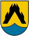
Blazon : Above a blue shield base in gold with a pointed tip, a black rafter, each branched twice at the top. The community colors are black-yellow-blue
history
Since the founding of the Duchy of Bavaria, the place was Bavarian until 1779 and came to Austria after the Treaty of Teschen with the Innviertel (then Innbaiern ). Briefly Bavarian again during the Napoleonic Wars , since 1814 it has finally belonged to Upper Austria. After the annexation of Austria to the German Reich on March 13, 1938, the place belonged to the Gau Oberdonau . After 1945 the restoration of Upper Austria took place.
Until the end of 2002, the community belonged to the Raab judicial district , after its dissolution it was assigned to the Schärding judicial district.
Population development
In 1991 the municipality had 687 inhabitants according to the census, in 2001 it had 678 inhabitants. A further increase to 697 inhabitants was recorded by 2019.
politics
The municipal council has a total of 13 members. With the municipal council and mayoral elections in Upper Austria in 2015 , the municipal council has the following distribution: 5 ÖVP, 5 SPÖ and 3 FPÖ.
mayor
- 1919–1938 Franz Altmann (1885–1947) (CSP)
- 1945–1947 Franz Altmann (ÖVP)
- since 2003 Josef Söberl (SPÖ)
Culture and sights
Economy and Infrastructure
Altschwendt has a wind farm with five wind turbines, which were built from 1998.
Clubs and leisure activities
- Theater group
- Union Tennis
- Union stick shooters
- Rural youth
- music Society
- Volunteer firefighter
- Hunter
- beekeeper
- Public playground
- Public library
Web links
- Further information about the municipality of Altschwendt can be found on the geographic information system of the federal state of Upper Austria .
Individual evidence
- ↑ Statistics Austria: Population on January 1st, 2020 by locality (area status on January 1st, 2020) , ( CSV )
- ↑ Alexandra Dick: Wind farm is the landmark of Altschwendt. tips.at, May 17, 2018, accessed on February 6, 2019 .


