Eferding district
| location | |
|---|---|
| Basic data | |
| state | Upper Austria |
| NUTS III region | AT-312 |
| Administrative headquarters | Grieskirchen |
| surface | 260 km² |
| Residents | 33,178 (January 1, 2020) |
| Population density | 128 inhabitants / km² |
| License Plate | EF |
| District Commission | |
| District Captain | Christoph Schweitzer |
| website | www.bh-eferding.gv.at |
| map | |
The Eferding district is a political district in the state of Upper Austria .
It is located in the Hausruckviertel , north of Wels .
The district administration Eferding started its activities in 1907 after the city of Eferding had tried to set it up in 1899. The district was created through the assignment of territory by the district administration Wels and formed from the judicial districts of Waizenkirchen and Eferding .
As early as 1912, however, most of the Waizenkirchen judicial district was ceded to the Grieskirchen district. During the Nazi era , the Eferding district was dissolved and the area was added to the Grieskirchen district. In 1948 the Eferding district was restored.
Since September 1, 2016, there has been an administrative association for the districts of Grieskirchen and Eferding with headquarters in Grieskirchen, in Eferding there is a citizen service point and a branch office for child and youth welfare as well as social issues.
Administrative division
The Eferding district is divided into twelve municipalities : one town (Eferding), three market municipalities and eight municipalities. The population figures are from January 1st, 2020.

| local community | location | Ew | km² | Ew / km² | Judicial district | region | Type
|
photo | Metadata |
|---|---|---|---|---|---|---|---|---|---|
alcove
|

|
6.004 | 42.49 | 141 | Eferding | local community
|

|
Acc. To code: 40501 |
|
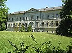
Aschach on the Danube
|

|
2.167 | 6th | 361 | Eferding | market community
|
|
According to code: 40502 |
|
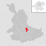
Eferding
|
|
4,259 | 2.81 | 1516 | Eferding | urban community
|
|
Acc. To code: 40503 |
|
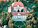
Fraham
|

|
2,391 | 16.94 | 141 | Eferding | local community
|
|
According to code: 40504 |
|
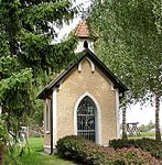
Haibach above the Danube
|

|
1,289 | 25.55 | 50 | Eferding | local community
|

|
Acc. To code: 40505 |
|
Hartkirchen
|

|
4,073 | 39.04 | 104 | Eferding | local community
|
|
Acc. To code: 40506 |
|
Hinzenbach
|

|
2,074 | 14.58 | 142 | Eferding | local community
|

|
Acc. To code: 40507 |
|
Prambachkirchen
|

|
2,933 | 28.72 | 102 | Eferding | market community
|
|
Acc. To code: 40508 |
|
Pupping
|

|
1,783 | 13.33 | 134 | Eferding | local community
|

|
According to code: 40509 |
|
Nicks
|

|
2,277 | 17.45 | 130 | Eferding | local community
|

|
Acc. To code: 40511 |
|
St. Marienkirchen an der Polsenz
|

|
2,314 | 23.84 | 97 | Eferding | market community
|

|
Acc. To code: 40510 |
|
Stroheim
|

|
1,614 | 28.78 | 56 | Eferding | local community
|

|
According to code: 40512 |
Population development

Individual evidence
- ↑ Statistics Austria - Population at the beginning of 2002–2020 by municipalities (area status 01/01/2020)
Web links
Coordinates: 48 ° 19 ' N , 14 ° 1' E


