
Nicks
|
Nicks
|
||
|---|---|---|
| coat of arms | Austria map | |
 |
|
|
| Basic data | ||
| Country: | Austria | |
| State : | Upper Austria | |
| Political District : | Eferding | |
| License plate : | EF | |
| Surface: | 17.45 km² | |
| Coordinates : | 48 ° 15 ' N , 14 ° 2' E | |
| Height : | 397 m above sea level A. | |
| Residents : | 2,277 (January 1, 2020) | |
| Postal code : | 4612 | |
| Area code : | 07272 | |
| Community code : | 4 05 11 | |
| NUTS region | AT312 | |
| Address of the municipal administration: |
Notches 60 4612 notches |
|
| Website: | ||
| politics | ||
| Mayor : | Jürgen Höckner ( ÖVP ) | |
|
Municipal Council : (2015) (25 members) |
||
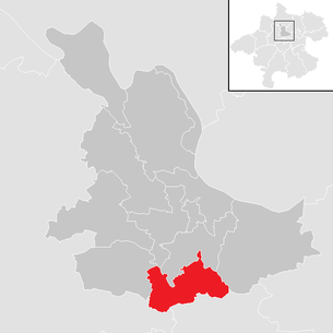
| Location of Scharten in the Eferding district | ||
  |
||
| Source: Municipal data from Statistics Austria | ||


Scharten is a municipality with 2277 inhabitants (as of January 1, 2020) in Upper Austria in the Eferding district in the Hausruckviertel . The community is located in the judicial district of Eferding .
geography
The village of Scharten is 397 m above sea level. The highest point is the "Roithner Kogl" at 448 m above sea level. The extension is 7 km from north to south and 5.1 km from west to east. The total area is 23.9 km², 10.9% of the area is forested, 75.3% of the area is used for agriculture.
Community structure
The municipality includes the following twelve localities (population in brackets as of January 1, 2020):
- Aigen (98)
- Breitenaich (334)
- Finklham (383)
- Herrnholz (129)
- Kronberg (114)
- Leppersdorf (348)
- Oberndorf (41)
- Rexham (177)
- Roitham (172)
- Roithen (80)
- Notches (378)
- Vitta (23)
The community consists of the two cadastral communities Finklham and Scharten.
history
Originally located in the eastern part of the Duchy of Bavaria, the place belonged to the Duchy of Austria since the 12th century. Since 1490 it has been assigned to the Principality of Austria ob der Enns . During the Napoleonic Wars , the place was occupied several times.
Scharten has been part of the federal state of Upper Austria since 1918. After the connection of Austria to the German Reich on 13 March 1938, the congregation to "Upper Danube" belonged. In 1945 Upper Austria was restored.
coat of arms
The official description of the municipal coat of arms reads:
- "In gold over a red three-mountain, a green balance with hanging hooks and bowls of the same size."
The community colors are gold-green-red.
The old beam scales characterize “die Scharten” as a focus area of fruit growing that is particularly favored by its location and climate; in the second interpretation it should be understood as an indication of the balanced, good coexistence of the Roman Catholic and the Protestant faith community in the community. The Dreiberg in the red "cherry color" emphasizes the location of the place and its hilly surroundings.
politics
The ÖVP holds a relative majority in the local council. The SPÖ, FPÖ and, since 2009, the Greens are also represented. Jürgen Höckner , who is also a member of the Upper Austrian state parliament, has been mayor since 2015 .
- mayor
- until 2015 Johann Meyr (ÖVP)
- since 2015 Jürgen Höckner (ÖVP)
Population development
In 1991 the community had 1780 inhabitants according to the census, in 2001 it had 2436 inhabitants and in 2006 it had 2322 inhabitants. In 2012 the municipality had only 2187 citizens.
Culture and sights
- Scharten Catholic Parish Church : The construction of the church began in 1506 by the Schaunbergers and was completed in 1632 after construction was interrupted during the Reformation. The aim of the pilgrimage is a crowned statue of the Virgin Mary (“Our Lady of the Scharten”) that carries the crowned baby Jesus. The pilgrimage church is located in Oberscharten.
- Evangelical Tolerance Church: Due to the tolerance patent from 1781, a wooden prayer house was built in 1782. This was the first and oldest tolerance prayer house in Upper Austria. This first wooden building was followed by a brick prayer house in 1819. The tower was built in 1900. In 1911 the conversion to the Tolerance Church was completed. The church is in Unterscharten.
- Obst-Hügel-Land Nature Park : The community of Scharten and St. Marienkirchen an der Polsenz together form the 'Obst-Hügel-Land Nature Park'. It describes a gentle hilly landscape in the Upper Austrian Alpine foothills, whose appeal lies in the high density of the many fruit trees. Scharten is especially known for cherry, apricot and apple trees. At the time of the cherry blossom and apple tree blossom, the nature park is a popular excursion area.
economy
- Before the beginning of the First World War , a spring was found in the village of Leppersdorf, first mentioned in a document in 1374 as "Leupolczstorf", the water of which was drawn into a well at around 21 degrees Celsius and used for a bathhouse. In the 1950s, the Bartenstein family from Wels used water to produce a drink they called the Schartner bomb .
Regular events
- Cherry blossom bike race , takes place annually in mid-April
- Cherry blossom hike, takes place annually in mid or late April
- Mostkost, takes place annually around May 1st
Personalities
- Sons and daughters of the church
- Gerhard Ortner (* 1933), bank manager, was born and raised in Scharten
- People related to the place
- Ernst Bornemann (1915–1995), anthropologist, psychoanalyst, author and sex researcher, lived in Scharten (since 1970) and died here
- Franz Weiß (* 1952), painter and art teacher; lives in gaps
- Jürgen Höckner (* 1966), member of the Upper Austrian state parliament, lives in Scharten
Web links
- Further information about the community of Scharten on the geo-information system of the federal state of Upper Austria .
- 40511 - nicks. Community data, Statistics Austria .
- Fruit Hill Country Natural Park
Individual evidence
- ↑ Statistics Austria: Population on January 1st, 2020 by locality (area status on January 1st, 2020) , ( CSV )
