Kirchdorf district
| location | |
|---|---|
| Basic data | |
| state | Upper Austria |
| NUTS III region | AT-314 |
| Administrative headquarters | Kirchdorf an der Krems |
| surface | 1239 km² |
| Residents | 57,071 (January 1, 2020) |
| Population density | 46 inhabitants / km² |
| License Plate | AI |
| District Commission | |
| District Captain | Dieter Goppold |
| website | www.bh-kirchdorf.gv.at |
| map | |
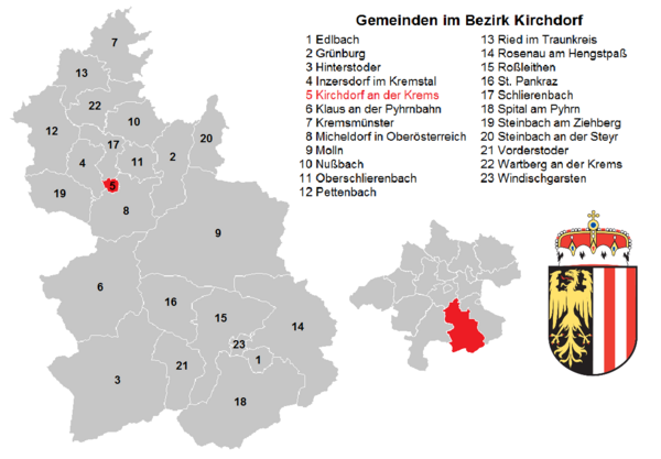
The Kirchdorf district is a political district in the Province of Upper Austria .
It lies south of Wels and borders clockwise from the north on the Upper Austrian districts of Wels-Land , Linz-Land and Steyr-Land , on the Styrian district of Liezen and on the Upper Austrian district of Gmunden .
history
In 1868 the Kirchdorf district administration was established. Territory changes followed in 1938, and the judicial districts of Grünburg and Kremsmünster were redistributed between the BHs Kirchdorf and Steyr-Land.
Administrative division
The Kirchdorf district covers 1,238.67 km² and is divided into 23 communities , including a town and six market communities. The population figures are from January 1st, 2020.
| local community | location | Ew | km² | Ew / km² | Judicial district | region | Type
|
photo | Metadata |
|---|---|---|---|---|---|---|---|---|---|
Edlbach
|

|
647 | 8.31 | 78 | Kirchdorf an der Krems | local community
|
Acc. To code: 40901 |
||
Grünburg
|

|
3,857 | 43.25 | 89 | Kirchdorf an der Krems | local community
|

|
Acc. To code: 40902 |
|
Hinterstoder
|

|
907 | 149.09 | 6.1 | Kirchdorf an der Krems | local community
|

|
According to code: 40903 |
|
Inzersdorf in the Kremstal
|

|
1,895 | 22.77 | 83 | Kirchdorf an der Krems | local community
|

|
According to code: 40904 |
|
Kirchdorf an der Krems
|
|
4,559 | 2.78 | 1640 | Kirchdorf an der Krems | urban community
|

|
According to code: 40905 |
|
Klaus at the Pyhrnbahn
|

|
1,061 | 107.94 | 9.8 | Kirchdorf an der Krems | local community
|

|
Acc. To code: 40906 |
|
Kremsmünster
|

|
6,697 | 42.14 | 159 | Kirchdorf an der Krems | market community
|

|
According to code: 40907 |
|
Micheldorf in Upper Austria
|

|
5,878 | 50.32 | 117 | Kirchdorf an der Krems | market community
|

|
Acc. To code: 40908 |
|
Minor
|
|
3,621 | 191.31 | 19th | Kirchdorf an der Krems | market community
|

|
Acc. To code: 40909 |
|
Nussbach
|
|
2,305 | 30.47 | 76 | Kirchdorf an der Krems | local community
|

|
Acc. To code: 40910 |
|
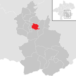
Oberschlierbach
|
|
492 | 18.22 | 27 | Kirchdorf an der Krems | local community
|

|
Acc. To code: 40911 |
|
Pettenbach
|

|
5,321 | 54.7 | 97 | Kirchdorf an der Krems | market community
|

|
According to code: 40912 |
|
Ried in the Traunkreis
|

|
2,785 | 31.16 | 89 | Kirchdorf an der Krems | local community
|

|
According to code: 40913 |
|
Rosenau am Hengstpaß
|

|
650 | 107.86 | 6th | Kirchdorf an der Krems | local community
|
According to code: 40914 |
||
Rossleithen
|

|
1.912 | 67.5 | 28 | Kirchdorf an der Krems | local community
|
Acc. To code: 40915 |
||
St. Pankraz
|

|
359 | 47.15 | 7.6 | Kirchdorf an der Krems | local community
|
According to code: 40916 |
||
Schlierbach
|

|
2,850 | 18.39 | 155 | Kirchdorf an der Krems | local community
|

|
Acc. To code: 40917 |
|
Spital am Pyhrn
|

|
2,251 | 108.86 | 21st | Kirchdorf an der Krems | local community
|

|
Acc. To code: 40918 |
|
Steinbach am Ziehberg
|

|
850 | 34.8 | 24 | Kirchdorf an der Krems | local community
|
|
According to code: 40919 |
|
Steinbach an der Steyr
|

|
1,978 | 28.08 | 70 | Kirchdorf an der Krems | local community
|

|
According to code: 40920 |
|
Vorderstoder
|

|
826 | 37.09 | 22nd | Kirchdorf an der Krems | local community
|

|
According to code: 40921 |
|
Wartberg on the Krems
|

|
2,978 | 31.56 | 94 | Kirchdorf an der Krems | market community
|

|
Acc. To code: 40922 |
|
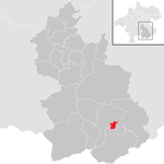
Windischgarsten
|
|
2,392 | 4.93 | 485 | Kirchdorf an der Krems | market community
|

|
According to code: 40923 |
Focus
The main area of the Kirchdorf district lies in the cadastral municipality of Ramsau , municipality of Molln ( ⊙ ).
Population development

Web links
Individual evidence
- ↑ Statistics Austria - Population at the beginning of 2002–2020 by municipalities (area status 01/01/2020)
- ↑ center point
Coordinates: 47 ° 54 ' N , 14 ° 7' E


