
Steinbach am Ziehberg
|
Steinbach am Ziehberg
|
||
|---|---|---|
| coat of arms | Austria map | |
 |
|
|
| Basic data | ||
| Country: | Austria | |
| State : | Upper Austria | |
| Political District : | Church Village | |
| License plate : | AI | |
| Surface: | 34.8 km² | |
| Coordinates : | 47 ° 54 ' N , 14 ° 2' E | |
| Height : | 547 m above sea level A. | |
| Residents : | 850 (January 1, 2020) | |
| Population density : | 24 inhabitants per km² | |
| Postal code : | 4562 | |
| Area code : | 07582 | |
| Community code : | 4 09 19 | |
| NUTS region | AT314 | |
| Address of the municipal administration: |
Steinbach 4 4562 Steinbach am Ziehberg |
|
| Website: | ||
| politics | ||
| Mayoress : | Bettina Lancaster ( SPÖ ) | |
|
Municipal Council : (2015) (13 members) |
||
| Location of Steinbach am Ziehberg in the Kirchdorf district | ||
  |
||

|
||
| Source: Municipal data from Statistics Austria | ||

Steinbach am Ziehberg is a municipality in Upper Austria in the Kirchdorf an der Krems district in the Traunviertel with 850 inhabitants (as of January 1, 2020). The responsible judicial district is Kirchdorf an der Krems .
geography
Steinbach am Ziehberg is located at 547 m altitude in the Traunviertel, in the valley of the Steinbach, which flows through the municipality from east to west and flows into the Alm in Pettenbach . The extension is 8.7 km from north to south and 6.7 km from west to east. The total area is 34.8 km². 65.2% of the area is forested and 26.7% of the area is used for agriculture. The cadastral communities are Oberdürndorf and Oberinzersdorf.
Neighboring communities
Steinbach borders the communities of Inzersdorf im Kremstal , Micheldorf and Pettenbach in the Kirchdorf district and Grünau im Almtal and Scharnstein in the Gmunden district .
| Pettenbach | Inzersdorf | |
| Scharnstein |
.svg)
|
Micheldorf |
| Grünau im Almtal |
history
Originally located in the eastern part of the Duchy of Bavaria , the place belonged to the Duchy of Austria since the 12th century. Since 1490 it has been assigned to the Principality of Austria ob der Enns .
During the Napoleonic Wars , the place was occupied several times.
Since 1918 the place belongs to the federal state of Upper Austria. After the annexation of Austria to the German Reich on March 13, 1938, the place belonged to the Gau Oberdonau . After 1945 the restoration of Upper Austria took place.
Population development
In 1991 the community had 834 inhabitants according to the census, in 2001 it had 854 inhabitants. Due to a negative migration balance , the population decreased to 828 people by 2018 despite a positive birth balance .
Culture and sights

At Landesstrasse 533

Municipal Office

Fire station

Ziehberghöhe
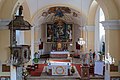
Catholic parish church hl. Florian

Panstone peaks


politics
Bettina Lancaster (SPÖ) has been mayor since 2009 .
coat of arms
Blazon : divided by red and green by a silver wavy bar; above in a golden, adjoining calyx a blue, long-stemmed gentian with a green calyx and green leaves. The community colors are white-green.
Web links
- Community website
- Further information about the municipality of Steinbach am Ziehberg can be found on the geographic information system of the federal state of Upper Austria .
Individual evidence
- ^ Statistics Austria, A look at the community of Steinbach am Ziehberg, population development. Retrieved March 22, 2019 .
- ^ Bettina Lancaster on the website of the Austrian Parliament
- ^ Province of Upper Austria, coat of arms of the municipality of Steinbach am Ziehberg. Retrieved March 22, 2019 .

Edlbach | Grünburg | Hinterstoder | Inzersdorf im Kremstal | Kirchdorf an der Krems | Klaus at the Pyhrnbahn | Kremsmünster | Micheldorf in Upper Austria | Molln | Nussbach | Oberschlierbach | Pettenbach | Ried im Traunkreis | Rosenau am Hengstpaß | Roßleithen | St. Pankraz | Schlierbach | Spital am Pyhrn | Steinbach am Ziehberg | Steinbach an der Steyr | Vorderstoder | Wartberg an der Krems | Windischgarsten