
Scharnstein
|
market community Scharnstein
|
||
|---|---|---|
| coat of arms | Austria map | |
 |
|
|
| Basic data | ||
| Country: | Austria | |
| State : | Upper Austria | |
| Political District : | Gmunden | |
| License plate : | GM | |
| Surface: | 47.84 km² | |
| Coordinates : | 47 ° 54 ' N , 13 ° 58' E | |
| Height : | 488 m above sea level A. | |
| Residents : | 4,871 (January 1, 2020) | |
| Population density : | 102 inhabitants per km² | |
| Postal code : | 4644 | |
| Area code : | 07615 | |
| Community code : | 4 07 19 | |
| Address of the municipal administration: |
Hauptstrasse 13 4644 Scharnstein |
|
| Website: | ||
| politics | ||
| Mayor : | Rudolf Raffelsberger ( ÖVP ) | |
|
Municipal Council : (2015) (31 members) |
||
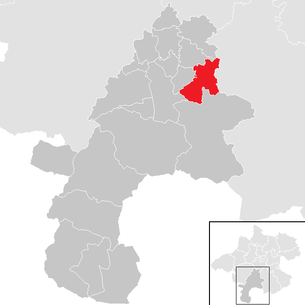
| Location of Scharnstein in the Gmunden district | ||
  |
||
| Source: Municipal data from Statistics Austria | ||

Scharnstein (1848–1976 Viechtwang ) is a market town in Upper Austria in the Gmunden district in the Traunviertel with 4871 inhabitants (as of January 1, 2020).
geography
Scharnstein is located in the heart of the Almtal at around 517 m above sea level. A. Height
The extension is 9.1 km from north to south and 10.5 km from west to east. The total area is 47.8 km². 54.8% of the area is forested, 36% of the area is used for agriculture. The highest point in the municipality is the Steineck at 1,418 m . Other well-known mountains are the Zwillingskogel 1405 m , the Hochsalm 1405 m and the Maisenkögerl 945 m .
Neighboring communities
| Kirchham | Vorchdorf | Pettenbach |
| St. Conrad |
.svg)
|
Steinbach am Ziehberg ( District Kirchdorf adK ) |
| Gmunden | Grünau im Almtal |
Community structure
The municipality includes the following four localities (population in brackets as of January 1, 2020):
- Village (668)
- Mühldorf (1544)
- Scharnstein (1323)
- Viechtwang (1336)
The community consists of the cadastral communities Dorf, Mühldorf I and Viechtwang .
The community is located in the judicial district of Gmunden .
history


The Counts of Rebgau began building Scharnstein Castle around 1120 . It was first mentioned in a document in 1204.
As early as 1492, the imperial keeper on Wildenstein, Christoph Jörger zu Reut, acquired the Alt-Scharnstein Castle and the district court on the Moos from Count Sigmund Schaunberg , which he sold to Emperor Maximilian I just a few years later . In 1538 the castle burned down due to negligence. Johann Fernberger did not use the money to rebuild the castle, but to build the nursing home (Schafferleithen). In 1584 the Jörger , namely Helmhart VIII. Jörger , acquired the Scharnstein lordship and built a mighty castle building next to the existing nursing home, the new office building on the Schafferleiten , and from 1585 also founded the first scythe hammers on the Alm.
During the Counter-Reformation in 1621, all of Jörger's possessions were confiscated, who had stood up for the spread of Protestant doctrine in Upper Austria with full commitment and finally with open resistance; the Scharnstein estate was sold to the Kremsmünster monastery in 1625 .
From 1625 the Scharnstein reign was under the Kremsmünster monastery . During the Napoleonic Wars , the region was occupied several times by French troops, but always remained a part of the country of Austria above the Enns .
From 1848, with the creation of the local communities after the revolution , the community was called Viechtwang , after the current district. In the 19th century the community was still the largest scythe production facility in the monarchy (see Simon Redtenbacher, the blessed widow & sons ). 700 employees produced 4,000 scythes and 5,000 sickles every day.
In 1901 the Almtalbahn from Wels to Grünau im Almtal was completed, and Scharnstein was accessible by rail. The municipality has belonged to the federal state of Upper Austria since 1918. In 1932 the community part of Scharnstein was raised to the place.
In 1967, Harald Seyrl, an Austrian historian, acquired the castle from Kremsmünster Abbey and began work to save the historical substance, which has now largely been completed.
In 1976 the community name was changed to Scharnstein .
The year 1987 brought the end of the 400-year-old Scharnstein scythe production. In 2004, on the occasion of its 800-year existence, the community of Scharnstein was founded by LH Dr. Josef Pühringer raised to a market town.
Population development
In 1991, according to the census, the community had 4,309 inhabitants, in 2001 it had 4,539 inhabitants, increased to 4,731 inhabitants in 2011 and reached a new high of 4,819 people in 2018. Despite the negative birth balance in the period 2001 to 2011, the strong growth is due to a very positive migration balance in recent decades.
politics
With the municipal council election in 2003, the local council had the following distribution with 32 seats: 16 SPÖ, 13 ÖVP and 3 FPÖ. The municipal council had the following distribution with 32 seats in the 2009 municipal council elections: 14 ÖVP, 12 SPÖ and 4 FPÖ. Since the 2015 municipal council election, the municipal council has the following distribution with 31 seats:
- 17 mandates of the Austrian People's Party (ÖVP)
- 9 seats in the Social Democratic Party of Austria (SPÖ)
- and 5 mandates for the Freedom Party of Austria (FPÖ)
- mayor
- until 2009 Franz Spieleder (SPÖ)
- since 2009 Rudolf Raffelsberger (ÖVP)
coat of arms
Description of the municipal coat of arms:
- Split by silver and black with two upright plow knives (six) in alternating colors with the edges turned outwards ; right a red, left a gold border .
The community colors are red and white .
The coat of arms is the main coat of arms of Jörger von Tollet , whose Helmhart VIII gained economic and historical importance for Scharnstein through his work, especially as the founder of the scythe industry in the Almtal.
The coat of arms was awarded in 1977 after the name of the municipality in Scharnstein was changed .
tourism
Scharnstein is part of the Almtal tourist region , which was founded on January 1st, 2013.
Main town of the community: Scharnstein
|
Scharnstein ( capital of a market town ) village ( main town of the municipality ) |
|
|---|---|
| Basic data | |
| Pole. District , state | Gmunden , Upper Austria |
| Pole. local community | Scharnstein ( KG Mühldorf I ) |
| Coordinates | 47 ° 54 ′ 11 " N , 13 ° 57 ′ 42" E |
| height | 488 m above sea level A. |
| Residents of the village | 1323 (January 1, 2020) |
| Building status | 399 (2001) |
| Statistical identification | |
| Locality code | 08782 |
| Counting district / district | Scharnstein- Mühldorf , Haid (40719 000.002) |
| Ortsch. with Spielangerthal, Tießenbach, Scharnstein Castle Source: STAT : Directory ; BEV : GEONAM ; DORIS |
|
The community capital is the market place Scharnstein . It is located directly on the Alm , at an altitude of 488 m above sea level. A.
The village Scharnstein includes about 400 buildings with about 1200 inhabitants, so 1 / 4 of the municipality's population, the majority of the town itself. For village area includes the composting game Anger valley and the settlement Tießenbach at the other Almufer as well Scharnstein Castle on the northern end of the town.
The place is on the B 120 Scharnsteiner Straße and has a stop for the Almtalbahn .
- Neighboring towns and cities
| Haid | Viechtwang (O.) | |
| Village (O.) |
|
Spielangerthal |
| Mühldorf (O.) | Tießenbach |
Culture and sights

- Scharnstein Castle : Scharnstein Castle dates back to 1538. There are two museums in the castle, the Austrian Crime Museum and the Austrian Gendarmerie Museum, which show the history of the Austrian judiciary and security from the late Middle Ages to the present day. A large space is devoted to the history of the gendarmerie from 1849 to the present day. In the Museum of Austrian Contemporary History, the development of Austria over the past century is shown using objects and pictures.
- Parish church Scharnstein : The church was built according to plans by Hans Foschum .
- Parish church Viechtwang
- Scharnstein Castle ruins : The castle was built in the first half of the 12th century. It once consisted of a tower fore, a bailey, a large storage vault and a main castle with a palace, chapel and keep.
- Geyerhammer scythe museum: The open-air museum shows the transition from manual to industrial scythe production. Blacksmith demonstrations with a hammer smith are held regularly. The Sensenweg is an economic and historical hiking trail with a length of 2.4 km. The Sensenweg leads to production facilities, residential buildings and the mansions of the Hammerherren ("black counts"). A special pastry was created to cater for the hard-working population. By an unknown master baker of only was Almtal known Zwieballen developed. Its name goes back to an old measure of the scythe forge: two heels of the hand. The onions are only available in the Almtal.
societies
- Market music Scharnstein-Redtenbacher
- Friends of nature Scharnstein, chairman: Martin Holzinger
- SV Scharnstein
- LRC Almtal
- WSV Scharnstein
education
There are two primary schools in Scharnstein (Mühldorf, Viechtwang), a new middle school (Scharnstein Mitte) and two kindergartens.
Personalities
- Daughters and sons of the church
- Hilde Berger (* 1946), actress, screenwriter and writer (novels)
- Gertrude Drack, zoologist, called Rabengerti , the foster mother of the tame common raven Kraxi (lives in Viechtwang )
- Wolfgang Leuthner (1744–1812), Benedictine and abbot of Kremsmünster Abbey
- Oddo Scharz (1691–1749), Benedictine priest and university professor
- People related to Scharnstein
- Karl von Kirchbach auf Lauterbach (1856–1939), Colonel General of the Austro-Hungarian Army , died in Scharnstein.
- Hanna Maria Drack (1913–1988), poet and writer, lived in Scharnstein from 1941.
- Thomas Dreßen (* 1993), German ski racer, lives in Scharnstein.
Web links
- Community website
- Entry on Scharnstein in the Austria Forum (in the AEIOU Austria Lexicon )
- 40719 - Scharnstein. Community data, Statistics Austria .
- Further information about the community of Scharnstein can be found on the geographic information system of the federal state of Upper Austria .
- Map in the Digital Upper Austrian Room Information System ( DORIS )
Individual evidence
- ↑ Statistics Austria: Population on January 1st, 2020 by locality (area status on January 1st, 2020) , ( CSV )
- ^ Statistics Austria, A look at the community of Scharnstein, population development. Retrieved March 14, 2019 .
- ↑ A mood of optimism in the Almtal. ORF Upper Austria, accessed on July 24, 2013 .
- ↑ Sense Museum Geyerhammer
- ↑ rabekraxi.at

Altmünster | Bad Goisern on Lake Hallstatt | Bad Ischl | Ebensee am Traunsee | Gmunden | Gosau | Grünau im Almtal | Gschwandt | Hallstatt | Kirchham | Laakirchen | Obertraun | Ohlsdorf | Pinsdorf | Roitham am Traunfall | St. Conrad | St. Wolfgang in the Salzkammergut | Scharnstein | Traunkirchen | Vorchdorf
Cadastral communities: village | Mühldorf I | Viechtwang
Locations: Village | Mühldorf | Scharnstein | Viechtwang
Market place: Scharnstein | Villages: Mühldorf • Viechtwang | Weiler: Laßelbauer | Rotten: Almegg • Baumgarten • Bühel • Dorf • Fischerbühel • Forest • Gries • Hacklberg • Haid • Halsgraben • Hauergraben • Herndlberg • Herrnberg • Hochbuchegg • In Fleck • In der Au • In der Thann • Landsberg • Mayrhof • Platz • Rathberg • Spielangerthal • Stoiberau • Wolmleiten | Settlements: At the brook • Haid • Hölzl • Matzing • Tießenbach • Traxenbichl | Scattered houses: Bäckerberg • Hinterbuchegg | Other locations: Kothmühle • Scharnstein Castle
Counting area: Scharnstein - Mühldorf | Scharnstein-Umgebung-Nord | Haid | Scharnstein-environment-south
| Previous station |
Almtalbahn R |
Next station |
|---|---|---|
| Viechtwang Hst. | Scharnstein-Mühldorf Bhf. | Kothmühle Hst. |