
Roitham am Traunfall
|
Roitham am Traunfall
|
||
|---|---|---|
| coat of arms | Austria map | |
 |
|
|
| Basic data | ||
| Country: | Austria | |
| State : | Upper Austria | |
| Political District : | Gmunden | |
| License plate : | GM | |
| Main town : | Roitham | |
| Surface: | 21.02 km² | |
| Coordinates : | 48 ° 2 ' N , 13 ° 49' E | |
| Height : | 424 m above sea level A. | |
| Residents : | 1,992 (January 1, 2020) | |
| Postal code : | 4661 | |
| Area code : | 07613 | |
| Community code : | 4 07 15 | |
| NUTS region | AT315 | |
| Address of the municipal administration: |
Community square 9 4661 Roitham am Traunfall |
|
| Website: | ||
| politics | ||
| Mayor : | Alfred Gruber ( SPÖ ) | |
|
Municipal Council : (2015) (25 members) |
||
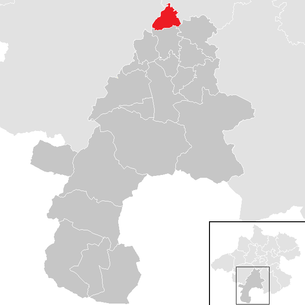
| Location of Roitham am Traunfall in the Gmunden district | ||
  |
||
| Source: Municipal data from Statistics Austria | ||

Roitham am Traunfall is a municipality in Upper Austria in the Gmunden district in the Traunviertel with 1992 inhabitants (as of January 1, 2020). The community is located in the judicial district of Gmunden .
geography
Roitham am Traunfall lies at an altitude of 424 m in the Traunviertel. The extension is 6.5 km from north to south and 6.2 km from west to east. The total area is 21 km². 20.5% of the area is forested, 69.5% of the area is used for agriculture.
Community structure
The municipality includes the following 27 localities (population in brackets as of January 1, 2020):
- Altmanning (43)
- Au (39)
- Auholz (5)
- Extracted (99)
- Extra raw (33)
- Bichlbauer (7)
- Buhl (15)
- Deising (58)
- Edt (11)
- Edtmayer (8)
- Hoetzelsdorf (4)
- Inner raw (35)
- Kemating (128)
- Kirnbach (29)
- Lebl-Roith (14)
- Magling (19)
- Mitterbuch (35)
- Nöstling (11)
- Oberbuch (77)
- Palmsdorf (72)
- Roitham (1014)
- Sand Alley (21)
- Stötten (81)
- Unterpühret (31)
- Front book (28)
- Wangham (59)
- Watzing (16)
The community consists of four cadastral communities (area 2016):
- Ausserpühret (238.54 ha)
- Deising (605.64 ha)
- Kemating (538.09 ha)
- Roitham (722.51 ha)
Neighboring communities
| Riistorf | Stadl-Paura | Bad Wimsbach-Neydharting |
| Desselbrunn |
.svg)
|
|
| Laakirchen | Vorchdorf |
Culture and sights


- Traunfall
- Late Gothic parish church of St. Jacob the Elder
- Au an der Traun Castle (privately owned)
- Siebenbrunn power plant with the first Kaplan turbines over 1000 hp, which went into operation in 1923 and is located next to the Traunfall Bridge built in 1925.
history
Originally located in the eastern part of the Duchy of Bavaria, the place belonged to the Duchy of Austria since the 12th century. The Roman Catholic parish church was built in the late Gothic style in 1350. Since 1490 it has been assigned to the Principality of Austria ob der Enns .
During the Napoleonic Wars , the place was occupied several times.
Since 1918 the place belongs to the federal state of Upper Austria. After the annexation of Austria to the German Reich on March 13, 1938, the place belonged to the Gau Oberdonau . In 1945 Upper Austria was restored.
In December 2016 the community was renamed from Roitham to Roitham am Traunfall .
Population development
In 1991 the municipality had 1,924 inhabitants according to the census. The population rose to 2,001 in 2018. In the last few decades the birth balance has always been positive, but the migration balance has become increasingly negative.
politics
The distribution of mandates since the last municipal council election in 2015 is:
- SPÖ 11 seats
- ÖVP 8 seats
- FPÖ 6 seats
Mayor is Alfred Gruber from the SPÖ.
coat of arms
Blazon : degraded by red and green, divided by a silver bar broken with a right step; Above under the silver, continuous Traunfall Bridge a silver Kaplan water turbine, below a golden shell. Community colors: green-white-green.
The municipal coat of arms was awarded in 1985. Under the Traunfall Bridge, the turbine and stage symbolize the power plant and the Traunfall itself. The shell as an attribute of St. James the Elder. Ä. stands for the parish patron.
Personalities
- Sons and daughters
- Franz Maier (1872–1945), politician
- Alois Hanselitsch (born November 25, 1914), state official, politician of the SPÖ , deputy mayor (1970–1972) and city councilor (1972–1980) of the city of Salzburg
- Maria Wolfsberger (* 1973), organist , cantor and religious sister
- People related to the community
- Christoph Ransmayr (born March 20, 1954), Austrian writer
- Adalbert Cramer (born February 5, 1951), politician
- Monika Forstinger (born July 15, 1963), politician
Web links
- 40715 - Roitham am Traunfall. Community data, Statistics Austria .
- www.roitham.at , website of the municipality
- Further information about the municipality of Roitham am Traunfall can be found on the geo-information system of the federal state of Upper Austria .
Individual evidence
- ↑ Statistics Austria - Population at the beginning of 2002–2020 by municipalities (area status 01/01/2020)
- ↑ Statistics Austria: Population on January 1st, 2020 by locality (area status on January 1st, 2020) , ( CSV )
- ↑ Federal Office for Metrology and Surveying, Regional Information, reference date December 31, 2016, accessed on February 19, 2017
- ↑ Provincial Law Gazette for Upper Austria, No. 99/2016 of December 29, 2016 ; accessed on January 9, 2017
- ^ Statistics Austria, A look at the community of Roitham am Traunfall, population development. Retrieved March 14, 2019 .
- ↑ Herbert Erich Baumert: The coats of arms of the cities, markets and communities of Upper Austria, 7th supplement (1984–1987) . In: Oberösterreichische Heimatblätter, Heft 4, 1988, p. 235 f, online (PDF; 7.2 MB) in the forum OoeGeschichte.at

Altmünster | Bad Goisern on Lake Hallstatt | Bad Ischl | Ebensee am Traunsee | Gmunden | Gosau | Grünau im Almtal | Gschwandt | Hallstatt | Kirchham | Laakirchen | Obertraun | Ohlsdorf | Pinsdorf | Roitham am Traunfall | St. Conrad | St. Wolfgang in the Salzkammergut | Scharnstein | Traunkirchen | Vorchdorf