
Hallein district
| location | |
|---|---|
  |
|
| Basic data | |
| state | Salzburg |
| NUTS III region | AT-323 |
| Administrative headquarters | Hallein |
| surface | 669 km² |
| Residents | 60,824 (January 1, 2020) |
| Population density | 91 inhabitants / km² |
| License Plate | HA |
| District Commission | |
| District Captain | Helmut Fürst |
| website | BH Hallein |
| map | |
  |
|
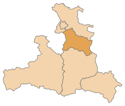
The Hallein district is a political district of the State of Salzburg , the area is 668.51 square kilometers.
It is congruent with the Tennengau , one of the five districts of the state. The Flachgau lies to the north and the Pongau to the south .
history
With the creation of a separate crown land of Salzburg in 1848, a state constitution was issued, which also brought about new regulations for the state administration and the introduction of municipal regulations. The Hallein district formed a unit with today's Flachgau until 1896. It was not until 1895 that a new district was approved to relieve the Salzburg district administration, which was too large, and was completed a year later with the establishment of the Hallein district administration.
Administrative division
The Hallein district is divided into 13 communities , including one town and four market communities . The number of inhabitants as of January 1, 2020 are in brackets.

| local community | location | Ew | km² | Ew / km² | Judicial district | region | Type | Metadata |
|---|---|---|---|---|---|---|---|---|
Abtenau
|

|
5,886 | 187.08 | 31 | Hallein | market community |
According to code: 50201 |
|
Adnet
|

|
3,624 | 29.94 | 121 | Hallein | local community |
According to code: 50202 |
|
Annaberg-Lungötz
|

|
2,231 | 60.89 | 37 | Hallein | local community |
According to code: 50203 |
|
Bad Vigaun
|

|
2,059 | 17.57 | 117 | Hallein | local community |
Acc. To code: 50213 |
|
Golling on the Salzach
|

|
4,313 | 82.09 | 53 | Hallein | market community |
According to code: 50204 |
|
Hallein_Coat_of_Arms_CoA.svg)
|

|
21,314 | 26.99 | 790 | Hallein | urban community |
According to code: 50205 |
|
Krispl
|

|
874 | 29.73 | 29 | Hallein | local community |
According to code: 50206 |
|
Kuchl
|

|
7,372 | 47.12 | 156 | Hallein | market community |
Acc. To code: 50207 |
|
Oberalm_Coat_of_Arms.svg)
|

|
4,437 | 6.39 | 694 | Hallein | market community |
According to code: 50208 |
|
Puch near Hallein
|

|
4,756 | 21.01 | 226 | Hallein | local community |
According to code: 50209 |
|
Russbach am Pass Gschütt
|

|
776 | 34.04 | 23 | Hallein | local community |
Acc. To code: 50210 |
|
Saint Koloman
|

|
1,769 | 56 | 32 | Hallein | local community |
Acc. To code: 50211 |
|
Scheffau am Tennengebirge
|

|
1,413 | 69.66 | 20th | Hallein | local community |
Acc. To code: 50212 |
Population development

Web links
Individual evidence
- ↑ Statistics Austria - Population at the beginning of 2002–2020 by municipalities (area status 01/01/2020)
Coordinates: 47 ° 41 ′ N , 13 ° 6 ′ E