Zell am See district
| location | |
|---|---|
| Basic data | |
| state | Salzburg |
| NUTS III region | AT-322 |
| Administrative headquarters | Zell am See |
| surface | 2642 km² |
| Residents | 87,628 (January 1, 2020) |
| Population density | 33 inhabitants / km² |
| License Plate | ZE |
| District Commission | |
| District Captain | Bernhard Gratz |
| website | BH Zell am See |
| map | |
The Zell am See district is one of six political districts in the state of Salzburg . It is congruent with the Pinzgau , one of the five districts of the Austrian state.
The name Pinzgau comes from the rushes that used to occur along the still unregulated Salzach . In the east the district borders on the Pongau , in the west on the state of Tyrol , in the north on Bavaria , Germany and in the south from west to east on South Tyrol ( Italy ), East Tyrol and Carinthia .
The Zell am See district is the third largest district in Austria in terms of area.
history
In 923 the counties of Upper , Middle and Lower Pinzgau are mentioned in documents. First part of the state of Bavaria, the Pinzgau was under the rule of the Salzburg prince archbishops from 1328 to 1803 . After the Pinzgau was under Bavarian administration for a short time from 1810, it came to Upper Austria with Salzburg in 1816 . With the creation of a separate crown land of Salzburg in 1848, a state constitution was issued, which also brought about new regulations for the state administration and the introduction of municipal regulations. The district administration was housed in Saalfelden from 1850 to 1854 and then returned to Zell am See .
Geography and traffic
The landscape of the Pinzgau encompasses the catchment areas of the Upper Salzach (from the Gerlospass to the confluence of the Gasteiner Ache ) and the upper Saalach (from Saalbach-Hinterglemm to the German border at the Steinpass ). After leaving the Glemmtal, the Saalach flows through a basin that extends north-south and is open to the upper Salzach valley, in which the city of Zell am See lies in the south and the city of Saalfelden in the north. At Maishofen , which is located between these two cities, the watershed between the Saalach (here 757 m above sea level) and the Zeller See (750 m above sea level), which is only three and a half kilometers away and drains south to the Salzach, is less than ten meters above the Saalach.
Since the Pinzgau borders Germany north of Lofer and borders Italy on the main Alpine ridge (ridge of the Hohen Tauern ) in the Venediger group and the Granatspitz group , all inner Austrian traffic routes to and from North Tyrol and Vorarlberg lead through this district. Since 1873/75 it was opened up by the Salzburg-Tyrolean Railway . Transalpine traffic between Germany and Italy has only touched the area since the Großglockner High Alpine Road was built in 1935, due to the difficulty in negotiating the Hohe Tauern. Another important north-south connection to East Tyrol was created in 1967 with the opening of the Felbertauern tunnel . From the Hohe Tauern, the Glockner group also belongs to the Pinzgau. The district also has a share in the Mitteralpen around the Glemmtal, the Steinerne Meer , the Dientener mountains and the Loferer Steinberge . The Leogang Mountains encompass almost completely.
The Pinzgauer Höhenweg is a long-distance hiking trail leading over mountains , which leads from Obertauern (Sankt Johann im Pongau district) via Zell am See to the west into the Kitzbühel Alps and continues in Tyrol.
Landscape structure
All communities of the old judicial district Mittersill from Krimml in the west to Niedernsill belong to the Oberpinzgau . To the east joins the Unterpinzgau , to which all places of the old judicial district Taxenbach , Piesendorf * , Kaprun * , as well as Bruck and Fusch belong. The cities of Zell am See and Saalfelden with the surrounding Pinzgau communities north of the Upper and Lower Pinzgau form the Mitterpinzgau .
- *The boundaries are not always seen clearly. Often Piesendorf and Kaprun are also counted as part of the Oberpinzgau.
Recently, a division into four sub-regions has also been rumored:
- Oberpinzgau, Unterpinzgau, "Pinzgauer Zentralraum" and "Unteres Saalachtal"
The latter name is incorrect from a geographical point of view, as only the middle reaches of the Saalach are located in this area.
Administrative division
The Zell am See district covers an area of 2,642.26 km² in the entire south-west of the state and is divided into the following 28 communities , which include three towns and four market communities. The population figures are from January 1st, 2020
| local community | location | Ew | km² | Ew / km² | Judicial district | region | Type | Metadata |
|---|---|---|---|---|---|---|---|---|
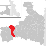
Bramberg am Wildkogel
|
|
3,935 | 117.27 | 34 | Zell am See | Oberpinzgau | local community |
According to code: 50601 |
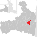
Bruck an der Großglocknerstrasse
|
|
4,802 | 45.68 | 105 | Zell am See | Unterpinzgau | local community |
According to code: 50602 |
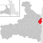
Served on the Hochkönig
|
|
736 | 49.79 | 15th | Zell am See | Unterpinzgau | local community |
Acc. To code: 50603 |
Fusch on Grossglocknerstrasse
|

|
714 | 158.05 | 4.5 | Zell am See | Unterpinzgau | local community |
According to code: 50604 |
Hollersbach in Pinzgau
|

|
1,244 | 76.95 | 16 | Zell am See | Oberpinzgau | local community |
According to code: 50605 |
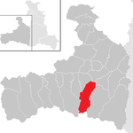
Kaprun
|
|
3.130 | 100.23 | 31 | Zell am See | Oberpinzgau | local community |
According to code: 50606 |
Krimml
|

|
830 | 169.46 | 4.9 | Zell am See | Oberpinzgau | local community |
According to code: 50607 |
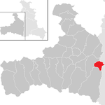
Loin
|
|
1,282 | 29.35 | 44 | Zell am See | Unterpinzgau | local community |
Acc. To code: 50608 |
Leogang
|

|
3,358 | 90.36 | 37 | Zell am See | Mitterpinzgau | local community |
According to code: 50609 |
Lofer
|

|
2,059 | 55.67 | 37 | Zell am See | Mitterpinzgau | market community |
According to code: 50610 |
Maishofen
|

|
3,643 | 29.53 | 123 | Zell am See | Mitterpinzgau | local community |
According to code: 50611 |
Maria Alm at the Stone Sea
|

|
2,207 | 125.49 | 18th | Zell am See | Mitterpinzgau | local community |
According to code: 50612 |
Mittersill
|

|
5,490 | 132.02 | 42 | Zell am See | Oberpinzgau | urban community |
According to code: 50613 |
Neukirchen am Großvenediger
|

|
2,593 | 165.98 | 16 | Zell am See | Oberpinzgau | market community |
Acc. To code: 50614 |
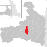
Niedernsill
|
|
2,736 | 57.44 | 48 | Zell am See | Oberpinzgau | local community |
According to code: 50615 |
Piesendorf
|

|
3.816 | 50.93 | 75 | Zell am See | Oberpinzgau | local community |
According to code: 50616 |
Rauris
|

|
3,036 | 253.33 | 12 | Zell am See | Unterpinzgau | market community |
Acc. To code: 50617 |
Saalbach-Hinterglemm
|

|
2,859 | 125.53 | 23 | Zell am See | Mitterpinzgau | local community |
Acc. To code: 50618 |
Saalfelden at the Stone Sea
|

|
16,705 | 118.46 | 141 | Zell am See | Mitterpinzgau | urban community |
Acc. To code: 50619 |
Saint Martin near Lofer
|

|
1,176 | 63.58 | 18th | Zell am See | Mitterpinzgau | local community |
Acc. To code: 50620 |
Stuhlfelden
|

|
1,588 | 29.62 | 54 | Zell am See | Oberpinzgau | local community |
Acc. To code: 50621 |
Taxenbach
|

|
2,704 | 88.31 | 31 | Zell am See | Unterpinzgau | market community |
According to code: 50622 |
Toads
|

|
1.917 | 108.88 | 18th | Zell am See | Mitterpinzgau | local community |
According to code: 50623 |
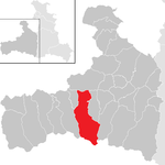
Uttendorf
|
|
3,037 | 167.75 | 18th | Zell am See | Oberpinzgau | local community |
According to code: 50624 |
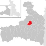
Viehhofen
|
|
607 | 38.62 | 16 | Zell am See | Mitterpinzgau | local community |
According to code: 50625 |
Forest in Pinzgau
|

|
1,139 | 69.28 | 16 | Zell am See | Oberpinzgau | local community |
Acc. To code: 50626 |
Weißbach near Lofer
|
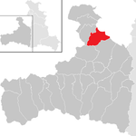
|
406 | 69.57 | 5.8 | Zell am See | Mitterpinzgau | local community |
Acc. To code: 50627 |
Zell am See
|

|
9,879 | 55.12 | 179 | Zell am See | Mitterpinzgau | urban community |
According to code: 50628 |
The communities are further subdivided into cadastral communities .
Population development

Culture
The Pinzgau, as part of the Inner Mountains , has a very independent folk culture. In the dialect language, Pinzgau , a sub-form of Middle Bavarian , the Salzburg elements, which are related to Pongau , mix with western Tyrolean elements, in Upper Pinzgau with southern Bavarian (South / East Tyrolean) influence.
The healing knowledge of the Pinzgau women , accumulated knowledge about the remedies and their practical application in the Pinzgau (a list of 106 remedies, their indications and effects is recorded), was in 2010 as Intangible World Heritage , as it was declared by UNESCO, in the Austria List (National Cultural Property ) recorded. The Hundstoaranggeln on the Hohen Hundstein was also included, a fight ritual ( Ranggeln ) and one of the oldest sports that is carried out in the Alpine region.
literature
- Martin Heintel , Markus Speringer, Ramon Bauer, Judith Schnelzer: Multiple Disadvantage Index : Case Study Oberpinzgau. In: Mitteilungen der Österreichische Geographische Gesellschaft , Vol. 159, Vienna 2017, ISBN 978-3-901313-30-1 , pp. 173-198, doi : 10.23781 / moegg159-173 .
Individual evidence
- ↑ regions in the Pinzgau regpi.at,
- ↑ Statistics Austria - Population at the beginning of 2002–2020 by municipalities (area status 01/01/2020)
- ^ Cadastral communities in Pinzgau
- ^ Healing knowledge of the Pinzgau women ( Memento from March 4, 2016 in the Internet Archive ). nationalagentur.unesco.at
- ↑ Hundstoaranggeln ( Memento from January 5, 2016 in the Internet Archive ). nationalagentur.unesco.at
Web links
Coordinates: 47 ° 17 ′ 0 ″ N , 12 ° 42 ′ 0 ″ E


