Taugl (Salzach)
|
Taugl Tauglbach |
||
| Data | ||
| Water code | AT : 2-8-272x | |
| location | Tennengau , State of Salzburg , Austria | |
| River system | Danube | |
| Drain over | Salzach → Danube → Black Sea | |
| source | west of the Gruberhorn 47 ° 40 ′ 32 ″ N , 13 ° 17 ′ 26 ″ E |
|
| Source height | 1363 m above sea level A. | |
| muzzle | west of Seeleiten (municipality of Kuchl) Coordinates: 47 ° 39 ′ 19 ″ N , 13 ° 7 ′ 15 ″ E 47 ° 39 ′ 19 ″ N , 13 ° 7 ′ 15 ″ E |
|
| Mouth height | 457 m above sea level A. | |
| Height difference | 906 m | |
| Bottom slope | approx. 76 ‰ | |
| length | approx. 12 km | |
|
Tauglgries (2013) |
||
|
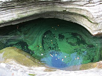
The Tauglbach erodes layered limestone (2013) |
||
The Tauglbach , mostly just called Taugl , is a year-round flowing water in Tennengau , Austria.
It flows into the Tennengau as a right tributary of the Salzach and forms the border between Bad Vigaun and Kuchl , the Taugl and Tauglwald European Protected Area.
course
The Taugl rises in the Salzkammergut Mountains west below the Gruberhorn and the Regenspitz at an altitude of 1363 m above sea level. A. as a mountain stream. On the first kilometer of flow in a south-westerly direction, it takes in about half a dozen other nameless mountain streams as a receiving water before it, already swollen into a small river, enters the Tauglboden above Sankt Koloman at 882 m .
There it swings to the west and flows about two kilometers downstream of the source through the Davidsgraben , a gorge around 20 meters deep and 100 meters long.
After another kilometer, the still narrow river falls over a 30 meter high waterfall into the Strubklamm , one of the most impressive and beautiful gorges in Austria. The gorge is about 150 meters long, 50 meters deep and only two meters wide at the narrowest points.
The Strubklamm is followed by the six kilometers long and up to 100 meters deep Tauglklamm, which has vertical rock walls over which more than a hundred small waterfalls feed the Taugl. At the end of this impressive gorge, the Taugl itself falls over a ten-meter-high waterfall and flows under the Römerbrücke , an approximately 400-year-old stone bridge.
Finally, the water runs off over the Tauglgries and flows northwest of Seeleiten into the Salzach.
Since it is still completely undeveloped, the Taugl does not endanger any surrounding villages during floods. Your water can run off unhindered over the 100 meter wide Tauglgries.
Tributaries
Over 100 smaller streams fall over the rock walls of the gorge into the Taugl.
The following tributaries are the most important:
- Kassbach
- Sommeregggraben
- Perreilbach
Places with flow through
The Taugl flows through the following communities:
- Saint Kolomann
- Bad Vigaun
- Kuchl
geology
The river course of Tauglbaches offers unique insight into the sedimentary history of the Northern Limestone Alps, whose stratification easily visible here through the incision of the watercourse through the rock open-minded are. The river cuts through very different rock zones on its approximately twelve kilometers long course.


