Gruberhorn
| Gruberhorn | ||
|---|---|---|
|
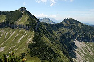
Gruberhorn (left, with east ridge) and Regenspitz (right) from the Gennerhorn |
||
| height | 1732 m above sea level A. | |
| location | Salzburg , Austria | |
| Mountains | Osterhorn Group , Salzkammergut Mountains | |
| Dominance | 0.8 km → Gennerhorn | |
| Notch height | 202 m ↓ Scharte to the Gennerhorn | |
| Coordinates | 47 ° 40 '29 " N , 13 ° 17' 56" E | |
|
|
||
| rock | Oberalm formation , Tauglboden formation | |
| Age of the rock | Kimmeridgian - Berriasium | |
| Normal way | East ridge | |
|
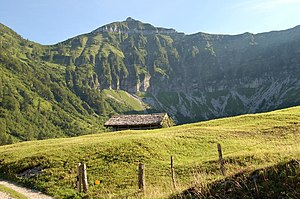
Gruberhorn from the Gruberalm (from the north) |
||
The Gruberhorn is a mountain with a height of 1732 m above sea level. A. and is located in the main ridge of the Osterhorn Group in the state of Salzburg in Austria .
Location and surroundings
The Gruberhorn rises south of the village of Hintersee as the middle summit of a striking group of three, which can still be clearly seen from Faistenau , between Gennerhorn ( 1735 m ) in the east and Regenspitz ( 1675 m ) in the northwest. To the north, these three peaks, but especially the Gruberhorn, break off with a mighty, grassy steep slope criss-crossed with gullies and gorges to the Gruberalm ( 1036 m ). The drainage of this boiler takes place over the Gruberbach in the Lämmerbach, which flows through the cadastral municipality of the same name of Hintersee, first drains into the Taugl and thus into the Hintersee .
In the west and southwest, the ridge that leads over Hohen First , Gruberhorn and Regenspitz is called Reinsberg and breaks richly structured, with many ditches and ridges, here called Riedeln , into the Tauglboden. The village of Sankt Koloman is at the end of the valley .
The view from the summit includes the Dachstein massif in the southeast , the Gosaukamm with the Bischofsmütze and the Tennengebirge in the south. The Untersberg builds up in the west, the Kolomannsberg , the Schober and the Faistenauer Schafberg ( 1559 m ) can be seen in the north . From the mountains of the Osterhorn group rises directly in the continuation of the south ridge of the Hohe First ( 1718 m ), in the west of the Schmittenstein ( 1695 m ) and the Schlenken ( 1648 m ).
geology
Striking on the mountains of the Osterhorn group are the horizontally banded limestone layers, which can also be clearly seen here on the Gruberhorn below the summit and all around.
Routes to the summit
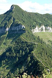
The Gruberhorn is a mountain overgrown with pines , climbs lead over the east ridge, the south ridge and the north-west ridge over Schrofen and partly through Latschengassen to the summit. There are no marked paths through the flanks.
The normal ascent starts from the Genneralm ( 1295 m ). The Genneralm can also be reached by private vehicle from the end of the Lämmerbachtal via a toll forest road. The footpath largely follows this road. From the Genneralm the path leads past the south side of the Gennerhorn into the saddle between Gennerhorn and Gruberhorn. (From here the Gennerhorn can also be climbed through a Latschengasse.) From the saddle you follow the east ridge directly to the summit of the Gruberhorn, whereby a steep step can be overcome surprisingly easily.
From the south, the path leads from the Hintertrattbergalm over the Hohen First and the Dürlstein ( 1697 m ) directly to the summit. The south ridge and east ridge are part of a variant of the Arnoweg .
The north-west ridge connects the Gruberhorn with the Regenspitz on a narrow edge and offers beautiful views of the alpine meadows of the Gruberalm. The base in the west is the Bergalm ( 1250 m ).


