Schlenken (mountain)
| Schlenken | ||
|---|---|---|
|
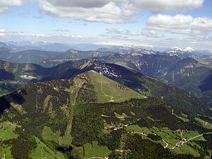
The Schlenken with the Schneekuppe at the summit and the main path over the treeless western slope to the summit |
||
| height | 1648 m above sea level A. | |
| location | Salzburg , Austria | |
| Mountains | Osterhorn Group | |
| Dominance | 1.71 km → Schmittenstein | |
| Notch height | 123 m ↓ Scharte to Schmittenstein | |
| Coordinates | 47 ° 40 '54 " N , 13 ° 12' 47" E | |
|
|
||
|
Schlenken left behind the Schmittenstein from the east |
||
The Schlenken is a 1648 m high mountain in the Osterhorn Group in the Hallein district in the state of Salzburg . It is a popular destination.
geography
The southwest side of the Schlenkens lies in the municipality of Bad Vigaun , the northeast side mainly belongs to the municipality of Krispl , outlying areas to Adnet . The summit is located on the municipal boundary between Krispl and Bad Vigaun. The striking silhouette of Schlenken and Schmittenstein can be seen from afar. The mountain resembles an extinct volcano.
There are around 25 caves in the Schlenken area , the most famous of which is the Schlenken passage cave .
Infrastructure
The Schlenken is - not least because of its proximity to Salzburg - a popular hiking and ski touring area. It is also popular with paragliders . In the Schlenken area there are 11 alpine pastures or huts, 4 of which are managed.
Web links
- schlenken.at ( Memento from December 27, 2018 in the Internet Archive )


