
Pfetttrach
| Pfetttrach | ||
| Water code | DE : 16724 | |
| location | Landshut district | |
| River system | Danube | |
| Drain over | Kleine Isar → Isar → Danube → Black Sea | |
| source | north of Obersüßbach 48 ° 37 ′ 22 ″ N , 11 ° 56 ′ 21 ″ E |
|
| Source height | approx. 480 m above sea level NN | |
| muzzle | In Landshut from the left into the Kleine Isar Coordinates: 48 ° 32 '58 " N , 12 ° 10' 6" E 48 ° 32 '58 " N , 12 ° 10' 6" E |
|
| Mouth height | 385 m above sea level NN | |
| Height difference | approx. 95 m | |
| Bottom slope | approx. 4.4 ‰ | |
| length | 21.4 km | |
| Catchment area | 167 km² | |
| Discharge at the extinguishing fire level |
MNQ MQ MHQ HHQ (1990) |
324 l / s 720 l / s 21.4 m³ / s 52.3 m³ / s |
| Medium-sized cities | Landshut | |
| Communities | Pfeffenhausen , Weihmichl , Furth , Altdorf | |
The Pfettrach is a left tributary of the short left branch of the Kleine Isar dividing the Isar in Landshut . It rises 900 meters north of Obersüßbach in the municipality of Pfeffenhausen , district Rainertshausen , in the forest area Gschwandholz at an altitude of around 480 m above sea level. NN . After 21 kilometers it flows northeast of the old town of Landshut at an altitude of 385 m above sea level. NN in the Kleine Isar. For the last four kilometers it meanders through the lower section of Landshut's flood basin . The Pfettrach is the most important body of water in the north-eastern district of Landshut . Its catchment area covers around 167 km². The most important inflow is the Further Bach. Before and at the beginning of the 20th century, the Pfettrach was also called Hirschauerbach.
nature and environment
The Pfettrach is notorious for its annual floods and floods , often triggered by heavy rain. In spring, when the snowmelts, the level rises up to five times (from 25 cm to 150 cm in January 2011, see references).
Bridges and adjacent buildings are regularly destroyed. In the village of Pfettrach , the two wooden bridges were replaced by a flood-proof concrete structure in 1934, which was reinforced again in 1982.

Pfettrach in the Restpfettrach landscape protection area (near Hofangerweg)

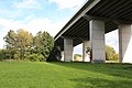
Flood in 2011 on the motorway bridge
Same view at normal level in 2012 (the stream is not visible behind the embankment)


In Altdorf there has been an air pressure-regulated inflatable weir since 2004 to control the runoff. It replaced the lock built in 1940 and 1954 . The bank was redeveloped to the adjacent properties between Ganslberg and Altdorf-Mitte. In the event of high water, the stream no longer overflows its banks. From Altdorf to extinguishing fire, comparable fortifications are to be built by 2020. The Hirschauerbrücke in Bahnhofstrasse just before the weir (with the same construction phases as the Pfettrach bridges) was completely renewed in 2011/2012 in order to cope with higher water levels and increased traffic. The recordings of the water levels at the extinguishing fire measuring point were ended on March 29, 2012. Flood events over 175 cm were documented here on February 20, 1999 and over 150 cm on January 13, 2011, January 14, 2004, March 21, 2002 and March 21, 2000. On August 25, 2005, the 150 cm was just missed. The measuring point in Altdorf continues the recordings.
Until the middle of the 20th century, the Pfettrach was used to dispose of domestic wastewater by means of small sewage treatment plants, some of which were in need of renovation . The catchment area is now connected to a central sewer system . There are only a few small initiators in exposed locations. Due to the amendment of the Waste Water Tax Act in 2006, their disposal systems had to be renewed. The Pfettrach does not serve as a drinking water supply. The area has abundant ground and deep water, the water supply is provided by the Pfettrach Group . The water quality of the Pfettrach can generally be classified as very good, which can be seen from the fish species native to it. To be mentioned are u. a. Mullet , chub , brook or rainbow trout , stone loach , Three-spined Ling , Elrike, gudgeon , hazel , arbor, roach and Schneider . Occasionally, eels also migrate up from the Isar. Reported sightings of the crayfish or the brook trout are not documented.
The catchment area of the stream offers a habitat for rare animal species such as the kingfisher , the great egret and the beaver .
Historical economic use
The Pfettrach was used by mills for wood and grain processing until the middle of the 20th century . Some street and place names such as Mühlkanalstraße, Haunmühle and Mühlbach are evidence of this. For this purpose and for flood regulation, it was laid several times and provided with a parallel canal . In the area of the sports field in Pfettrach on Talstrasse ( 48 ° 34 '21 " N , 12 ° 4' 31.5" E ), a canal branch runs underground. Radicals of the channel system exist in the section between Arth and Aich at 48 ° 34 ' "56 N , 50.4 12 ° 3' ' O .
Tributaries
- Leitengraben (right)
- Stollnrieder Bächlein (left)
- Edenlander Bächlein (left)
- Schachtner Bach (left)
- Further Bach (right)
- Lippbach (left)
- Weiherbach (right)
- (Flood basin) (right)
- Remaining pancake? (right)
Individual evidence
- ↑ Flood news service of the Bavarian State Office for the Environment: Information on the flood situation . Online at www.hnd.bayern.de. Retrieved April 3, 2015.
- ^ Greetings, Ernst: 7000 years of history in words and pictures - Heimatbuch Altdorf, Eugenbach, Pfettrach , 1984 community Altdorf self-published, p. 227
- ^ Greetings, Ernst: 7000 years of history in words and pictures - Heimatbuch Altdorf, Eugenbach, Pfettrach , 1984 community Altdorf self-published, p. 222
- ↑ Markt Altdorf: Restriction of the tonnage on the Hirschauerbrücke ( Memento of the original from July 15, 2014 in the Internet Archive ) Info: The archive link was automatically inserted and not yet checked. Please check the original and archive link according to the instructions and then remove this notice. . Online at www.markt-altdorf.de. Retrieved April 3, 2015.
- ↑ Flood news service of the Bavarian State Office for the Environment: Level in the Danube area: extinguishing fire / Pfettrach . Online at www.hnd.bayern.de. Retrieved April 3, 2015.
- ^ Flood news service of the Bavarian State Office for the Environment: Level in the Danube area: Altdorf / Pfettrach . Online at www.hnd.bayern.de. Retrieved April 3, 2015.
- ↑ Administration Service Bavaria: Wastewater disposal; Smallinleiter tax . Online at www.behoerdenwegweiser.bayern.de. Retrieved April 3, 2015.
- ↑ Information board of the Altdorf municipal administration