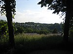
List of landscape protection areas in Landshut
There are eleven landscape protection areas in Landshut . (As of November 2018)
Notes on the information in the table
- Area name : Official designation of the protected area
- Image / Commons : Image and link to other images from the protected area
- LSG-ID : Official number of the protected area
- WDPA-ID : Link to the World Database on Protected Areas database of the protected area
- Wikidata : Link to the Wikidata entry for the protected area
- Designation : Date of designation as a protected area
- Municipality (s) : Municipalities in which the protected area is located
- Location : geographical location
- Area : total area of the protected area in hectares
- Area share : Proportionate areas of the protected area in counties / municipalities, given in% of the total area
- Comment : Special features and comments
Except for the Position column , all columns can be sorted.
| Territory name | Image / Commons | LSG ID | WDPA ID | Wikidata | Expulsion | Parish (noun) | location | Area ha | Area share | comment |
|---|---|---|---|---|---|---|---|---|---|---|
| LSG protection of parts of the landscape in the hill country east of Schweinbach - city limits - ST 2045 |

|
LSG-00584.01 | 396134 | Q59655764 | 2006 | position | 72.94 | Landshut (99.8%) | ||
| Protection of a part of the landscape in the city of Landshut (Gutenbergweg) |
 |
LSG-00093.01 | 395516 | Q59655711 | 1960 | position | 3.38 | Landshut (100%) | ||
| Protection of a part of the landscape in the city of Landshut (Restpfettrach) |
 |
LSG-00097.01 | 395519 | Q59655714 | 1961 | position | 0.5 | Landshut (100%) | ||
| Protection of parts of the landscape of the Isar slope on the Annaberg |
 |
LSG-00333.01 | 395823 | Q59655749 | 1982 | position | 4.66 | Landshut (100%) | ||
| Protection of parts of the landscape of the Isar-Hangleiten in the Klausenberg - Ochsenbuckel area |
 |
LSG-00300.01 | 395779 | Q59655740 | 1979 | position | 16.67 | Landshut (99.5%) | ||
| Protection of parts of the landscape of the Isar slope between the B 299 new and Schweinbachtal |
 |
LSG-00301.01 | 395780 | Q59655741 | 1979 | position | 108.6 | Landshut (100%) | ||
| Protection of parts of the landscape of the Isar slope between Bernlochner Schluchtweg and Hagrainer Straße | LSG-00332.01 | 395822 | Q59655748 | 1982 | position | 2.07 | Landshut (100%) | |||
| Protection of parts of the landscape of the Isar slope between Carossahöhe and B 299 new | LSG-00331.01 | 395821 | Q59655746 | 1982 | position | 26.91 | Landshut (100%) | |||
| Protection of parts of the landscape of the Isar slope between Schweinbachtal and the planned A93 motorway | LSG-00302.01 | 395781 | Q59655742 | 1979 | position | 174.28 | Landshut (100%) | |||
| Protection of parts of the landscape in the hill country between Wilhelm-Hauff-Straße and Sallmannsberg (Josaphat valley) | LSG-00601.01 | 555595857 | Q59655767 | 2015 | position | 23.47 | Landshut (100%) | |||
| Protection of parts of the landscape in the Lower Isar floodplains at the Altheim reservoir |
 |
LSG-00521.01 | 396042 | Q59655757 | 1998 | position | 23.63 | Landshut (99.3%) |
See also
- List of nature reserves in the Landshut district
- List of landscape protection areas in the Landshut district
- List of FFH areas in the Landshut district
- List of geotopes in the Landshut district
Individual evidence
- ↑ Green List of Landscape Protection Areas in Lower Bavaria , accessed on March 2, 2017.
Web links
Commons : Landscape protection areas in Landshut - collection of images, videos and audio files