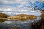
List of landscape protection areas in the Weilheim-Schongau district
In Weilheim-Schongau , there are 17 landscape conservation areas . (As of November 2018)
Notes on the information in the table
- Area name : Official designation of the protected area
- Image / Commons : Image and link to other images from the protected area
- LSG-ID : Official number of the protected area
- WDPA-ID : Link to the World Database on Protected Areas database of the protected area
- Wikidata : Link to the Wikidata entry for the protected area
- Designation : Date of designation as a protected area
- Municipality (s) : Municipalities in which the protected area is located
- Location : geographical location
- Area : total area of the protected area in hectares
- Area share : Proportionate areas of the protected area in counties / municipalities, given in% of the total area
- Comment : Special features and comments
Except for the Position column , all columns can be sorted.
| Territory name | Image / Commons | LSG ID | WDPA ID | Wikidata | Expulsion | Parish (noun) | location | Area ha | Area share | comment |
|---|---|---|---|---|---|---|---|---|---|---|
| LSG Ammertal, Böbing, Hohenpeißenberg, Peißenberg, Peiting |
 |
LSG-00422.01 | 395930 | Q59643813 | 1988 | position | 1376.12 | District of Weilheim-Schongau (100%) | ||
| LSG Hardtlandschaft and Eberfinger Drumlinfelder, Weilheim, Wiedenbach, Bernried, Seeshaupt, Eberting |
 |
LSG-00371.01 | 395880 | Q59643531 | 1985 | position | 5845.87 | District of Weilheim-Schongau (100%) | ||
| LSG Hohenkastener Filz with Stadler Weiher and Mühlgraben, Eberfing |
 |
LSG-00478.01 | 395986 | Q59643771 | 1994 | position | 176.44 | District of Weilheim-Schongau (100%) | Stadler pond | |
| LSG Langer Filz and Gruber See in the communities of Peiting and Steingaden |
 |
LSG-00023.01 | 395466 | Q59643501 | 1953 | position | 70.44 | District of Weilheim-Schongau (100%) | ||
| LSG Raistinger Lichtenau and the Rott valley between Stillern and Zellsee |
 |
LSG-00520.01 | 396041 | Q59643562 | 1998 | position | 516.7 | District of Weilheim-Schongau (100%) | ||
| LSG kettle between Burggen and Bernbeuren |
 |
LSG-00016.01 | 395459 | Q59643800 | 1952 | position | 15.08 | District of Weilheim-Schongau (100%) | ||
| LSG riverside area at Lake Starnberg Bernried, Seeshaupt |
 |
LSG-00368.01 | 395877 | Q59643497 | 1985 | position | 706.73 | District of Weilheim-Schongau (100%) | starnberger Lake | |
| Protection of the Loisach and Erlfilze in the area of the city of Penzberg and the community of Sindelsdorf |
 |
LSG-00295.01 | 395774 | Q59643677 | 1978 | position | 294.49 | District of Weilheim-Schongau (100%) | ||
| Protection of the Osterseen and their surroundings in the municipalities of Frauenrain, Iffeldorf and Seeshaupt |
 |
LSG-00059.01 | 395485 | Q59643823 | 1955 | position | 1234.94 | District of Weilheim-Schongau (100%) | ||
| Protection of the wide felt district of Schönberg, district of Schongau |
 |
LSG-00068.01 | 395493 | Q59643663 | 1955 | position | 31.62 | District of Weilheim-Schongau (100%) | ||
| Protection of the castle hill, municipality of Burggen |
 |
LSG-00228.01 | 395706 | Q59643759 | 1972 | position | 19.77 | District of Weilheim-Schongau (100%) | ||
| Protection of the area around the Wies |
 |
LSG-00603.01 | Q59651168 | position | 2933.13 | Weilheim-Schongau district (99.9%) | ||||
| Protection of the Haslacher See in the municipalities of Burggen u. Bernbeuren |
 |
LSG-00229.01 | 395707 | Q59643422 | 1972 | position | 97.71 | District of Weilheim-Schongau (100%) | ||
| Protection of the Hirschberg, the Kerschlacher Forest and the subsequent moraine landscape, municipality of Pähl |
 |
LSG-00209.01 | 395689 | Q59643808 | 1971 | position | 1460.15 | Weilheim-Schongau district (99.9%) | ||
| Protection of the linden trees east of Schwaig in the area of the Wildsteig community |
 |
LSG-00014.01 | 395457 | Q59643502 | 1952 | position | 7.99 | District of Weilheim-Schongau (100%) | ||
| Protection of parts of the landscape on the south bank of the Ammersee, Pähl |
 |
LSG-00225.01 | 395703 | Q59643693 | 1971 | position | 285.96 | District of Weilheim-Schongau (100%) | Ammersee | |
| Protection of parts of the landscape of the Lech and its bank areas between Gründl, the municipality of Prem and Niederwies, Markt Peiting (Bernbeuren, Steingaden, Burggen, Peiting) |
 |
LSG-00358.01 | 395867 | Q59643482 | 1984 | position | 743.23 | District of Weilheim-Schongau (100%) |
Former protected areas
- LSG-00212.01, protection of the area around the Wies in the communities of Steingaden and Wildsteig
See also
- List of nature reserves in the Weilheim-Schongau district
- List of FFH areas in the Weilheim-Schongau district
- List of geotopes in the Weilheim-Schongau district
- List of natural monuments in the Weilheim-Schongau district
Individual evidence
- ↑ Green List of Landscape Protection Areas in Upper Bavaria , accessed on May 1, 2015.
Web links
Commons : Landscape protection areas in the Weilheim-Schongau district - collection of images, videos and audio files