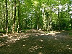
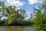
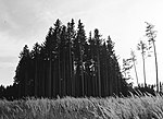
List of landscape protection areas in the Fürstenfeldbruck district
In the district of Furstenfeldbruck , there are 13 landscape conservation areas . (As of November 2018)
Notes on the information in the table
- Area name : Official designation of the protected area
- Image / Commons : Image and link to other images from the protected area
- LSG-ID : Official number of the protected area
- WDPA-ID : Link to the World Database on Protected Areas database of the protected area
- Wikidata : Link to the Wikidata entry for the protected area
- Designation : Date of designation as a protected area
- Municipality (s) : Municipalities in which the protected area is located
- Location : geographical location
- Area : total area of the protected area in hectares
- Area share : Proportionate areas of the protected area in counties / municipalities, given in% of the total area
- Comment : Special features and comments
Except for the Position column , all columns can be sorted.
| Territory name | Image / Commons | LSG ID | WDPA ID | Wikidata | Expulsion | Parish (noun) | location | Area ha | Area share | comment |
|---|---|---|---|---|---|---|---|---|---|---|
| Ampermoos and Eichbühl | LSG-00500.01 | 396008 | Q59643452 | 1996 | position | 81.42 | Fürstenfeldbruck district (100%) | |||
| Fußberger moss | LSG-00309.02 | 395789 | Q59643803 | 1979 | position | 148.46 | Fürstenfeldbruck district (100%) | |||
| Graßlfinger Moos and Olchinger See |
 |
LSG-00309.09 | 395796 | Q59643527 | 1979 | position | 598.11 | Fürstenfeldbruck district (100%) | Olchinger See , a quarry pond in the west of the city of Olching | |
| Haspelmoor |
 |
LSG-00309.04 | 395791 | Q59651198 | 1979 | position | 265.08 | Fürstenfeldbruck district (100%) | ||
| Kreuzling Forest |
 |
LSG-00309.07 | 395794 | Q59643683 | 1979 | position | 290.99 | Fürstenfeldbruck district (100%) | ||
| LSG Scharwerkholz |
 |
LSG-00484.01 | 395992 | Q59643767 | 1994 | position | 18.77 | Fürstenfeldbruck district (100%) | ||
| Middle amperes, pond catching Fürstenfeldbruck |
 |
LSG-00309.08 | 395795 | Q59643545 | 1979 | position | 541.69 | Fürstenfeldbruck district (100%) | ||
| Upper amperes |
 |
LSG-00309.01 | 395788 | Q59643749 | 1979 | position | 2135.82 | Fürstenfeldbruck district (99.9%) | ||
| Parsberg |
 |
LSG-00309.06 | 395793 | Q59643585 | 1979 | position | 488.51 | Fürstenfeldbruck district (100%) | ||
| Triftwiesen Germering |
 |
LSG-00309.03 | 395790 | Q59643801 | 1979 | position | 148.8 | Munich (1.3%), Fürstenfeldbruck district (98.6%) | ||
| Lower amperes |
 |
LSG-00480.01 | 395988 | Q59643537 | 1994 | position | 566.69 | Fürstenfeldbruck district (100%) | ||
| Ordinance of the district of Fürstenfeldbruck on the LSG Emmeringer Leite , Eichenauer Wald |
 |
LSG-00503.01 | 396014 | Q59643544 | 1996 | position | 547.78 | Fürstenfeldbruck district (100%) | ||
| Wild moss | LSG-00309.05 | 395792 | Q59643843 | 1979 | position | 102.67 | Fürstenfeldbruck district (100%) |
See also
- List of nature reserves in the Fürstenfeldbruck district
- List of FFH areas in the Fürstenfeldbruck district
- List of geotopes in the Fürstenfeldbruck district
Individual evidence
- ↑ Green List of Landscape Protection Areas in Upper Bavaria , accessed on May 1, 2015.
Web links
Commons : Protected landscape areas in Fürstenfeldbruck district - Collection of images, videos and audio files