List of landscape protection areas in the Donau-Ries district
In the district of Donau-Ries , there are 22 landscape conservation areas . (As of November 2018)
Notes on the information in the table
- Area name : Official designation of the protected area
- Image / Commons : Image and link to other images from the protected area
- LSG-ID : Official number of the protected area
- WDPA-ID : Link to the World Database on Protected Areas database of the protected area
- Wikidata : Link to the Wikidata entry for the protected area
- Designation : Date of designation as a protected area
- Municipality (s) : Municipalities in which the protected area is located
- Location : geographical location
- Area : total area of the protected area in hectares
- Area share : Proportionate areas of the protected area in counties / municipalities, given in% of the total area
- Comment : Special features and comments
Except for the Position column , all columns can be sorted.
| Territory name | Image / Commons | LSG ID | WDPA ID | Wikidata | Expulsion | Parish (noun) | location | Area ha | Area share | comment |
|---|---|---|---|---|---|---|---|---|---|---|
| Altwasser near Donauwörth |
 |
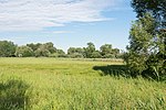
LSG-00315.01 | 395802 | Q59610671 | 1980 | position | 6.08 | District of Donau-Ries (100%) | Exceptional location as a residual natural area in the middle of the industrial area south of Donauwörth, bordered to the east and embraced by Airbus Helicopters, north of railway facilities, west and south of industrial companies, including a large slaughterhouse. | |
| Backwater at lifeguards |
 |
LSG-00312.01 | 395799 | Q59610665 | 1980 | position | 10.86 | District of Donau-Ries (100%) | ||
| At Langweidlegraben east of Heissesheim |
 |
LSG-00314.01 | 395801 | Q59610669 | 1980 | position | 52.73 | District of Donau-Ries (100%) | ||
| Augsburg - Western forests |
 |
LSG-00417.01 | 395925 | Q59608104 | 1988 | position | 69892.76 | Augsburg (2.2%), Augsburg district (61.1%), Dillingen an der Donau district (10.0%), Günzburg district (15.7%), Unterallgäu district (10.1%), Donau- Ries (0.9%) |
|
|
| Danube floodplains between Blindheim and Tapfheim |
 |
LSG-00471.01 | 395979 | Q59610693 | 1993 | position | 1095.37 | District of Dillingen an der Donau (73.2%), District of Donau-Ries (26.7%) | ||
| Firnhabermoos (Mertinger Hell) |
 |
LSG-00211.01 | 395691 | Q59610661 | 1971 | position | 182.24 | District of Donau-Ries (100%) | ||
| In the Osterried southeast of Auchsesheim |
 |
LSG-00324.01 | 395812 | Q59610673 | 1981 | position | 34.38 | District of Donau-Ries (100%) | ||
| Karthäusertal |
 |
LSG-00409.01 | 395917 | Q59610687 | 1987 | position | 884.21 | District of Donau-Ries (100%) | Part of the area is the juniper heather on the Ganzenberg | |
| Lechheide-Sachsenwald south of Oberpeiching |
 |
LSG-00366.01 | 395875 | Q59610684 | 1985 | position | 22.91 | District of Donau-Ries (100%) | ||
| Marienhöhe and Stoffelsberg |
 |
LSG-00451.01 | 395959 | Q59610690 | 1990 | position | 26.62 | District of Donau-Ries (100%) | ||
| Northern edge of the Ries |
 |
LSG-00254.01 | 395732 | Q59610833 | 1973 | position | 8425 | District of Donau-Ries (100%) | ||
| Upper Kesseltal |
 |
LSG-00140.01 | 395613 | Q59610653 | 1967 | position | 1062.64 | District of Dillingen an der Donau (71.8%), District of Donau-Ries (28.2%) | ||
| Riedgraben with leaves |
 |
LSG-00313.01 | 395800 | Q59610667 | 1980 | position | 17.89 | District of Donau-Ries (100%) | ||
| Riegelberg near Holheim |
 |
LSG-00325.01 | 395813 | Q59610675 | 1981 | position | 62 | District of Donau-Ries (99.9%) | ||
| Schmähingen North |
 |
LSG-00353.01 | 395861 | Q59610678 | 1984 | position | 10.36 | District of Donau-Ries (100%) | ||
| Schmähingen West |
 |
LSG-00353.02 | 395862 | Q59610680 | 1984 | position | 28.09 | District of Donau-Ries (100%) | ||
| Schmutterwäldchen near Bäumenheim |
 |
LSG-00360.01 | 395869 | Q59610683 | 1984 | position | 13.19 | District of Donau-Ries (100%) | ||
| Protection of the area between Katzenstein and Sonderhof |
 |
LSG-00188.01 | 395658 | Q59610655 | 1970 | position | 210.58 | District of Donau-Ries (100%) | ||
| Protection of parts of the landscape in the area of the city of Harburg and the community of Großsorheim |
 |
LSG-00253.01 | 395731 | Q59610659 | 1973 | position | 146.99 | District of Donau-Ries (100%) | ||
| Protection of parts of the landscape in the city of Donauwörth and in the communities of Altisheim, Graisbach, Marxheim and Schäfstall |
 |
LSG-00233.01 | 395709 | Q59610663 | 1972 | position | 973.72 | District of Donau-Ries (100%) | ||
| Protection of parts of the landscape in the city of Oettingen and the municipality of Hainsfarth |
 |
LSG-00250.01 | 395728 | Q59610657 | 1972 | position | 74.4 | District of Donau-Ries (100%) | ||
| Protection zone in the Altmühltal nature park |
 |
LSG-00565.01 | 396115 | Q23787649 | 1995 | position | 163135.05 | Ingolstadt (0.1%), District of Eichstätt (36.3%), District of Neuburg-Schrobenhausen (4.0%), District of Kelheim (8.7%), District of Neumarkt in der Oberpfalz (8.2%), District Regensburg (1.5%), Roth district (6.4%), Weißenburg-Gunzenhausen district (22.8%), Donau-Ries district (11.8%) |
See also
- List of nature reserves in the Donau-Ries district
- List of FFH areas in the Donau-Ries district
- List of geotopes in the Donau-Ries district
- List of natural monuments in the Donau-Ries district
Individual evidence
- ↑ Green List of Landscape Protection Areas in Swabia , accessed on April 28, 2015.
Web links
Commons : Protected landscape areas in the Donau-Ries district - Collection of images, videos and audio files