List of landscape protection areas in the district of Amberg-Sulzbach
In Amberg-Sulzbach , there are 32 landscape conservation areas . (As of November 2018)
Notes on the information in the table
- Area name : Official designation of the protected area
- Image / Commons : Image and link to other images from the protected area
- LSG-ID : Official number of the protected area
- WDPA-ID : Link to the World Database on Protected Areas database of the protected area
- Wikidata : Link to the Wikidata entry for the protected area
- Designation : Date of designation as a protected area
- Municipality (s) : Municipalities in which the protected area is located
- Location : geographical location
- Area : total area of the protected area in hectares
- Area share : Proportionate areas of the protected area in counties / municipalities, given in% of the total area
- Comment : Special features and comments
Except for the Position column , all columns can be sorted.
| Territory name | Image / Commons | LSG ID | WDPA ID | Wikidata | Expulsion | Parish (noun) | location | Area ha | Area share | comment |
|---|---|---|---|---|---|---|---|---|---|---|
| Ammerthal |
 |
LSG-00125.02 | 395588 | Q59654969 | 1965 | position | 172.55 | District of Amberg-Sulzbach (100%) | ||
| Annaberg |
 |
LSG-00191.11 | 395668 | Q59654997 | 1970 | position | 11.27 | District of Amberg-Sulzbach (100%) | ||
| Breitenbrunn valley |
 |
LSG-00191.09 | 395666 | Q59654995 | 1970 | position | 70.26 | District of Amberg-Sulzbach (100%) | ||
| Breitenstein with Steinberg |
 |
LSG-00191.01 | 395660 | Q59654989 | 1970 | position | 105.38 | District of Amberg-Sulzbach (100%) | ||
| Buchberg |
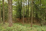 |
LSG-00105.06 | 395532 | Q59654940 | 1962 | position | 242.58 | District of Amberg-Sulzbach (100%) | ||
| Buchenberg between Hirschricht and Schwend | LSG-00191.04 | 395662 | Q59654991 | 1970 | position | 135.85 | District of Amberg-Sulzbach (100%) | |||
| Freihung - Seugast | LSG-00125.10 | 395596 | Q59654977 | 1965 | position | 440.74 | District of Amberg-Sulzbach (100%) | |||
| Freudenberg, Wutschdorf and Etsdorf |
 |
LSG-00125.03 | 395589 | Q59654970 | 1965 | position | 1617.12 | Amberg-Sulzbach district (99.9%) | ||
| Hahnbach - Frohnberg | LSG-00125.08 | 395594 | Q59654975 | 1965 | position | 33.95 | District of Amberg-Sulzbach (100%) | |||
| Hammerweiher | LSG-00125.09 | 395595 | Q59654976 | 1965 | position | 79.43 | Amberg-Sulzbach district (98.9%) | |||
| Hirschau - north |
 |
LSG-00125.11 | 395597 | Q59654978 | 1965 | position | 571.53 | District of Amberg-Sulzbach (100%) | ||
| Hirschau - south | LSG-00125.04 | 395590 | Q59654971 | 1965 | position | 1013.69 | District of Amberg-Sulzbach (100%) | |||
| Högenbachtal, Lichtenegg, Beselberg with western Birgland |
 |
LSG-00191.07 | 395665 | Q59654994 | 1970 | position | 2524.78 | Amberg-Sulzbach district (99.8%) | ||
| Katzenbergl with rupture area north of Sulzbach | LSG-00191.13 | 395670 | Q59655001 | 1970 | position | 128.77 | District of Amberg-Sulzbach (100%) | |||
| Köferinger Tal, Köferinger Heide, Hirschwald and Vilstal south of Amberg |
 |
LSG-00125.01 | 395587 | Q59654968 | 1965 | position | 8786.12 | Amberg-Sulzbach district (99.6%) | ||
| District ordinance on the protection of parts of the landscape in Markt Hohenburg and in the municipality of Adertshausen in the district of Amberg |
 |
LSG-00109.01 | 395537 | Q59654942 | 1963 | position | 541.55 | Amberg-Sulzbach district (98.7%) | ||
| Landscape strip along the B 85 |
 |
LSG-00191.03 | 395661 | Q59654990 | 1970 | position | 660.14 | District of Amberg-Sulzbach (100%) | ||
| Landscape strips along the Nuremberg - Amberg motorway | LSG-00191.14 | 395671 | Q59655002 | 1970 | position | 506.24 | Amberg-Sulzbach district (99.9%) | |||
| Lauterachtal with the valleys of the Hausener and Utzenhofener Bach and the Jura region between Kastl and Utzenhofen |
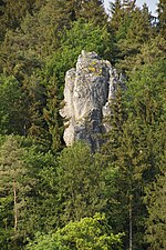 |
LSG-00121.09 | 395581 | Q59654964 | 1965 | position | 4682.01 | District of Amberg-Sulzbach (97.7%), District of Neumarkt in the Upper Palatinate (2.3%) | ||
| Lauterachtal and Vilstal (east side) |
 |
LSG-00119.11 | 395556 | Q59654957 | 1964 | position | 812.2 | District of Amberg-Sulzbach (70.4%), District of Schwandorf (28.3%) | ||
| LSG within the Franconian Switzerland Nature Park - Veldensteiner Forst (formerly protection zone) |
 |
LSG-00566.01 | 396116 | Q59655009 | 1995 | position | 11981.99 | Amberg-Sulzbach district (98.8%) | ||
| LSG within the Upper Palatinate Forest Nature Park (formerly protection zone) |
 |
LSG-00567.01 | 396117 | Q59655010 | 1995 | position | 55355.95 | District of Schwandorf (100%) | ||
| Upper Vils between Reisach and Irlbach | LSG-00125.06 | 395592 | Q59654973 | 1965 | position | 275.03 | District of Amberg-Sulzbach (100%) | |||
| Poppberg |
 |
LSG-00191.06 | 395664 | Q59654993 | 1970 | position | 71.09 | Amberg-Sulzbach district (99.8%) | ||
| Sackdillinger-Krottenseer Forest | LSG-00191.17 | 395672 | Q59655003 | 1970 | position | 306.37 | District of Amberg-Sulzbach (100%) | |||
| Protection strip along the B 85 new | LSG-00125.05 | 395591 | Q59654972 | 1965 | position | 153.1 | Amberg (99.9%) | |||
| Spittlberg | LSG-00191.12 | 395669 | Q59654999 | 1970 | position | 2.67 | District of Amberg-Sulzbach (100%) | |||
| Star stone | LSG-00191.10 | 395667 | Q59654996 | 1970 | position | 46.91 | District of Amberg-Sulzbach (100%) | |||
| Dry valley above Ammerthal with Hainsburg |
 |
LSG-00191.05 | 395663 | Q59654992 | 1970 | position | 918.67 | District of Amberg-Sulzbach (100%) | ||
| Ursensollen and Rängberg |
 |
LSG-00125.13 | 395599 | Q59654980 | 1965 | position | 269.34 | District of Amberg-Sulzbach (100%) | ||
| Weißenberg (bird sanctuary) | LSG-00125.07 | 395593 | Q59654974 | 1965 | position | 4.07 | District of Amberg-Sulzbach (100%) | |||
| Zant |
 |
LSG-00125.14 | 395600 | Q59654981 | 1965 | position | 197.41 | District of Amberg-Sulzbach (100%) |
See also
- List of nature reserves in the district of Amberg-Sulzbach
- List of protected landscape components in the district of Amberg-Sulzbach
- List of FFH areas in the district of Amberg-Sulzbach
- List of geotopes in the Amberg-Sulzbach district
- List of landscape protection areas in Amberg
- List of FFH areas in the city of Amberg
- List of geotopes in Amberg
Individual evidence
- ↑ Green List of Landscape Protection Areas in the Upper Palatinate , accessed on September 7, 2019.
Web links
Commons : Landscape protection areas in the Amberg-Sulzbach district - collection of images, videos and audio files