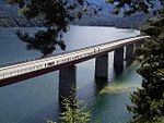
List of landscape protection areas in the Bad Tölz-Wolfratshausen district
In the district of Bad Tolz-Wolfratshausen , there are 20 landscape conservation areas . (As of November 2018)
Notes on the information in the table
- Area name : Official designation of the protected area
- Image / Commons : Image and link to other images from the protected area
- LSG-ID : Official number of the protected area
- WDPA-ID : Link to the World Database on Protected Areas database of the protected area
- Wikidata : Link to the Wikidata entry for the protected area
- Designation : Date of designation as a protected area
- Municipality (s) : Municipalities in which the protected area is located
- Location : geographical location
- Area : total area of the protected area in hectares
- Area share : Proportionate areas of the protected area in counties / municipalities, given in% of the total area
- Comment : Special features and comments
Except for the Position column , all columns can be sorted.
| Territory name | Image / Commons | LSG ID | WDPA ID | Wikidata | Expulsion | Parish (noun) | location | Area ha | Area share | comment |
|---|---|---|---|---|---|---|---|---|---|---|
| Order to protect the Altenberg felt in the Manhartshofen community |
 |
LSG-00055.01 | 395483 | Q59643685 | 1955 | position | 29.82 | Bad Tölz-Wolfratshausen district (100%) | ||
| Eglinger and Ascholdinger felts |
 |
LSG-00326.01 | 395814 | Q59643530 | 1981 | position | 59.02 | Bad Tölz-Wolfratshausen district (100%) | ||
| Großer Weiher (= Harmatinger Weiher) |
 |
LSG-00326.03 | 395816 | Q59643589 | 1981 | position | 47.36 | Bad Tölz-Wolfratshausen district (100%) | ||
| Protection of the Oberallmannshauser Filze as LSG in the area of the communities of Höhenrain and Münsing |
 |
LSG-00206.01 | 395686 | Q59643489 | 1971 | position | 73.57 | Bad Tölz-Wolfratshausen district (99.9%) | ||
| Landscape protection for the high moor near the Schemeralm, Lenggries municipality | LSG-00005.01 | 395449 | Q59643745 | 1950 | position | 22.97 | Bad Tölz-Wolfratshausen district (100%) | |||
| LSG Ebenbergfilze in the Dietramszell community |
 |
LSG-00329.01 | 395819 | Q59643773 | 1982 | position | 17.36 | Bad Tölz-Wolfratshausen district (100%) | ||
| LSG Isarauen |
 |
LSG-00202.01 | 395682 | Q59643836 | 1971 | position | 1103.75 | Bad Tölz-Wolfratshausen district (100%) | ||
| LSG east bank of Lake Starnberg near Münsing |
 |
LSG-00425.01 | 395933 | Q59643442 | 1988 | position | 85.64 | Bad Tölz-Wolfratshausen district (99.9%) | starnberger Lake | |
| LSG Schönberg in the municipalities of Deining and Egling, now Egling, Bad Tölz-Wolfratshausen district |
 |
LSG-00264.01 | 395742 | Q59643750 | 1973 | position | 213.57 | Bad Tölz-Wolfratshausen district (100%) | ||
| LSG Sylvensteinsee and upper Isar valley in the communities of Lenggries and Jachenau |
 |
LSG-00341.01 | 395849 | Q59643565 | 1983 | position | 5105.16 | Bad Tölz-Wolfratshausen district (99.9%) | ||
| LSG Walchensee |
 |
LSG-00492.01 | 396000 | Q59643643 | 1995 | position | 3506.76 | Bad Tölz-Wolfratshausen district (100%) | ||
| Mooshamer pond |
 |
LSG-00326.02 | 395815 | Q59643558 | 1981 | position | 53.12 | Bad Tölz-Wolfratshausen district (100%) | with spade felt | |
| Protection of part of the landscape in the municipality of Jachenau, high moor at Rauthof | LSG-00002.01 | 390713 | Q59643456 | 1949 | position | 8.02 | Bad Tölz-Wolfratshausen district (100%) | |||
| Protection of parts of the landscape in the area of the so-called Bergl northeast of Ramsau in the municipality of Oberbuchen, now Bad Heilbrunn | LSG-00098.01 | 395520 | Q59643847 | 1961 | position | 1.01 | Bad Tölz-Wolfratshausen district (100%) | |||
| Protection of parts of the landscape in the Hirschbachtal |
 |
LSG-00214.01 | 395693 | Q59643846 | 1971 | position | 1001.96 | Bad Tölz-Wolfratshausen district (100%) | ||
| Protection of parts of the landscape in the Isar valley between Icking and Königsdorf |
 |
LSG-00155.01 | 395625 | Q59643841 | 1968 | position | 1037.65 | Bad Tölz-Wolfratshausen district (100%) | ||
| Protection of parts of the landscape in the municipality of Dietramszell (Kreuzbichl) |
 |
LSG-00527.01 | 396060 | Q59651115 | 1998 | position | 49.09 | Bad Tölz-Wolfratshausen district (100%) | ||
| Position of the Rothenrainer Moore, Unterfischbach municipality, under landscape protection | LSG-00065.01 | 395490 | Q59643777 | 1955 | position | 166.2 | Bad Tölz-Wolfratshausen district (100%) | |||
| Position of the Auerfilzes with carp lakes, community Schönrain, under landscape protection |
 |
LSG-00066.01 | 395491 | Q59242010 | 1955 | position | 90.27 | Bad Tölz-Wolfratshausen district (100%) | Carp lakes | |
| Ordinance of the district of Upper Bavaria on the protection of parts of the landscape along the Isar in the districts of Bad-Tölz-Wolfratshausen, Munich, Freising and Erding as LSG |
 |
LSG-00384.01 | 395892 | Q59643434 | 1986 | position | 8931.65 | Bad Tölz-Wolfratshausen district (7.2%), Erding district (4.0%), Freising district (52.8%), Munich district (36.0%) |
|
See also
- List of nature reserves in the Bad Tölz-Wolfratshausen district
- List of FFH areas in the Bad Tölz-Wolfratshausen district
- List of geotopes in the Bad Tölz-Wolfratshausen district
Individual evidence
- ↑ Green List of Landscape Protection Areas in Upper Bavaria , accessed on May 1, 2015.
Web links
Commons : Protected landscape areas in Bad Tölz-Wolfratshausen district - Collection of images, videos and audio files