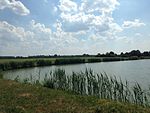
List of landscape protection areas in the city of Erlangen
There are 19 landscape protection areas in Erlangen . (As of November 2018)
Notes on the information in the table
- Area name : Official designation of the protected area
- Image / Commons : Image and link to other images from the protected area
- LSG-ID : Official number of the protected area
- WDPA-ID : Link to the World Database on Protected Areas database of the protected area
- Wikidata : Link to the Wikidata entry for the protected area
- Designation : Date of designation as a protected area
- Municipality (s) : Municipalities in which the protected area is located
- Location : geographical location
- Area : total area of the protected area in hectares
- Area share : Proportionate areas of the protected area in counties / municipalities, given in% of the total area
- Comment : Special features and comments
Except for the Position column , all columns can be sorted.
| Territory name | Image / Commons | LSG ID | WDPA ID | Wikidata | Expulsion | Parish (noun) | location | Area ha | Area share | comment |
|---|---|---|---|---|---|---|---|---|---|---|
| Grünau | LSG-00340.01 | 395830 | Q59585102 | 2004 | position | 56.74 | Erlangen (99.8%) | |||
| Dechsendorfer pond area |
 |
LSG-00340.02 | 395831 | Q59585104 | 2004 | position | 169.83 | Erlangen (99.9%) | ||
| Mönau |
 |
LSG-00340.03 | 395832 | Q59585105 | 2004 | position | 554.53 | Erlangen (99.9%) | ||
| Dechsendorfer Lohe | LSG-00340.04 | 395833 | Q59585107 | 2004 | position | 67.18 | Erlangen (99.9%) | |||
| Seebachgrund |
 |
LSG-00340.05 | 395834 | Q59585109 | 2004 | position | 114.48 | Erlangen (99.9%) | ||
| Moorbachtal |
 |
LSG-00340.06 | 395835 | Q59585110 | 2004 | position | 49.55 | Erlangen (99.9%) | ||
| Regnitz Valley |
 |
LSG-00340.07 | 395836 | Q59585112 | 2004 | position | 927.48 | Erlangen (99.9%) | ||
| Meilwald with ice pit |
 |
LSG-00340.08 | 395837 | Q59585114 | 1983 | position | 226.38 | Erlangen (99.9%) | ||
| Schwabach Valley |
 |
LSG-00340.09 | 395838 | Q59585116 | 2004 | position | 66.71 | Erlangen (100%) | ||
| Steinforstgraben with Kosbacher ponds and permanent forest strips east of the Main-Danube Canal |
 |
LSG-00340.10 | 395839 | Q59585118 | 2004 | position | 142.12 | Erlangen (100%) | ||
| Bimbachtal |
 |
LSG-00340.11 | 395840 | Q59585119 | 2004 | position | 51.75 | Erlangen (100%) | ||
| Rittersbachtal |
 |
LSG-00340.12 | 395841 | Q59585121 | 2004 | position | 68.69 | Erlangen (100%) | ||
| Protective strips on both sides of the A3 federal motorway | LSG-00340.13 | 395842 | Q59585123 | 2004 | position | 52.27 | Erlangen (100%) | |||
| Monastery forest with Lobersweihern and the green corridor west of the Neuses district |
 |
LSG-00340.14 | 395843 | Q59585124 | 2004 | position | 193.96 | Erlangen (100%) | ||
| Aurach Valley |
 |
LSG-00340.15 | 395844 | Q59585126 | 2004 | position | 192.81 | Erlangen (99.9%) | ||
| Römerreuth and the surrounding area | LSG-00340.16 | 395845 | Q59585128 | 1983 | position | 107.88 | Erlangen (99.9%) | |||
| Hat trench with angular field and wolf cloak |
 |
LSG-00340.17 | 395846 | Q59585129 | 1983 | position | 188.33 | Erlangen (99.9%) | ||
| Creek ditch |
 |
LSG-00340.18 | 395847 | Q59585131 | 1983 | position | 9.59 | Erlangen (100%) | ||
| Bruck pool with Langenauffeld |
 |
LSG-00340.19 | 395848 | Q59585133 | 1983 | position | 322.4 | Erlangen (100%) |
Individual evidence
- ↑ Green List of Landscape Protection Areas in Middle Franconia , accessed on April 15, 2015.
- ↑ City of Erlangen: Landscape Protection , accessed on September 23, 2015.
Web links
Commons : Protected landscape areas in Erlangen - Collection of images, videos and audio files