
Federal motorway 8
| Bundesautobahn 8 in Germany | ||||||||||||||||||||||||||||||||||||||||||||||||||||||||||||||||||||||||||||||||||||||||||||||||||||||||||||||||||||||||||||||||||||||||||||||||||||||||||||||||||||||||||||||||||||||||||||||||||||||||||||||||||||||||||||||||||||||||||||||||||||||||||||||||||||||||||||||||||||||||||||||||||||||||||||||||||||||||||||||||||||||||||||||||||||||||||||||||||||||||||||||||||||||||||||||||||||||||||||||||||||||||||||||||||||||||||||||||||||||||||||||||||||||||||||||||||||||||||||||||||||||||||||||||||||||||||||||||||||||||||||||||||||||||||||||||||||||||||||||||||||||||||||||||||||||||||||||||||||||||||||||||||||||||||||||||||||||||||||||||||||||||||||||||||||||||||||||||||||||||||||||||||||||||||||||||||||||||||||||||||||||||||||||||||||||||||||||||||||||||||||||||||||||||||||||||||||||||||||||||||||||||||||||||||||||||||||||||||||||||||||||||||||||||||||||||||||||||||||||||||||||||||||||||||||||||||||||||||||||||||||||||||||||||||||

|
||||||||||||||||||||||||||||||||||||||||||||||||||||||||||||||||||||||||||||||||||||||||||||||||||||||||||||||||||||||||||||||||||||||||||||||||||||||||||||||||||||||||||||||||||||||||||||||||||||||||||||||||||||||||||||||||||||||||||||||||||||||||||||||||||||||||||||||||||||||||||||||||||||||||||||||||||||||||||||||||||||||||||||||||||||||||||||||||||||||||||||||||||||||||||||||||||||||||||||||||||||||||||||||||||||||||||||||||||||||||||||||||||||||||||||||||||||||||||||||||||||||||||||||||||||||||||||||||||||||||||||||||||||||||||||||||||||||||||||||||||||||||||||||||||||||||||||||||||||||||||||||||||||||||||||||||||||||||||||||||||||||||||||||||||||||||||||||||||||||||||||||||||||||||||||||||||||||||||||||||||||||||||||||||||||||||||||||||||||||||||||||||||||||||||||||||||||||||||||||||||||||||||||||||||||||||||||||||||||||||||||||||||||||||||||||||||||||||||||||||||||||||||||||||||||||||||||||||||||||||||||||||||||||||||||
|
|
||||||||||||||||||||||||||||||||||||||||||||||||||||||||||||||||||||||||||||||||||||||||||||||||||||||||||||||||||||||||||||||||||||||||||||||||||||||||||||||||||||||||||||||||||||||||||||||||||||||||||||||||||||||||||||||||||||||||||||||||||||||||||||||||||||||||||||||||||||||||||||||||||||||||||||||||||||||||||||||||||||||||||||||||||||||||||||||||||||||||||||||||||||||||||||||||||||||||||||||||||||||||||||||||||||||||||||||||||||||||||||||||||||||||||||||||||||||||||||||||||||||||||||||||||||||||||||||||||||||||||||||||||||||||||||||||||||||||||||||||||||||||||||||||||||||||||||||||||||||||||||||||||||||||||||||||||||||||||||||||||||||||||||||||||||||||||||||||||||||||||||||||||||||||||||||||||||||||||||||||||||||||||||||||||||||||||||||||||||||||||||||||||||||||||||||||||||||||||||||||||||||||||||||||||||||||||||||||||||||||||||||||||||||||||||||||||||||||||||||||||||||||||||||||||||||||||||||||||||||||||||||||||||||||||||
| map | ||||||||||||||||||||||||||||||||||||||||||||||||||||||||||||||||||||||||||||||||||||||||||||||||||||||||||||||||||||||||||||||||||||||||||||||||||||||||||||||||||||||||||||||||||||||||||||||||||||||||||||||||||||||||||||||||||||||||||||||||||||||||||||||||||||||||||||||||||||||||||||||||||||||||||||||||||||||||||||||||||||||||||||||||||||||||||||||||||||||||||||||||||||||||||||||||||||||||||||||||||||||||||||||||||||||||||||||||||||||||||||||||||||||||||||||||||||||||||||||||||||||||||||||||||||||||||||||||||||||||||||||||||||||||||||||||||||||||||||||||||||||||||||||||||||||||||||||||||||||||||||||||||||||||||||||||||||||||||||||||||||||||||||||||||||||||||||||||||||||||||||||||||||||||||||||||||||||||||||||||||||||||||||||||||||||||||||||||||||||||||||||||||||||||||||||||||||||||||||||||||||||||||||||||||||||||||||||||||||||||||||||||||||||||||||||||||||||||||||||||||||||||||||||||||||||||||||||||||||||||||||||||||||||||||||
 |
||||||||||||||||||||||||||||||||||||||||||||||||||||||||||||||||||||||||||||||||||||||||||||||||||||||||||||||||||||||||||||||||||||||||||||||||||||||||||||||||||||||||||||||||||||||||||||||||||||||||||||||||||||||||||||||||||||||||||||||||||||||||||||||||||||||||||||||||||||||||||||||||||||||||||||||||||||||||||||||||||||||||||||||||||||||||||||||||||||||||||||||||||||||||||||||||||||||||||||||||||||||||||||||||||||||||||||||||||||||||||||||||||||||||||||||||||||||||||||||||||||||||||||||||||||||||||||||||||||||||||||||||||||||||||||||||||||||||||||||||||||||||||||||||||||||||||||||||||||||||||||||||||||||||||||||||||||||||||||||||||||||||||||||||||||||||||||||||||||||||||||||||||||||||||||||||||||||||||||||||||||||||||||||||||||||||||||||||||||||||||||||||||||||||||||||||||||||||||||||||||||||||||||||||||||||||||||||||||||||||||||||||||||||||||||||||||||||||||||||||||||||||||||||||||||||||||||||||||||||||||||||||||||||||||||
| Basic data | ||||||||||||||||||||||||||||||||||||||||||||||||||||||||||||||||||||||||||||||||||||||||||||||||||||||||||||||||||||||||||||||||||||||||||||||||||||||||||||||||||||||||||||||||||||||||||||||||||||||||||||||||||||||||||||||||||||||||||||||||||||||||||||||||||||||||||||||||||||||||||||||||||||||||||||||||||||||||||||||||||||||||||||||||||||||||||||||||||||||||||||||||||||||||||||||||||||||||||||||||||||||||||||||||||||||||||||||||||||||||||||||||||||||||||||||||||||||||||||||||||||||||||||||||||||||||||||||||||||||||||||||||||||||||||||||||||||||||||||||||||||||||||||||||||||||||||||||||||||||||||||||||||||||||||||||||||||||||||||||||||||||||||||||||||||||||||||||||||||||||||||||||||||||||||||||||||||||||||||||||||||||||||||||||||||||||||||||||||||||||||||||||||||||||||||||||||||||||||||||||||||||||||||||||||||||||||||||||||||||||||||||||||||||||||||||||||||||||||||||||||||||||||||||||||||||||||||||||||||||||||||||||||||||||||||
| Operator: |
|
|||||||||||||||||||||||||||||||||||||||||||||||||||||||||||||||||||||||||||||||||||||||||||||||||||||||||||||||||||||||||||||||||||||||||||||||||||||||||||||||||||||||||||||||||||||||||||||||||||||||||||||||||||||||||||||||||||||||||||||||||||||||||||||||||||||||||||||||||||||||||||||||||||||||||||||||||||||||||||||||||||||||||||||||||||||||||||||||||||||||||||||||||||||||||||||||||||||||||||||||||||||||||||||||||||||||||||||||||||||||||||||||||||||||||||||||||||||||||||||||||||||||||||||||||||||||||||||||||||||||||||||||||||||||||||||||||||||||||||||||||||||||||||||||||||||||||||||||||||||||||||||||||||||||||||||||||||||||||||||||||||||||||||||||||||||||||||||||||||||||||||||||||||||||||||||||||||||||||||||||||||||||||||||||||||||||||||||||||||||||||||||||||||||||||||||||||||||||||||||||||||||||||||||||||||||||||||||||||||||||||||||||||||||||||||||||||||||||||||||||||||||||||||||||||||||||||||||||||||||||||||||||||||||||||||
| further operator: | PANSUEVIA GmbH & Co. KG (between AK Ulm / Elchingen and AS Augsburg-West) autobahnplus A8 GmbH (between AS Augsburg-West and AD München-Eschenried) |
|||||||||||||||||||||||||||||||||||||||||||||||||||||||||||||||||||||||||||||||||||||||||||||||||||||||||||||||||||||||||||||||||||||||||||||||||||||||||||||||||||||||||||||||||||||||||||||||||||||||||||||||||||||||||||||||||||||||||||||||||||||||||||||||||||||||||||||||||||||||||||||||||||||||||||||||||||||||||||||||||||||||||||||||||||||||||||||||||||||||||||||||||||||||||||||||||||||||||||||||||||||||||||||||||||||||||||||||||||||||||||||||||||||||||||||||||||||||||||||||||||||||||||||||||||||||||||||||||||||||||||||||||||||||||||||||||||||||||||||||||||||||||||||||||||||||||||||||||||||||||||||||||||||||||||||||||||||||||||||||||||||||||||||||||||||||||||||||||||||||||||||||||||||||||||||||||||||||||||||||||||||||||||||||||||||||||||||||||||||||||||||||||||||||||||||||||||||||||||||||||||||||||||||||||||||||||||||||||||||||||||||||||||||||||||||||||||||||||||||||||||||||||||||||||||||||||||||||||||||||||||||||||||||||||||
| Start of the street: |
Perl ( 49 ° 29 ′ N , 6 ° 22 ′ E ) |
|||||||||||||||||||||||||||||||||||||||||||||||||||||||||||||||||||||||||||||||||||||||||||||||||||||||||||||||||||||||||||||||||||||||||||||||||||||||||||||||||||||||||||||||||||||||||||||||||||||||||||||||||||||||||||||||||||||||||||||||||||||||||||||||||||||||||||||||||||||||||||||||||||||||||||||||||||||||||||||||||||||||||||||||||||||||||||||||||||||||||||||||||||||||||||||||||||||||||||||||||||||||||||||||||||||||||||||||||||||||||||||||||||||||||||||||||||||||||||||||||||||||||||||||||||||||||||||||||||||||||||||||||||||||||||||||||||||||||||||||||||||||||||||||||||||||||||||||||||||||||||||||||||||||||||||||||||||||||||||||||||||||||||||||||||||||||||||||||||||||||||||||||||||||||||||||||||||||||||||||||||||||||||||||||||||||||||||||||||||||||||||||||||||||||||||||||||||||||||||||||||||||||||||||||||||||||||||||||||||||||||||||||||||||||||||||||||||||||||||||||||||||||||||||||||||||||||||||||||||||||||||||||||||||||||
| End of street: |
Bad Reichenhall ( 47 ° 46 ′ N , 12 ° 57 ′ E ) |
|||||||||||||||||||||||||||||||||||||||||||||||||||||||||||||||||||||||||||||||||||||||||||||||||||||||||||||||||||||||||||||||||||||||||||||||||||||||||||||||||||||||||||||||||||||||||||||||||||||||||||||||||||||||||||||||||||||||||||||||||||||||||||||||||||||||||||||||||||||||||||||||||||||||||||||||||||||||||||||||||||||||||||||||||||||||||||||||||||||||||||||||||||||||||||||||||||||||||||||||||||||||||||||||||||||||||||||||||||||||||||||||||||||||||||||||||||||||||||||||||||||||||||||||||||||||||||||||||||||||||||||||||||||||||||||||||||||||||||||||||||||||||||||||||||||||||||||||||||||||||||||||||||||||||||||||||||||||||||||||||||||||||||||||||||||||||||||||||||||||||||||||||||||||||||||||||||||||||||||||||||||||||||||||||||||||||||||||||||||||||||||||||||||||||||||||||||||||||||||||||||||||||||||||||||||||||||||||||||||||||||||||||||||||||||||||||||||||||||||||||||||||||||||||||||||||||||||||||||||||||||||||||||||||||||
| Overall length: | 505 km | |||||||||||||||||||||||||||||||||||||||||||||||||||||||||||||||||||||||||||||||||||||||||||||||||||||||||||||||||||||||||||||||||||||||||||||||||||||||||||||||||||||||||||||||||||||||||||||||||||||||||||||||||||||||||||||||||||||||||||||||||||||||||||||||||||||||||||||||||||||||||||||||||||||||||||||||||||||||||||||||||||||||||||||||||||||||||||||||||||||||||||||||||||||||||||||||||||||||||||||||||||||||||||||||||||||||||||||||||||||||||||||||||||||||||||||||||||||||||||||||||||||||||||||||||||||||||||||||||||||||||||||||||||||||||||||||||||||||||||||||||||||||||||||||||||||||||||||||||||||||||||||||||||||||||||||||||||||||||||||||||||||||||||||||||||||||||||||||||||||||||||||||||||||||||||||||||||||||||||||||||||||||||||||||||||||||||||||||||||||||||||||||||||||||||||||||||||||||||||||||||||||||||||||||||||||||||||||||||||||||||||||||||||||||||||||||||||||||||||||||||||||||||||||||||||||||||||||||||||||||||||||||||||||||||||
|
State : |
||||||||||||||||||||||||||||||||||||||||||||||||||||||||||||||||||||||||||||||||||||||||||||||||||||||||||||||||||||||||||||||||||||||||||||||||||||||||||||||||||||||||||||||||||||||||||||||||||||||||||||||||||||||||||||||||||||||||||||||||||||||||||||||||||||||||||||||||||||||||||||||||||||||||||||||||||||||||||||||||||||||||||||||||||||||||||||||||||||||||||||||||||||||||||||||||||||||||||||||||||||||||||||||||||||||||||||||||||||||||||||||||||||||||||||||||||||||||||||||||||||||||||||||||||||||||||||||||||||||||||||||||||||||||||||||||||||||||||||||||||||||||||||||||||||||||||||||||||||||||||||||||||||||||||||||||||||||||||||||||||||||||||||||||||||||||||||||||||||||||||||||||||||||||||||||||||||||||||||||||||||||||||||||||||||||||||||||||||||||||||||||||||||||||||||||||||||||||||||||||||||||||||||||||||||||||||||||||||||||||||||||||||||||||||||||||||||||||||||||||||||||||||||||||||||||||||||||||||||||||||||||||||||||||||||
| Development condition: | 2 × 2, 2 × 3, 2 × 4 lanes | |||||||||||||||||||||||||||||||||||||||||||||||||||||||||||||||||||||||||||||||||||||||||||||||||||||||||||||||||||||||||||||||||||||||||||||||||||||||||||||||||||||||||||||||||||||||||||||||||||||||||||||||||||||||||||||||||||||||||||||||||||||||||||||||||||||||||||||||||||||||||||||||||||||||||||||||||||||||||||||||||||||||||||||||||||||||||||||||||||||||||||||||||||||||||||||||||||||||||||||||||||||||||||||||||||||||||||||||||||||||||||||||||||||||||||||||||||||||||||||||||||||||||||||||||||||||||||||||||||||||||||||||||||||||||||||||||||||||||||||||||||||||||||||||||||||||||||||||||||||||||||||||||||||||||||||||||||||||||||||||||||||||||||||||||||||||||||||||||||||||||||||||||||||||||||||||||||||||||||||||||||||||||||||||||||||||||||||||||||||||||||||||||||||||||||||||||||||||||||||||||||||||||||||||||||||||||||||||||||||||||||||||||||||||||||||||||||||||||||||||||||||||||||||||||||||||||||||||||||||||||||||||||||||||||||
.jpg) |
||||||||||||||||||||||||||||||||||||||||||||||||||||||||||||||||||||||||||||||||||||||||||||||||||||||||||||||||||||||||||||||||||||||||||||||||||||||||||||||||||||||||||||||||||||||||||||||||||||||||||||||||||||||||||||||||||||||||||||||||||||||||||||||||||||||||||||||||||||||||||||||||||||||||||||||||||||||||||||||||||||||||||||||||||||||||||||||||||||||||||||||||||||||||||||||||||||||||||||||||||||||||||||||||||||||||||||||||||||||||||||||||||||||||||||||||||||||||||||||||||||||||||||||||||||||||||||||||||||||||||||||||||||||||||||||||||||||||||||||||||||||||||||||||||||||||||||||||||||||||||||||||||||||||||||||||||||||||||||||||||||||||||||||||||||||||||||||||||||||||||||||||||||||||||||||||||||||||||||||||||||||||||||||||||||||||||||||||||||||||||||||||||||||||||||||||||||||||||||||||||||||||||||||||||||||||||||||||||||||||||||||||||||||||||||||||||||||||||||||||||||||||||||||||||||||||||||||||||||||||||||||||||||||||||||
| Federal motorway 8 near Stuttgart | ||||||||||||||||||||||||||||||||||||||||||||||||||||||||||||||||||||||||||||||||||||||||||||||||||||||||||||||||||||||||||||||||||||||||||||||||||||||||||||||||||||||||||||||||||||||||||||||||||||||||||||||||||||||||||||||||||||||||||||||||||||||||||||||||||||||||||||||||||||||||||||||||||||||||||||||||||||||||||||||||||||||||||||||||||||||||||||||||||||||||||||||||||||||||||||||||||||||||||||||||||||||||||||||||||||||||||||||||||||||||||||||||||||||||||||||||||||||||||||||||||||||||||||||||||||||||||||||||||||||||||||||||||||||||||||||||||||||||||||||||||||||||||||||||||||||||||||||||||||||||||||||||||||||||||||||||||||||||||||||||||||||||||||||||||||||||||||||||||||||||||||||||||||||||||||||||||||||||||||||||||||||||||||||||||||||||||||||||||||||||||||||||||||||||||||||||||||||||||||||||||||||||||||||||||||||||||||||||||||||||||||||||||||||||||||||||||||||||||||||||||||||||||||||||||||||||||||||||||||||||||||||||||||||||||||
|
Course of the road
|
||||||||||||||||||||||||||||||||||||||||||||||||||||||||||||||||||||||||||||||||||||||||||||||||||||||||||||||||||||||||||||||||||||||||||||||||||||||||||||||||||||||||||||||||||||||||||||||||||||||||||||||||||||||||||||||||||||||||||||||||||||||||||||||||||||||||||||||||||||||||||||||||||||||||||||||||||||||||||||||||||||||||||||||||||||||||||||||||||||||||||||||||||||||||||||||||||||||||||||||||||||||||||||||||||||||||||||||||||||||||||||||||||||||||||||||||||||||||||||||||||||||||||||||||||||||||||||||||||||||||||||||||||||||||||||||||||||||||||||||||||||||||||||||||||||||||||||||||||||||||||||||||||||||||||||||||||||||||||||||||||||||||||||||||||||||||||||||||||||||||||||||||||||||||||||||||||||||||||||||||||||||||||||||||||||||||||||||||||||||||||||||||||||||||||||||||||||||||||||||||||||||||||||||||||||||||||||||||||||||||||||||||||||||||||||||||||||||||||||||||||||||||||||||||||||||||||||||||||||||||||||||||||||||||||||
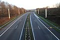
The federal autobahn 8 (abbreviation BAB 8 ) - short form Autobahn 8 or A 8 - is a German autobahn that runs in three sections from the Luxembourg border at Perl via Pirmasens , Karlsruhe , Stuttgart , Ulm , Augsburg , and Munich to Bad Reichenhall on the border leads to Austria . It is one of the most important east-west connections in Central Europe.
Large parts of the route were built and completed during the National Socialist era . As the traffic increased, the old route no longer met the requirements, which is why traffic often jammed. Particularly on the slopes of the northern Black Forest between Karlsruhe and Stuttgart and on the ascent of the Alb between Stuttgart and Ulm, the steep and winding route and a too narrow lane in combination with bad weather often led to serious accidents, which is why the motorway between Karlsruhe and Munich is almost continuous today was renewed. However, the route from Munich to the Austrian border still follows the pre-war situation.
The A 8 has had its number since the introduction of today's numbering system in 1975; In the previously designed numbering system, which was not introduced, the section from Perl to Pirmasens was assigned the number 172, the unrealized section from Pirmasens to Karlsruhe the 76 and the section from Karlsruhe to Bad Reichenhall the 21.
course
Luxembourg border to Pirmasens
The federal motorway 8 begins as a continuation of the Luxembourg A 13 at the Viaduct of Schengen . It leads out of the Moselle valley , past Perl , along the border with France that runs directly on the western edge of the road and through the Pellinger Berg tunnel . From Merzig it follows the Saar until shortly before Saarlouis . At the Saarlouis motorway triangle , the motorway changes lanes, as the straight lanes lead to the BAB 620 to Saarbrücken . It runs past Dillingen , with some large industrial companies ( Dillinger Hütte , Ford works) being connected. At the Saarbrücken junction , the BAB 1 (section Kelberg –Saarbrücken) is crossed and a few kilometers further at the Friedrichsthal triangle , the BAB 623 branches off , also into Saarbrücken city center.
After Friedrichsthal, the Sulzbachtal is crossed and the city of Neunkirchen (Saar) is connected via several connection points. Then the BAB 6 (French border - Mannheim ) crosses at the Neunkirchen junction . The BAB 8 then continues through the Bliestal and changes shortly before Zweibrücken from Saarland to Rhineland-Palatinate . This is followed by a course through the city center of Zweibrücken and an ascent to the Sickinger Höhe near Contwig . Shortly before Pirmasens , the first section of the BAB 8 ends at the Pirmasens-Winzeln junction and continues seamlessly as BAB 62 . Originally, a motorway triangle was planned at this point, after the further construction through the Palatinate Forest to Karlsruhe was abandoned, a lane separation was available at this point as an advance payment, in which a junction was built.

On the Schengen Viaduct, the motorway crosses the Moselle and thus the border between Germany and Luxembourg

For a long time, only one directional carriageway was completed near Merzig

Curvy route between Saarlouis and Neunkirchen
The (meanwhile no longer existing) wire rope network over the roadway near Heusweiler


Karlsruhe to Munich
The next section of the BAB 8 begins at the Karlsruhe motorway triangle in Baden-Württemberg as a six-lane route that branches off from the BAB 5 . Right at the beginning, the route climbs into the heights on the northern edge of the Black Forest to Pforzheim . It crosses the Enz Valley and leads through the Heckengäu into the Stuttgart region . At the Leonberg motorway triangle , the A 81 branches off in the direction of Würzburg , the subsequent section to the Stuttgart motorway junction picks up traffic on both the BAB 8 and the BAB 81 and has eight lanes. At the Stuttgart junction , the BAB 81 continues towards Lake Constance and the short BAB 831 to Stuttgart city center. The following connection point Stuttgart-Degerloch creates a further connection to Stuttgart, shortly afterwards the Stuttgart airport and the new state fair are reached.
At Wendlingen the Neckar is crossed and behind Kirchheim unter Teck the two-stage ascent to the Swabian Alb begins . The first step is climbed between Aichelberg and Gruibingen with some bridge structures, the second step between Mühlhausen and Hohenstadt leads with separate lanes in two separate valleys to the now sloping Alb plateau to Ulm . After Ulm, the BAB 7 ( Flensburg - Hamburg - Kassel - Würzburg - Füssen ) is crossed at the Ulm / Elchingen junction . Then the Danube is crossed at Leipheim and you are in Bavaria. Through the hilly landscape of the Western Woods Nature Park (southern edge of the wooden angle ) is after Schmutter - sink the Lech Valley ( plateau ) and the city of Augsburg reached. The Lech is crossed at Gersthofen and the steep slope of the Lechleite rises. Before the hilly landscape of the Wittelsbacher Land is crossed again until the first suburbs in the Munich gravel plain follow. At the Munich-Eschenried motorway triangle , a branch of the A 99 branches off and the BAB 8 becomes four-lane again, shortly afterwards at the Munich-West junction , the BAB 99, the Munich Ring, is crossed. Finally the motorway section ends at the Obermenzing roundabout.

Completely renewed route near Karlsbad

The Enztal crossing east of Pforzheim is currently the last section of the A 8 between Karlsruhe and Stuttgart that has not yet been renewed

Bosch parking garage above the motorway at Stuttgart Airport

Six-lane ascent or descent from the Alb on the Aichelberg

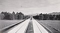
Separate directional lanes on the Albaufstieg between Mühlhausen and Hohenstadt

Lech crossing near Augsburg
.jpg)

_at_Airport_Stuttgart_at_15_March_2015_-_panoramio.jpg)


Munich to the Austrian border
On the southern outskirts of Munich, the BAB 8 starts again at the intersection of Rosenheimer Straße and Mittlerer Ring in the Ramersdorf district . The initially six lanes already narrow to four lanes after around two kilometers. Shortly afterwards, it crosses under the former Neubiberg air base in a 327 meter long tunnel. This tunnel was not built until the Olympic Games and replaced the traffic lights originally used there .
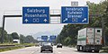
At the Munich-Süd junction , the A 8 takes traffic from the A 99 and the federal highway 13 ( federal highway 995 ) and leads to the Hofoldinger Forst junction first seven lanes (four lanes to the south and three to the north), then six lanes via Holzkirchen and the Irschenberg to the Inntal motorway triangle near Rosenheim , where the BAB 93, known as the Inntal motorway , branches off towards Kufstein , Innsbruck and the Brenner Pass . After the subsequent crossing of the Inn , the BAB 8 continues in four lanes to the east, along the south bank of the Chiemsee , in a very hilly stretch with sometimes unusual curve radii to Bad Reichenhall, where the Saalach Bridge reaches the federal border. On the Austrian side, just before Salzburg , the motorway splits at the Salzburg junction into the Austrian West motorway (A 1) to Vienna and the Tauern motorway (A 10) to Carinthia.

Heavy traffic A 8 near Holzkirchen (Upper Bavaria)

Alpine panorama on the Irschenberg
Triangle Inntal: Old ...

... and new signposts

Walserberg border crossing

.jpg)
.jpg)
.JPG)

Sections as a European route
The following European roads run along the BAB 8:
- E 29 : Luxembourg border triangle Saarlouis
- E 52 : Triangle Karlsruhe – Triangle Munich-Eschenried, Kreuz München-Süd – Austrian border
- E 45 : Kreuz München-Süd – Dreieck Inntal
- E 60 : Triangle Inntal – Austrian border
Vacant lots
Pirmasens – Karlsruhe
From Pirmasens, the A 8 is interrupted for the first time. The gap filling through the Palatinate Forest to Karlsruhe / Ettlingen was never built for various reasons. Instead, the B 10 from the end of the motorway in Pirmasens to Landau in the Palatinate was or will be expanded with two to four lanes as a replacement and largely free of intersections.
From Landau, the A 65 and then the Karlsruhe Südtangente (from the Rhine bridge Maxau to the Karlsruhe-Mitte junction of the A 5 ), which has again been developed as a continuous four-lane urban motorway , closes the remaining gap. It remains to be seen whether the B 10 in this area will be relocated to the north of Karlsruhe via a second Rhine bridge and a north bypass, connecting to the A 5 at the Karlsruhe-Nord junction and then returning to the A 8 at the Karlsruhe motorway junction .
Although this route is the shortest between Saarland and central and southern Baden-Württemberg , long-distance traffic with the destination Karlsruhe is guided on the signs from the Neunkirchen junction via the A 6 , A 61 and A 5 through the Rhine-Neckar region .
City of Munich
In Munich, the A 8 is interrupted. The A 99 motorway ring , which is only closed to the north and east of Munich , provides a direct motorway connection to the third section towards Salzburg .
The bypass from the Munich-West motorway junction or the Munich-Eschenried motorway triangle via the A 99 East to the Munich-South junction is longer, but a continuous six- to eight-lane motorway. The connection via A 99 West / A 96 / Mittlerer Ring / A 995 is shorter, but includes city streets that are at least free of intersections after the Luise-Kiesselbach tunnel has been built .
history
For the most part, the course of today's Federal Highway 8 is based on plans that originate from the Weimar Republic and were built during the Nazi era . Only the Saarland section has been built since the 1970s, on the one hand to create a motorway connection to Luxembourg , on the other hand to create a - ultimately never realized - continuous motorway between Saarland and southern Germany.
1927 to 1933 - First plans
HaFraBa network plans
Even during the Weimar Republic , the HaFraBa e. V. a network of highways that were reserved for motor traffic. While the plans initially only referred to a route from Hamburg via Frankfurt to Basel and on through Switzerland to Italy , a network of long-distance roads extending across Germany was already drawn in a network plan by Robert Otzen from 1927. Routes from Karlsruhe via Stuttgart to Munich and from Munich to Salzburg were also part of this planning. A network plan by Theodor Golder from 1930, which was intended as an extension to the HaFraBa trunk line, also showed these road connections.
A connection from Saarbrücken via Landau to Karlsruhe was also planned, according to the plan from the 1970s. A continuation from Saarbrücken to Luxembourg was not listed.
Road planning in Württemberg
Due to the strong increase in motorized individual traffic, which at that time still had poorly developed roads with numerous local passages, in Württemberg , as before in the Rhineland , which had a similar traffic situation , the plans for the motor vehicle road from Karlsruhe via Stuttgart to Munich were more in focus. A western extension to Paris and an eastern extension to Vienna were also planned. True-to-scale models were created for the 76 km long Stuttgart – Ulm section before the route was determined at the end of 1933, when the NSDAP was already in power.
The crossing of the Swabian Alb proved to be problematic . Initially, the plan was to cope with the difference in altitude through two tunnels with a total length of 4 km. For this purpose, the motorway from Kirchheim should be led via Nabern into the Neidlinger Tal , before a tunnel under the Reußenstein and then the motorway should reach the Upper Fils valley. After a 65 m high viaduct over the Fils , another tunnel would have followed, through which the Alb plateau would have been reached at Hohenstadt . Since at that time there was no experience of building longer tunnels and such would have been very expensive, the planning was changed later. Now the motorway at Bissingen should lead up the Randecker Maar and through a tunnel to the Alb plateau. In contrast, the planning that was drawn up in June 1934 and finally implemented completely dispensed with tunnels, as it ran much further north.
1934 to 1945 - Reichsautobahn construction
Although the detailed plans of the HaFraBa association in the Reichstag initially met with broad rejection on the part of the NSDAP (“luxury streets of the rich”), the National Socialists who came to power on January 30, 1933 nevertheless decided to carry out these motorway plans. The main reason for this was the promise to curb the high unemployment at the time by building the highways. Hailed by the National Socialists as a “world first”, only the HaFraBa plans, which had been ready for construction since 1932, were implemented for their construction and the Cologne – Bonn motorway, which opened a year earlier, was degraded to a country road. A model was also taken from Benito Mussolini's fascism , during whose reign the first roads reserved for motor traffic ( Autostrada dei Laghi ) were opened as early as 1924 . The HaFraBa association was renamed GEZUVOR ("Society for the preparation of the Reichsautobahn eV") after the seizure of power, before work on the first Reichsautobahn between Frankfurt am Main , Darmstadt and Mannheim officially began in September 1933 .
Munich – Salzburg


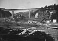
In addition to the Reichsautobahn Frankfurt – Mannheim as part of HaFraBa planning, the route from Munich to Salzburg was the second major prestige project of the National Socialists - it was supposed to open up the Munich area with Tegernsee , Alps and Chiemsee for tourism, as well as the traffic situation through the connections to the subordinate road network improve in southeast Bavaria. As early as autumn 1933, earthworks were carried out near Taufkirchen in preparation for the construction of the 145 km long Munich – Salzburg route, after the Supreme Construction Management Munich was established on September 1, 1933 . However, the groundbreaking and official start of construction did not take place until March 21, 1934 during a large-scale celebration in the presence of Adolf Hitler . This represented the main event for the opening of the so-called Second Labor Battle, as Reichsautobahn 26 , at which 22 positions in the German Reich simultaneously broke ground for new Reichsautobahn routes.
When planning the route, an elaborate route with steep inclines, slopes and numerous curves was deliberately chosen, which had been commissioned by the General Inspector for German Roads, Fritz Todt . The "car wandering" that was so possible was part of National Socialist propaganda, which combined the achievements in road construction with a conscious staging of the "German homeland". As a “panorama motorway”, the route was divided into five sections: After driving through the extensive forest area south of Munich, the driver has an impressive view of the Alps. Leading in the immediate vicinity of the northern edge of the Alps, the motorway then swivels to the Chiemsee, along whose southern bank it runs. After leaving the region around the Chiemsee, the route continues along the Alps to Salzburg. In order to give motorists a panoramic view of the Alps, the motorway was led over the 700 m high Irschenberg with a route that was up to 7% steep . In addition, a curved line with curves was accepted in order to adapt the route to the surrounding landscape.
Since all structures on the route were erected quickly in a simple style, the motorway could be completed quickly: The first section between the end of the motorway in Munich-Ramersdorf and Holzkirchen was opened to traffic on June 29, 1935. The section to Weyarn followed in January 1936, to Achenmühle in May 1936 and to Siegsdorf in August 1936 . The most outstanding structure is the Mangfall Bridge near Weyarn, which was completed next to the Main Bridge near Frankfurt as the second large bridge structure on the Reichsautobahn. On the south bank of the Chiemsee in 1937 near Bernau , the Rasthaus am Chiemsee was the first service area on the Reichsautobahn.
The motorway between Siegsdorf and Bad Reichenhall was opened in 1937. Since a low traffic volume was forecast for this section, this section was carried out with a reduced cross-section of the roadway and narrower curve radii. On the banks of the Chiemsee, a rest area with a gas station and boat dock was also created, the Rasthaus am Chiemsee .
A continuation from Bad Reichenhall over the Austrian border to Salzburg was not included in the planning at the beginning (the route was given as Munich-Reichs border ), after the connection of Austria on March 12, 1938, the continuation was pushed through Salzburg to Vienna . By 1941 the motorway was opened to traffic until shortly after Salzburg, before construction work ceased due to the Second World War . Shortly after the border with Austria, a motorway triangle was created for a Reichsautobahn route to the south in the direction of Villach , which reached as far as Grödig (junction Salzburg-Süd ). It was not until the 1960s that the route in restored Austria was completed as the West Autobahn (A1).

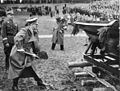
Opening ceremony for the groundbreaking ceremony near Unterhaching in 1934

Monument at kilometer 0.0, the beginning of the former Reichsautobahn Munich – Salzburg near Ramersdorf, archived in the Ida-Seele archive
The Mangfall Bridge, around 1936
Former Reichsautobahn between Chiemsee and Siegsdorf approx. 1936, archived in the Ida-Seele archive
Groundbreaking for the continuation to Austria on the Walserberg , 1938


Karlsruhe – Munich
Like the Munich – Salzburg section, the Reichsautobahn from Karlsruhe via Stuttgart, Ulm and Augsburg to Munich was one of the 22 new autobahns that arose as part of the Second Labor Battle. On January 1, 1934, the Supreme Construction Management for Motorways (OBK) Stuttgart was established. The groundbreaking for the Stuttgart – Ulm section ( route 43 ) took place on March 21, 1934 near Echterdingen . For most of this route, the route was already established with the HaFraBa planning in the early 1930s. On the Albaufstieg behind Kirchheim , for which various variants had been planned, the route via Aichelberg was chosen - it did not contain any tunnels, but a long viaduct, which turned out to be the most cost-effective option.
The first two finished sections between Karlsruhe and Munich were between the Stuttgart-Degerloch and Wendlingen (then Unterboihingen ) junctions and between the Ulm-West and Ulm-East junctions . Both routes with a total length of 16 and 5 km respectively were opened to traffic on September 27, 1936 - at the same time as numerous other sections of the route in the Reich, including the 1000th kilometer of the Reichsautobahn, which was celebrated for propaganda purposes. Until the eastern continuation of the line from Unterboihingen to Kirchheim / Teck was finished, it took until August 28, 1937. Two months later, the Kirchheim / Teck – Ulm-West line was also completed on October 30, 1937 - here was in the west Due to the difficult terrain, only the northern lane (Ulm – Stuttgart) along the Drackensteiner slope was initially released. This motorway stretch, known as the Albaufstieg, featured the first motorway tunnel in Germany with the 60 m long Nasenfels tunnel and the 781 m above sea level. NN is the highest point of all Reichsautobahn built before the Second World War. At the same time as the complex route from Kirchheim / Teck to Ulm-West, the section from the Ulm-East junction to Leipheim was also created . This area on the Danube Bridge Leipheim a striking reinforced concrete arch bridge that, Danube crossing. The line from Leipheim to Limbach near Burgau was completed on September 14, 1937.
On December 17, 1937, the western route from Stuttgart-Degerloch to the Stuttgart-Südwest junction (at today's Stuttgart motorway junction ) was opened. At this point in time, with the simultaneous opening of other motorway sections, 2000 km of Reichsautobahn had already been completed. In March 1938, a motorway filling station opened on the south side of the Stuttgart-Degerloch junction.
The second lane in the direction of the Albaufstieg was opened to traffic on July 29, 1938 between Aichelberg and Mühlhausen . In this area, the Aichelberg Viaduct was a very striking bridge structure, which has a length of 940 m and a longitudinal incline of 7%. This section of the motorway was thus one of the steepest sections of the Reichsautobahn ever to be realized. Although the construction of the second lane between Mühlhausen and Hohenstadt began, which runs up the upper Filstal at a distance of about two kilometers west of the existing Stuttgart lane and then tunnels under the Lämmerbuckel, the Second World War initially prevented this lane from being opened to traffic.
Most of the remaining sections of the west and east of route 42 connecting Reichsautobahn routes Karlsruhe – Stuttgart ( route 36 ) and Ulm – Munich ( route 43 ) were completed at the end of 1938. On November 5, 1938, the first section west of Stuttgart opened between the Pforzheim- East and Leonberg junctions . On December 10 of the same year, the Limbach – Munich – Obermenzing (93.3 km) and Karlsruhe – Pforzheim-West triangle (22.2 km) sections followed. While the former closed the gap between Stuttgart and Munich and connected Augsburg to the Reichsautobahn network, the Pforzheim bypass was missing after the latter was completed. It was not until November 7, 1939, when traffic was opened between Pforzheim-West and Pforzheim-East, the motorway from Karlsruhe to Munich was continuously passable. Rest areas near Gruibingen and Leipheim opened along the route in the course of 1939 .

Reichsautobahn on the steep slope of the Alb by Michael Zeno Diemer

Danube bridge near Leipheim


Second World War
With the outbreak of World War II in September 1939, motorway construction in the German Reich came to a standstill, as most of the workers were withdrawn from the construction sites. Up until 1943, construction work continued on some routes with an interruption with reduced workload using forced labor (mostly concentration camp prisoners and prisoners of war ), but from April 1943, due to a decree, there was no continuation of the construction work and therefore no route openings.
The Karlsruhe – Munich and Munich – Salzburg routes were made fully passable before the Second World War, only the second carriageway of the Albaufstieg was not completed. The Lämmerbuckeltunnel, which was started in 1937 and completed in 1942, along this roadway was converted into a bomb-proof bunker for armaments assembly during the war; aircraft engines from Daimler-Benz , among others, were assembled here. At least a section between Augsburg and Munich served as a parking space for aircraft that were just completed (Me-262, Ju-188, Ju-288, Me-410, He-177, He-219). These could then start work directly from the motorway.
In the last days of the war, the Wehrmacht blew up numerous motorway bridges to make it more difficult for the Allies to advance . Along the Karlsruhe – Munich route, the Lech Bridge near Augsburg, the Danube Bridge near Leipheim, the Aichelberg Viaduct, the Franzosenschlucht Viaduct and the Drachenloch Bridge on the Albaufstieg as well as the Sulzbach Viaduct near Wendlingen fell victim to the blasting, making sections of the motorway impassable. Between Munich and Salzburg, Waffen SS troops blew up the Mangfall Bridge near Weyarn.
post war period

With the surrender of the Wehrmacht and the ensuing end of World War II in Europe, US troops occupy southern and western Germany. In June 1945 France received parts of the British and American occupation zones and thus became an independent occupying power. In addition to the current federal state of Rhineland-Palatinate , which emerged from the southern part of the Prussian Rhine province , parts of the Prussian province of Hesse-Nassau and the People's State of Hesse and the former Bavarian Palatinate , France received an area in the south of the states of Baden and Württemberg . For strategic reasons, the border with the American northern part of the two countries followed a line south of the Karlsruhe – Munich motorway. On the one hand, the industrialized north of Baden and Württemberg was under American control; on the other hand, there was a connection to the rest of the American regions via the Reichsautobahn network. The country emerged from the French southern Baden and Württemberg-Hohenzollern , from the American northern part of Württemberg-Baden .
Most of the war damage along the route was only temporarily repaired. Only after the establishment of the Federal Republic in 1949, with which the former Reichsautobahn in the area of the three western occupation zones came into the property of the federal government, the final restoration of the blown-up bridges followed. From 1946 to 1951, parts of today's autobahn near Karlsruhe were used as a racing track, and prominent racing drivers such as Karl Kling and Hans Stuck took part in the Karlsruhe triangular race. The states of Baden, Württemberg-Baden and Württemberg-Hohenzollern united in 1952 after a referendum to form the new state of Baden-Württemberg .
The Mangfall Bridge in the section between Munich and Salzburg was initially made passable to a limited extent with a temporary superstructure from 1946 to 1948, before a completely new construction of the superstructure was carried out in 1958 using the remaining pillars.
The Sulzbach Viaduct near Denkendorf was rebuilt from 1950 to 1952, the less destroyed Aichelberg Viaduct a few kilometers further east was opened to traffic again in 1951.
Up until the 1950s, the section in the Enz Valley east of Pforzheim was made with cobblestones from the time of the Reichsautobahn construction. An asphalt surface was not installed until 1956 and 1960.
In 1958, Germany's first motorway church was consecrated at the Adelsried junction west of Augsburg .
Completion of the Alb ascent
The second lane of the Albaufstieg along the Filstal (direction lane Munich / Ulm) had already begun under the National Socialists and was closed to traffic due to the use of the Lämmerbuckeltunnel as an assembly hall for aircraft engines. The tunnel, bridge piers and the cleared route were already in place when work on completing the carriageway began in 1955. In May 1957, the line was opened to traffic, which means that after almost 20 years it was no longer possible to operate oncoming traffic on the Stuttgart lane on the Drackensteiner slope.
Continuation through Munich

In the Munich urban development plan of 1963 it was still planned to close the gap in the urban area. The highway would be in terms of a car-friendly city by today " By overlooking Park " in Pasing-Obermenzing and south of the Nymphenburg Park was performed would, then on the site of today's popular West Park , the south to today's A 95 solid A 92 crossed and would be south of Theresienwiese continued on the current route of the A 995 .
Introduction of motorway numbering
On January 1, 1975, a new, uniform numbering scheme was introduced for the motorways in the Federal Republic of Germany and West Berlin. Initially, only internally managed numbering was used and only the numbers of the European roads running along the route were indicated on the signposts, but the new national numbering was brought forward. A system previously described in the requirement plan for federal trunk roads 1971–1985 , which assigned the single-digit numbers A 1 to A 6 to the routes branching off from the Berliner Ring , could not prevail , even with regard to the German division that still existed at the time . The number A 8 was not provided in this system, after the one-digit numbered motorways leading away from Berlin, the A 10 , consisting of the north-south motorway from Flensburg via Hamburg , Hanover and Frankfurt am Main to Basel , was to follow. In this system, today's federal motorway 8 bore the numbers A 21 (Karlsruhe – Munich – Salzburg) and A 172 (Luxembourg – Pirmasens).
The system ultimately used assigns the nationally important motorways, mostly routes from the HaFraBa planning, single-digit numbers - odd numbers for those running in north-south direction, especially in east-west direction, ascending from north to south or west to east. The number 8 was assigned to the southernmost west-east connection between the Luxembourg and Austrian borders. At that time it was still planned to establish a motorway connection through the Palatinate Forest between Pirmasens and Karlsruhe. The western Munich city entrance of the A 8 was planned as the A 998 from the Munich-West intersection , the southern city entrance from the Munich-South intersection as the A 994.
Construction of the Saar line

The section between the Luxembourg border and Pirmasens goes back to the planning of long-distance roads in the autonomous Saarland in the 1950s, when an efficient connection between Luxembourg and Saarbrücken was planned for the first time under the designation F 101 . After the Saarland was incorporated into the Federal Republic of Germany in 1957, plans ran as Bundesstraße 406 .
The first section of the predecessor of today's autobahn was built in 1959 together with the Saarbrücken– Mannheim autobahn, which was then completed (today's BAB 6 ). This so-called Limbach feeder initially served as a driveway to the autobahn from the direction of Homburg , but from 1961 was gradually extended as federal road 10 in a westerly direction to Spiesen and in an easterly direction to Einöd , giving the cities of Neunkirchen and Zweibrücken an efficient road connection. It was planned to expand the motor road to two lanes, the planning approval decision for this was issued in 1965. In 1971 the line was then expanded to a length of 20 km with two lanes and four lanes and was upgraded to the A 170 motorway in the course of this expansion .
Until 1973 the A 171 was extended in a westerly direction to Friedrichsthal , then in 1975 in an easterly direction to Zweibrücken . The striking Sulzbachtalbrücke at the western end of the expansion was built between 1966 and 1969. In the same year, with the renumbering of the German motorway network, the A 171 was added to the federal motorway 8 (section Saarbrücken-Karlsruhe). 1979 followed another 13 km from Zweibrücken to Walshausen .
The first section between Merzig and Saarlouis on the route of the federal highway 406 was created in 1978, when a 2 km long road was built along a one-way carriageway near Merzig- Mechern . In 1980, this section was supplemented by the second carriageway, expanded by just under 4 km to the south until shortly before Rehlingen and upgraded to federal motorway 8. A year later it was followed by 2 km north to the Merzig- Schwemlingen junction .
Also in 1981 the first section between Friedrichsthal and Saarlouis between Saarwellingen and Schwalbach was opened and the extension from Walshausen to Pirmasens opened. The last-mentioned route established a trunk road connection between Saarbrücken and Pirmasens and at the eastern end southwest of Pirmasens already contained preliminary payments for a motorway triangle with a continuation in the direction of Karlsruhe. The completed lanes were intended as connecting ramps from Zweibrücken to the BAB 62 in the direction of Trier , and a bridge was also built to cross the continuation in the direction of Karlsruhe. The construction of the 7.4 km long line cost around 76 million DM.
The extension from Merzig to the Luxembourg border near Perl began in the 1980s and was initially carried out with only one lane. The first approximately 6 km long section between the Merzig-Schwemlingen and Merzig-Wellingen junctions was completed in 1984 on the northern lane with two lanes in the west and one in the east, in order to be able to overtake on the uphill stretch from the Saar valley into the Saargau . The following 11km long section of Wellingen continue until the junction Perl-Borg was completed in 1997 and included on the most part also just a finished carriageway - an exception is the already since the beginning in two tubes with vehicle traffic and approximately 600 m long tunnel Pellinger Berg directly east of Wellingen. In 2002 a further 3.5 km were completed up to the Perl junction, which is located directly on the Luxembourg border. One year later, in 2003, the cross-border connection was completed with the viaduct from Schengen over the Moselle , which forms the border river to Luxembourg here, and at the same time the second lane was opened to traffic between Perl and Merzig-Wellingen.
The last section between the Merzig-Wellingen and Merzig-Schwemlingen junctions, which has not yet been upgraded to motorway standards, which includes two viaducts and an unmanaged rest area, was only expanded in the mid-2010s. In particular, commuter traffic from the Saarland to Luxembourg caused increasing traffic on this section after the completion of the BAB 8 and the Luxembourg A 13. The federal funds for the full expansion planned as an urgent requirement since the Federal Transport Infrastructure Plan 2003 were released on July 31, 2014. In addition to the construction of two new bridge structures and the thorough repair of the existing directional carriageway, the expansion of the Weiler Süd rest area was also part of the expansion. In January 2015, clearing was carried out along the route before the first construction work began in April of the same year. In mid-2016, the new carriageway was largely ready, so that the renewal of the existing carriageway could begin. In August 2018, the two-lane route, now fully completed with a motorway cross-section, was opened.
List of traffic clearances
| section | year | km |
|---|---|---|
| Border D / L - AS Perl | 2003 | 0.9 km |
| AS Perl - AS Perl-Borg | 2002, 2003 | 3.5 km |
| AS Perl-Borg - AS Merzig-Wellingen | 1997, 2003 | 11.1 km |
| AS Merzig-Wellingen - AS Merzig-Schwemlingen | 1984, 2018 | 6.2 km |
| AS Merzig-Schwemlingen - AS Merzig | 1981 | 2.2 km |
| AS Merzig - Mechern | 1978, 1980 | 1.8 km |
| Mechern - Niedmünd | 1980 | 4.3 km |
| Niedmünde - Rehlingen | 1985 | 4.4 km |
| Rehlingen - AS Dillingen-Mitte | 1986 | 1.6 km |
| Saarwellingen - Schwarzenholz | 1981 | 6.7 km |
| Schwarzenholz - Cross Saarbrücken | 1982 | 11.1 km |
| Triangle Friedrichsthal - AS Elversberg | 1972 | 3.6 km |
| AS Elversberg - AS Neunkirchen / Spiesen | 1973 | 2.2 km |
| AS Neunkirchen / Spiesen - AS Einöd | 1971 | 19.6 km |
| AS Einöd - AS Zweibrücken | 1975 | 4.9 km |
| AS Zweibrücken - AS Walshausen | 1979 | 12.5 km |
| AS Walshausen - AS Pirmasens | 1981 | 4.9 km |
| Triangle Karlsruhe - AS Pforzheim-West | 1938 | 22 km |
| AS Pforzheim-West - AS Pforzheim-Ost | 1939 | 9 km |
| AS Pforzheim-Ost - Kreuz Stuttgart | 1938 | 34 km |
| Cross Stuttgart - AS Stuttgart-Degerloch | 1937 | 7 km |
| AS Stuttgart-Degerloch - Unterboihingen | 1936 | 16 km |
| Unterboihingen - AS Ulm-West | 1937 | 4.9 km |
| AS Ulm-West - AS Ulm-East | 1936 | 5 km |
| AS Ulm-Ost - Limbach | 1937 | 25 km |
| Limbach - Munich-West | 1938 | 93 km |
| AS Holzkirchen - AS Traunstein / Siegsdorf | 1936 | 74 km |
| AS Traunstein / Siegsdorf - AS Bad Reichenhall | 1937 | 22 km |
| AS Bad Reichenhall - border D / A | 1938 | 2 km |
Traffic volume
Especially around Stuttgart, the BAB 8 has a constantly high volume of traffic. In addition to the BAB 81 , it is one of only two supraregional motorway routes in the catchment area of the state capital, because most of the motorway projects were abandoned in the 1970s or only partially implemented as a two-lane motorway. Accordingly, the section on which both motorways run together on the same route is the most heavily used motorway section in Baden-Württemberg. In addition to the eight-lane expansion of this section, a traffic control system and a temporary hard shoulder release were set up. Further measures are being planned.
The motorway is also heavily used south of Munich, on the one hand by holiday traffic to Austria and Italy , on the other hand by commuters from the Munich area. Here the route was expanded to three to four lanes in each direction in accordance with the volume of traffic in the 1970s and 1980s.
Sections with DTV of more than 100,000 vehicles per day 2015
| section | DTV |
|---|---|
| Heimsheim - Rutesheim | 111,600 |
| Rutesheim - Leonberg-West | 108,500 |
| Leonberg-West - Leonberg triangle | 117,500 |
| Triangle Leonberg - Leonberg-Ost | 140,500 |
| Leonberg-Ost - Kreuz Stuttgart | 154,000 |
| Cross Stuttgart - Stuttgart-Möhringen | 101,900 |
| Stuttgart-Möhringen - Stuttgart-Degerloch | 117,000 |
| Stuttgart-Plieningen - Esslingen | 100,000 |
| Dachau / Fürstenfeldbruck - triangle Munich-Eschenried | 103,500 |
| Kreuz München-Süd - Hofoldinger Forst | 117,400 |
| Hofoldinger Forest - Holzkirchen | 106,900 |
expansion
While the Saar section between Perl and Pirmasens has been expanded according to the volume of traffic since the completion of the second lane near Merzig in 2018, a complete expansion to six to eight lanes between the Karlsruhe motorway triangle and the Munich / Eschenried triangle and from the Munich-Süd junction to Federal border can be reached at Bad Reichenhall. As recently as the early 2000s, most of the sections that have meanwhile been expanded or are being expanded were designed as four-lane routes without hard shoulder, with shortened or nonexistent entry and exit lanes as well as steep inclines and declines, which together with the high volume of traffic lead to numerous accidents led.
Perl - Pirmasens
The Saarland and Rhineland-Palatinate section of the BAB 8 has been under traffic for the most part with four lanes since the completion of both lanes between Perl and Merzig. On the ascent of the Moselle near Perl there is a third additional lane for the direction of Pirmasens, between the Friedrichsthal motorway triangle and the Neunkirchen / Spiesen junction, the motorway has six lanes. Between Neunkirchen and Zweibrücken there are sections of hard shoulder, for example at bridge structures, because the motorway in this area was designed as a motor vehicle and was only upgraded a few years later.
Karlsruhe - Stuttgart
The first plans for a six-lane expansion between the Karlsruhe motorway triangle and the Leonberg motorway triangle date from the 1970s. In the course of the planning for the Saarland line from the Saarland state border through the Palatinate Forest to Karlsruhe, it was planned that this motorway route would lead through the Bienwald , cross the Rhine near Neuburg and cross the BAB 5 south past Karlsruhe near Ettlingen- Bruchhausen. To the east of this, a tour was planned on the northern edge of the Black Forest, south of Pforzheim, before it would meet the existing route from the 1930s near Wimsheim . The existing route between Karlsruhe and Pforzheim would have been given the designation Bundesautobahn 82 (BAB 82) if the Albga line had been implemented according to the 1975 numbering scheme . Due to massive ecological concerns regarding the route, the Albgaulinie project was abandoned in November 1976, instead the six-lane expansion of the existing road was pushed.
It took almost 20 years before the first section on this section of the route was actually extended. After the Wettersbachtalbrücke was replaced by a new building from 1990 to 1993, the expansion began in the mid-1990s, initially between the Karlsruhe motorway triangle and the Karlsbad junction. In this area there is a distinctive uphill / downhill section that leads from the Rhine plain to a plateau on the northern edge of the northern Black Forest. This approximately 7 km long section was completed in 1998. In addition to the relocation of the route at the Karlsbad junction and the redesign of this, a new, unmanaged rest area was created in each direction of travel. The next step was to build almost 9 km between the Pforzheim-West and Pforzheim-East junctions. An additional junction (Pforzheim-Nord) was built in this area, which leads to the B 294 . The eastern end of the expansion is just before the curve on the descent into the Enz Valley, from here to the Pforzheim-Ost junction, the motorway was initially not expanded. This section was completed in 2000.
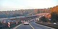
Construction work between Pforzheim and the Leonberg motorway triangle began for the 10.5 km long Heimsheim – Leonberg section in March 2006, after the planning approval decision was concluded in 1997 and the construction of the Neuenbühltal bridge began in 2003. The narrow cross-section without an existing hard shoulder in connection with high traffic loads (over 70,000 vehicles / day in 2005 with a high proportion of heavy traffic) made a thorough expansion necessary, which was carried out in the form of a completely new lane in the alignment parallel to the existing route. On July 26, 2007, traffic in both directions was transferred to a completed new lane so that the demolition of the existing line could begin. In addition, two new junctions were built near Rutesheim and in the western urban area of Leonberg . The Heimsheim – Leonberg section was finally released in September 2008.
The approximately 12 km long section between the Pforzheim service station and the Heimsheim junction was divided into three construction lots (subsections) for the expansion: from the Pforzheim service area to the newly built Pforzheim-Süd junction, from Pforzheim-Süd to Wimsheim and from Wimsheim to the junction Heimsheim. In the northern area, the two new lanes were already completed in October 2007 and the new junction was opened to traffic. The second construction lot between the Pforzheim-Süd and Wimsheim junction was completed a year later on September 11, 2008. The roadway between Pforzheim-Süd and Pforzheim-Nord was completely renovated between July 2008 and August 2009. Between Wimsheim and the Heimsheim junction, expansion to 4.8 km did not begin until after the other two construction lots had been completed in August 2009 in order to avoid too long a construction site. After the clearing work was finished, the construction of the first directional carriageway began, to which the traffic was relocated in August 2010, followed by the construction of the second carriageway. On October 17, 2011, this section was then opened to traffic on both lanes, so that the last section between Pforzheim and Leonberg was completed on six lanes. As of the 2011 planning stage, the plan was to have the entire section between Karlsruhe and Stuttgart expanded to include six lanes by around 2020.

First of all, the section between the triangle Karlsruhe and Karlsbad was developed

Expansion work near Leonberg, 2008

_-_panoramio.jpg)
For the section between the Karlsbad and Pforzheim-West junctions, the planning approval decision was issued on July 6, 2006. The first work was carried out in 2009 with the clearing of the construction site and clearing in the western part of the section. In May 2010 the construction of the 470 m long Pfinztal Bridge near Nöttingen began as an early measure , which was completed in May 2012 after two years of construction. This was built to compensate for an uphill and downhill section of the old route (the so-called Nöttinger Senke ). In September 2011, construction work began on the new carriageway, and at the beginning of 2012, construction of the southern half of the 180 m long Bocksbachtal bridge directly at the western beginning of the expansion section. Since the old autobahn route had steep longitudinal inclines, the new route in the section between Karlsbad and the Klosterwegbrücke was slightly relocated and runs up to 25 meters (Pfinztalbrücke) above it by means of extensive earthworks and engineering structures, at other points up to 15 meters in the cut below the level of the terrain that the old route largely followed. The earthworks for this new route west of the Pfinztal Bridge started in August 2012.
In the area of today's Klosterwegbrücke, the BAB 8 was relocated between 1970 and 1972, also to compensate for an accident-prone uphill and downhill section with a sharp combination of curves (called Nöttinger slope ). In the direction of Pforzheim, the motorway also received an additional lane. The route was retained during the expansion and now also extended to three lanes with hard shoulder in the direction of Karlsruhe, for which the existing superstructure of the Klosterweg Bridge could be extended.

Pfinztal Bridge under construction, October 2011
Bocksbachtal Bridge under construction, October 2013

Movement of traffic from the new to the old lane west of the Klosterweg Bridge, August 2014
New six-lane motorway between Karlsbad and Pforzheim, a few days after completion


Since December 2013, traffic has been gradually relocated to the new, completed carriageway: initially between the Karlsbad and Darmsbach junction on the southern carriageway, so that construction of the northern half of the Bocksbachtal bridge could begin in the route space of the old carriageway. In May 2014, traffic in the eastern area between the Klosterwegbrücke and the Pforzheim-West junction was relocated to the new Karlsruhe carriageway. In September 2014, the north carriageway (direction Karlsruhe) in the remaining area between Darmsbach and the Klosterwegbrücke was completed so that on September 17, initially the direction of Karlsruhe and on September 18, the direction of Stuttgart was relocated to the new route. Since the Pfinztal Bridge was now put into traffic for the first time, the section through the Nöttinger Senke, which was completely renatured, was omitted. With the completion of the second carriageway (direction Karlsruhe west and direction Stuttgart east of the Pfinztalbrücke), the six-lane route was released on June 19, 2015, six months earlier than planned.

Renatured Nöttinger Senke BAB 8, looking towards West / Karlsruhe, opening in 1938 as RAB route 36

Renatured Nöttinger Basin, looking towards East / Stuttgart
Renatured Nöttinger Basin


As of the end of 2019, the last section not yet expanded to six lanes runs between the Pforzheim-Nord junction and the Pforzheim service station. Due to the steep inclines and declines in the Enz Valley , narrow overpasses and underpasses as well as the routing right next to Nieferner and Eutingen housing developments, widening the lane is very complex. The start of construction was originally planned for immediately after the completion of the construction work for the section from Karlsbad to Pforzheim-West, but due to the noise protection concept, construction has not yet started. In the meantime, a solution has been found with regard to noise protection, in which noise barriers , noise barriers , wall-wall combinations up to 18.5 meters high and whispered asphalt were built over the entire length and a 380 meter long enclosure in the Niefern suburb of “Am Enzberg” and Pforzheim / Eutingen to be built. With this 32 million euro package, significant improvements will be achieved for the districts most afflicted by motorway noise.
On November 20, 2014, was planning decision by the regional council adopted Karlsruhe. As a preparatory measure, the overpass of the Karlsruhe – Mühlacker railway line , which was too narrow for a six-lane motorway , was demolished in April 2018 and replaced by a wider new building.
The groundbreaking for the first construction measures (clearing, clearing of the construction site) was carried out on April 28, 2018. The planned start of construction work on the new carriageway is in the second half of 2020.
Stuttgart - Ulm
Six or eight lane expansion triangle Leonberg - Kreuz Stuttgart
The 8 km long section between the Leonberg motorway triangle and the Stuttgart motorway junction is special in that the BAB 81 also runs along this route. After the planned continuation of the route coming from Heilbronn via Leonberg to Gärtringen , where a motorway junction was created as an advance payment, was postponed at the beginning of the 1970s , before the route was finally abandoned in 1985, the decision was made to use the route as BAB 831 The section between the Stuttgart junction and the Gärtringen junction of the BAB 81 is to be transferred. Since then, traffic has in fact been taken up by two motorways on the same route. The resulting high volume of traffic meant that the Leonberg – Kreuz Stuttgart triangle was expanded to six lanes in the 1970s, and an additional lane in the direction of Munich was set up in 1966. The Rohrbachbrücke south of Leonberg, an arched bridge, built between 1936 and 1938, was supplemented from 1976 by a parallel girder bridge for the Karlsruhe carriageway. In 1979 the six-lane section was opened to traffic.
Between 1998 and 2000, due to the further increase in traffic in combination with the relatively steep incline, the Munich lane was extended to four lanes. At the level of the Sindelfinger Wald rest area, which was built in 1996 to replace the rest area at the Stuttgart-Degerloch junction, an arched bridge from the time of the autobahn construction in the 1930s crossed the Rotes Steigle route. Due to the limited clearance profile, the motorway had no hard shoulder in the area of the bridge.
This section was widened again from February to December 2017: The Karlsruhe lane was extended by an additional lane so that four regular lanes are available in both directions, and the Sommerhofen rest area in the direction of Karlsruhe is being extended. Since the Rotes Steigle bridge was too narrow for the full eight-lane expansion , it was replaced by a neighboring new building. On October 15, 2016, the old bridge was blown up during a full closure at the weekend. At the same time as the full closure, a medium-voltage line across the motorway was dismantled. Work on the carriageway began in February 2017. After ten months of construction, the additional lane was opened to traffic on December 21, 2017.

The main lane in the Leonberg triangle has only two lanes per direction of travel

Old (back) and new (front) Rohrbachbrücke near Leonberg
,_Richtungstafel.JPG)

Extension and renovation of the Stuttgart - Aichelberg intersection

The section east of the Stuttgart motorway junction up to the beginning of the ascent of the Alb, as well as the section to the west towards Leonberg, was one of the first to be extended to six lanes along the entire route from Karlsruhe to Munich. First, they started on the sections of the Stuttgart – Stuttgart-Degerloch and Denkendorf – Wendlingen junction. While the six-lane carriageway was extended by around 8 km to the east in the first-mentioned construction phase, thus removing the bottleneck to the B 27 in the direction of Tübingen, in the last-mentioned construction phase three larger bridge structures had to be built over a length of only 4.5 km: between 1980 and In 1982, the bridges over the Denkendorfer Tal, the Sulzbachtal and the Neckar were built as six-lane pre-stressed concrete bridges - the Sulzbach Viaduct was blown up in December 1981, just like its predecessor during World War II, and is now being rebuilt for the third time. In 1982 the two construction phases went into operation in six lanes.
The next step was to continue the expansion work on the 5 km long section immediately west of the Albaufstieg between the Kirchheim (Teck) -Ost and Aichelberg junctions. The expansion lasted from the beginning of 1985 to December 1986. In the course of the expansion, two unmanaged rest areas were built near Aichelberg. When this section was completed, there were still two sections between Stuttgart and Aichelberg that had not yet been widened to six lanes - on the one hand between Stuttgart-Degerloch and Denkendorf, and on the other between Wendlingen and Kirchheim (Teck) -Ost.
The line between Stuttgart-Degerloch and Denkendorf, which also includes the Stuttgart Airport and Esslingen junctions, was expanded in the early 1990s. Since the motorway ran very close to the airport runway and stood in the way of the planned extension of the runway by almost 1 km, it was relocated a few hundred meters further north to a new route in this area. The space gained between the old runway and the motorway made it possible to allocate additional usable space for the airport. In 1993 the motorway on the new route was completed, the expansion work at Stuttgart Airport lasted from 1993 to 1996. The southern branch of the Stuttgart Airport junction was relocated around 2 km to the west for reasons of space and is therefore closer to the terminals.
With the section between the Wendlingen and Kirchheim (Teck) -Ost junctions, also completed in 1993, the continuous expansion of the BAB 8 between Leonberg and Aichelberg was completed that year.
The Stuttgart-Degerloch junction, originally a conventional junction, was expanded into a roundabout by 1965 together with the construction of the adjacent large housing estate Fasanenhof , through which all connections between the autobahn and the B27 were made. With the B 27 to Tübingen , which has been expanded like a motorway since 1979 , additional connecting ramps were created, via which the Stuttgart motorway service station on the south side could be reached from all directions . Due to the shape of the long roundabout, the junction was known as the Echterdinger Ei . The service area was closed in December 2000, because space constraints prevented the necessary expansion, which is why the Sindelfinger Wald service area between Leonberg and the Stuttgart junction opened as a replacement in 1996 . The junction itself was converted from March 2002 to December 2003 into a motorway junction with direct connections without crossing the individual routes.

With the relocation of the Stuttgart exhibition center from Killesberg to Stuttgart Airport ( Neue Landesmesse Stuttgart ), construction of the new exhibition center began in September 2004 on an area between the motorway, the B 27 and the airport terminals. In the course of this new building, another motorway junction was built in the direction of Karlsruhe compared to the southern part of the former Stuttgart-Airport junction (now Stuttgart-Airport / Messe ), which was relocated in 1993 and is connected to the preceding Stuttgart-Degerloch junction with an additional parallel lane. The former northern part of the airport connection, which only existed in the direction of Karlsruhe, was renamed Stuttgart-Plieningen . A multi-storey car park was built across the motorway in the area of the Stuttgart-Airport / Messe junction.
After a semi-junction in the direction of Munich was built around 1.7 km west of the Esslingen junction in 2009, four lanes are effectively available in this short section, as the entry and exit lanes merge - so the backlog, which often leads to accidents, was able to reach the Autobahn to be avoided.
On December 19, 2017, the road construction administration of the state of Baden-Württemberg submitted a feasibility study on the six-lane expansion between the Sindelfingen Ost junction and the A 8 / A 831 motorway junction to the Federal Ministry of Transport for further coordination. The study also includes an eight-lane expansion of the A 8 in the vicinity of the motorway junction. The total costs of the renovation and expansion measures are estimated at 90 million euros.
Expansion on the Aichelberg
The section between the Aichelberg and Mühlhausen junctions represents the first stage of the Alb ascent from the central foothills of the Alb to the plateau of the Swabian Alb . During construction in the 1930s, due to Nazi propaganda, emphasis was placed on staging the surrounding landscape from the point of view of the driver laid, which caused an unusual and indirect route. The ascent originally began with a roughly 900 m long viaduct, which, in addition to the longitudinal incline, also had a relatively narrow right-hand bend. At the eastern end of the viaduct there was a left curve with lanes at different heights on the Turmberg , which enabled a broad view of the foothills of the Alb, before a very narrow combination of curves and a viaduct over the Franzosenschlucht followed. Then the first stage of the ascent was reached at Gruibingen .
Since around the 1970s, the four-lane route without hard shoulder had become the focus of accidents due to the steep inclines and declines of over 7%, especially for trucks whose brakes fail when driving downhill, the route on the Aichelberg Viaduct developed into a fatal trap. In the course of the six-lane expansion between Aichelberg and Gruibingen, it was therefore decided to build a new route that has both a lower incline and fewer curves.
The extremely complex construction of the new motorway began with clearing work in 1985: Instead of the already dilapidated viaduct, a dam was raised, which moved the motorway away from the village of Aichelberg. A gigantic construction pit was excavated, with a green bridge around 100 m long, designed as a tunnel, creating a connection between the natural areas separated by the cut. During the last construction phase, from April 1988 traffic was provisionally routed over this structure. Two new viaducts were built, which made a more direct route possible. The developed section with a maximum of 5.2% longitudinal incline ends at the level of the Gruibingen service area.
The transfer of traffic from the old to the new lane was carried out in two phases in 1990: First, from July 8, 1990, traffic was moved to the southern Munich lane. At the end of 1990 the other lane was finally released, completing the expansion. The demolition work on the Aichelberg Viaduct lasted until 1993. The old Franzosenschlucht Viaduct was blown up in May 1992.

Former route on the Albsaufstieg with Aichelberg Viaduct, 1983
New six-lane routes on the Aichelberg, 2014
Remnants of the former height-offset carriageway

.jpg)
Expansion of Gruibingen - Mühlhausen
The planning approval decision for the 3.9 km long section between the Gruibingen service area and the Mühlhausen junction at the beginning of the second stage of the Alb ascent was made on July 21, 1999 after the original planning from 1983 was revised. Thus, a 540 m long, single-tube noise protection tunnel for the direction of Munich near Gruibingen will be built in this section.
From 2001 to July 2003 the Gruibingen service area was demolished and rebuilt. The first stage of the six-lane expansion began in 2005 with the construction of the overpasses over the motorway, as they had become too narrow for a six-lane route. The new bridge at the entrance to Gruibingen was opened to traffic in December 2007. By the end of 2009, pipeline work and the construction of noise barriers were carried out along the route. The earthworks began in April 2009, the construction work on the noise protection tunnel near Gruibingen in September 2010. After almost two years of construction, the tunnel was completed in July 2012 and traffic on the Munich carriageway led through the tunnel in oncoming traffic to carry out work on the Stuttgart carriageway to be able to. In November 2012, the six-lane expansion between Gruibingen and Mühlhausen was completed with the completion of the Stuttgart carriageway.

Rest area Gruibingen from 2003

Gruibingen tunnel


New construction of the Alb ascent between Mühlhausen and Hohenstadt
A new six-lane route was to be built between the interchanges in Mühlhausen and Hohenstadt (or at the height of Widderstall ) from 2008 (planning approval decision at the beginning of 2006). In 2006, the tender for the concession for the construction and operation of the line should be launched. It was planned to implement the Alb ascent according to the F model . With the F-model, all users are charged a toll to refinance construction, operation and maintenance . Construction was scheduled to start in 2008. However, the project was stopped by a new feasibility study, in which the federal government moved away from the planned financing of the 405 million euro project via a single toll. According to the Federal Ministry of Transport, the route is not suitable for the F-model despite the high volume of traffic. However, as a precaution, the Federal Ministry is keeping 80 million euros in start-up financing in its 2010 investment master plan. Full financing of the project was not foreseeable at this time. On July 1, 2014, the state of Baden-Württemberg was instructed to continue the plan approval procedure , with the start of construction in 2018 and funding of the section from federal funds. In June 2018, the earliest possible start of construction was 2021 and the earliest possible traffic opening was 2026.
Expansion of Hohenstadt - Ulm
The planning approval decision for the six-lane expansion of the motorway between the planned connection of the new Albaufstiegstrasse near Widderstall and the Ulm-West junction of November 12, 2008 became final on March 10, 2010. For 148 million euros, the existing route will be expanded over 23 km in four sections and the position and height will be re-routed. Most of the funding comes from federal funds. At the same time, the new Wendlingen – Ulm line of Deutsche Bahn is being built in this area parallel to the expanded motorway . The secondary warning system installed between Hohenstadt and Leipheim-Riedheim in 1992 will be renewed after the expansion with a system of traffic control systems.
The expansion of the motorway and the construction of the new railway line began on May 7, 2012 in the eastern, 7.8 km long section between Temmenhausen and Dornstadt. After almost four years of construction, it was completed in March 2016. In the section to the west between Nellingen and Temmenhausen, construction work began on 6.8 km in December 2014 and was completed in February 2017. In the westernmost, 6.2 km long section between Widderstall and Nellingen, the motorway was expanded from autumn 2016 to summer 2019, with the preparatory work starting in December 2015. Due to the parallel high-speed line, the Merklingen and Ulm-West junctions, the Aichen tank and rest area and the Widderstall and Kemmental rest areas have been adapted to the expansion of the A8. The Albhöhe rest area was rebuilt at the same point on the planned Widderstall tunnel on the new line. To replace the Imberg rest area , a new rest area was built near Scharenstetten.
In order to connect the transshipment station , which went into operation in 2005, and the adjacent commercial areas to the motorway, the Ulm-West junction will be converted into a double Ulm-West / Ulm-North junction from 2016 to 2020 as part of the six-lane expansion. As of June 2018, this 2.3 km long section is planned to be completed by 2021.

Symbolic groundbreaking ceremony for the expansion of the A 8 and the construction of the new Wendlingen – Ulm line on the Alb plateau (May 7, 2012)

Preparations for construction of the parallel high-speed line near Widderstall
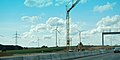
Expansion work between Temmenhausen and Dornstadt, 2014


Planned expansion Ulm-West - Ulm / Elchingen junction
As of the end of 2019, the section between the Ulm-West junction and the Ulm / Elchingen motorway junction, along with the Albaufstieg between Mühlhausen and Hohenstadt, is the only one between Karlsruhe and Munich that has not yet been expanded to six lanes or is currently being expanded. On November 16, 2015, the Elchingen community's expansion plans for this section of the route were presented. The 6-lane expansion of this section of the route is intended to make the traffic flow "more harmonious and thus both safer and more environmentally friendly". There are already three lanes in the direction of Stuttgart between the Oberelchingen junction and the Ulm / Elchingen junction. The plan approval documents are currently being drawn up for the expansion of the Ulm-West motorway section to the Ulm / Elchingen motorway junction to six lanes.
Ulm - Munich
Expansion of Ulm – Günzburg and new construction of the Danube bridge in Leipheim

The section between the Ulm / Elchingen junction and the Günzburg junction was expanded in two sections from four to six lanes. First of all, from 1996 to 2001 the Danube bridge near Leipheim was replaced by a new building due to its poor condition, which is designed for six lanes with an additional hard shoulder in each direction of travel. This was followed by the expansion of the Munich carriageway over a few kilometers in the area of the Danube bridge and the Leipheim junction. This construction project was completed in 1999 with the completion of the first half of the bridge, although only two lanes were marked in each direction. By 2002, the Munich lane was expanded to the east of the Günzburg junction and the lane between the Danube bridge and Günzburg was re-marked to three lanes.
Work on expanding the northern carriageway in this area or both lanes between the Ulm / Elchingen junction and the Leipheim Danube bridge to a total of six lanes began in summer 2006. The northern carriageway was completed in two construction phases in December 2007 and December 2008, respectively. Between the Ulm / Elchingen intersection and the Leipheim Danube bridge, the six-lane expansion was completed in summer 2010 and opened to traffic on July 27, 2010. At the Ulm / Elchingen junction, an additional parallel lane for the Munich – Kempten route was set up and released on November 4, 2010.
Expansion of Günzburg – Augsburg in a public-private partnership

The section between Günzburg and the Augsburg- West junction (59 km extension length, 330 million euros in construction costs) was extended to six lanes according to the A model (see below). The expansion of this route began on August 3, 2011. The last section of the six-lane A 8 in Bavaria was opened on September 28, 2015, but the construction work was not fully completed until the end of November 2015. The 41 km long section was built by the Pansuevia consortium (Hochtief and Strabag) over a four-year construction period for 410 million euros. The consortium will receive the truck toll revenue until 2041.
In the so-called A model , private operators are entrusted with the construction, maintenance, operation and financing of the six-lane expansion. For refinancing, the general toll for heavy trucks incurred on the respective route, which has been levied since January 1, 2005, is passed on to the operator. The infrastructure costs resulting from the use of vehicles that are not subject to the toll are also raised in the form of start-up financing from the federal trunk road budget.
The aim of the Bavarian road construction administration was to carry out the procedure for awarding the concession in 2009, to start construction in 2010 and to expand this section to six lanes throughout by 2014. At the end of June 2008, the Federal Ministry of Transport approved the expansion of the A 8, with construction starting in mid-2010. From November 2009 to February 2010, clearing work was carried out on an area of 85 ha between Burgau and Neusäß in order to carry out the six-lane expansion on this route to be able to. On January 21, 2011, the Federal Ministry of Transport released the funds for the expansion. The South Bavarian autobahn directorate decided in favor of bidder A-Model A 8, the objection of the unsuccessful bidder A 8 Mobil was rejected by the Southern Bavaria Public Procurement Chamber on February 8, 2011. The unsuccessful bidder A 8 Mobil filed a complaint with the Munich Higher Regional Court against this decision, which was rejected on April 7, 2011. The expansion could begin in summer 2011. Hochtief and Strabag , who founded the joint subsidiary “Pansuevia”, were awarded the contract for the expansion that began on August 3, 2011 . This was completely taken over by Strabag in August 2018, subject to the approval of the Federal Cartel Office .
Serious accidents have been increasing since the six-lane expansion between the Ulm-Elchingen junction and Munich. The reason given by the police is that significantly higher speeds will be driven after the expansion than before. The number of injured people at speeds of more than 130 km / h on the A 8 in the Augsburg district was 700 percent higher in 2018 than before the six-lane motorway expansion. Police and rescue workers are therefore demanding speed limits.
New construction of the Lech Bridge Augsburg-Gersthofen
The first Lech bridge was built in 1935/1936 as part of the construction of the Munich – Ulm motorway with only one superstructure for two-lane traffic. After the demolition on April 26, 1945, the superstructure was rebuilt with parts from the inventory, with individual new parts, new bearings and new abutments. The second superstructure on the south side was completely rebuilt. In 1982 the existing reinforced concrete deck was replaced by a new one.
As steel from the original bridge was partly used in the reconstruction of the bridge that had been blown up during the war, fatigue cracks caused by bridge vibrations became increasingly apparent in the steel girders in the 1990s. Therefore, in August 2004, the South Bavarian Motorway Directorate initiated speed restrictions on the bridge (80 km / h for cars, 60 km / h for trucks), which could not be rehabilitated with reasonable economic effort.
In the course of the six-lane expansion of the motorway, the existing bridge was demolished and replaced by two new bridges. While maintaining the motorway traffic, the construction of the new structure on the southern side began. For this purpose, temporary pillars and temporary abutments were built in the Lech, which were necessary for the longitudinal displacement. In order to establish the makeshift pillars in the Lech, the river bed was cleared of the rubble of the blown pre-war bridge as well as grenades and ammunition from the war as part of a preliminary measure .
In July 2005 the new south bridge was pushed over the Lech, where it was supposed to accommodate all traffic until the old Lech bridge was demolished and the north bridge was rebuilt. Then, planned for November 2006, the bridge was to be moved transversely to the north in its final position.
During the floods in August 2005 , the scheduled work was interrupted. The provisional eastern foundation was undermined, the still unfinished new bridge sagged on one side and threatened to plunge into the Lech, which led to the proclamation of the disaster alarm for the city of Augsburg because of the threat of flooding from backwater. As a result, the A 8 in the section between Augsburg-East and Augsburg-West had to be completely closed for over a day, which led to traffic chaos in the region and backlogs of over 40 km on the A 8. The foundation could be stabilized, but the final repair took until December 2005. In mid-December 2007 the new bridge was opened to traffic.
The new Lech bridge, built for six-lane traffic, was initially driven on with four lanes, the third lane was only released after the complete six-lane expansion of the motorway section in 2010.
Expansion of Augsburg – Bergkirchen in a public-private partnership
The award procedure for the six-lane expansion of the 37-kilometer section between the Augsburg-West junction and the transition to the six-lane section at Bergkirchen- Palsweis, which has been in place since 2003 , was completed as part of an A-model. The operating company Autobahnplus was awarded the contract . The contract for this was supposed to be signed in the presence of Transport Minister Wolfgang Tiefensee on April 14, 2007, but since the negotiations on the financing were difficult, it was not signed until April 30, 2007.
The 230 million euro expansion began on May 15, 2007 with the groundbreaking ceremony on June 12, 2007 on the Adelzhausener Berg between the Adelzhausen and Odelzhausen junctions . The 37-kilometer section between Augsburg-West and the Palsweis car park is the first German motorway project with private financing based on the PPP ( Public Private Partnership ) model. For thirty years the expansion and maintenance will be financed by a consortium, which in return will receive the revenue from the truck toll on a distance of 52 kilometers.
After three years of construction, the six-lane line was completed in early December 2010 and opened to traffic on December 9, 2010. The concession for the operator Autobahnplus runs until 2037 (30 years after the start of construction) and, in addition to the section developed in a public-private partnership, also includes the remaining 15 km of conventionally developed route, the BAB 8 to the triangle Munich / Eschenried and the Eschenrieder Clasp includes.
Expansion of Bergkirchen – Eschenried and connection to the Munich motorway ring

For a long time, the traffic coming from the BAB 8 from Stuttgart either had to drive through the Munich urban area via the Mittlerer Ring or at the Dachau / Fürstenfeldbrück junction via the B 471 to the Oberschleißheim junction of the BAB 92 , in order to be completed in the mid-1970s BAB 99 and finally continue towards Salzburg. Although the ring motorway around the Bavarian capital was planned as early as the 1930s, a few kilometers of route and a motorway junction with the BAB 8 near Allach-Untermenzing were completed before the Second World War. When the BAB 99 was built in the 1970s, only the section between the Munich-Feldmoching motorway triangle in the north and the Munich-South motorway junction in the south of Munich was built; the planned continuation to the BAB 8 in the west of the city was delayed due to a dispute the exact route (pre-war road through area populated after the war or completely new route) until the beginning of the 1990s.
In 1993, after the planning approval decision, the construction of the BAB 99 section to the west of Munich to BAB 8 began, but had to be discontinued after only one year due to doubts about the environmental compatibility. After the Federal Court of Justice had allowed further construction in 1996, the 6.7 km long network connection was created by 1998. It was implemented on a new route, which has an approximately 1 km long tunnel ( Allacher Tunnel ). In 1999 the second construction phase to Lochhausen was completed. In contrast to the pre-war road, the newly constructed line was built further west and on a more curvy route. Only the location of the Munich-West motorway junction is roughly the same as the intersection planned before the war. During construction, a bridge built in the 1930s as a preliminary work over the BAB 8 was demolished without any use.
Since most of the traffic coming from Stuttgart changes to the BAB 99 and does not follow the BAB 8 to Obermenzing, the connection Stuttgart-Münchner Nordring was not used as a driving connection at the Munich West junction, but as a separate four-lane route with two motorway triangles ( Eschenrieder Spange ) realized in a more direct way. In the course of the motorway construction in the west of Munich, an approximately 6 km long section of the BAB 8 was expanded to six lanes. The expansion between the Dachau / Fürstenfeldbruck junction and the Munich-Eschenried triangle cost 24 million euros and was completed in 1997, one year before the Eschenrieder Spange opened.
From 2000 to 2003 the BAB 8 was then extended by a further 8 km in the direction of Augsburg to just before the Sulzemoos junction near Bergkirchen-Palsweis to six lanes. In the course of this, an unmanaged rest area was created at the western end of the expansion in both directions.
The section from the Munich-Eschenried triangle to the end of the motorway in Munich-Obermenzing was not expanded. The motorway here still has four lanes, but has been extended by a hard shoulder for each direction of travel. Since the beginning of 2006 the BAB 99 was released beyond Lochhausen to the Munich-Southwest motorway triangle, there has been an alternative connection to the Middle Ring via the BAB 99 and BAB 96 , which has been developed as a motorway throughout. From the end of the motorway at the Obermenzinger roundabout, however, you have to drive a few kilometers on city roads through the districts of Obermenzing and Neuhausen-Nymphenburg to get to the Mittlerer Ring.
Construction progress
| section | start of building | status | length |
|---|---|---|---|
| Triangle Karlsruhe – east. AS Karlsbad | 1990s | completed (1998) | 7.3 km |
| east junction Karlsbad – junction Pforzheim-West | 2009 | completed (2015) | 9.1 km |
| AS Pforzheim-West – east. AS Pforzheim-Nord | 1990s | completed (2000) | 9.0 km |
| east AS Pforzheim-Nord – Rasthof Pforzheim | 2018 | under construction (until 2025) | 4.8 km |
| Rasthof Pforzheim – AS Pforzheim-Süd | 2006 | completed (2007) | 3.0 km |
| AS Pforzheim-Süd-Wimsheim | 2006 | completed (2008) | 4.2 km |
| Wimsheim – AS Heimsheim | 2009 | completed (2011) | 4.8 km |
| AS Heimsheim – Dreieck Leonberg | 2006 | completed (2008) | 10.6 km |
| Triangle Leonberg – Kreuz Stuttgart | 1979 | Completed (1979) Additional lanes since 2000 and 2017 |
8.3 km |
| Cross Stuttgart – AS Stuttgart-Degerloch | 1980 | Completed (1982) Temporary exit lane since 2013 |
8.4 km |
| AS Stuttgart-Degerloch-Denkendorf | 1991 | completed (1993) | 11.5 km |
| Denkendorf – AS Wendlingen | 1980 | completed (1982) | 4.6 km |
| AS Wendlingen – AS Kirchheim (Teck) -Ost | 1990s | completed (1993) | 9.0 km |
| AS Kirchheim (Teck) -East – west. AS Aichelberg | 1985 | completed (1986) | 7.1 km |
| west of the Aichelberg – Gruibingen junction | 1985 | completed (1990) | 7.3 km |
| west Gruibingen – west AS Mulhouse | 2009 | completed (2012) | 3.9 km |
| west of the Mühlhausen – Widderstall AS | Plan approval procedure (2018) | 7.6 km | |
| Widderstall – Nellingen | 2016 | completed (2019) | 6.2 km |
| Nellingen-Temmenhausen | 2014 | completed (2017) | 6.8 km |
| Temmenhausen – AS Ulm-West | 2012 | completed (2016) | 7.8 km |
| AS Ulm-West – east. AS Ulm-Nord | 2016 | under construction (until 2020) | 2.3 km |
| east AS Ulm-Nord – Kreuz Ulm / Elchingen | Plan approval procedure (2015) | 12.0 km | |
| Cross Ulm / Elchingen - west of the Leipheim junction | 2006 | completed (2010) | 8 kilometers |
| west junction Leipheim - east junction Günzburg | 1999 | completed (2007) | 7 km |
| east AS Günzburg - AS Augsburg-West | 2011 | completed (2015) | 41 km |
| AS Augsburg-West - Fuchsberg | 2007 | completed (2010) | 37 km |
| Fuchsberg - west of the Dachau / Fürstenfeldbruck junction | 2000 | completed (2003) | 8 kilometers |
| west of the Dachau / Fürstenfeldbruck junction - Munich-Eschenried triangle | 1993 | completed (1997) | 6 km |
Munich - Bad Reichenhall
Expansion of the Munich-Süd intersection - Inntal triangle
In the 1960s, a tunnel was built under the runway of the air base in Neubiberg, which was used by the Bundeswehr until 1991 , so that the motorway could be led from the south to the Mittlerer Ring without intersections. As part of the 1972 Olympic Games in Munich , the BAB 995 was a second motorway that leads from the south into Munich city center.
The section from the Munich-Süd junction with the Munich motorway ring to the Inntal triangle, which is heavily used by holiday and commuter traffic, has been expanded in sections to three to four lanes in each direction since the early 1970s, with the route largely being retained. A third lane was set up in the Irschenberg area as early as 1969 , but the autobahn still has no hard shoulder here. From 1974 to 1975 the section from the Munich-Süd junction to the Holzkirchen junction and from 1979 to 1981 the section from Holzkirchen to Irschenberg was expanded to include six lanes. As part of the expansion in this section, the Mangfall Bridge was supplemented by a second parallel structure from 1977 to 1979, so that both directions of travel are guided with three lanes over one structure each. Since March 1996, the expanded section has been equipped with a traffic control system in the direction of Salzburg and since June 1997 in the direction of Munich.
Planned expansion between the Inntal triangle and the border
The implementation of the planned expansion from Rosenheim to the border with Austria on the Walserberg is currently being prepared. The Federal Ministry of Transport and Digital Infrastructure is planning to expand the A 8 federal motorway from the Inn Valley to the federal border with six lanes. The construction costs of the 70 km long route amount to 1.2 billion euros. In particular, the scope of the noise protection measures, and in some cases alternative routes, are discussed. A particularly large number of expansion options are being discussed in Piding , including a complete relocation as a northern bypass along the Högl . Further junctions are planned on the Walserberg to relieve the B 20 in Piding. On July 8, 2014, the planning approval procedure for the section between Rosenheim and Achenmühle was initiated.
The plan approval procedure for the section Achenmühle to Bernauer Berg was initiated in August 2014, and construction was expected to start at the beginning of 2018. As of October 2017, according to the Southern Bavaria Motorway Directorate, "a serious statement about the start of construction ... is not possible" .
The Inntal to Chiemsee section is used by an average of 60,000 to 70,000 vehicles per day. The traffic load between the Chiemsee and the federal border is 50,000 vehicles per day. According to the Federal Audit Office , a six-lane expansion is therefore only necessary from the Inntal to the Chiemsee. For the section from Chiemsee to the federal border, the traffic loads only justify a four-lane expansion with temporary hard shoulder clearance for peak traffic loads. The construction costs could thus be reduced by at least 110 million euros.
Further planning
- Widening to 6 lanes between AS Pforzheim-Nord and Pforzheim-Süd (urgent need); under construction since 2017
- Widening to 8 lanes between AD Leonberg and AS Wendlingen (further requirement)
- Widening to 8 lanes between AK München-Süd and AD Inntal (47 km, additional requirements)
- Widening to 6 lanes between AD Inntal and AS Frasdorf (16 km, urgent need)
- Widening to 6 lanes between AS Frasdorf and AS Grabenstätt (14 km, additional requirements)
- Widening to 6 lanes and partly relocation between AS Grabenstätt and the federal border (35 km, further requirements with preparation of a preliminary draft)
Others

- Since the Schengen junction of the Luxembourg A 13 is directly behind the Schengen viaduct in the direction of Luxembourg , the 500 m signpost is already on the German side. It shows Luxembourg street names with German design. Motorway 13 is shown with the correct Luxembourg sign. The Luxembourg N 10, however, which is reached via the exit, is shown as “10” with the German federal road sign in red (for national roads in Luxembourg) instead of the yellow color that is usual in Germany.
- In Heusweiler the highway leading directly to the now demolished towers of the SR - medium wave transmitter Heusweiler over. Since its construction in 1982, the autobahn had been spanned by a wire rope network ( Faraday cage ) over a length of around 500 m , in order to exclude negative influences of the 1200 kW transmitter on the vehicle electronics. After the transmitter was switched off in 2015, the lattice masts were blown up on September 21, 2018 and the network dismantled.
- During the Lindwurm campaign , the A 8 between Pirmasens and Homburg served as an alternative route to the A 62 .
- On August 11, 2011, the construction of a traffic control system on the section between the Leonberg and Wendlingen triangles began. The plant has been in operation since July 26, 2012. A temporary hard shoulder clearance between the Stuttgart junction and Stuttgart-Degerloch has been in operation since May 2013 .
- About one kilometer southeast of the Hohenstadt temporary exit, the A 8 crosses the main European watershed between the catchment area of the Rhine ( North Sea ) and the Danube ( Black Sea ) at an altitude of 785 meters above sea level . For a long time this was the highest point on a German autobahn, until the completion of the A 7 near Nesselwang.
- The worst accident on the Munich – Bad Reichenhall section occurred on the morning of January 18, 1985 near Holzkirchen, when 37 vehicles crashed into one another in a bank of fog that suddenly appeared , 20 vehicles burned out and seven people died.
- The sometimes unfavorable routing and the old age of the Rosenheim – Bad Reichenhall section and the associated, sometimes inadequate state of development, combined with high traffic volumes, lead to numerous accidents and, especially on holiday weekends, to extremely long traffic jams . On the Irschenberg and in the section Inntal triangle up to the federal border near Salzburg there are still no hard lanes , many curves are too narrow by today's standards, acceleration lanes too short and inclines too steep. Heavily loaded trucks only manage around 40 km / h on the Irschenberg ramp and thus cause constant traffic obstructions. There are also unmarked entrances and exits - e.g. B. for the town of Anger - which serve as operational or makeshift connections. In order to remedy this situation, there are plans to build a new one-way carriageway and expand it to 6 lanes. At the moment, however, neither legal nor financial security has been created.
Motorway maintenance depots or private operators
As of January 1, 2016, the responsibilities for the A 8 were as follows:
- Free State of Bavaria
- in the area of the junction Oberelchingen (64) and the Ulm / Elchingen motorway junction with the A 7 (65/120) at the Memmingen / Vöhringen motorway maintenance office,
- in the area of the Leipheim junction (66) and the Augsburg-West junction (72) at PANSUEVIA Service (operator route II),
- in the area of the Augsburg-West junction (72) and the Munich-Eschenried motorway triangle with the A 99a (79 / 9a) at autobahnplus Services (operator route I),
- in the area of the Munich-Eschenried motorway triangle with the A 99a (79 / 9a) and the Munich-West motorway junction with the A 99 (81/8) at the Munich-North / West motorway maintenance authority,
- in the area of the Munich-Ramersdorf junction (91) and the Bernau junction (106) at the Rosenheim / Holzkirchen motorway maintenance facility,
- in the area of junction Bernau (106) and junction Behelfs-AS Schwarzbach (115a) at the Siegsdorf motorway maintenance facility.
Trivia

The umbra course of the solar eclipse of August 11, 1999 in Germany corresponded relatively exactly to the course of the federal highway 8.
See also
literature
- Klaus Schefold, Alois Neher (Ed.): 50 years of motorways in Baden-Württemberg. A documentation. On behalf of the Autobahn Office Baden-Württemberg. Baden-Württemberg motorway office, Stuttgart 1986.
- Konrad Plieninger: Panoramastraße and Führer Monument - the Reichsautobahn over the Swabian Alb in Swabian Homeland , No. 51, April 2000, pp. 426–435.
- Roland Gabriel, Wolfgang Wirth: Right through the middle or around the outside? The long planning history of the Munich motorway ring. Verlag Franz Schiermeier, Munich 2013, ISBN 978-3-943866-16-2 .
Web links
- Detailed route description of the federal highway 8 on autobahnatlas-online.de
- Quiet A8 e. V. (Homepage of an association that deals with planning and especially noise protection in the Pforzheim area; shows, among other things, historical photos of the A8).
- A 8 - Heimsheim exit to Aichelberg exit (April 2005). (No longer available online.) 2005, archived from the original on May 20, 2016 (private website with photo series, also for other motorway sections).
- Jens Glaßer: Albaufstieg Aichelberg. March 9, 2018 (private website with information on the history of the Albaufstieg Aichelberg and the Drackensteiner slope).
- The panorama motorway A8 Munich - Salzburg: year 1938 in the online exhibition 100 years of landscape architecture . Association of German Landscape Architects bdla, 2013.
Individual evidence
- ↑ Web site Pansuevia , accessed on 24 June 2018th
- ^ Website of autobahnplus , accessed on June 24, 2018.
- ↑ autobahn-online.de
- ↑ Strictly speaking, the B 10 only goes to exit 6 (Kriegstraße), then leaves the city motorway and goes right through the city center (B 10n). The further course of the city motorway to the A 5 is officially signposted as the B 10, but theoretically represents a district road (K 9657). See for example Google Maps
- ↑ Michael Kriest, Die Reichsautobahn , accessed on August 1, 2018.
- ↑ The beginning of 1931 to 1951 albaufstieg-aichelberg.de, accessed on August 1, 2018
- ↑ Marion Hombach and Joachim Telgenbüscher: Das Märchen von der Autobahn, p. 85. (No longer available online.) In: GEO EPOCHE No. 57 - 10/12 - Germany under the swastika - Part 1 . September 27, 2012, archived from the original on November 9, 2012 ; accessed on July 26, 2018 .
- ↑ Ulli Kulke: How Hitler stole the idea with the Autobahn. In: The world . May 1, 2016, accessed December 4, 2018 .
- ^ Carl Walter Schmidt: Vacation in Italy. Schützen-Verlag, Berlin 1939, p. 44.
- ↑ Detlev Humann: "Labor Battle". Job creation and propaganda in the Nazi era 1933–1939. Wallstein, Göttingen 2011. ISBN 978-3-8353-0838-1 .
- ↑ Mangfallbrücke webreichsautobahn.de, accessed on August 2, 2018
- ^ A8 Munich Ramersdorf - border to Austria webreichsautobahn.de, accessed on August 2, 2018
- ↑ Rasthaus Chiemsee webreichsautobahn.de, accessed on August 2, 2018
- ↑ a b Archive for Autobahn and Road History: Events of 1934. Retrieved on November 17, 2019 .
- ↑ a b c Archive for Autobahn and Road History: Events of 1937. Retrieved November 17, 2019 .
- ↑ The old A8 is 80 years old - and disappears Pforzheimer Zeitung from April 20, 2018, accessed on August 2, 2018
- ^ A b Archive for Autobahn and Road History: Events of 1938. Retrieved on November 17, 2019 .
- ^ Bridges & structures on the A8 Flickr , accessed on August 2, 2018
- ^ Archives for Motorway and Road History: Events of 1939. Retrieved on November 17, 2019 .
- ^ Archives for Motorway and Road History: Events of 1943. Retrieved on November 17, 2019 .
- ↑ Motorway airfields (emergency landing sites NLP-Str)
- ↑ New A8 in the Enztal: When the expansion can finally begin and which problems are making it difficult to award the construction work , PZ-News, May 8, 2020
- ^ Building Department of the City of Munich (Ed.): Building in Munich 1960–1970 . Harbeke Verlag, Munich 1970, p. 13
- ^ Axel Winterstein: "Highway" fever in the economic wonderland. Süddeutsche Zeitung 71/1999 (March 26, 1999), p. S2
- ↑ Numbering of the German motorway network according to the western model before 1974 (incomplete)
- ↑ a b c Federal Ministry of Transport and Digital Infrastructure : A 8 - completion between Wellingen and Schwemlingen. (PDF) Retrieved November 24, 2019 .
- ↑ Federal Ministry of Transport and Digital Infrastructure : Complete renovation of the A 8 between the Neunkirchen-Oberstadt junction and the Neunkirchen motorway junction; Project description. (PDF) Retrieved November 24, 2019 .
- ^ German Bundestag: Road Construction Report 1981 (PDF) Retrieved on November 24, 2019 .
- ↑ List of traffic clearances
- ↑ Compilation of the traffic clearances 2003 , autobahn-online.de
- ↑ Compilation of the 2002 traffic releases , autobahn-online.de
- ↑ Compilation of the 1997 traffic releases , autobahn-online.de
- ↑ Compilation of the traffic clearances 1984 , autobahn-online.de
- ↑ a b c compilation of the 1981 traffic releases , autobahn-online.de
- ↑ Compilation of the 1978 traffic releases , autobahn-online.de
- ↑ Compilation of the traffic clearances 1980 , autobahn-online.de
- ↑ Compilation of the traffic clearances 1985 , autobahn-online.de
- ↑ Compilation of the traffic clearances 1986 , autobahn-online.de
- ↑ Compilation of the traffic clearances 1982 , autobahn-online.de
- ↑ Compilation of the traffic clearances 1972 , autobahn-online.de
- ↑ Compilation of the 1973 traffic releases , autobahn-online.de
- ↑ Compilation of the traffic releases 1971 , autobahn-online.de
- ↑ Compilation of the traffic clearances 1975 , autobahn-online.de
- ↑ Compilation of the traffic releases 1979 , autobahn-online.de
- ↑ a b c d Autobahn openings in 1938 , autobahn-online.de
- ^ Motorway openings in 1939 , autobahn-online.de
- ↑ a b c d Motorway openings 1937 , autobahn-online.de
- ↑ a b c Autobahn openings in 1936 , autobahn-online.de
- ^ Report of the Federal Highway Research Institute. (PDF file)
- ↑ A 8 Albgaulinie Karlsruhe - Stuttgart. In: autobahn-online.de. Retrieved December 3, 2019 .
- ↑ Wettersbach viaduct. In: structurae.net. Retrieved December 29, 2019 .
- ↑ a b c d e The Unfinished. In: Waiblinger Kreiszeitung. July 20, 2012, accessed December 3, 2019 .
- ↑ a b BAB A 8 Leonberg – Heimsheim. (PDF) In: Federal Ministry of Transport, Building and Urban Development . Retrieved December 3, 2019 .
- ↑ Expansion of the A8 Pforzheim-Süd to Heimsheim. In: ka-news.de. August 24, 2009, accessed December 3, 2019 .
- ↑ Less traffic jams: A8 will be released into six lanes after expansion. In: ka-news. October 17, 2011, accessed May 8, 2013 .
- ↑ The colossus bridge makes Nöttinger Senke safer. In: Pforzheimer Zeitung. July 28, 2010, accessed December 3, 2019 .
- ↑ A 8 Six-lane expansion Karlsbad - Pforzheim-West. In: eAUTOBAHN. Retrieved December 3, 2019 .
- ↑ Plan approval decision issued: Karlsruhe Regional Council approves the six-lane expansion of the A 8 federal motorway between Karlsbad and Pforzheim-West. In: autobahn-online.de. Retrieved August 20, 2020 .
- ↑ Disconcerting scenes in the former A8 curve on the Nöttinger slope. In: Pforzheimer Zeitung. October 22, 2010, accessed December 3, 2019 .
- ↑ Approval of the new Karlsruhe carriageway between Pforzheim-West (Klosterwegbrücke) and Darmsbacher Höhe. In: Metropol News. September 17, 2014, accessed December 3, 2019 .
- ↑ Autobahn 8 near Karlsbad: six-lane section released. In: Stuttgarter Zeitung. June 19, 2015, accessed June 19, 2015 .
- ↑ Start of the final expansion of the A8 near Pforzheim. In: Stuttgarter Zeitung. April 28, 2018, accessed December 4, 2019 .
- ↑ A 8 Enztal crossing. In: Karlsruhe Regional Council. Retrieved December 4, 2019 .
- ↑ autobahn-online.de: A 81 Leonberg - Gärtringen. Retrieved December 11, 2019 .
- ↑ albaufstieg-aichelberg.de: collection of bridges along the A8. Retrieved December 11, 2019 .
- ^ Landesarchiv Baden-Württemberg: Addition of a third lane to the Karlsruhe - Stuttgart lane, km 209.730 to 211.808. Retrieved May 1, 2020 .
- ↑ baunetzwerk.biz: Additional interweaving strips against traffic jams. Retrieved December 16, 2019 .
- ↑ Stuttgarter Zeitung: 35 hours full closure due to the bridge being blown. October 14, 2016, accessed December 11, 2019 .
- ↑ Leonberger Kreizeitung: It will soon be tight again on Autobahn 8. March 2, 2017, accessed December 11, 2019 .
- ↑ Helmut Werner: A 8 / A 81 traffic release lanes between the Stuttgart intersection and the Leonberg triangle. December 27, 2017, accessed December 11, 2019 .
- ↑ Motorway bridges in Germany: Motorways A1 to A9. In: Karl Gotsch. Retrieved December 14, 2019 .
- ^ Sulzbach Viaduct from 1982. In: Landesarchiv Baden-Württemberg. Retrieved December 14, 2019 .
- ^ The expansion 1985 to 1990. In: albaufstieg-aichelberg.de. Retrieved December 14, 2019 .
- ↑ Only the traffic jam never changes. In: Stuttgarter Zeitung. July 24, 2017, accessed December 14, 2019 .
- ↑ Feasibility study for A-81 expansion . In: Gäubote . December 27, 2017, p. 21 ( online ).
- ↑ albaufstieg-aichelberg.de
- ↑ Ceremonial traffic clearance A 8, Gruibingen - Mühlhausen ( Memento from January 11, 2014 in the Internet Archive )
- ↑ Now it's time to start building the tunnel ( Memento from June 7, 2013 in the Internet Archive ) Südwest-Presse, September 8, 2010.
- ↑ Six-lane expansion of the A 8 Gruibingen - Mühlhausen. (PDF) In: BMVBS. Retrieved December 20, 2019 .
- ↑ Ceremonial road opening A 8, Gruibingen - Mühlhausen. (No longer available online.) Federal Ministry of Transport and Digital Infrastructure , December 4, 2012, archived from the original on January 11, 2014 ; accessed on August 31, 2018 .
- ↑ Alexander Ikrat: Albaufstieg - financing threatens to fail. (No longer available online.) Stuttgarter Nachrichten , February 29, 2008, archived from the original on March 30, 2010 ; Retrieved May 21, 2011 .
- ↑ Andreas Böhme: A8 planning: restart on the Albaufstieg. Südwest-Presse , July 1, 2014, accessed on August 31, 2018 .
- ↑ dpa / Andreas Böhme: A8 planning: Albaufstieg is being expanded. Südwest-Presse , July 2, 2014, accessed on August 31, 2018 .
- ↑ Johannes Fischer: A 8-Albaufstieg: How does it go on? (PDF) Regional Council Stuttgart, Department 4 - Road Construction and Transportation, June 6, 2018, p. 34 , accessed on August 31, 2018 .
- ↑ a b At the same time, the six-lane expansion of the A 8 begins , press release 084/2012 of the BMVBS from May 7, 2012 ( Memento from June 28, 2012 in the Internet Archive )
- ↑ Fog warning system on the A8. DÜRR Group GmbH, accessed on December 27, 2019 .
- ↑ A8 expansion completed at the end of July - two more full closures required . In: Schwäbische Zeitung . April 26, 2019.
- ↑ Expansion of the A 8 motorway, Tübingen regional council, accessed on June 7, 2017 .
- ↑ Joachim Striebel: Expansion of the A 8: work on the eye of a needle. Südwest-Presse, June 26, 2018, accessed on August 31, 2018 .
- ↑ Plan approval procedure according to the Federal Trunk Road Act (FStrG) and the Bavarian Road and Road Act (BayStrWG). In: Explanatory report on the draft assessment: 6-lane expansion of the Ulm-West junction - Ulm / Elchingen junction. Retrieved March 1, 2018 .
- ^ Federal motorway A 8 (Stuttgart - Ulm - Munich) 6-lane expansion between the junction AS Ulm-West and the motorway junction AK Ulm / Elchingen. (PDF) Autobahn Directorate South Bavaria , accessed on October 24, 2015 .
- ↑ Oliver Heider: Elchingen: Plans for A-8 expansion presented. Südwest-Presse , November 18, 2015, accessed on August 31, 2018 .
- ↑ Compensation for the effects of the A8 expansion? Augsburger Allgemeine , November 18, 2015, accessed on August 31, 2018 .
- ↑ Berthold Veh: Autobahn: A8 expansion: It starts on August 3 , augsburger-allgemeine.de, May 28, 2011, accessed on March 24, 2013
- ↑ The A8 is open - and yet not finished , augsburger-allgemeine.de, September 29, 2015
- ^ Andre Böhme, Patrick Guyton: Free travel to Munich . In: Südwest Presse . September 28, 2015, ZDB ID 1360527-6 , p. 3 ( online ).
- ↑ zg, bv: A-8 expansion can begin. Augsburger Allgemeine , January 21, 2011, accessed on May 21, 2011 .
- ↑ Ongoing merger control proceedings. Bundeskartellamt , September 11, 2018, accessed on September 14, 2018 .
- ^ Südwest Presse Online-Dienst GmbH: Traffic: When Gaffers film tragedies . In: swp.de . February 28, 2018 ( online [accessed February 28, 2018]).
- ↑ A8: Variable speed limits should come - but not everywhere. Bayerischer Rundfunk, March 23, 2019, accessed on September 22, 2019 .
- ↑ Süddeutsche Zeitung: Eschenrieder Spange. September 4, 2017, accessed September 30, 2016 .
- ↑ 50 years of the Holzkirchen motorway police 1962 - 2012. Bavarian police, accessed on January 7, 2020 .
- ↑ Annual Report 2017 - Comments No. 15 - Economic viability of the expansion of the A 8 federal motorway between Chiemsee and the federal border not proven - Savings potential of 110 million euros - Home page. Federal Audit Office, December 12, 2017, accessed April 1, 2018 .
- ↑ Community report special edition on the subject of "Expansion of the A 8" (PDF; 1.2 MB) on gemeinde-piding.de, accessed on March 9, 2011.
- ↑ Pidinger Community Report - February 2009 - Special edition of the motorway expansion
- ↑ Government of Upper Bavaria initiates the planning approval procedure for the six-lane expansion of the A 8 Ost Rosenheim - Salzburg motorway between the Rosenheim and Achenmühle junction. Government of Upper Bavaria, July 8, 2014, accessed on August 31, 2018 .
- ↑ Government presents further A8 expansion plans. rosenheim24.de, August 28, 2014, accessed on August 31, 2018 .
- ↑ Katja Schlenker: A8 expansion: "First we have to wait for any complaints". rosenheim24.de, October 10, 2017, accessed on August 31, 2018 .
- ↑ Annual Report 2017 - Comments No. 15 - Economic viability of the expansion of the A 8 federal motorway between Chiemsee and the federal border not proven - Savings potential of 110 million euros - Home page. Federal Audit Office, December 12, 2017, accessed April 1, 2018 .
- ^ Heusweiler motorway A8 . Alexey Gavrilin. March 27, 2007. Retrieved March 6, 2011.
- ↑ Installation of the first traffic sign bridge on the A8. (No longer available online.) In: Ministry of Transport and Infrastructure Baden-Württemberg. August 9, 2011, archived from the original on October 5, 2013 ; Retrieved May 8, 2013 .
- ^ Road traffic center Baden-Württemberg , accessed on October 2, 2013.
- ↑ "Inferno in the Fog Bank", Holzkirchner Merkur No. 13/2010, January 18, 2010.
- ^ Federal motorway A 8 Munich – Salzburg: six-lane expansion of the Grabenstätt – federal border. (PDF) Autobahn Directorate South Bavaria, August 2008, accessed on November 24, 2019 .
- ↑ Supreme building authority in the Bavarian State Ministry of the Interior, for construction and traffic: Free State of Bavaria - Road overview map - Responsibilities of the motorway maintenance authorities . PDF. January 1, 2016, online at www.baysis.bayern.de, accessed on September 17, 2016.
