
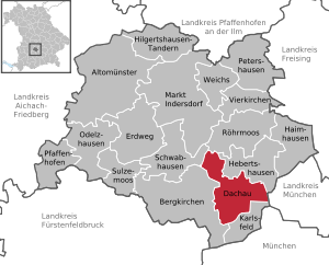
Dachau
| coat of arms | Germany map | |
|---|---|---|

|
Coordinates: 48 ° 16 ' N , 11 ° 26' E |
|
| Basic data | ||
| State : | Bavaria | |
| Administrative region : | Upper Bavaria | |
| County : | Dachau | |
| Height : | 482 m above sea level NHN | |
| Area : | 34.96 km 2 | |
| Residents: | 47,721 (Dec. 31, 2019) | |
| Population density : | 1365 inhabitants per km 2 | |
| Postal code : | 85221 | |
| Area code : | 08131 | |
| License plate : | DAH | |
| Community key : | 09 1 74 115 | |
| City structure: | 20 parish parts | |
City administration address : |
Konrad-Adenauer-Strasse 2-6 85221 Dachau |
|
| Website : | ||
| Lord Mayor : | Florian Hartmann ( SPD ) | |
| Location of the city of Dachau in the district of Dachau | ||
  |
||


.jpg)
Dachau is a large district town in the Upper Bavarian district of the same name and is located northwest of Munich in the Munich metropolitan region .
geography
Geographical location and landscape

The city is located northwest of Munich on the Amper at the interface between the Munich gravel plain , in which the Dachauer Moos lies, and the tertiary Danube-Isar hill country adjacent to the north .
topography
The highest point within the city limits is the Schlossberg (518 m above sea level ) , the lowest point is near the Prittlbach district on the border with the municipality of Hebertshausen (472 m above sea level ) .
nature
The beautiful nature in Dachau includes the Dachauer Moos , the Schlossberg with its courtyard garden and park and, since 2001, a fauna, flora, habitat (FFH) and bird sanctuary along the Amper. Rare animal and plant species also live here. In the south is the city forest with a landscape lake for breeding birds. There is a 2.75 km long " fitness trail " in the city forest . The ADFC certified 4-star Ammer-Amper-Radweg, which connects the Ammerquelle with Moosburg an der Isar , leads through the charming landscape along the Amper . There are 30 natural monuments in the city of Dachau : the 100-year-old Stadtlinden (planted as a 10-year-old tree in 1907) at the Resistance Square and Gottesackerstraße, for example, the beeches at the water tower and the Rotkreuzheim, the lime tree avenue at the Scheierlwiese, the chestnuts at the train station and in the pub garden of the "Stadtkeller" or the poplar at the Amperbrücke. The Würm-Reschenbach-Aue was renatured by the city.
Viewpoints
Popular vantage points are the terrace of the Hofgarten and the terrace at the town hall with a wide view over the gravel plain, Munich and, especially with Föhn, of the Alps. A beautiful view of the Dachau region, Dachau, castle and the old town can be found north of Steinkirchen below the Hohe Berg at the eastern " Hafnerloch " in an oak and beech grove . The open-air painters of the Dachau artists' colony loved this view: from the so-called "Lange Gasse", a field lane in Etzenhausen in the northwest of Dachau via Steinkirchen to the historic old town of Dachau. From the Thomawiese, at the western foot of the old town, you can see the typical Dachau city silhouette at a glance. From the Dachau Castle via the new and old town hall, behind it the tower of St. Jacob's Church rises.
Neighboring communities
Neighboring communities are:
| Schwabhausen | Röhrmoos | Hebertshausen |
| Bergkirchen |
.svg)
|
Oberschleißheim ( district of Munich ) |
| Karlsfeld |
Waters
Rivers and canals


The Amper flows from the west to the south of the old town over, changing its course from the former paper mill in northeast and flows at Prittlbach just behind the Würmmühle in the community Hebertshausen.
Also coming from the west, the Maisach joins the Amper near Mitterndorf . The river has its source in the Fürstenfeldbruck district near Moorenweis and over long stretches it delimits the tertiary hill country from the plain that extends south towards Amper.
Coming from Karlsfeld, the Würm crosses Dachau-Ost and touches the Dachau concentration camp memorial . A few hundred meters behind the Würmmühle it flows into the Amper just before the municipality boundary with Hebertshausen.
The Gröbenbach , which has its origin near Germering , flows from Dachau-Süd through the urban area and flows east of Martin-Huber-Straße in front of the railway line into the Amper.
The Ascherbach flows into the Amper at the height of the festival meadow. He comes from Graßlfinger Moos near Groebenzell, Fürstenfeldbruck district. There was a mud bath, which was set up by Andreas Deger in 1878. Today there is a natural Kneipp bath there.
The Mühlbach is an artificial brook that branches off from the power station of the Amper, runs parallel to it and flows into it again after the former paper mill. The name is derived from the mills that were frequent in the past and made use of the gradient between the Mühlbach and the Amper. In earlier times it served as a bathing river, the drinking water supply of the castle, the mills and above all the paper mill with its high water consumption. To the west of the festival meadow there is still a canal (Lodererbach).
Parts of the Dachau-Schleissheim Canal still exist in the urban area . This canal was built at the end of the 17th century as part of the northern Munich canal system , which also includes the Nymphenburg Canal . The canal was used as a transport route between Dachau and Schleissheim Palace. The building material obtained by demolishing the three wings of the Dachau Palace was transported to Schleissheim in this way. The canal is only recognizable as such between the spring road and the Pollnbach due to the naturalization and deliberate planting through the city. After the city limits, the canal is available again as far as Schleissheim Palace .
Lakes
In the urban area there is a swimming lake, the Stadtweiher, in Dachau Süd.
climate
The climate is mild and generally warm and temperate. "Cfb" is the Köppen-Geiger classification . The average annual temperature in Dachau is 8.1 ° C. About 886 mm of precipitation falls annually.
There is significant rainfall throughout the year in Dachau. Even the driest month of February still has high rainfall with an average of 48 mm. Compared to the wettest month, June, with an average of 118 mm of precipitation, the difference is 70 mm.
Average temperatures fluctuate around 19.1 ° C over the course of the year between the warmest month of July and the coldest January. The average temperature in July is 17.5 ° C. In January the average temperature is -1.6 ° C.
| Dachau (1982 - 2012) | ||||||||||||||||||||||||||||||||||||||||||||||||
|---|---|---|---|---|---|---|---|---|---|---|---|---|---|---|---|---|---|---|---|---|---|---|---|---|---|---|---|---|---|---|---|---|---|---|---|---|---|---|---|---|---|---|---|---|---|---|---|---|
| Climate diagram | ||||||||||||||||||||||||||||||||||||||||||||||||
| ||||||||||||||||||||||||||||||||||||||||||||||||
|
Monthly average temperatures and precipitation for Dachau (1982 - 2012)
Source: Climate-Data.org
|
||||||||||||||||||||||||||||||||||||||||||||||||||||||||||||||||||||||||||||||||||||||||||
history

.jpg)
Early history
The old water-rich Amper could be crossed here by some fords. The oldest finds in the Dachau area therefore go back to the Stone Age. In the Latène period , Celts settled in the area around Dachau.
Roman times
The foothills of the Alps was founded in 15 BC. Conquered by the Romans. The Romans incorporated the area into the province of Raetia . Three Roman roads crossed at the Ambra road station in the Würmmühle an der Amper district and partially led through today's urban area. The most important connections through the road station Ambra (Würmmühle) ran from Augsburg to Salzburg , from Kempten to Salzburg and from Ambra via Partenkirchen into the Inn Valley. Further connections led north to the Danube and on to Regensburg , along the Amper and Isar to the Danube and on to Passau and a connection via Föhring towards Wasserburg .
middle Ages
The first mention of Dachau found in a medieval deed of gift of the noble Erchana of Dahauua to the Bishop of Freising, both from the noble Aribonen come. With this document, she signed over her five colonial farms and the associated serfs to the Bishop of Freising after her death in 805 AD .
The origin of the name Dachau is not clear. It could go back to both Celtic and - what is more likely - Old High German origins. According to this, the name Dachau is made up of the Old High German words dâha (clay) and ouwe (land surrounded by water). Both variants are traced back to the loamy soil of the tertiary hill country .
Originally a castle of the Counts of Dachau from the early Middle Ages stood on the approx. 500 meter high Schlossberg. The Counts were a branch of the Counts of Scheyern . In 1182 Otto I, from the Palatinate line of the Wittelsbach family, acquired the castle and county of Dachau. However, it was destroyed in 1398 and 1403.
The favorable location on the main street that connected Munich with Augsburg gave Dachau an upswing. From the 12th century Dachau served as a summer residence for numerous Bavarian princes. Between 1240 and 1270 Dachau received market rights , either from Duke Otto II or his son, Duke Ludwig II the Strict. From 1467 to 1501 Dachau was the domain of the abdicated Duke Siegmund and so the short-lived Duchy of Bavaria-Dachau existed, which fell back to Bavaria-Munich after the Duke's death .
Renaissance and Baroque
_b_38.jpg)
Between 1546 and 1577, Dachau Castle was rebuilt in the Renaissance style by the Wittelsbach family , Duke Wilhelm IV and later his son Duke Albrecht V. A four-wing renaissance castle and courtyard garden were created.
From around the middle of the 16th century, a paving duty was levied on the use of the inner-city streets . The Zollhäusl (18sqm) in Dachau's old town was built especially for this purpose around 1820. Today the information office "Local recreation and tourism in the Dachau region" is located there.
The worst time for the population was the Thirty Years' War , when the market was besieged and looted by the Swedes. Dachau was involved in the war until the last year of the war: the Battle of Dachau on October 5, 1648 was the last major military confrontation of the Thirty Years' War .
In the years 1715 to 1717, Joseph Effner's palace was then redesigned in Baroque style according to the latest French fashion. Under Elector Max Emanuel, Dachau again became a preferred country seat of the Munich court for some time. In the course of the 18th century, the buildings fell into disrepair because the farm came to Dachau less and less. At the beginning of the 19th century, the north, east and south wings of the palace complex were demolished because the first King of Bavaria, Max Joseph, did not have the money to carry out extensive repairs after the Napoleonic Wars. The dance or garden hall wing has been preserved to this day.
The original wooden Renaissance coffered ceiling can still be seen on the first floor of this wing. It is the work of Kistler Hans Wisreutter and is considered one of the most important Renaissance ceilings in southern Germany. Remnants of the terracing on the Schloßberg still bear witness to the fruit growing there for the court kitchen. In earlier centuries Dachau was famous for the excellent quality of the table fruit produced here in protected locations .
Dachau in the 19th century

In Dachau, a profound change began from around 1840 with industrialization, the construction of the railway and the drainage of the Dachau Moos. New population groups settled in the moss. Another germ was the Paun'sche paper mill in Brunngartenstrasse, which was bought in 1859 by the Munich paper manufacturer Gustav Medicus. In 1862 he founded the Munich-Dachauer Actiengesellschaft für Maschinenpapierfabrikation (MD), which at times rose to become the largest paper factory in Germany and was the largest employer in the region until 2007. A malt factory was established in 1865.
In 1867 the Munich – Ingolstadt railway line with Dachau station was opened. Dachau station was put into operation on November 14, 1867.
The Royal Bavarian Powder Factory (called "Pumpf"), from which the Dachau powder and ammunition factory emerged from 1915/1916 on the corridors of the Prittlbach and Ebenhausen municipalities at the gates of Dachau in the Würmmüllerhölzl, drew thousands of workers to Dachau, and thus shaped the sociological change of Dachau from a trading and agricultural area to a location for industrial workers.
After the middle of the 19th century, the place became home to numerous artists. The Dachau artists 'colony made the place the most important painters' colony next to Worpswede in Germany outside of the big cities. In order to do justice to this status, a municipal picture gallery was opened in Dachau Castle at the belated celebration of the 1100th anniversary of the market in 1908 .
Dachau in the early 20th century
The First World War marked a turning point for Dachau, because Dachau and artists now had to go to the front. 160 soldiers were killed in Dachau between 1914 and 1918.
Above all, the Dachau powder and ammunition factory ensured a strong increase in the workforce during the First World War . Due to the end of the war in 1918, the factory had to cease operations. In 1919 there was still fighting in Dachau as part of the Munich Soviet Republic , which also went down in history as the Battle of Dachau . The lack of jobs resulted in high and persistent unemployment. Until the 1930s, Dachau was considered a so-called emergency community in the German Reich. An attempt was made to alleviate the suffering of the population with numerous government measures, such as regulating the Amper river, building electrical power plants or building roads.
Dachau during the Nazi dictatorship (1933–1945)

Dachau was a working-class city and at the time of the Munich Soviet Republic it was definitely a stronghold of the SPD, USPD and KPD. When Rudolf Hess wanted to advertise the NSDAP in the "Hörhammer" inn and was driven out with cheers and whistles and the "International". In the Reichstag elections in March 1933, the Nazis got only 23.9 percent in Dachau, in Bavaria it was 43.1 percent. One was proud to be a red city.
Nevertheless, Dachau achieved inglorious fame through the Dachau concentration camp established by the National Socialists in 1933 , the first “official” camp which, along with Auschwitz , became the epitome of concentration camps in Germany .
Heinrich Himmler , Reichsführer SS and Munich Police President in 1933 , had it built east of the city of Dachau on the site of the former Royal Powder and Ammunition Factory Dachau . The factory fell into disrepair since 1920. The fully developed and hermetically sealed site belonged to the state and Heinrich Himmler was already familiar with it - this is probably why this location was chosen for the first warehouse. The Dachau municipal council was not informed. Dachau itself was by no means a stronghold of the Volkish movement; the NSDAP, unlike the KPD, had not benefited from unemployment. The concentration camp served - especially in its early years when the NSDAP wanted to consolidate its power - to imprison and to deter politically dissenters. As early as March 22nd, around 150 prisoners from the Landsberg am Lech , Neudeck and Stadelheim prisons were brought to the site.
On November 15, 1933, the former market of Dachau was elevated to a town.
Since April 1, 1939, the Dachau concentration camp belonged to the Dachau urban area. The concentration camp was a training center for the SS concentration camp guards and is now a memorial.
During the Second World War , thousands of Soviet prisoners of war were shot by SS men on the shooting range near Hebertshausen between October 1941 and April 1942 on the basis of the " Commissar's Order " . In 1945, primarily those former prisoners of the Dachau concentration camp were buried in the forest cemetery in the Etzenhausen district, who died as a result of their imprisonment in the months immediately after the camp was liberated. In addition, this is the final resting place of Jewish prisoners who did not survive the death march from Flossenbürg to Dachau at the end of April 1945. Another memorial site has been the Leitenberg Cemetery of Honor since 1959 .
From May 1944, an air raid shelter with numerous tunnels and shelters was built under the Dachau Schlossberg.
Shortly before the end of the war, on April 28, 1945, the Dachau uprising took place. A resistance group led by Georg Scherer and Walter Neff , consisting of concentration camp prisoners who had fled shortly before, Dachau citizens and members of the Volkssturm wanted to end the Nazi regime in the city and prevent a senseless defensive battle.
Dachau from 1945

The Dachau Dora Trial took place in Dachau in 1947 . He was part of the 489 Dachau trials that US Army courts conducted from 1945 to 1948 in Dachau on the site of the former Dachau concentration camp against Nazi war criminals .
After the end of the Second World War , as in many other Bavarian communities, displaced people were settled in Dachau, which led to a population increase of around 30 to 40%. After being temporarily housed in the barracks of the former concentration camp, the families were housed with the local population. It was not until the expansion with the new development areas in Dachau-Süd and the new Dachau-Ost settlement that the situation was relaxed. Overall, the population of the place grew very strongly during the " economic miracle " and there was a structural change from a rural and small-business place to a place of residence with many commuters.
The former SS accommodation at Dachau concentration camp was occupied by the US Army as Eastman Barracks after 1945 . In 1973 the Bavarian riot police (VI. Department) moved there .
In the 2002 local elections in the Dachau election fraud scandal, votes were manipulated hundreds of times in favor of several CSU candidates.
Dachau in the 21st century
In June 2007 the traditional MD paper mill, the largest employer in the city with 350 jobs, was closed after a last shift of workers. It went back to the Munich-Dachau paper mills , which as MD paper mills were at times the largest paper mill in Germany. Among other things, the paper for the satirical newspaper "Simplicissimus" was produced there and even money notes during the Soviet Republic. The closure was preceded by the takeover of MD Papier GmbH by the Finnish paper group Myllykoski on February 1, 1996 . Myllykoski justified the closure with a very poor market situation and overcapacity. In addition, the systems in Dachau are outdated and Myllykoski's sister company in Plattling is more efficient in order to continue production there. The demolition of the factory began in January 2019, whereby smaller parts are to be preserved as listed buildings. The necessary remediation of the contaminated soil and the associated costs are the main reasons for the many years of wasteland in the attractive city center. The total area of the former premises is 17 hectares. The city of Dachau announced an ideas competition for the redesign of the MD district ("Mühlenquartier"), as the area enables a completely new district. The award winners were the architects Trojan, Trojan & Wendt and the landscape architects Lohrer & Hochrein. The city is striving for a heterogeneous use of the Mühlenquartier as a cultural, work, residential and business district and wants to develop a development plan.
On January 11, 2012, there was a tragic murder in the district court of Dachau , which attracted nationwide attention and led to stricter access regulations of the district court.
In 2015, the city council decided to rebuild the city's indoor swimming pool, a major investment for the city (planned costs EUR 20 million). Most recently, almost 70,000 visitors annually had used the old indoor swimming pool and clearly pushed it to its capacity limits. At the end of 2020, the new indoor pool is to have eight lanes, a slide, one- and three-meter board, sauna, as well as non-swimmer pools and a children's area.
Today Dachau sees itself as a place of learning and memory. Art and culture also play a major role.
structure
Urban structure and expansion of the urban area
The old town of Dachau with its charming silhouette, colorful houses and small alleys has been under ensemble protection since 1984 . This also means that all streets of the old town are paved with traditional cobblestones.
The municipality has 20 officially named municipality parts (the type of settlement is given in brackets ):
|
|
|
The city is divided into three sub-centers:
- Old town: Old town Dachau , Mitterndorf, Udlding, Etzenhausen, Unterer Markt , Webling
- Dachau-Ost: Unteraugustenfeld, Obergrashof, parts of Prittlbach , Würmmühle
- Dachau-Süd: Oberaugustenfeld, Himmelreich , Holzgarten, parts of Gröbenried
as well as the area of the former municipality of Pellheim , which was incorporated in 1972 as part of the municipal reform, with the places Pellheim, Pullhausen, Assenhausen, Lohfeld and Viehhausen. The urban area has an area of 34.96 km².
Incorporations
In the second half of the 19th century, Dachau had a large influx of industrial workers, especially for the cardboard industry. But the artists' colony also brought an influx of people to Dachau. The first urbanization tendencies could also be observed through the new railway connection to Munich. The long constant population of Dachau rose from 1,404 in 1861 to 5,764 in 1910. The rapid increase to over 7,000 residents is due to the opening of a powder and ammunition factory in 1915. As a result, Dachau suffered from a severe housing shortage between the two world wars. A further increase was recorded from 1933 onwards due to the influx of SS members.
On April 1, 1939, several areas were incorporated into Dachau (population figures in brackets):
- Etzenhausen community (complete): Etzenhausen, Steinkirchen, Webling, parts of the SS camp, Obergrashof (2,510)
- Municipality of Augustenfeld: Polln, Ober- and Unteraugustenfeld, Schuster cardboard factory, Obermoosschwaige (1,300)
- Municipality of Günding: Holzgarten, Bad, Udlding (280)
- Municipalities of Prittlbach and Hebertshausen: parts of the SS area (3,520)
As a result, the population jumped from 9,960 to 17,570 people.
On July 1, 1972, the Pellheim community was incorporated. The village of Mitterndorf of the municipality of Günding was added on May 1, 1978. Parts of the neighboring community of Karlsfeld followed on January 1, 1979.
With effect from February 1, 1973, Dachau was elevated to a major district town.
Population development

Since the 1980s, suburbanization and the increasing attractiveness of the Munich metropolitan region have ensured a steady influx of people to Dachau, but also a high number of working people who commute. In the course of this, the population rose from 33,950 in 1980 to 47,400 in 2018. Between 1988 and 2018, the city grew from 34,183 to 47,400 by 13,217 inhabitants or by 38.7%.
|
|
|
The population forecast is 53,400 inhabitants in 2037.
Socio-cultural population development
Historically, Dachau was initially a city with craftsmen and tradespeople who faced a peasant society from the urban area and the surrounding area. From around 1840, this changed fundamentally with the industrialization in Dachau, as the companies recruited numerous workers. Large companies, like the Dachau paper mill, required a large workforce. The increase in the labor force of the powder and ammunition factory in Dachau during the First World War was sudden. From 5,764 in 1910, the number of residents soared to 7,054 in 1916 (+ 22.4%). After the end of the war in 1918, the workforce of a "workers town" could hardly be employed. This led to the impoverishment of large sections of the population. In some cases there was emigration or the workers were poorly employed by the government of the Weimar Republic with job creation measures such as river regulation , road construction, infrastructure, etc. In fact, the population fell in the early 1920s. With the establishment of the Dachau concentration camp, the structure changed again: personnel from the Reich territory came to Dachau or locals found work here.
After the war, displaced persons and refugees moved in and settled in Dachau for a long time. These were distributed over the entire city area, with a focus on Dachau-Ost and Dachau-Süd. In 1960 Dachau already had 29,036 inhabitants. There was also an increased influx of guest workers during the recruitment period of the economic boom from 1955 to 1973. B. from Greece, which still forms a strong community in Dachau today.
politics
Lord Mayor
Lord Mayor Florian Hartmann (SPD) was confirmed as a joint candidate of the SPD, Bündnis für Dachau and Bündnis90 / Die Grünen and with 76.0% in office in the 2020 local elections.
City council
In the 2020–2026 legislative period, the city council consists of 40 members and the mayor Florian Hartmann (SPD).

| Party / list | Seats 2014 | Seats 2020 |
|---|---|---|
| SPD | 8 1 | 12 1 |
| CSU | 15th | 10 |
| Alliance 90 / The Greens | 4th | 6th |
| Alliance for Dachau | 4th | 3 |
| AfD | 0 | 2 |
| OV | 4th | 2 |
| Free voters Dachau | 3 | 2 |
| FDP | 1 | 1 |
| Citizens for Dachau | 2 | 1 |
| The Left / The PARTY | 0 | 1 |
| WE | 0 | 1 |
| total | 41 | 41 |
1 including the seat of the mayor


coat of arms
The Dachau coat of arms shows three little shields in blue , the characters of which are related to the history of the Bavarian ruling house of the Wittelsbachers : in red a silver spur , in black a left-facing, red crowned and red armored golden lion, in silver a blue snake with red Tongue.
The spur that adorned the Dachau seal as early as 1374 probably comes from the coat of arms of Hans von Marschalck, who was Dachau castle keeper in the service of the Wittelsbachers from 1371 to 1373. The Palatinate-Bavarian lion underscores the close connection between Dachau and the Wittelsbach house since the 1180s. In the past, the shield with the lion was interpreted as the apocryphal coat of arms of the Counts of Dachau, who with Konrad III. died out in 1182. The snake is the heraldic animal of the Visconti family , which Elisabetta Visconti , the daughter of the Milanese city lord Bernabò Visconti , brought to Bavaria. The woman from Milan, who married the Bavarian Duke Ernst in 1396, received the city of Landsberg am Lech and the Dachau market as a morning gift.
The colors of the city are white and red.
Town twinning
-
 Austria : Klagenfurt am Wörthersee in Carinthia
-
 Italy : Fondi
-
 France : Léognan
-
 Netherlands and Belgium : cultural partnership with the artist colonies Renkum (Netherlands) and Tervuren (Belgium), since 2005
-
 Paraguay : Friendly relations with Areguá
Culture and sights
architecture


The sights of Dachau include the old town, the old and new town hall, Dachau Castle and its courtyard garden. The Dachau picture gallery , which mainly shows exhibits with landscapes from the Dachau area, the Neue Galerie Dachau - a collection of works from modern art - and the district museum , which illuminates the cultural history and folklore of Dachau , also play a part in Dachau's cultural life .
Notable sacred buildings include the parish church of St. Jakob and the branch church of St. Laurentius in Etzenhausen, where today's appearance was mainly shaped in the period from 1500 onwards. The parish church of St. Jakob can be seen from afar and with its 44 meter high, octagonal tower towers over the old town of Dachau. It stands in the middle of picturesque town houses right in the city center. In the years 1624-25, today's building was built in the late Renaissance style. At this point there was previously a small late Gothic church from which the sacristy and the square basement are still preserved. The choir was built under the direction of the Munich court architect Friedrich Sustris, and the nave was built according to a design by Hans Krumpper. A stately sundial from the 18th century adorns the south side, on which not only the time, but also the month and zodiac sign can be read. Incidentally, Dachau and the Church of St. Jakob are on the famous Way of St. James.
The branch church of St. Johann in Schillerstraße was built in 1932/1933 and has been used for Greek Orthodox services since 2000. Other parish churches worth seeing are St. Nikolaus and Maria in Mitterndorf, Heilig Kreuz in Dachau-Ost, which is now a listed building, the Evangelical Church of Peace Dachau , which was completed in 1953, and the Dachau Gnadenkirche from 1964.
Dachau is known mainly as a former site of the Dachau concentration camp in the Nazi era to which the concentration camp memorial remembered as Mahnstätte. The Church of Reconciliation is an important architectural example of brutalism . Nearby is the Carmel of the Holy Blood , the monastery of the Carmelites at the concentration camp memorial.
A decorative and protective symbol on houses that has been typical of Dachau and the Dachau region since the 19th century are the numerous Dachau house signs .
Nazi memorial sites
The city is expressly committed to dealing with the Nazi past. It therefore promotes the culture of remembrance with different approaches. The historically significant history of the Dachau concentration camp , the prototype of National Socialist misanthropy, makes Dachau a place with memorials and places of remembrance. These places of remembrance of the Nazi victims are visited annually by over 1,000,000 visitors from Germany and abroad. These places include:
- Dachau concentration camp memorial
- SS shooting range Hebertshausen
- Dachau Leitenberg concentration camp cemetery (with the Regina Pacis chapel)
- Dachau herb garden
- two railroad ramps or track on Isar-Amperwerk-Straße
- Carmel Holy Blood Monastery
- Graves complex Waldfriedhof Dachau.
The “Path of Remembrance” was inaugurated in March 2007. This is lined with twelve information boards that are set up along the route from the Dachau train station to the visitor center of the Dachau concentration camp memorial. These plaques remind of the historical significance of the route on which most of the prisoners were brought to the Dachau concentration camp during the Nazi era. The three-kilometer walk takes around 45 minutes. The information boards show the prisoners' relationship to the Dachau environment. They indicate traces that have remained in Dachau as a result of the Nazi regime. A railway embankment can still be seen, along which entire trains with prisoners were transported to the camp. The prisoners were used to build public roads along the way. The last part leads along the former SS barracks to today's concentration camp memorial.
The city also had the artist Gunter Deming's " stumbling blocks " laid. The brass plates embedded in the floor bring to mind the names of fellow Jewish citizens who were murdered during the Nazi dictatorship.
The Max-Mannheimer -Haus study center and international youth hostel is an educational and meeting place on the Nazi past. Every year in July / August, workshops for young people from all over the world on forms of nationalism and discrimination are held in the Max-Mannheimer-Haus. Every year in October, a scientific exchange on topics related to National Socialism takes place in Dachau.

Monuments
Since 1964 a memorial by the sculptor Will Elfes has commemorated the mass shootings of thousands of Soviet prisoners of war . Further memorials at the graves of thousands of concentration camp victims are located in the Leitenberg cemetery , the Dachau forest cemetery . as well as on the resistance square in memory of the " Dachau uprising " of April 28, 1945. The " Death March " memorial on Theodor-Heuss- / Sudetenlandstrasse commemorates the death march of April 26, 1945 when the SS were almost 7,000 prisoners in the Dachau concentration camp drifted south on foot. Memorials along the route have been adding to the memory since the late 1980s .
Culture and regular events
Museums and galleries
Dachau has a district museum, which is dedicated to the Dachau region. In the field of art, there is the Dachau Gemäldegalarie, which exhibits numerous works by the Dachau artists' colony . This artist colony was one of the most important artist colonies in Germany until World War I. The second art museum with a focus on modern and contemporary art is the Neue Galerie. In September, a " Long Night of the Open Doors " is organized by studios, galleries and artist workshops, also as a reminder of the Dachau artists' colony.
Dachau folk festival

.jpg)
The Dachau Volksfest has its origins in horse races that were held from 1652 and already had a kind of folk festival character. The original location of these events was the so-called Zieglerwiese, where the “Postschule” was located until December 2006. These festivals were celebrated in more or less longer periods of time. In 1894, the town of Dachau's port of luck was set up for the first time, a raffle for the Dachau Poor's Fund, today the Citizens Hospital Foundation. In 1920 the folk festival was relocated from the Zieglerwiese to the current location, the Ludwig-Thoma-Wiese. The Dachau Volksfest has been held there every year since 1946. Ox races were held from 1947 to 1973.
The Dachau Volksfest takes place every year for ten days in August from a Saturday to the Monday after the next. The folk festival always ends on the Monday after the Assumption Day on August 15th. If the Assumption of Mary falls on a Monday, the festival ends on August 22nd at the latest. It ends on August 16 at the earliest if the public holiday falls on a Sunday. Since 1989, the Dachau Children's Festival has been held on the first Sunday of the festival in odd years . The Dachau Volksfest traditionally has the lowest beer price of all major Bavarian festivals. Since 2002, the Blechblos'n -Tag has been held every year on the evening before the folk festival in the large festival tent .
Cultural events
The Dachau Old Town Festival is held every year on the second Saturday of July . For many years, a beer mug with a historical motif was issued on this occasion. Older editions of these beer mugs are sold by collectors for a four-digit euro amount. At the beginning of September there is a street festival called " LangeTafel " along Münchner Straße .
A Christmas market also takes place annually in the old town of Dachau, during which the town hall front above the Christmas market serves as an advent calendar .
International concerts with classical chamber music have been offered since 1979 by the Dachau Palace Concerts in the renaissance hall of the Dachau Palace.
In the summer months of June / July, the Dachau Music Summer takes place every year with a large number of individual events. These include " Jazz in all streets ", " Baroque picnics " and open-air concerts . The artists who have already performed in Dachau include the band Haindling , Angelo Branduardi , Umberto Tozzi , Nigel Kennedy , Abdullah Ibrahim , Biréli Lagrène , Calexico , The National , Lambchop and Fiddler's Green .
Every year in the last week of September, Dachau associations organize the cultural spectacle Amperitiv on the Ludwig-Thoma-Wiese.
The Dachau Mountain Criterion , one of the largest road bike races in Bavaria, takes place in the old town on August 15th every year .
Since 2005, the city of Dachau has awarded the Dachau Prize for Civil Courage every two years . In addition, the city of Dachau awarded the annual collaboration with the Youth Council Dachau Dachau Youth Award .
Every year around All Saints' Day one of the most beautiful bird shows in Bavaria takes place in the gym on Brunngartenstrasse. Since 2007 the bird protection and breeding association eV Dachau and the surrounding area has organized an open city championship.
Beer gardens
Beer gardens, as a traditional Bavarian institution, can be found in three places in the city: Drei Rosen , Stadtkeller and Alte Liebe an der Amper in the Mitterndorf district.
Sports
.jpg)
Dachau has an indoor pool, which is currently being expanded with a new building, and a spacious family / outdoor pool with diving pool, swimmer's pool and non-swimmer's pool. The city pond is available as a natural pool for swimming.
In winter (late October to early March) there is an artificial ice rink on the ASV site . The ice rink has an ice surface of 60 × 30 m and was opened in 1978. Around 12,000 adults and 19,000 children come each season - plus the several thousand young people who go ice skating with their schools on four mornings. The ice hockey players of the ESV Dachau Woodpeckers eV train and play there too. Ice stock sport is also possible there.
- The ASV Dachau was several times German champion in the volleyball league . With the TSV 1865 Dachau there is only one other sports club in Dachau, as this was merged with the SSV Dachau.
- The billiards club BSV Dachau is the German team champion in pool in 2005, 2006, 2016 and 2017. Among others, the European pool coach, Andreas Huber (billiard trainer) , as well as many successful individual players belong to this club.
- The soccer club JFG Dachau-Land 06 is active in several localities in the district of Dachau.
- The Dachau Golf Club was founded in 1965, making it one of the oldest golf clubs in Bavaria.
Economy and Infrastructure
Commercial enterprises

The formerly most important pillars of the Dachau economy, brick production and paper production (closure of the MD paper factory on July 1, 2007) are in decline. Larger employers within the city of Dachau today are the Dachau municipal utilities and municipal companies, the MAN spare parts warehouse , Autoliv and the Helios Amper-Klinikum Dachau. A number of medium-sized industrial, service and handicraft companies are concentrated in Dachau Ost. The largest employers are:
- 1. Amper Kliniken AG
- 2. Autoliv BV & Co. KG
- 3. MAN Truck & Bus AG
- 4. Sparkasse Dachau and Volksbank Dachau eG
- 5. Ludwig Meister GmbH & Co. KG
- 6. NAT Neuberger Anlagen-Technik AG
- 7. Marco System Analysis and Development GmbH
- 8. Louis Renner GmbH
- 9. MayTec Aluminum-Systemtechnik GmbH
- 10. Peter Fink Society for Intelligent Disposal.
Industry structure
| Economic sector | Share of employees (%) |
|---|---|
| Manufacturing | 30.7 |
| Commerce, hospitality, transport | 24.1 |
| other services | 45.2 |
(Source: Bay. State Office for Statistics and Data Processing)
retail trade
The industrial area Dachau Ost on the Schwarzen Graben , which was expanded in the 1980s and greatly expanded from the 1990s, made it possible for discounters, retail stores, hardware stores and wholesale markets (REWE and Kaufland) to settle here. Due to the increased settlement of large supermarkets on the Schwarzen Graben , the extinction of smaller shops, especially in the old town of Dachau, increased. With the exception of the commercial area, there are primarily retail outlets in Dachau along Münchner Straße and at the beginning of Schleißheimer Straße. In fact, the retail space was divided into three parts: Old Town (Upper Town), Münchnerstrasse, Bahnhofstrasse and Schleissheimer Strasse (Lower Town) and Dachau Ost (Schwarzer Graben).
Banks and credit institutions
The important local credit institutions include the Volksbank Raiffeisenbank Dachau and the Sparkasse Dachau . Postbank, Commerzbank and Hypovereinsbank are also represented with branches.
Transportation
Reference point
The parish church of St. Jakob in the old town is the reference point for all distances to and from Dachau .
Road traffic

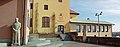
_-_Bahnhof.jpg)

In the south of Dachau, Münchner Straße merges into Bundesstraße 304 to Munich. The federal highway 471 runs along the southern edge of the entire urban area . In the west it leads to the federal motorway 8 (Munich – Stuttgart) and to Fürstenfeldbruck , and in the east to the federal motorway 92 (towards Munich Airport and Deggendorf ) and to Oberschleißheim. There is an indirect connection to the A99 motorway ring via the arterial roads and motorways mentioned .
Rail transport
Dachau is connected to the MVV by rail with the S2 line of the Munich S-Bahn and is the end point of the ten-minute intervals. At Dachau train station , the S2 branches off into the Dachau – Altomünster line and to Petershausen . The second station in Dachau, the city station, is on the S2 to Altomünster. From Dachau train station, there are continuous regional connections to Ingolstadt , Treuchtlingen , Nuremberg and Munich Central Station . The regional trains to Munich reach the main station in approx. 15 minutes from Dachau, with the S2 the route takes around 30 minutes.
Air traffic
Dachau can be reached via Munich Airport, which is approximately 26.8 km away. The next airfield is in Augsburg.
Bus transport
In town, the Dachau public transport company operates eight bus routes:
- Ring line 716: Dachau, train station - Watzmannstraße - school center - Dachau, train station
- Ring line 717: Dachau, Bf - Moosstraße
- Ring line 718: Dachau, train station - Am Rennplatz - Stadtweiher - Dachau, train station
- Ring line 719: Connects the train station directly with the old town.
- Ring line 720: runs from the train station via indoor and outdoor pools to the hospital and back via the old town and Dachau-Ost.
- Ring line 722: Serves the destinations of line 720 in reverse order, in a counterclockwise direction.
- Ring line 726: Connects the train station with the memorial of the concentration camp.
- Ring line 744: Uses a similar route as the former line 724, but omits traffic-intensive roads. The turning point is the herb garden .
In addition, the city of Dachau is served by an MVG line that enables a connection to the north of Munich via Karlsfeld:
- Line 172: Dachau Bhf - Karlsfeld - Munich-Feldmoching Bhf (- Am Hart)
Education


In Dachau there is a wide range of public and private schools consisting of
- four primary schools,
- two secondary schools (also with an M-branch ),
- a Montessori school (elementary and secondary school),
- a special educational support center,
- a secondary school ,
- two high schools ( Josef-Effner-Gymnasium Dachau , abbreviated JEG, and Ignaz-Taschner -Gymnasium Dachau, abbreviated ITG),
- the state-recognized business school Scheibner eV (abbreviated WSS),
- a state vocational school ,
- a vocational school for nursing
Dachau is also a police training location for VI. Riot Police Department in Bavaria.
There is also a wide range of adult education options . This is mainly supported by the municipal adult education center Dachau and the Catholic Dachau Forum .
A special feature is the youth hostel of the German Youth Hostel Association (DJH) . It supports historical and political education on the history of the city and the history of the concentration camp.
Public facilities

.jpg)
Hospitals
The former two clinics of Dachau, the district hospital and the Dr. Koschade clinic (later Dachau gynecological clinic) merged in the 1990s. After major renovation and expansion work on the district hospital between 1997 and 2005, the gynecological clinic was closed. The house of the Helios-Kliniken-Gruppe , known today as the Amper-Klinikum Dachau , has developed into a modern hospital for specialized care and holds the specialist departments internal medicine I and II, visceral, thoracic and vascular surgery, trauma surgery and orthopedics, ear, nose and throat medicine , Gynecology and Obstetrics, Neurology, Physical Medicine, Pain Management, and Plastic and Reconstructive Surgery.
Sovereign institutions
- District court Dachau
- Bavarian riot police : VI. Riot Police Department
- Police station Dachau of the Bavarian State Police
- Technical relief organization OV Dachau
- Dachau volunteer fire brigade V.
- Bavarian Red Cross , Dachau district association
Dachau as a film city
The district clinic served as the location for two films by comedian Didi Hallervorden . Recordings of the series of doctors Dr. Stefan Frank shot. The crime series Agathe can't keep it was partly shot in the old town of Dachau.
Since August 2007, the new series Dahoam is Dahoam of Bavarian television has been recorded on the former site of the Schuster fine cardboard factory, then the Seeber company . For this purpose, the old buildings were extensively rebuilt and renovated.
Some scenes from the series Um Himmels Willen were filmed in the Hörhammerbräu in Dachau's old town.
Personalities
Illustrations
Former Zollhäusl in Dachau (seat of Tourismus Dachauer Land - Dachau AGIL e.V.) at Karlsberg 1a, D-85221 Dachau (hipped roof construction, around 1820)

The Dachau town hall in Advent with an advent calendar

Nursery of the court garden

Dachau Palace - Palace Management

Christophorusfigur on the Amperbrücke

Ernst-Reuter -Platz (district center in Dachau-Ost)

Old water tower on the Schlossberg in Dachau (operating from 1910 to 1969)

Dachau Palace (park side)

Dachau Castle (driveway side)
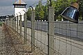
Dachau concentration camp memorial

Main building of the former German Research Institute for Nutrition and Catering (DVA), Dachau, Am Kräutergarten 4

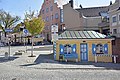
Weekly market in the old town

Filial church St. Johann
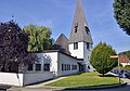
Evangelical Peace Church from 1953
Viewing terrace behind the town hall


.jpg)


_1933.jpg)

literature
- Gerhard Hanke, Wilhelm Liebhart, Norbert Göttler and Hans-Günter Richardi: History of the market and the city of Dachau , cultural history of the Dachau country, Volume 3, Museumsverein Dachau eV, Bayernland Verlag, Dachau 2000, ISBN 3-926355-03-4
- Hans-Günther Richardi: Dachau contemporary history guide. Dachau 1998.
- Wilhelm Neuhauser. Dachauer Museumsschriften , Volume 1, Museumsverein Dachau eV in cooperation with the publishing company "Bayerland" Dachau, 1985.
- Lorenz Josef Reitmeier (Ed.): Dachau - Views and testimonies from twelve centuries , City of Dachau, Dachau 1976.
- Franz Dionys Reithofer : Chronological history of Dachau in Baiern. Munich 1816 ( [2] ).
- August Kübler: Dachau in the past centuries, “Bayerland” printing and publishing house, Dachau, 1928.
Web links
- City administration
- Churches and chapels in the Dachau urban area
- Dachau: Official statistics of the LfStat
- Dachau from a bird's eye view - video from the tourist office
Individual evidence
- ↑ "Data 2" sheet, Statistical Report A1200C 202041 Population of the municipalities, districts and administrative districts 1st quarter 2020 (population based on the 2011 census) ( help ).
- ↑ The Lord Mayor. City administration Dachau, accessed on June 5, 2020 .
- ↑ Natural monuments: local recreation and tourism Dachauer Land. In: www.tourismus-dachauer-land.de. Retrieved December 26, 2019 .
- ↑ a b c d City of Dachau: Viewpoints in Dachau. City of Dachau, accessed December 26, 2019 .
- ↑ a b c d Alexander Merkel: Climate in Dachau. climate-data.org, accessed on December 22, 2019 .
- ↑ Andreas R. Bräunling: The Celts in the Dachauer Land. In: Amperland. 47, 2011, pp. 302-306.
- ↑ Hans Bauer: The Roman highways between Iller and Salzach according to the Itinerarium Antonini and the Tabula Peutingeriana. New research results on route guidance. Munich 2007, pp. 52f and 103.
- ↑ Scientific review
- ^ Johann Jakob Egli : Nomina geographica. Language and factual explanation of 42,000 geographical names of all regions of the world. 2nd, increased and improved edition. Brandstetter, Leipzig 1893, DNB 579328538 ; Reprint of the 2nd edition. Olms, Hildesheim / New York 1973, ISBN 3-487-04571-0 , p. 229.
- ↑ Documentation of the exhibition "Franked City History (s)" Postcards from Dachau, p. 9. (PDF file; 10.5 MB)
- ↑ a b Peter Schmalz: Shame as an opportunity. In: The world. January 21, 1999, accessed February 27, 2020 .
- ↑ a b MD paper mill is closed. In: Münchner Merkur . August 4, 2009. Retrieved November 24, 2019 .
- ↑ Petra Schafflik: Demolition of the MD paper mill - 40 articulated trucks daily on Dachau's streets. In: Süddeutsche Zeitung . November 22, 2018, accessed November 24, 2019 .
- ^ City of Dachau: Excerpt from the explanatory report. City of Dachau, accessed on November 24, 2019 .
- ↑ Dachau municipality in the local database of the Bavarian State Library Online . Bavarian State Library, accessed on September 11, 2019.
- ^ StadtA DAH files before 1945 Subject 96/19: Incorporation
- ^ Wilhelm Volkert (ed.): Handbook of Bavarian offices, communities and courts 1799–1980 . CH Beck, Munich 1983, ISBN 3-406-09669-7 , p. 443 .
- ^ Federal Statistical Office (ed.): Historical municipality directory for the Federal Republic of Germany. Name, border and key number changes in municipalities, counties and administrative districts from May 27, 1970 to December 31, 1982 . W. Kohlhammer, Stuttgart / Mainz 1983, ISBN 3-17-003263-1 , p. 571 .
- ^ Ordinance of January 4, 1973, GVBl p. 19
- ↑ https://www.statistik.bayern.de/mam/produkte/veroffnahmungen/statistische_berichte/a1210c_201800.pdf
- ↑ https://www.pv-muenchen.de/fileadmin/Medien_PV/Leistungen/Daten_und_Studien/Gemeindedaten/GDE_Datengrund_2018/GDE__Dachau__Datengrundlagen_2018.pdf
- ↑ Bavarian State Office for Statistics: Local elections - results of the person selection in the graphic view for Dachau, GKSt. Bavarian State Office for Statistics, March 15, 2020, accessed on March 24, 2020 .
- ↑ Preliminary official final results City Council election Dachau 2020. Accessed on March 16, 2020 .
- ↑ Allocation of seats in 2014. Accessed on March 16, 2020 .
- ↑ Distribution of seats in 2020. Accessed on March 16, 2020 .
- ↑ Entry on the Dachau coat of arms in the database of the House of Bavarian History
- ↑ Dachau city partnerships. on: dachau.de
- ↑ The first 50 years of the Parish of the Assumption
- ^ Gerhard Hanke: The beginnings of the evangelical parish in Dachau. In: Amperland . 1988, pp. 150-151.
- ↑ Path of Remembrance. City of Dachau, accessed December 26, 2019 .
- ↑ Memorial sites for the victims of National Socialism. A documentation. Volume 1, Federal Agency for Civic Education, Bonn 1995, ISBN 3-89331-208-0 , p. 128.
- ^ Gerhard Hanke: The Dachau folk festivals before 1900 . In: Amperland. 1989, pp. 289-292.
- ^ City of Dachau: History of the Dachau Volksfest. Retrieved December 26, 2019 .
- ^ City of Dachau: Dachau Christmas market. Retrieved December 26, 2019 .
- ^ City of Dachau: Family pool / outdoor pool Dachau. Retrieved December 26, 2019 .
- ^ City of Dachau: Municipal artificial ice rink Dachau. Retrieved December 26, 2019 .
- ^ City of Dachau: History of the artificial ice rink. Retrieved December 26, 2019 .
- ↑ a b Economic structure - City of Dachau In: dachau.de , accessed on January 22, 2020.
- ↑ New bus line: On the direct route from Dachau-Süd to the herb garden. ( Memento from December 13, 2016 in the web archive archive.today ) In: Merkur-online. July 8, 2014.
- ↑ The Bavarian Police - Your training and study locations
- ↑ Dachau - Understanding History. German Youth Hostel Association, Main Association for Youth Hikers and Youth Hostels, accessed on April 19, 2019 .
