North Munich canal system
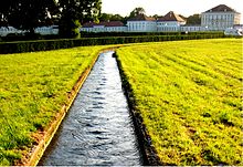
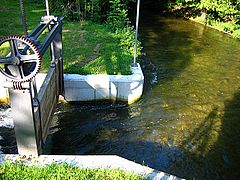
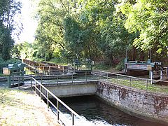
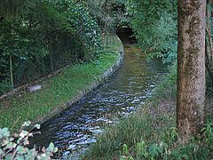
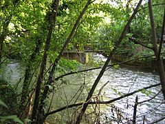
The north Munich canal system connects Würm , Isar and Amper in the north and north of Munich . Today it essentially consists of the Würm Canal , the Schleissheim Canal , the Dachau-Schleissheim Canal , the Pasing-Nymphenburg Canal and the Nymphenburg-Biederstein Canal . It mainly serves to supply the moats and lakes in the parks of the castles Nymphenburg and Schleissheim . Of the historical 50 kilometers, 36 kilometers are still or again filled with water after 300 years.
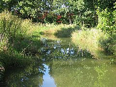
The construction of the canals in the area of the Munich gravel plain and the Dachauer Moos had a lasting effect on the existing meadow and moss streams in this area, as well as on the water flow of the Würm below Munich- Pasing and Karlsfeld . Due to drainage measures and in particular the construction of the marshalling yard in Munich-North (started in 1939, completed in 1990 after re-planning) and the associated gravel mining in what is now known as the Dreiseenplatte , as well as the construction of the Oberschleißheim regatta route (completed in 1972), the change in Water landscape continued. More recently, individual bodies of water have also been renatured .
history
The construction of the canal system dates back to 1601. After Duke Wilhelm V acquired Schwaige Schleißheim in 1597, the estate was expanded. In order to supply the mills on the Moosach with more water, the Würm at Karlsfeld Wasser was branched off by a driving water canal and fed to the upper reaches of the Moosach (now Feldmochinger Mühlbach ). A canal dug in 1687, which led from the Gröbenbach to Allach zur Würm near Langwied Wasser , also belonged in the broadest sense to the north Munich canal system. This canal was filled in again in the 19th century.
The first canal was the works canal from the Würm in Karlsfeld to Schleissheim, which replaced the driving water canal ( Würm Canal ) dug in 1601 . In 1689, under Elector Maximilian II Emanuel, the Schleissheim Canal was built between the Isar and Schleissheim Palace in order to be able to supply the parks of Lustheim and later the new palace (construction began in 1701) with water. For this purpose, water from the Schwabinger Bach , a tributary of the Isar, was diverted from the Aumeister and led in a straight line to the north-northeast along today's federal road B11 . At Dirnismaning (town of Garching near Munich ) the canal bends almost at right angles to the west-north-west and at the Garching district of Hochbrück to the west. Today the Schleissheim Canal begins 2.7 km further north at the level of the Großlappen sewage treatment plant .
In 1691/92 the Schleissheim Canal was extended westwards to Dachau ( Dachau-Schleissheim Canal ). This section is also no longer completely available. Water is diverted from the canal to the north into the Berglbach (tributary of the Moosach), the Gänsgraben, the Schwebelbach and the Kalterbach. The canal no longer carries any water between Kalterbach and Saubach. To the west of it, the canal takes in the water from the deep trench and forwards it to the east to the Kalterbach and west to the Würm. In the urban area of Dachau, water from the Gröbenbach is diverted eastwards into the Pollnbach and via this to the Würm in the old canal bed.
Also in the years 1690/91 the driving water channel between Karlsfeld and Schleissheim was expanded and in the middle section it was relocated slightly to the north. Today's Würm Canal emits water to the north to the Kalterbach and Schwebelbach , crosses the Würmhölzlgraben and completely absorbs the Schwabenbächl and Feldmochinger Mühlbach.
Also under Elector Maximilian II Emanuel, the Nymphenburg Palace was expanded and the palace gardens laid out. A water supply was also necessary here. At Pasing, water has been diverted from the Würm since 1701 and led to the Nymphenburg Palace Park in a canal ( Pasing-Nymphenburger Canal ). The canal initially runs to the north-northeast. Today, after almost a kilometer, part of the water is returned to the Würm in a 200 m long channel. The canal branches out within the Nymphenburg Palace Park. The overflow of the Kleiner See is discharged to the north via the Hartmannshofer Bach . This stream has no further connection to a body of water and is therefore fed to the groundwater via two drainage wells after about 2.2 km north of Allacher Strasse. The rest of the water from the Pasing-Nymphenburg Canal is led in a straight line to the northeast via the Nymphenburg-Biederstein Canal, built in 1702/04, to the Georgenschwaige. The Türkengraben , which was built at the same time and which was fed with water from Munich's city streams , opened up from the south . The location of this canal, which was filled in again in 1811, is still evident in the streets of Munich today through the course of Belgradstraße, Kurfürstenstraße, Nordendstraße and Fürstenstraße. A planned extension of the Turks Trench as the New Schleissheim Canal to the north directly to Schleißheim Palace was not implemented. In the second half of the 18th century, the Nymphenburg-Biederstein Canal was extended beyond the Georgenschwaige, first to the east, then to the southeast and introduced into the Schwarze Lacke , a former arm of the Isar. This finally flows into the Schwabinger Bach. Today there are two lake-like extensions along the Nymphenburg-Biederstein Canal, namely the Olympiasee within the Olympic Park , which was created in 1968/72, and the Schwabinger See , which was created at the end of the 1980s on the site of the former Schwabingen freight yard.
The last major expansion of the north Munich canal system was the construction of the 1.5 km long Nymphenburg branch canal east of the palace gardens to the orphanage in 1727/30. In 1939, gravel extraction resulted in the Karlsfelder See , the water of which is passed on from the Tiefengraben and Moosgraben over the Kalterbach to the Amper .
Appreciation
The canal system between Schleissheim, Nymphenburg and Dachau is unique in Central Europe.
photos
literature
- Adolf Kleinschroth, Helmut Michel: Water as an architectural element. The canals for the development of the palace complex in the north of Munich. In: Münchner Stadtanzeiger. No. 1, Jan 5, 1984, pp. 4-5.
- Gerhard Ongyerth: The Würm. In the flow of stories. The Würm and Würm canals. Forays from Starnberg to Gauting, Pasing, Schwabing and Dachau, to the Nymphenburg, Blutenburg, Schleissheim and Dachauer Moos castles. Photographs by Erich Weichelt and Mark Schütze. Buchendorfer Verlag, Munich 1995, ISBN 3-927984-46-9 .
- Adolf Mathias Fuchs: The “running and jumping” waters in Nymphenburg (= Neuhauser, Nymphenburger Hefte. 31). Breu & Schneider, Munich 2004, DNB 110992058X .
- Gerhard Ongyerth: The Schleissheim sewer system. 400 years of baroque landscape design between Dachau, Oberschleißheim, Garching and Munich. In: Amperland. Vol. 42, No. 2, 2006, OCLC 907834939 , pp. 288-294.
- Uli Lamey: The 300 year old canals between the Residenz in Munich and the castles of Nymphenburg, Schleissheim and Dachau. A guide. 2nd Edition. Dachauer Moos Association, Karlsfeld 2007, ISBN 978-3-00-021268-0 .
Web links
- Water Management Office Munich
- Dachauer Moos eV association
- Schleissheim Court Garden
- Nymphenburg-Biederstein Canal on KulturGeschichtspfad 9 Neuhausen-Nymphenburg (p. 32–33) at muenchen.de
- Topography (1976): A baroque canal system, a film by Dieter Wieland , Bayerisches Fernsehen
Individual evidence
- ↑ When Max Emanuel was planning a Bavarian Versailles. In: sueddeutsche.de. June 9, 2017. Retrieved June 27, 2018 .
- ^ Adolf Kleinschroth, Helmut Michel: Water as an architectural element. The canals for the development of the palace complex in the north of Munich. In: Münchner Stadtanzeiger. January 3, 1984, p. 4.
- ^ Ernst Götz, Brigitte Langer: Schleißheim Castle Complex. Official leader. 2nd edition of the new version. 2009, ISBN 978-3-932982-93-4 , p. 37.
