Allach-Untermenzing
|
Allach-Untermenzing
State capital Munich
Coordinates: 48 ° 12 ′ 0 ″ N , 11 ° 27 ′ 10 ″ E
|
|
|---|---|
| Area : | 15.45 km² |
| Residents : | 34,261 (Jan 31, 2020) |
| Population density : | 2.217 inhabitants / km² |
| Postcodes : | 80995, 80997, 80999, 81247, 81249 |
| Area code : | 089 |
|
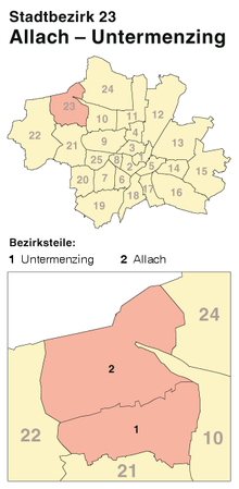
Location of the city district 23 Allach-Untermenzing in Munich
|
|
Allach-Untermenzing is the city district 23 of the Bavarian capital Munich .
The city district consists of the former municipality of Untermenzing and largely the former municipality of Allach . It still shows remnants of a village appearance. Allach-Untermenzing has existed since 1938 and is one of those districts that survived all the reorganizations.
location
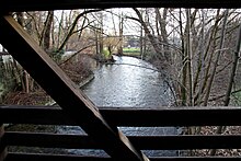
The district is located in the extreme northwest of the city and stretches on both sides of the Würm downstream from the district boundary to Obermenzing (district 21 Pasing-Obermenzing ) in the south, to the city boundary in the north. Since the reorganization in 1992, Dachauer Straße has formed the border in the east , after the areas of the Munich-North marshalling yard on Allacher Flur were added to the 10 Moosach district.
Neighboring districts are Feldmoching-Hasenbergl and Moosach in the east, Pasing-Obermenzing in the south and Aubing-Lochhausen-Langwied in the west. In the north the district borders on the municipality of Karlsfeld .
District parts
Allach
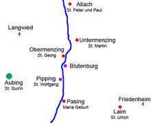
Allach was first mentioned in a document on March 30, 774 as "Ahaloh". The name means forest by the water, since aha means water and loh means forest. In the course of time, tan was ground down to flat . Already at the time of the first documentary mention of the district court, Allach retained this status with the exception of the years 1678 to 1702. Allach was linked to Dachau in terms of landscape and politics . Only after the Munich Regional Court was rebuilt in 1803, Allach came to the Munich Regional Court District. In 1678 Allach was incorporated into the newly created Hofmark Menzing, which was transferred to Anton von Berchem . In 1702, two years after Berchem's death, the Hofmark Menzing fell back to the Electorate, so that Allach was restored to its old status as a district court. In 1818 Allach became an independent municipality in the modern sense.
After the Munich - Ingolstadt railway line, now part of the Nuremberg – Ingolstadt – Munich high-speed line , was opened in 1867 , Allach grew rapidly. Industrial and commercial areas were built along the railway line and for reasons of emission protection to the east of the village center around the parish church of St. Peter and Paul (today Eversbuschstraße 195), (wind direction from the west). This is how the Kirsch steam sawmill, the Diamalt factory, the Krauss-Maffei and BMW companies (from 1936 engine construction for Junkers ) came into being. Allach was incorporated into the city of Munich on December 1, 1938 on the basis of the contract of October 27, 1938.
In 1938 the dry biotope gravel route, originally planned as a motorway section, was also built . During the Second World War , the Allach subcamp , a branch of the Dachau concentration camp , was located in Allach in place of today's Ludwigsfeld settlement , mainly to provide labor for the BMW plant II at low cost. There was a POW camp with 1,300 prisoners on the unfinished motorway that ran north of Allach .
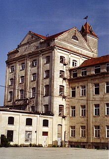
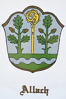
- Design of a coat of arms for the municipality of Allach
After the First World War , communities with more than 4,000 inhabitants had the right to have their own coat of arms. The municipality of Allach wanted to adopt a coat of arms in 1934 - like Untermenzing.
Otto Hupp designed the coat of arms on behalf of the municipality and the Bavarian State Ministry of the Interior: In silver, a green shield base through which a silver cross brook flows, from which a golden crosier grows between two green oak trees. The symbolism of the coat of arms unites the memory of the Loh with the affiliation to the diocese of Freising and connects it with the location on the Würm .
Probably in 1934, the document does not have an exact date, the municipal council wanted to present the coat of arms to the main state archive for examination. Apparently nothing more happened after that. One can only speculate about the reasons that led to the standstill of the actually fully completed procedure. Helmuth Stahleder suspects that it was the incorporation four years later.
- New districts of the former municipality of Allach in today's city district
- Angerloh-Siedlung: Krauss-Maffei built a privately run factory housing estate for its employees in Rueßstrasse and Manzostrasse from 1952 to 1972. The name Angerloh-Siedlung describes the location of the settlement south of the Angerlohe forest.
- Beer settlement: Also south of Angerlohe, the building contractor Korbinian Beer built a one-family house settlement in 1937. The Beer settlement was the last settlement in the Allach community before it was incorporated.
- Flak settlement: From 1957 , a settlement based on plans by the architect and caricaturist Ernst Maria Lang was built on a site that was used by the Wehrmacht to set up anti-aircraft cannons , or flak for short, during the Second World War .
- Gerberau: After BMW had set up its aircraft engine plant in the northern part of the Allach Forest in 1938, a BMW plant settlement was built west of the plant and the Munich – Ingolstadt railway line. It was named after the senior civil engineer, bridge construction director Heinrich Gottfried Gerber . The hall of Munich Central Station , which was destroyed in 1944, was built according to his design . Heinrich Gerber was also the founder of MAN's main plant in Gustavsburg . After the factory was taken over by MAN, the settlement was given the name Gerberau, which became the official place name in 1957. At the same time, the city council named the Gerberau main access road after him. The Gerberau is characterized by its own infrastructure. Before 1960, the community of Karlsfeld was considerably closer than Munich's building line. In October 1948 an elementary school was built for the BMW housing estate in Karlsfeld, which was then replaced by the association elementary school of the state capital and the community of Karlsfeld, which was built between 1963 and 1965. The Munich-Karlsfeld S-Bahn station is not completely located in Karlsfeld, but partly in the Gerberau on Allacher Flur.
- Forest colony: The so-called forest colony was created as a skilled workers' settlement by Krauss-Maffei and was also called Sachsensiedlung after the first craftsmen who settled there. Settlement construction was very progressive for the time (around 1900). The houses were drained long before the rest of Allachs were connected to the municipal sewer system. The typical semi-detached houses were small but functional and each family had a small garden. Much of the original charm has been lost as a result of demolition, redensification and insensitive renovations.
Untermenzing
Untermenzing was created by dividing Menzing, which was first mentioned in a document on November 6, 817. The place first mentioned as "Mezinga" got its name from a man who was named Manzo, Manzio, Menzio or Mennisco.
In the Conradin register of 1315, the term “duo menzing” is mentioned for the first time. So 1315 is considered the birth year Untermenzings, because until then that occurred due to ownership transfers local responses are likely to have affected Obermenzing after after the Urbar of 1397 the monastery Wessobrunn with two goods in today Untermenzing around the modern town with the parish church of St. Martin (now Eversbuschstraße 11 ) names and in today's Obermenzing, however, eleven goods. A little later Untermenzing was incorporated into the ducal Hofmark Menzing, which was first mentioned in 1442.
During the Thirty Years War , Untermenzing was 50 percent destroyed when Sweden invaded in May 1632: The Swedes burned 16 houses. When Baron Anton von Berchem took over Hofmark Menzing in 1676 , 31 properties were already inhabited again, i.e. as many as before the Thirty Years' War. The population of Untermenzing - in contrast to that of Allach - remained constant: in 1809 the number of properties had only increased by four to 35. In 1818 Untermenzing was elevated to an independent municipality.
Although Untermenzing is also on the Munich – Ingolstadt railway line, which opened in 1867, the community could not benefit from industrial development, as Allach did. This is mainly due to the lack of a train station, which Untermenzing received as a stop for the S-Bahn on December 11, 2005 as part of the expansion to the high-speed line Nuremberg – Ingolstadt – Munich . Nevertheless, Untermenzing grew rapidly: While the street village only had 266 inhabitants in 1855, their number rose to 384 by 1900. In 1925 there were already 1662 inhabitants and in the year of incorporation in 1938 4800 inhabitants. Untermenzing was incorporated into the city of Munich on December 1, 1938 on the basis of the contract of October 27, 1938.
- Coat of arms of the former municipality of Untermenzing
After the municipal council had decided on May 30, 1934 to adopt a coat of arms and to submit a draft for approval, the Ministry of the Interior granted permission to use the coat of arms on December 1, 1934.
Blazon : “Split shield, upper half triple check in red and silver; lower half a black undershot half mill wheel on gold. "
After the incorporation into the city of Munich in 1938, the city council of the state capital Munich has all rights to use and manage the coat of arms.
General
Social structure
The social structure is clearly dominated by multi-person households with children. While the workforce predominated until the 1960s, especially in Allach, today employees are represented in the entire city district with over 50 percent. However, the social stratification in the city district has not changed. For the near future, the age distribution suggests an increase in the number of people of retirement age, which should, however, be offset by the strong presence of today's 25 to 35 year olds or those under 15 years of age. Untermenzing, in particular, has traditionally been shaped by single-family settlements. Only in the area south of Angerlohe and around Manzostraße and Allacher Straße are there larger settlement areas with apartment buildings. The Hartmannshofen district bordering to the south, like most of the settlement areas west of the Würm, is one of Munich's good residential areas. There was brisk construction activity between 1946 and 1970. In the resulting residential development of single and multi-family houses, interspersed with terraced houses and condominiums, mainly refugees who had found accommodation in the Allach refugee camps settled. Nevertheless, the city district has a high proportion of green space, which, together with the grown residential areas with a largely garden city character, makes a more rural impression. The population density of the city district is the second thinnest in Munich. The proportion of foreigners is 19 percent, well below the urban average.
Industry and commerce
While Untermenzing has hardly any business, Allach has the highest concentration of industrial and commercial space in the city with almost 200 hectares. The companies MAN , MTU and Krauss-Maffei provide more than three quarters of the 25,000 jobs in the city district. With the decline of the manufacturing industry, more and more land is lying idle that MAN and MTU could initially use. Thus - as in Freimann - the development of new usage concepts is necessary. Due to the abandonment of businesses in the craft and manufacturing industries, the retail and service sectors now dominate in the city district , the largest of which is Deutsche Telekom . There are also a large number of farms. Many logistic companies are located in the Kirschstrasse industrial park .
In autumn 2011, Air Liquide applied for a permit to build a gas storage and filling plant in the Allach industrial area on Ludwigsfelder Strasse, which would have come under the Hazardous Incident Ordinance due to the substances stored there . This system would have been a short distance of around 200 meters from the residential development, whereupon there was strong resistance from the population of the city district, but also the neighboring districts affected. Those affected joined together in a citizens' initiative. In April 2012 the company withdrew its application.
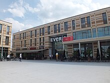
In 2019 the EVER.S shopping center was opened on Oertelplatz .
traffic
In terms of private transport , the city district has Eversbuschstraße as the most important north-south connection. This means that the character of Allach and Untermenzing as street villages is still clearly visible today. The east-west connections include Ludwigsfelder Strasse, which connects Allach towards the east / city center, and Von-Kahr-Strasse, which has a connecting function for Untermenzing. Since there is a surplus of inbound commuters, especially after Allach, which is in addition to outbound commuting towards the city center, the road network is overloaded beyond its limits. The A 99 - motorway ring Munich-Northwest with the Eschenrieder Spange has brought relief, but this has been compensated for by new construction activities. Relief concepts are under discussion, but still far from being implemented.
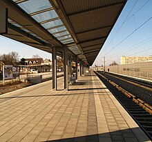
In local public transport , Allach-Untermenzing is mainly accessible via the S-Bahn line 2 with the Untermenzing and Karlsfeld stops and the Allach train station . MVG bus routes provide feeder services to the S-Bahn. Since April 29, 2019 Untermenzing has a stop on the express line X80 towards Moosach and Puchheim. It connects the S-Bahn lines S1 to S4.
Public facilities
The Carl-Spitzweg-Realschule and the Louise-Schroeder-Gymnasium are the most important educational institutions in the district. TSV Allach 09 was founded in 1909, followed by SV Untermenzing in 1925. The Epiphany Church was built in 1932 and the Bethlehem Church in 1961 . The Diakonie Hasenbergl is also active in the district. In the summer of 2019, the Munich adult education center opened a district center on Oertelplatz .
Local recreation and ecological compensation areas
The city district is characterized by a number of green spaces, especially on the Würm . With the Allacher Forest , Allacher Lohe , dry biotope Kies-Trasse and the Angerlohe , the city district offers additional ecological compensation and recreational areas. The Allach Forest in particular is now such a rare alluvial forest that, after massive protests from the population and specialist circles, the A99 motorway ring Munich northwest in the so-called "Allach Tunnel" passes under the Allach Forest.
The Allach summer pool
After construction began in the spring of 1938, the construction of the Allach summer pool was stopped again after a short time, as plans from 1937 for the motorway ring (now A 99 ) and the marshalling yard competed with the pool. As a result of violent protests from the community and citizens, construction work resumed after three months. In a newspaper note from August 5, 1938, the completion of the bath was finally reported, with particular emphasis on the exemplary community performance and the massive influx of visitors. The bath was opened in August 1938. It was built directly on the edge of what was then the village center on Eversbuschstrasse by the Allach citizens themselves. For this reason, it was stipulated in the contract of incorporation of the municipality of Allach into the city of Munich of October 27, 1938 that “users of the municipal swimming pool, who have carried out joint work to create it, will, upon presentation of a photo ID issued by the municipal administration of Allach or the municipal administration of Munich, in the accounting years 1939 and 1940 [have] free entry ”. Thus, a two-year free use of the pool was set for all construction workers. Other visitors paid fees between ten and forty Reichspfennig during this time.
In 1993 the city wanted to close the Allacher Bad to save costs. The closure could be prevented by the commitment of the citizens for their bathroom, the district committee and some politicians of the CSU in the west of Munich.
In 2001 the pool was equipped with a beach volleyball court by a private citizens 'initiative with the support of the district committee and the Allach-Untermenzinger citizens' association.
In 2003 the public utility company closed the pool. After that, it was initially operated privately under the administration of the Allach-Untermenzinger citizens' association until the Bad Allach non-profit company was founded, which operated the pool until 2008.
In 2009 the pool was demolished after the lease between Bad Allach non-profit AG and Stadtwerke München expired. There is now a publicly accessible leisure area on the site.
Architectural monuments
statistics

(As of December 31, residents with main residence)
| year | Residents | including foreigners | Inhabitants per km² |
|---|---|---|---|
| 2000 | 26,680 | 4,652 (17.4%) | 1,726 |
| 2001 | 26,794 | 4,647 (17.3%) | 1,733 |
| 2002 | 26,903 | 4,611 (17.1%) | 1,740 |
| 2003 | 26,977 | 4,450 (16.5%) | 1,745 |
| 2004 | 27,374 | 4,666 (17.0%) | 1,772 |
| 2005 | 27,586 | 4,671 (16.9%) | 1,785 |
| 2006 | 27,730 | 4,498 (16.2%) | 1,795 |
| 2007 | 28,165 | 4,540 (16.1%) | 1,823 |
| 2008 | 28,796 | 4,646 (16.1%) | 1,864 |
| 2009 | 28,732 | 4,480 (15.6%) | 1,859 |
| 2010 | 29,161 | 4,639 (15.9%) | 1,887 |
| 2011 | 29,693 | 4,933 (16.6%) | 1,922 |
| 2012 | 30,393 | 5,396 (17.8%) | 1,967 |
| 2013 | 30,737 | 5,653 (18.4%) | 1,989 |
| 2014 | 31,353 | 6,116 (19.5%) | 2,029 |
| 2015 | 31,882 | 6,688 (21.0%) | 2,063 |
| 2016 | 32,248 | 7,087 (22.0%) | 2,093 |
| 2017 | 32,677 | 7,527 (23.0%) | 2.115 |
| 2018 | 33,355 | 8,062 (24.2%) | 2.159 |
| 2019 | 34,277 | 8,598 (25.1%) | 2,218 |
Source with further data
politics
District committee election
The district committee of Allach-Untermenzing was last elected on March 15, 2020. The distribution of seats is as follows: CSU 6, Greens 5, SPD 3, FW 1. AfD 1 and FDP 1. Of the 24,557 residents in Allach-Untermenzing who are entitled to vote, 12,629 have exercised their right to vote, bringing the turnout to 51.4 percent lay.
Mayor election
In the election of the mayor on March 15, 2020, 45.3% of the voters from Allach-Untermenzing voted for Dieter Reiter , the SPD candidate, and 29.9% for Kristina Frank, the CSU candidate. The turnout was 51.3%. No figures are available for the city districts for the subsequent runoff between the named candidates. In Munich, 71.7% of the voters voted for Dieter Reiter and 28.3% for Kristina Frank. The turnout was 50.7%.
Personalities
- Benno König (1885–1912), aviation pioneer born in Untermenzing
- Hans Schweighart (1894–1934), SA leader and murderer , born in Allach
- Hans Steyrer (1849–1906), "the Bavarian Hercules"
literature
- Florian Breu: The Munich districts after the urban area reorganization . In: Munich Statistics . No. 1 , 1996, ISSN 0171-0583 , p. 1-14 .
- Klaus Gallas : Munich. From the Guelph foundation of Henry the Lion to the present: art, culture, history . DuMont, Cologne 1979, ISBN 3-7701-1094-3 (DuMont documents: DuMont art travel guide).
- Ernst Rudolph: Allach-Untermenzing. The history of a district . Buchendorfer Verlag, Munich 1997, ISBN 3-927984-69-8 .
- Ernst Rudolph: Munich Allach-Untermenzing. The history of a district , with a walk “Allach and Untermenzing” and a bike tour through Allach, MünchenVerlag, Munich 2012, 2nd completely revised edition, ISBN 978-3-937090-55-9 .
- Helmuth Stahleder: From Allach to Zamilapark. Names and basic historical data on the history of Munich and its incorporated suburbs. Published by the Munich City Archives . Buchendorfer Verlag, Munich 2001, ISBN 3-934036-46-5 .
Individual evidence
- ↑ Population status 01 2020 (PDF). Statistical Office of the State Capital Munich. Retrieved March 3, 2020.
- ↑ a b Wilhelm Volkert (Ed.): Handbook of the Bavarian offices, communities and courts 1799–1980 . CH Beck, Munich 1983, ISBN 3-406-09669-7 , p. 601 .
- ↑ Stahleder 2001, p. 17
- ↑ Group report 2005 ( Memento from May 8, 2007 in the Internet Archive ) (PDF; 4.1 MB) of the Munich Transport and Tariff Association ; Retrieved June 10, 2011
- ↑ Air Liquide withdraws application ( Memento from May 10, 2012 in the Internet Archive )
- ↑ SVU. Retrieved May 28, 2018 .
- ↑ Anita Naujokat: Heart of the quarter. In: www.sueddeutsche.de. July 17, 2019, accessed September 29, 2019 .
- ^ Ernst Rudolph, "Allach-Untermenzing, the history of a district", Buchendorfer Verlag 1997
- ^ Archive district information . State capital Munich. Retrieved January 6, 2019.
- ↑ a b Election of the District Committee - District 23 - Allach-Untermenzing . State capital Munich. Retrieved April 29, 2020.
- ↑ https://www.wahlen-muenchen.de/verbindungen/20200315bezirksausschusswahl/verbindungen_stadt usual_23.html
- ↑ Election of the Lord Mayor - District 23 - Allach-Untermenzing . State capital Munich. Retrieved April 29, 2020.
- ↑ https://www.wahlen-muenchen.de/verbindungen/20200315oberbuergermeisterwahl/verbindungen_stadt region_23.html
- ↑ https://www.wahlen-muenchen.de/verbindungen/20200329oberbuergermeisterwahl/index.html
Web links
- Allach district - state capital Munich
- Untermenzing district - state capital Munich
- City district and district committee 23 Allach-Untermenzing - City of Munich
- Munich is getting bigger (1838-1938) thanks to Allach-Untermenzing: District historian Walter Demmel reports on the expansion of Munich , Münchner Wochenanzeiger, November 6, 2012.

