Schwabing-West
|
Schwabing-West
State capital Munich
Coordinates: 48 ° 9 ′ 40 ″ N , 11 ° 34 ′ 8 ″ E
|
|
|---|---|
| Area : | 4.36 km² |
| Residents : | 68,935 (Dec. 31, 2019) |
| Population density : | 15,800 inhabitants / km² |
| Postcodes : | 80796, 80797, 80798, 80799, 80801, 80803, 80804, 80809 |
| Area code : | 089 |
|
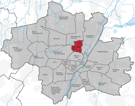
Location of the city district 4 Schwabing-West in Munich
|
|
Schwabing-West is the 4th district of the Bavarian capital Munich .
The city district is one of the few homogeneous city districts in Munich with a uniform appearance. It mainly includes the city extensions around 1900, which arose in the area of the city of Schwabing , which was incorporated in 1890 .
location
Schwabing-West is in the north of Munich, west of the Isar and north of Maxvorstadt . Its border in the south runs along Lothstrasse and Georgenstrasse to Dachauer Strasse , which forms the western border to Schwere-Reiter-Strasse . In the north-west, its border runs first along Schwere-Reiter-Straße to the east and then following the curve of Ackermannstraße to Winzererstraße ; First it follows this and then Lerchenauer Straße to the north to the Mittlerer Ring / Petuelring . This is the northern border of the district, in the east it runs along Isolden-, Simmern-, Viktoria- and Friedrichstraße.
Neighboring districts are Milbertshofen-Am Hart in the north-west and north, Schwabing-Freimann in the east, Maxvorstadt in the south and Neuhausen-Nymphenburg in the west.
history
The old Schwabing is located in today's city districts 4 and 12 .
Schwabing
Schwabing was first mentioned in a document as Suuapinga in 782 . The name comes from Swapo and means settlement of a Swabian . The village was elevated to a town in 1886 and then incorporated into Munich in 1890. As early as 1909, the then new development areas in the west of the former Schwabing urban area were separated from the Schwabing district and elevated to a separate district. In 1996, the area was expanded to include northern Schwabing with the hospital and Luitpoldpark and the southeastern part of the Oberwiesenfeld , which was previously part of Neuhausen. As a result, the city district tripled its area and the number of inhabitants doubled.
Historic districts of the former city of Schwabing in what is now the city district
- Konradshof , Stadt Schwabing: The place was first mentioned in 1260 as Chunratshoven . The meaning of the name can be derived almost literally: Hof einer Konrad. The identity of this Konrad is controversial; this is probably the person of the provost Konrad von Schäftlarn, since the Schäftlarn monastery owned the fields on the southern part of the Oberwiesenfeld until the secularization of 1803. These fields were leased to citizens of Munich. An associated homestead never existed. Since the reorganization of the city districts, part of it belongs to the city district of Neuhausen-Nymphenburg .
New districts in the area of the former city of Schwabing in what is now the city district
- Military housing complex in Barbarastraße : The small housing complex, also known as the Barbarasiedlung , was built in 1909/10 for employees of the nearby Army Clothing Office who were soldiers without active service.
- Development area on Ackermannbogen in Ackermann street corner severity Rider road instead of the well to the former Kasernament Oberwiesenfeld belonging Waldmann barracks , the Stetten barracks and parts of Prince Leopold barracks , where (as of 2014) of the third phase of construction has been realized and the fourth Construction phase is currently being realized.
New development areas around 1900
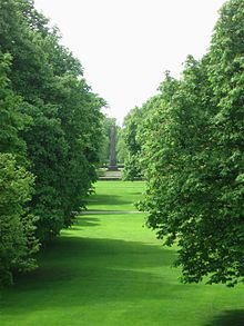
The new development areas that were built around 1900 do not have their own official name. These districts, often in Art Nouveau style, were loosened up by a series of squares, each of which represented a center of the district and was mostly given additional weight by a public institution such as a school or a municipal office. This square concept of the Gründerzeit town planning was retained even after the First World War . The most important places are: Kurfürstenplatz , Hohenzollernplatz , Elisabethplatz , Bayernplatz, Scheidplatz , Pündterplatz, Kölner Platz and Bonner Platz . This rather upper-class area was rounded off by the Luitpoldpark, which was laid out in 1912 . The vacant lots were closed in the 1950s and 1970s, some of which were badly damaged in the Second World War . From around 1985 the renovation of the old buildings, which is still very distinctive.
General
Social structure
The Schwabing-West district is clearly middle-class oriented . The proportion of qualified employees is above average, so the level of training is correspondingly high. 63 percent of all households in the district are one-person households, especially with younger and middle-aged residents; families with children are rather underrepresented at 11 percent. 26 percent of all households in the district are childless multi-person households. As of December 31, 2014, the proportion of foreigners was 22.3 percent, which is just below the city average (26.4 percent).
Due to the relatively high proportion of jobs in public institutions and administrations, the service sector and trade dominate, which together account for 60 percent of jobs.
traffic

Schwabing-West is mainly developed through six connecting axes, which today are not all fully used as main collecting roads: Schleißheimer Straße and Belgradstraße in particular serve as north-south connections as well as Leopoldstraße , which belongs to the Schwabing-Freimann district and which transports traffic from the east -West connections Karl-Theodor-Straße / Bonner Platz / Rheinstraße, Herzogstraße and Elisabethstraße / Franz-Joseph-Straße.
In local public transport , the district is served by the underground lines U2 (underground stations Hohenzollernplatz and Scheidplatz ), U3 (underground stations Bonner Platz , Scheidplatz and Petuelring ), by tram lines 12 and 27 and by several MVG bus lines.
Public facilities

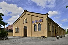
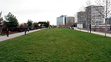
A large number of public institutions are located in the Schwabing-West district. In addition to the Schwabing municipal clinic , the Willi-Graf-Gymnasium , the Sophie-Scholl-Gymnasium , the Max Planck Institute for Psychiatry and the Rehabilitation Center for the Physically Disabled ( Pfennigparade Foundation ) should be mentioned. Important cultural institutions are the children's and youth theater Schauburg (Munich) . In the Petuelpark the cube is in the Petuelpark . The Nordbad is located on Schleißheimer Straße and the Georgenschwaige outdoor pool is located on Luitpoldpark / Petuelring .
statistics

(As of December 31, residents with main residence)
| year | Residents | including foreigners | Inhabitants per km² |
|---|---|---|---|
| 2000 | 53,789 | 11,144 (20.7%) | 12,311 |
| 2001 | 54,580 | 11,868 (21.7%) | 12,492 |
| 2002 | 54,272 | 11,674 (21.5%) | 12,421 |
| 2003 | 54,351 | 11,960 (22.0%) | 12,440 |
| 2004 | 55.231 | 12,012 (21.7%) | 12,647 |
| 2005 | 56.033 | 12,125 (21.6%) | 12,830 |
| 2006 | 59,553 | 12,323 (20.7%) | 13,720 |
| 2007 | 61,514 | 12,653 (20.6%) | 14,176 |
| 2008 | 62,541 | 12,635 (20.2%) | 14,412 |
| 2009 | 62,028 | 12,181 (18.6%) | 14,217 |
| 2010 | 62,856 | 12,481 (19.9%) | 14,407 |
| 2011 | 63,644 | 12,882 (20.2%) | 14,587 |
| 2012 | 64,768 | 13,462 (20.8%) | 14,845 |
| 2013 | 65,892 | 14,115 (21.4%) | 15.102 |
| 2014 | 67.094 | 14,959 (22.3%) | 15,378 |
| 2015 | 68,527 | 15,781 (23.0%) | 15,706 |
| 2016 | 69,407 | 16,264 (23.4%) | 15,908 |
| 2017 | 68,265 | 15,356 (22.5%) | 15,646 |
| 2018 | 68,527 | 15,528 (22.7%) | 15,706 |
| 2019 | 68,935 | 15,730 (22.8%) | 15,800 |
Source with further data
politics
The district committee of Schwabing-West was last elected on March 15, 2020. The distribution of seats is as follows: Greens 12, SPD 6, CSU 6, FDP 2, LINKE 2 and FW / ÖDP 1. Of the 52,382 residents entitled to vote in Schwabing-West, 28,104 exercised their right to vote, bringing the turnout to 53.7 % (2014: 44.6%).
Great personalities
The following people lived in what is now the Schwabing-West district for at least a while:
- Rainer Maria Rilke
- Rainer Werner Fassbinder
- Leon Trotsky
- Vladimir Ilyich Lenin
- Walter Sedlmayr
- Feodor Lynen
- Arlette Pielmann
- Werner Heisenberg
- Olga Benario-Prestes
See also
literature
- Florian Breu: The Munich districts after the urban area reorganization . In: Munich Statistics . No. 1 , 1996, ISSN 0171-0583 , p. 1-14 .
- Klaus Gallas : Munich. From the Guelph foundation of Henry the Lion to the present: art, culture, history . DuMont, Cologne 1979, ISBN 3-7701-1094-3 (DuMont documents: DuMont art travel guide).
- Ilse Macek (Ed.): Excluded - Disenfranchised - Deported. Schwabing and Schwabing fates 1933 to 1945 . Volk Verlag, Munich 2008, ISBN 978-3-937200-43-9 .
- Helmuth Stahleder : From Allach to Zamilapark. Names and basic historical data on the history of Munich and its incorporated suburbs. Edited by Munich City Archives . Buchendorfer Verlag, Munich 2001, ISBN 3-934036-46-5 .
Web links
- District Schwabing-West - State capital Munich
- City district and district committee 4 Schwabing-West - City of Munich
Individual evidence
- ↑ Statistical Pocket Book 2020 (PDF). Statistical Office of the State Capital Munich. Retrieved August 24, 2020.
- ↑ Proven by GEOlino Copyright.
- ↑ The population in the city districts by migration background on December 31, 2014 (PDF; 425 kB). Statistical Office of the State Capital Munich. Retrieved November 11, 2015.
- ^ Archive district information . State capital Munich. Retrieved January 6, 2019.
- ↑ a b c Election of the District Committee - District 4 - Schwabing-West . State capital Munich. Retrieved June 10, 2020.


