
Schleissheimer Strasse (Munich)
| Schleissheimer Strasse | |
|---|---|
|
|
|
 |
|
| Beginning of Schleissheimer Strasse at Stiglmaierplatz | |
| Basic data | |
| place | Munich |
| Townships | Maxvorstadt , Milbertshofen-Am Hart , Schwabing-West , Hasenbergl |
| Created | 14th Century |
| Hist. Names | Rennweg (bridle path) |
| Name received | 1931 |
| Connecting roads | Seidlstrasse, Fortnerstrasse |
| Cross streets | Dachauer Strasse , Rottmannstrasse, Gabelsbergerstrasse , Maßmannstrasse, Theresienstrasse, Heßstrasse, Schellingstrasse , Görresstrasse, Georgenstrasse , Kreuslinstrasse, Agnesstrasse, Wormser Strasse, Elisabethstrasse, Hohenzollernstrasse , Mitterwieserstrasse, Farinellistrasse, Herzogstrasse , Clemensstrasse , Hildeboldstrasse, Leonhard-Strasse, Leonhard-Strasse Theodor Strasse, Bechsteinstrasse, Hornstrasse, Lerchenauer Strasse , Bamberger Strasse, Burgunderstrasse, Gartenstrasse, Giselherstrasse, Birnauer Strasse, Petuelring, Kantstrasse, Schopenhauerstrasse, Georgenschwaigstrasse, Keferloherstrasse, Graf-Konrad-Strasse, Piccoloministrasse, Milbertshofener Strasse, Bertholdstrasse, Neustifter Strasse, Moosacher Strasse , Frankfurter Ring , Motorstrasse, Hamburger Strasse, Max-Diamand-Strasse, Detmoldstrasse, BMW-Allee, Schätzweg, Augustin-Rösch-Straße, Rathenaustraße, Freudstraße, Weyprechtstraße, Caracciolatrsaße, Weitlstraße, Neuherbergstraße , Zauneidechsenweg, Stabelerstraße, Dülferstraße , Sandbienenweg, Harpprechtstraße, Kugystraße, Aschenbrennerstraße |
| Places | Stiglmaierplatz , Rudi-Hierl-Platz, Curt-Mezger-Platz , Milbertshofener Platz , Nordhaideplatz, Goldschmiedplatz |
| Buildings | Maßmannpark , Nordbad , Kulturhaus Milbertshofen , research and innovation center , Mira |
| use | |
| User groups | Pedestrian traffic , bicycle traffic , car traffic , public transport |
| Technical specifications | |
| Street length | 8.14 km |
The Schleißheimerstraße with 8.14 km length after Dachauerstraße (11,2 km), the second longest street in Munich . It begins in the city center at Stiglmaierplatz , leads through five districts and ends at Goldschmiedplatz . It takes its name from the northern suburb of Oberschleißheim , where it originally ended at the Schleißheim palace complex .
course
Schleißheimer Straße begins as a one-way one-way street in the Maxvorstadt district in the center as a junction of Dachauer Straße a little north of Stiglmaierplatz , passes the Maßmannpark and runs almost in a straight line from south to north through Schwabing , Am Riesenfeld , Milbertshofen , Lerchenau and Harthof to the Hasenbergl district . From the city center up to Moosacher Straße / Frankfurter Ring , the road is mostly single-lane, the only exception being a section in front of the Petuelring . It crosses under the Münchner Nordring north of Hamburger Strasse . It then leads continuously in at least two lanes to its end at Goldschmiedplatz / corner of Aschenbrennerstraße. An extension to the north to the A99 is being planned. Because of the adjacent residential areas, the town hall SPD is also discussing a 2.5 km long tunnel that could run north from Rathenaustraße. A special feature of Schleißheimer Straße is the fact that you can see the towers of the Munich Frauenkirche almost all the way up to and including the end in Hasenbergl .
At Schleißheimer Str. 142 in Schwabing there is the Nordbad in the Milbertshofen district at Schleißheimer Str. 281 a bunker , the Kulturhaus Milbertshofen at Curt-Mezger-Platz . Is at the Schleißheimerstraße 387A channel operating station of the city drainage Munich , in Lerchenau on the Schleißheimerstraße 393 the Virginia habitat where Schleißheimerstraße 424, the Research and Innovation Center of the car manufacturer BMW , at the Schleißheimerstraße 506, the Mira shopping center , the Nordhaide housing estate with the Nordhaide school center at Schleißheimer Straße 510, Goldschmiedplatz and then Panzerwiese .
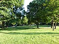
Maßmannpark

Nordbad

Milbertshofen cultural center

Schleissheimer Strasse 271-273
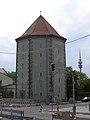
Bunker at Schleißheimer Straße 281
BMW FIZ

Virginia biotope

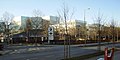
Mira
Nordhaide

Panzerwiese
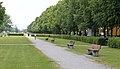
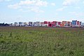
Fürstenachse at the end of Schleißheimer Straße in Hasenbergl


.JPG)


history
The road originally followed the course of today's Lerchenauer Straße towards Feldmoching / Schleißheim. Since the 14th century it has been called Rennweg (Reitweg). From the 17th century, the Schleißheimer Straße connected Munich with the summer residence of the Bavarian rulers in Schleißheim Palace . With the construction of the Oberschleißheim airfield in 1912, the road crossed the airfield and was permanently interrupted in 1917 after several near-misses.
The Powder Tower , in the former Alabama depot , was a well-known former meeting place for the " black scene ". It was closed on January 1, 2007 and has since been demolished. Line 27 of the Munich tram runs on it between Nordbad and Petuelring , which runs on a section of line 7 between Görresstraße and Petuelring , which was closed in 1980 with the opening of the U2 underground line. Until 1993, tram line 13 ran on the section between Rathenaustraße and its end in Hasenbergl. This line was closed on November 21, 1993, as it was replaced by the mostly parallel underground line U2. The former Hasenbergl terminus has been converted into a sports and play facility.
See also
Web links
Individual evidence
- ↑ http://www.ris-muenchen.de/RII/RII/DOK/SITZUNGSVORLAGE/2341511.pdf
- ↑ Archived copy ( memento of the original dated November 16, 2015 in the Internet Archive ) Info: The archive link was inserted automatically and has not yet been checked. Please check the original and archive link according to the instructions and then remove this notice.
- ↑ This is how Munich's underground is kept in good shape. In: sueddeutsche.de. May 4, 2018, accessed June 14, 2018 .
Coordinates: 48 ° 11 ′ 1 ″ N , 11 ° 34 ′ 0 ″ E